
Importe total (1 artículo artículos):
Destino del pedido:

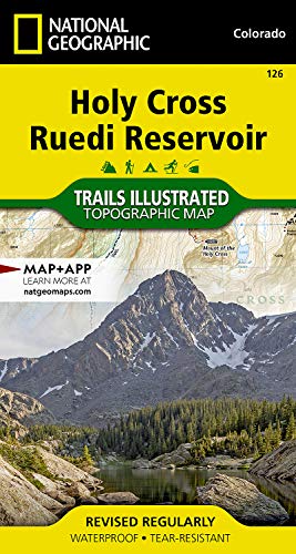
9781566952927 - National Geographic Trails Illustrated Topographic Map Holy Cross / Reudi Reservoir: Colorado de Nat Geo Maps (12 resultados)
Ir a los resultados principales
Filtros de búsqueda
Tipo de artículo
- Todos los tipos de productos
- Libros (10)
- Revistas y publicaciones (No hay ningún otro resultado que coincida con este filtro.)
- Cómics (No hay ningún otro resultado que coincida con este filtro.)
- Partituras (No hay ningún otro resultado que coincida con este filtro.)
- Arte, grabados y pósters (No hay ningún otro resultado que coincida con este filtro.)
- Fotografías (No hay ningún otro resultado que coincida con este filtro.)
- Mapas (2)
- Manuscritos y coleccionismo de papel (No hay ningún otro resultado que coincida con este filtro.)
Condición Más información
- Nuevo (10)
- Como nuevo, Excelente o Muy bueno (No hay ningún otro resultado que coincida con este filtro.)
- Bueno o Aceptable (2)
- Regular o Pobre (No hay ningún otro resultado que coincida con este filtro.)
- Tal como se indica (No hay ningún otro resultado que coincida con este filtro.)
Encuadernación
- Todas
- Tapa dura (No hay ningún otro resultado que coincida con este filtro.)
- Tapa blanda (No hay ningún otro resultado que coincida con este filtro.)
Más atributos
- Primera edición (No hay ningún otro resultado que coincida con este filtro.)
- Firmado (No hay ningún otro resultado que coincida con este filtro.)
- Sobrecubierta (No hay ningún otro resultado que coincida con este filtro.)
- Con imágenes (2)
- No impresión bajo demanda (12)
Idioma (1)
Gastos de envío gratis
Ubicación del vendedor
Valoración de los vendedores
-
Holy Cross, Ruedi Reservoir Map (National Geographic Trails Illustrated Map, 126)
Idioma: Inglés
Publicado por Natl Geographic Society Maps, 2019
ISBN 10: 1566952921 ISBN 13: 9781566952927
Librería: World of Books (was SecondSale), Montgomery, IL, Estados Unidos de America
Calificación del vendedor: 5 de 5 estrellas

EUR 7,01
Gastos de envío gratis
Se envía dentro de Estados Unidos de AmericaCantidad disponible: 1 disponibles
Ańadir al carritoCondición: Good. Item in good condition. Textbooks may not include supplemental items i.e. CDs, access codes etc.
-
Holy Cross, Ruedi Reservoir Map (National Geographic Trails Illustrated Map, 126)
Idioma: Inglés
Publicado por Natl Geographic Society Maps, 2019
ISBN 10: 1566952921 ISBN 13: 9781566952927
Librería: HPB-Ruby, Dallas, TX, Estados Unidos de America
Calificación del vendedor: 5 de 5 estrellas
EUR 3,62
Envío por EUR 3,30
Se envía dentro de Estados Unidos de AmericaCantidad disponible: 1 disponibles
Ańadir al carritomap. Condición: Good. Connecting readers with great books since 1972! Used books may not include companion materials, and may have some shelf wear or limited writing. We ship orders daily and Customer Service is our top priority!
-
Holy Cross, Ruedi Reservoir Map (National Geographic Trails Illustrated Map, 126) [Map] National Geographic Maps
Idioma: Inglés
Publicado por Natl Geographic Society Maps, 2019
ISBN 10: 1566952921 ISBN 13: 9781566952927
Librería: Lakeside Books, Benton Harbor, MI, Estados Unidos de America
Calificación del vendedor: 5 de 5 estrellas
EUR 11,21
Envío por EUR 3,51
Se envía dentro de Estados Unidos de AmericaCantidad disponible: 1 disponibles
Ańadir al carritoCondición: New. Brand New! Not Overstocks or Low Quality Book Club Editions! Direct From the Publisher! We're not a giant, faceless warehouse organization! We're a small town bookstore that loves books and loves it's customers! Buy from Lakeside Books!
-

Holy Cross, Ruedi Reservoir Map
Idioma: Inglés
Publicado por National Geographic Maps, US, 2012
ISBN 10: 1566952921 ISBN 13: 9781566952927
Librería: Rarewaves.com USA, London, LONDO, Reino Unido
Calificación del vendedor: 5 de 5 estrellas
EUR 18,08
Gastos de envío gratis
Se envía de Reino Unido a Estados Unidos de AmericaCantidad disponible: 5 disponibles
Ańadir al carritoMap. Condición: New. 2019th ed. . Waterproof . Tear-Resistant . Topographic MapNational Geographic's Trails Illustrated map of Holy Cross and Ruedi Reservoir delivers unmatched detail and valuable information to assist you in your exploration of this rugged area. Expertly researched and created in partnership with the U.S. Forest Service and others, this map features key points of interest including White River National Forest, Hunter-Fryingpan and Holy Cross Wilderness areas, Mount of the Holy Cross, Sawatch Range, Turquoise Lake, Sylvan Lake State Park and Continental Divide. Trailheads will lead you to precisely mapped trails with clear mileage indicators and marked according to their designated usage, whether your adventure involves hiking, cross-country skiing, biking, snowmobiling or using some other motorized vehicle. The Continental Divide Trail and Colorado Trail are both highlighted. The map displays contour lines labeled with elevations; passes, peaks and summits; reservoirs, lakes and other water features; and boundaries between public and private land. Some of the many recreation features include campgrounds, fishing areas, including gold medal fishing streams; boat launch points and canoe areas; and 10th Mountain Division huts.Every Trails Illustrated map is printed on 'Backcountry Tough' waterproof, tear-resistant paper. A full UTM grid is printed on the map to aid with GPS navigation.Other features found on this map include: Holy Cross Wilderness, Hunter-Fryingpan Wilderness, Mount of the Holy Cross, Red Table Mountain, San Isabel National Forest, White River National Forest.
-
Holy Cross, Ruedi Reservoir Map
Idioma: Inglés
Publicado por National Geographic Maps, 2012
ISBN 10: 1566952921 ISBN 13: 9781566952927
Librería: PBShop.store UK, Fairford, GLOS, Reino Unido
Calificación del vendedor: 5 de 5 estrellas
EUR 18,04
Envío por EUR 3,81
Se envía de Reino Unido a Estados Unidos de AmericaCantidad disponible: 9 disponibles
Ańadir al carritoUNK. Condición: New. New Book. Shipped from UK. Established seller since 2000.
-
Holy Cross, Ruedi Reservoir Map
Idioma: Inglés
Publicado por National Geographic Maps, 2012
ISBN 10: 1566952921 ISBN 13: 9781566952927
Librería: PBShop.store US, Wood Dale, IL, Estados Unidos de America
Calificación del vendedor: 5 de 5 estrellas
EUR 22,16
Gastos de envío gratis
Se envía dentro de Estados Unidos de AmericaCantidad disponible: 9 disponibles
Ańadir al carritoUNK. Condición: New. New Book. Shipped from UK. Established seller since 2000.
-
Holy Cross, Ruedi Reservoir Map (Folded)
Idioma: Inglés
Publicado por National Geographic Maps, Evergreen, 2012
ISBN 10: 1566952921 ISBN 13: 9781566952927
Librería: Grand Eagle Retail, Bensenville, IL, Estados Unidos de America
Calificación del vendedor: 5 de 5 estrellas
EUR 22,41
Gastos de envío gratis
Se envía dentro de Estados Unidos de AmericaCantidad disponible: 1 disponibles
Ańadir al carritoFolded. Condición: new. Folded. National Geographic's Trails Illustrated Maps are the most detailed and up-to-date topographic recreation maps available for US National Parks, National Forests and other popular outdoor recreation areas. A necessity for exploring the outdoors, each map is printed on waterproof, tear-resistant material. They also contain key safety and contact information, GPS and compass coordinates, Leave No Trace ethical guidelines and hundreds of points-of-interest, including scenic viewpoints, campgrounds, boat launches, swimming areas, marine sanctuaries and wildlife refuges. Shipping may be from multiple locations in the US or from the UK, depending on stock availability.
-
National Geographic Trails Illustrated Topographic Map Holy Cross / Reudi Reservoir: Colorado
Librería: Revaluation Books, Exeter, Reino Unido
Calificación del vendedor: 5 de 5 estrellas
Mapa
EUR 14,37
Envío por EUR 11,59
Se envía de Reino Unido a Estados Unidos de AmericaCantidad disponible: 2 disponibles
Ańadir al carritoMap. Condición: Brand New. map edition. 2 pages. 0.25x9.25x4.25 inches. In Stock.
-
Holy Cross, Ruedi Reservoir (National Geographic Trails Illustrated Map, 126)
Idioma: Inglés
Publicado por Natl Geographic Society Maps, 2019
ISBN 10: 1566952921 ISBN 13: 9781566952927
Librería: Russell Books, Victoria, BC, Canada
Calificación del vendedor: 5 de 5 estrellas
EUR 10,85
Envío por EUR 17,61
Se envía de Canada a Estados Unidos de AmericaCantidad disponible: 2 disponibles
Ańadir al carritoMap. Condición: New. Special order direct from the distributor.
-
National Geographic Trails Illustrated Topographic Map Holy Cross / Reudi Reservoir: Colorado
Librería: Revaluation Books, Exeter, Reino Unido
Calificación del vendedor: 5 de 5 estrellas
Mapa
EUR 29,17
Envío por EUR 11,59
Se envía de Reino Unido a Estados Unidos de AmericaCantidad disponible: 1 disponibles
Ańadir al carritoMap. Condición: Brand New. map edition. 2 pages. 0.25x9.25x4.25 inches. In Stock.
-
Holy Cross, Ruedi Reservoir Map (Folded)
Idioma: Inglés
Publicado por National Geographic Maps, Evergreen, 2012
ISBN 10: 1566952921 ISBN 13: 9781566952927
Librería: AussieBookSeller, Truganina, VIC, Australia
Calificación del vendedor: 5 de 5 estrellas
EUR 46,00
Envío por EUR 32,59
Se envía de Australia a Estados Unidos de AmericaCantidad disponible: 1 disponibles
Ańadir al carritoFolded. Condición: new. Folded. National Geographic's Trails Illustrated Maps are the most detailed and up-to-date topographic recreation maps available for US National Parks, National Forests and other popular outdoor recreation areas. A necessity for exploring the outdoors, each map is printed on waterproof, tear-resistant material. They also contain key safety and contact information, GPS and compass coordinates, Leave No Trace ethical guidelines and hundreds of points-of-interest, including scenic viewpoints, campgrounds, boat launches, swimming areas, marine sanctuaries and wildlife refuges. Shipping may be from our Sydney, NSW warehouse or from our UK or US warehouse, depending on stock availability.
-

Holy Cross, Ruedi Reservoir Map
Idioma: Inglés
Publicado por National Geographic Maps, US, 2012
ISBN 10: 1566952921 ISBN 13: 9781566952927
Librería: Rarewaves.com UK, London, Reino Unido
Calificación del vendedor: 5 de 5 estrellas
EUR 18,03
Envío por EUR 75,36
Se envía de Reino Unido a Estados Unidos de AmericaCantidad disponible: 5 disponibles
Ańadir al carritoMap. Condición: New. 2019th ed. . Waterproof . Tear-Resistant . Topographic MapNational Geographic's Trails Illustrated map of Holy Cross and Ruedi Reservoir delivers unmatched detail and valuable information to assist you in your exploration of this rugged area. Expertly researched and created in partnership with the U.S. Forest Service and others, this map features key points of interest including White River National Forest, Hunter-Fryingpan and Holy Cross Wilderness areas, Mount of the Holy Cross, Sawatch Range, Turquoise Lake, Sylvan Lake State Park and Continental Divide. Trailheads will lead you to precisely mapped trails with clear mileage indicators and marked according to their designated usage, whether your adventure involves hiking, cross-country skiing, biking, snowmobiling or using some other motorized vehicle. The Continental Divide Trail and Colorado Trail are both highlighted. The map displays contour lines labeled with elevations; passes, peaks and summits; reservoirs, lakes and other water features; and boundaries between public and private land. Some of the many recreation features include campgrounds, fishing areas, including gold medal fishing streams; boat launch points and canoe areas; and 10th Mountain Division huts.Every Trails Illustrated map is printed on 'Backcountry Tough' waterproof, tear-resistant paper. A full UTM grid is printed on the map to aid with GPS navigation.Other features found on this map include: Holy Cross Wilderness, Hunter-Fryingpan Wilderness, Mount of the Holy Cross, Red Table Mountain, San Isabel National Forest, White River National Forest.