9780770600303 - from sea unto sea art of discover maps of canada [idioma inglés] de armstrong, joe c. w. (20 resultados)

- Tapa blanda
Librería: medimops, Berlin, Alemaniamedimops
Contactar con el vendedorVendedor de 5 estrellasCondición: Usado - Aceptable
EUR 4,55
Envío por EUR 10,00Se envía de Alemania a Estados Unidos de AmericaCantidad disponible: 1 disponibles
Condición: good. Befriedigend/Good: Durchschnittlich erhaltenes Buch bzw. Schutzumschlag mit Gebrauchsspuren, aber vollständigen Seiten. / Describes the average WORN book or dust jacket that has all the pages present.
- Tapa dura
Librería: Nerman's Books & Collectibles, Pembina, ND, Estados Unidos de AmericaNerman's Books & Collectibles
Contactar con el vendedorVendedor de 5 estrellasCondición: Usado - Muy bueno
EUR 12,63
Envío por EUR 5,26Se envía dentro de Estados Unidos de AmericaCantidad disponible: 1 disponibles
Hard Cover. Condición: Near Fine. A near fine red ribbed half leather hardcover. Repro book of maps. Copyright 1982.
- Tapa dura
Librería: Terra Firma Books, San Diego, CA, Estados Unidos de AmericaTerra Firma Books
Contactar con el vendedorVendedor de 5 estrellasCondición: Usado - Excelente
EUR 18,04
Envío por EUR 5,25Se envía dentro de Estados Unidos de AmericaCantidad disponible: 1 disponibles
Hardcover. Condición: Fine. 38 maps/charts. Leather spine & marbled endpapers. 15.5"/40cm. Measures No name or writing. CLEAN.
- Tapa dura
Librería: B-Line Books, Amherst, NS, CanadaB-Line Books
Contactar con el vendedorVendedor de 5 estrellasCondición: Usado - Bueno
EUR 14,44
Envío por EUR 10,95Se envía de Canada a Estados Unidos de AmericaCantidad disponible: 1 disponibles
Hardcover. Condición: Very Good+. Estado de la sobrecubierta: Good. Stiff unmarked book in glossy dust jacket with dampstain to lower spine. ; 10.5 x 16"; 81 pages.
- Tapa dura
Librería: B-Line Books, Amherst, NS, CanadaB-Line Books
Contactar con el vendedorVendedor de 5 estrellasCondición: Usado - Excelente
EUR 18,05
Envío por EUR 10,95Se envía de Canada a Estados Unidos de AmericaCantidad disponible: 1 disponibles
Hardcover. Condición: Fine. Estado de la sobrecubierta: Very Good+. Stiff unmarked book in glossy dust jacket with 1 " corner tear. ; 10.5 x 16"; 81 pages.
Idioma: Inglés
Editorial: Fleet Publishers, Scarborough, Ontario, Canada, 1982
- Tapa dura
Librería: Cultural Connection, Cape Coral, FL, Estados Unidos de AmericaCultural Connection
Contactar con el vendedorVendedor de 5 estrellasCondición: Usado
EUR 27,07
Envío por EUR 3,50Se envía dentro de Estados Unidos de AmericaCantidad disponible: 1 disponibles
38 numbered 16th to 19th century maps reproduced as full page plates each facing text. Printed on thick high quality paper. Elephant Folio 15 3/4" tall x 10 5/8". Dark blue cloth stamped in gilt on spine. Clean. Sharp. Tightly bound. Dust jacket. Fine/ Fine.

- Tapa blanda
Librería: Bay Used Books, Sudbury, ON, CanadaBay Used Books
Contactar con el vendedorVendedor de 5 estrellasCondición: Usado - Aceptable
EUR 15,88
Envío por EUR 15,39Se envía de Canada a Estados Unidos de AmericaCantidad disponible: 1 disponibles
large format softcover. Condición: Good. Good condition.?Oversized poster book. Minor to Moderate wear. Binding tight, pages have some moisture staining and rippling. Pictures available upon request.? dw.

- Tapa dura
- Primera edición
Librería: Abbey Books, Toronto, ON, CanadaAbbey Books
Contactar con el vendedorVendedor de 4 estrellasCondición: Usado - Bueno
EUR 27,03
Envío por EUR 14,02Se envía de Canada a Estados Unidos de AmericaCantidad disponible: 1 disponibles
Hardcover. Condición: Very Good. Estado de la sobrecubierta: Very Good. 1st Edition. Elephant folio; 88 pages. Exhibits and describes 38 original maps from the earliest era of the exploration of Canada. The maps range from La Nuova Francia (1556) by Giacomo Gastaldi to West Canada 1851 by John Rapkin, Henry Warren and John Talli…s. Well illustrated.
- Tapa dura
- Firmado
Librería: Global Village Books, Bundall, QLD, AustraliaGlobal Village Books
Contactar con el vendedorVendedor de 4 estrellasCondición: Usado - Muy bueno
EUR 12,48
Envío por EUR 28,48Se envía de Australia a Estados Unidos de AmericaCantidad disponible: 1 disponibles
Hardcover. Condición: Near Fine. Estado de la sobrecubierta: Near Fine. First Edition. very lovely book with 38 maps, and sea charts. Beautfully produced in beautiful condition. Inscribed by Armstrong to prev. owners on half title page Size: Folio. Signed by Author(s).
Idioma: Inglés
Editorial: Scarborough, Ont., Canada : Fleet Publishers, 1984
- Tapa dura
- Primera edición
Librería: MW Books, New York, NY, Estados Unidos de AmericaMW Books
Contactar con el vendedorVendedor de 5 estrellasCondición: Usado
EUR 55,80
Gastos de envío gratisSe envía dentro de Estados Unidos de AmericaCantidad disponible: 1 disponibles
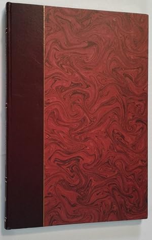
1st edition. Very good copy bound in contemporary leather-backed, marbled boards. Gilt-blocked leather label to spine, and raised bands. Spine bands and panel edges somewhat dulled and rubbed as with age (with some tear to the paper). Marbled end-papers. Remains particularly well-preserved overall; tight, bright, clean and stron…g. Physical description; 1 atlas (38 [i.e. 76] p.) : maps (some col.) ; 40 cm. Subjects; Cartography Canada History. Canada Maps. Canada Historical geography ; Maps. Maps Facsimiles. Canada. ; [Literature] 1982. Canada 1982 ; Atlases. Canada [Appendix]. Scales differ. 3 Kg.

Editorial: Scarborough Ont.: Fleet Books, 1982
- Tapa dura
- Mapa
Librería: Barry McKay Rare Books, Appleby-in-Westmorland, CUMBR, Reino UnidoBarry McKay Rare Books
Contactar con el vendedorVendedor de 5 estrellasMiembro de asociación: PBFA
Condición: Usado
EUR 11,96
Envío por EUR 27,86Se envía de Reino Unido a Estados Unidos de AmericaCantidad disponible: 1 disponibles
Folio, (393x267mm), [84]p. 38 colour & monochrome full-pages illustrations. Original dark red leather, marbled paper covered boards and endleaves, a small piece of the cover paper missing from the front fore-edge. HEAVY BOOK please note that this title weighs more than the 1 kg packed average on which postage charges are based a…nd we may request additonal postage. Overseas customers are advised to email us through the 'Ask the bookseller a question' option for delivery options and charges.
Idioma: Inglés
Editorial: Scarborough, Ont., Canada : Fleet Publishers, 1984
- Tapa dura
- Primera edición
Librería: MW Books Ltd., Galway, IrlandaMW Books Ltd.
Contactar con el vendedorVendedor de 5 estrellasCondición: Usado
EUR 48,95
Envío por EUR 13,95Se envía de Irlanda a Estados Unidos de AmericaCantidad disponible: 1 disponibles
1st edition. Very good copy bound in contemporary leather-backed, marbled boards. Gilt-blocked leather label to spine, and raised bands. Spine bands and panel edges somewhat dulled and rubbed as with age (with some tear to the paper). Marbled end-papers. Remains particularly well-preserved overall; tight, bright, clean and stron…g. Physical description; 1 atlas (38 [i.e. 76] p.) : maps (some col.) ; 40 cm. Subjects; Cartography Canada History. Canada Maps. Canada Historical geography ; Maps. Maps Facsimiles. Canada. ; [Literature] 1982. Canada 1982 ; Atlases. Canada [Appendix]. Scales differ. 1 Kg.
 Más imágenes
- Tapa dura
- Primera edición
Librería: Librairie La forêt des Livres, Lévis, QC, CanadaLibrairie La forêt des Livres
Contactar con el vendedorVendedor de 5 estrellasCondición: Usado
EUR 50,50
Envío por EUR 16,43Se envía de Canada a Estados Unidos de AmericaCantidad disponible: 1 disponibles
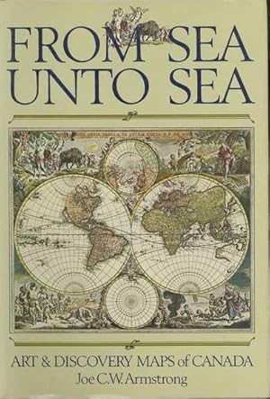
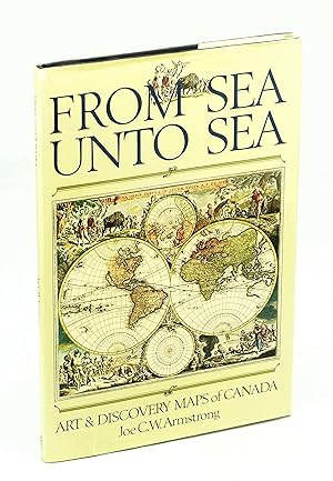
Hardcover. Condición: Fine. Edition originale. First Edition. Maroon ribbed half leather hardcover; gilt on spine, and edges; marbled cover, and endpapers. -Exhibits and describes 38 original maps from the earliest era of the exploration of Canada. The maps range from La Nuova Francia (1556) by Giacomo Gastaldi to West Canada 18…51 by John Rapkin, Henry Warren and John Tallis. Brings together for the first time thirty-eight stunning, original Canadian maps-many of them national treasures-and the fascinating stories of the explorers and cartographers who made them. From Gastaldi's woodcut map of 1556 in which monsters roam the sea, through Champlain's 1612 collage map of Canada's bounty, to Sanson's foundation map of 1656-the first to show all five Great Lakes-this superb 'atlas' takes the modern navigator on a voyage of rediscovery to Canada's beginnings, beginnings not only in strength and adventure but also in humanity and art. Charts a compelling route to the nation's past."Well illustrated; sea charts. Beautfully produced in beautiful condition. .Oversized poster book : 27/39cm.
Idioma: Inglés
Editorial: Toronto: Fleet Books / Lester & Orpen Dennys, 1982
- Tapa dura
- Primera edición
- Firmado
Librería: Abbey Books, Toronto, ON, CanadaAbbey Books
Contactar con el vendedorVendedor de 4 estrellasCondición: Usado - Excelente
EUR 54,10
Envío por EUR 14,02Se envía de Canada a Estados Unidos de AmericaCantidad disponible: 1 disponibles
Hardcover. Condición: Fine. Estado de la sobrecubierta: Fine. 1st Edition. Elephant folio; 88 pages. Exhibits and describes 38 original maps from the earliest era of the exploration of Canada. The maps range from La Nuova Francia (1556) by Giacomo Gastaldi to West Canada 1851 by John Rapkin, Henry Warren and John Tallis. Well il…lustrated. An excellent copy. Signed on half-title page by Joe Armstrong. Signed by Author(s).
Idioma: Inglés
Editorial: Fleet/Lester & Orpen Dennys Books, Scarborough, 1982
- Tapa dura
Librería: Edmonton Book Store, Edmonton, AB, CanadaEdmonton Book Store
Contactar con el vendedorVendedor de 4 estrellasCondición: Usado - Bueno
EUR 18,05
Envío por EUR 49,94Se envía de Canada a Estados Unidos de AmericaCantidad disponible: 1 disponibles
Condición: Very Good. Estado de la sobrecubierta: Very Good. 4to pp. 79, full-page coloured maps, 38 stunning, original Canadian maps, with fascinating stories of the explorers and cartographers who made them on the facing page of each map. book.
Idioma: Inglés
Editorial: Fleet / Lester & Orpen Dennys, Scarborough, ON / Toronto, 1982
- Tapa dura
- Primera edición
Librería: Purpora Books, Comox, BC, CanadaPurpora Books
Contactar con el vendedorVendedor de 5 estrellasCondición: Usado
EUR 54,15
Envío por EUR 17,52Se envía de Canada a Estados Unidos de AmericaCantidad disponible: 1 disponibles
Hard Cover. Condición: Near Fine Plus. Estado de la sobrecubierta: No Dust Jacket as Issued. First Edition. Large: 10 1/2" x 15 1/2". Quarter bound in maroon leather with marble paper (offset printed, not hand-made) over boards, same marbled endpapers; all page edges gilt. Gilt lettering on spine "A Mari Usque Ad Mare" / By C.W.… Armstrong / 1984". This is the Latin form of the title and Canadian national motto. 38 early maps of Canada are reproduced in colour and B&W.
- Tapa dura
Librería: Anthony Vickers Bookdealer PBFA, Selby, Reino UnidoAnthony Vickers Bookdealer PBFA
Contactar con el vendedorVendedor de 5 estrellasMiembro de asociación: PBFA
Condición: Usado - Bueno
EUR 41,85
Envío por EUR 34,83Se envía de Reino Unido a Estados Unidos de AmericaCantidad disponible: 1 disponibles
Large Format Hardback. Condición: Very Good +. Estado de la sobrecubierta: No Jacket as Issued. 38 bw & col maps with text. Quarter bound in red leather with marbled boards, Gilt to page edges and spine. PLEASE NOTE the image shown is NOT the image of my book. I WILL NOT SHIP OUTSIDE THE UK.
From Sea Unto Sea Art of Discover Maps of Canada Armstrong, Joe C. W.
From Sea Unto Sea Art of Discover Maps of Canada Armstrong, Joe C. W.
- Tapa blanda
Librería: Aragon Books Canada, OTTAWA, ON, CanadaAragon Books Canada
Contactar con el vendedorVendedor de 3 estrellasCondición: Nuevo
EUR 86,64
Envío por EUR 20,15Se envía de Canada a Estados Unidos de AmericaCantidad disponible: 1 disponibles
Condición: New.
Editorial: Fleet Books, Toronto
- Tapa dura
Librería: Burton Lysecki Books, ABAC/ILAB, Winnipeg, MB, CanadaBurton Lysecki Books, ABAC/ILAB
Contactar con el vendedorVendedor de 5 estrellasCondición: Usado
EUR 42,64
Envío por EUR 21,90Se envía de Canada a Estados Unidos de AmericaCantidad disponible: 1 disponibles
[0-7706-0030-1] [1982]. (Folio hardcover) Very good in very good dust jacket. Not paginated. Maps, charts. Locale: Canada. (Atlases, Cartography, Geography, Maps).
- Tapa dura
- Primera edición
Librería: RareNonFiction, IOBA, Ladysmith, BC, CanadaRareNonFiction, IOBA
Contactar con el vendedorVendedor de 5 estrellasMiembro de asociación: IOBA
Condición: Usado - Bueno
EUR 180,45
Envío por EUR 17,51Se envía de Canada a Estados Unidos de AmericaCantidad disponible: 1 disponibles
Hardcover. Condición: Very Good. Estado de la sobrecubierta: Good. First Edition. Approximately 75 pages. "Brings together for the first time thirty-eight stunning, original Canadian maps - many of them national treasures - and the fascinating stories of the explorers and cartographers who made them. From Gastaldi's woodcut map…of 1556 in which monsters roam the sea, through Champlain's 1612 collage map of Canada's bounty, to Sanson's foundation map of 1656 - the first to show all five Great Lakes - this superb 'atlas' takes the modern navigator on a voyage of rediscovery to Canada's beginnings, beginnings not only in strength and adventure but also in humanity and art. Charts a compelling route to the nation's past." - from dust jacket. Book clean and unmarked with light wear to navy cloth boards. Price clipped dust jacket bears two closed tears and average wear. Overall a nice copy of this spectacular work.; Elephant Folio - over 15" - 23" tall; Armstrong, Joe C.W. From Sea Unto Sea: Art & Discovery Maps of Canada Antique Maps Historical Geography Armstrong, Joe C.W. From Sea Unto Sea: Art & Discovery Maps of Canada Approximately 75 pages. "Brings together for the first time thirty-eight st.


