
Importe total (1 artículo artículos):
Destino del pedido:

9780715344330 - Canterbury (No. 81) (Victorian Ordnance Survey) (6 resultados)
Ir a los resultados principales
Filtros de búsqueda
Tipo de artículo
- Todos los tipos de productos
- Libros (3)
- Revistas y publicaciones (No hay ningún otro resultado que coincida con este filtro.)
- Cómics (No hay ningún otro resultado que coincida con este filtro.)
- Partituras (No hay ningún otro resultado que coincida con este filtro.)
- Arte, grabados y pósters (No hay ningún otro resultado que coincida con este filtro.)
- Fotografías (No hay ningún otro resultado que coincida con este filtro.)
- Mapas (3)
- Manuscritos y coleccionismo de papel (No hay ningún otro resultado que coincida con este filtro.)
Condición Más información
- Nuevo (No hay ningún otro resultado que coincida con este filtro.)
- Como nuevo, Excelente o Muy bueno (No hay ningún otro resultado que coincida con este filtro.)
- Bueno o Aceptable (4)
- Regular o Pobre (No hay ningún otro resultado que coincida con este filtro.)
- Tal como se indica (2)
Encuadernación
- Todas
- Tapa dura (No hay ningún otro resultado que coincida con este filtro.)
- Tapa blanda (4)
Más atributos
- Primera edición (No hay ningún otro resultado que coincida con este filtro.)
- Firmado (No hay ningún otro resultado que coincida con este filtro.)
- Sobrecubierta (No hay ningún otro resultado que coincida con este filtro.)
- Con imágenes (5)
- No impresión bajo demanda (6)
Idioma (1)
Precio
- Cualquier precio
- Menos de EUR 20
- EUR 20 a EUR 45
- Más de EUR 45 (No hay ningún otro resultado que coincida con este filtro.)
Gastos de envío gratis
Ubicación del vendedor
Valoración de los vendedores
-

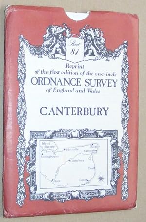
CANTERBURY (Map) Sheet Number 81: Reprint of the First Edition of the One-inch Ordnance Survey of England and Wales
Idioma: Inglés
Publicado por David & Charles, Newton Abbot, Devon, 1969
ISBN 10: 0715344331 ISBN 13: 9780715344330
Librería: Stephen Dadd, Ashford, Reino Unido
Calificación del vendedor: 5 de 5 estrellas

EUR 6,01
Envío por EUR 15,12
Se envía de Reino Unido a Estados Unidos de AmericaCantidad disponible: 1 disponibles
Ańadir al carritoMap. Condición: Good+. Folded map. Some wear to outer cover & owner address label to rear. Internally, the map seems to be in good order. Size: 12mo - over 63/4" - 73/4" tall. Book.
-
Canterbury: Sheet 87, reprint of the first edition of the one-inch Ordnance Survey of England and Wales
Idioma: Inglés
Publicado por David & Charles, Newton Abbot, 1980
ISBN 10: 0715344331 ISBN 13: 9780715344330
Librería: Nigel Smith Books, Gunnislake, Reino Unido
Calificación del vendedor: 5 de 5 estrellas
Mapa
EUR 6,01
Envío por EUR 20,43
Se envía de Reino Unido a Estados Unidos de AmericaCantidad disponible: 1 disponibles
Ańadir al carritoMap. Condición: Very Good. Folded map in very good condition, in an envelope which has some wear and rubbing.
-

Reprint of the first edition of the one-inch Ordnance Survey of England and Wales Sheet no 81 Canterbury. / cartographical notes by J.B. Harley
Idioma: Inglés
Publicado por Newton Abbot, Devon : David & Charles, 1980
ISBN 10: 0715344331 ISBN 13: 9780715344330
Librería: MW Books, New York, NY, Estados Unidos de America
Calificación del vendedor: 5 de 5 estrellas
EUR 27,29
Gastos de envío gratis
Se envía dentro de Estados Unidos de AmericaCantidad disponible: 1 disponibles
Ańadir al carritoSecond Edition. Fine folding map in a near fine paper envelope, edges slightly dust-toned and nicked. Remains particularly well-preserved overall; tight, bright, clean and strong. Physical description; 1 map ; 77 x 101 cm. folded to 19 x 12 cm. Notes; Map published in facsimile is a composite document (surveyed in 1801) and reproduces the engraving of 1819 with railways added. Subjects; Great Britain Surveys Maps. Kent (England) ; Maps. 3 Kg.
-

Reprint of the first edition of the one-inch Ordnance Survey of England and Wales Sheet no 81 Canterbury. / cartographical notes by J.B. Harley
Idioma: Inglés
Publicado por Newton Abbot, Devon : David & Charles, 1980
ISBN 10: 0715344331 ISBN 13: 9780715344330
Librería: MW Books Ltd., Galway, Irlanda
Calificación del vendedor: 5 de 5 estrellas
EUR 18,00
Envío por EUR 13,95
Se envía de Irlanda a Estados Unidos de AmericaCantidad disponible: 1 disponibles
Ańadir al carritoSecond Edition. Fine folding map in a near fine paper envelope, edges slightly dust-toned and nicked. Remains particularly well-preserved overall; tight, bright, clean and strong. Physical description; 1 map ; 77 x 101 cm. folded to 19 x 12 cm. Notes; Map published in facsimile is a composite document (surveyed in 1801) and reproduces the engraving of 1819 with railways added. Subjects; Great Britain Surveys Maps. Kent (England) ; Maps. 1 Kg.
-

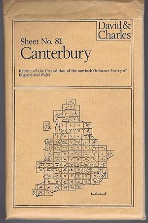
Canterbury Sheet No.81 Reprint of the First Edition of the One-inch Ordnance Survey of England and Wales
Idioma: Inglés
Publicado por David & Charles, Newton Abbot, 1980
ISBN 10: 0715344331 ISBN 13: 9780715344330
Librería: Lazy Letters Books, Market Rasen, Reino Unido
Calificación del vendedor: 5 de 5 estrellas
Mapa
EUR 12,03
Envío por EUR 21,02
Se envía de Reino Unido a Estados Unidos de AmericaCantidad disponible: 1 disponibles
Ańadir al carritoMap. Condición: Very Good. Canterbury Sheet No.81 Reprint of the First Edition of the One-inch Ordnance Survey of England and Wales. Minimal wear. Folded map presented in printed envelope.
-
Canterbury Sheet No.81 Reprint of the First Edition of the One-inch Ordnance Survey of England and Wales
Idioma: Inglés
Publicado por David & Charles, Newton Abbot, 1980
ISBN 10: 0715344331 ISBN 13: 9780715344330
Librería: Lazy Letters Books, Market Rasen, Reino Unido
Calificación del vendedor: 5 de 5 estrellas
Mapa
EUR 14,43
Envío por EUR 21,02
Se envía de Reino Unido a Estados Unidos de AmericaCantidad disponible: 1 disponibles
Ańadir al carritoMap. Condición: Very Good. Canterbury Sheet No.81 Reprint of the First Edition of the One-inch Ordnance Survey of England and Wales. Minimal wear. Folded map presented in printed envelope.