
Importe total (1 artículo artículos):
Destino del pedido:

raynaud rene (36 resultados)
Ir a los resultados principales
Filtros de búsqueda
Tipo de artículo
- Todos los tipos de productos
- Libros (14)
- Revistas y publicaciones (No hay ningún otro resultado que coincida con este filtro.)
- Cómics (1)
- Partituras (No hay ningún otro resultado que coincida con este filtro.)
- Arte, grabados y pósters (No hay ningún otro resultado que coincida con este filtro.)
- Fotografías (No hay ningún otro resultado que coincida con este filtro.)
- Mapas (21)
- Manuscritos y coleccionismo de papel (No hay ningún otro resultado que coincida con este filtro.)
Condición Más información
- Nuevo (8)
- Como nuevo, Excelente o Muy bueno (4)
- Bueno o Aceptable (23)
- Regular o Pobre (No hay ningún otro resultado que coincida con este filtro.)
- Tal como se indica (1)
Encuadernación
Más atributos
- Primera edición (No hay ningún otro resultado que coincida con este filtro.)
- Firmado (No hay ningún otro resultado que coincida con este filtro.)
- Sobrecubierta (No hay ningún otro resultado que coincida con este filtro.)
- Con imágenes (13)
- No impresión bajo demanda (31)
Idioma (3)
Gastos de envío gratis
Ubicación del vendedor
Valoración de los vendedores
-

Journal
Idioma: Inglés
Publicado por Independently published, 2019
ISBN 10: 1674985215 ISBN 13: 9781674985213
Librería: Revaluation Books, Exeter, Reino Unido
Calificación del vendedor: 5 de 5 estrellas

EUR 10,49
Envío por EUR 11,45
Se envía de Reino Unido a Estados Unidos de AmericaCantidad disponible: 1 disponibles
Ańadir al carritoPaperback. Condición: Brand New. 110 pages. 11.00x8.50x0.25 inches. In Stock.
-

Journal
Idioma: Inglés
Publicado por Independently published, 2019
ISBN 10: 1674985304 ISBN 13: 9781674985305
Librería: Revaluation Books, Exeter, Reino Unido
Calificación del vendedor: 5 de 5 estrellas
EUR 12,58
Envío por EUR 11,45
Se envía de Reino Unido a Estados Unidos de AmericaCantidad disponible: 1 disponibles
Ańadir al carritoPaperback. Condición: Brand New. 110 pages. 11.00x8.50x0.25 inches. In Stock.
-

Sébastien le saint percé de flčches
Librería: medimops, Berlin, Alemania
Calificación del vendedor: 5 de 5 estrellas
EUR 9,00
Envío por EUR 10,00
Se envía de Alemania a Estados Unidos de AmericaCantidad disponible: 2 disponibles
Ańadir al carritoCondición: good. Raynaud De Prigny, Marion Ilustrador. Befriedigend/Good: Durchschnittlich erhaltenes Buch bzw. Schutzumschlag mit Gebrauchsspuren, aber vollständigen Seiten. / Describes the average WORN book or dust jacket that has all the pages present.
-
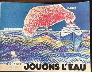
JOUONS L'EAU du bouchon au bateau
Publicado por LES EDITIONS DU SCARABEE, 1979
Librería: Démons & Merveilles, Joinville, Francia
Calificación del vendedor: 4 de 5 estrellas

EUR 6,40
Envío por EUR 22,00
Se envía de Francia a Estados Unidos de AmericaCantidad disponible: 1 disponibles
Ańadir al carritoCondición: Good. French Ă©dition - Livre de bibliothèque recyclĂ© avec Ă©tiquette et couverture plastifiĂ©e - quelques marques d'usures de lecture et/ou de stockage marques de plis sur couverture mais du reste en bon Ă©tat de lecture- ExpĂ©dition soignĂ©e sou. in8. 1979. BrochĂ©. 189 pages. Good.
-

Introduction au droit (2020)
Librería: Ammareal, Morangis, Francia
Calificación del vendedor: 5 de 5 estrellas
EUR 22,23
Envío por EUR 20,50
Se envía de Francia a Estados Unidos de AmericaCantidad disponible: 1 disponibles
Ańadir al carritoSoftcover. Condición: Trčs bon. Edition 2020. Ammareal reverse jusqu'ŕ 15% du prix net de cet article ŕ des organisations caritatives. ENGLISH DESCRIPTION Book Condition: Used, Very good. Edition 2020. Ammareal gives back up to 15% of this item's net price to charity organizations.
-
EUR 21,39
Envío por EUR 56,50
Se envía de Francia a Estados Unidos de AmericaCantidad disponible: 1 disponibles
Ańadir al carritoCondición: fine. trčs bon état. Optez pour nos livres d'occasion en trčs bon état, et soutenez l'insertion sociale et l'écologie en leur offrant une seconde vie,Couverture abîmée. 319068-2 - Introduction au droit 2020, Beignier, Bernard, LGDJ, 2020.
-
EUR 21,46
Envío por EUR 56,50
Se envía de Francia a Estados Unidos de AmericaCantidad disponible: 1 disponibles
Ańadir al carritoCondición: fine. trčs bon état. Optez pour nos livres d'occasion en trčs bon état, et soutenez l'insertion sociale et l'écologie en leur offrant une seconde vie,Couverture abîmée. 319068-3 - Introduction au droit 2020, Beignier, Bernard, LGDJ, 2020.
-

ALMANACH VERMOT 1958.
Publicado por Paris, Société parisienne d'édition, 1958. In-8, broché., 1958
Librería: Librairie Dhouailly, Paris, Francia
Miembro de asociación: ILAB
Calificación del vendedor: 4 de 5 estrellas
EUR 30,00
Envío por EUR 30,00
Se envía de Francia a Estados Unidos de AmericaCantidad disponible: 1 disponibles
Ańadir al carrito[5627].
-

Versailles et les marbres d'Occitanie.
Idioma: Francés
Publicado por Montpellier,, 2019
Librería: Librairie du Camée, PARIS, Francia
Calificación del vendedor: 4 de 5 estrellas
EUR 55,00
Envío por EUR 22,00
Se envía de Francia a Estados Unidos de AmericaCantidad disponible: 1 disponibles
Ańadir al carritoCondición: NEUF. Montpellier, 2019, in-4 cart. éditeur (270 pages). Planches en couleurs dans et hors-texte. NEUF.
-

CAHUET, THARAUD, LICHTENBERGER. La Petite Illustration 1927 - Série romans
Ańo de publicación: 1927
Librería: La Fatrasie, Pontoise, Francia
Calificación del vendedor: 4 de 5 estrellas
Cómic
EUR 16,00
Envío por EUR 52,00
Se envía de Francia a Estados Unidos de AmericaCantidad disponible: 1 disponibles
Ańadir al carritoCouverture souple/livre broché. Condición: Trčs bon. Cahuet, Albéric; De Tejeda, Carlos S.; Cheffer, Henry; Lichtenberger, André; Braun, Georges; Gilbert, Marion; Fauret, Léon; Derčme, Tristan; Dumas, André; Fontainas, André; Garnier, A.P.; Gregh, Fernand; Jammes, Francis; Larguier, Léo; Leconte, SC; Le Goffic, Ch.; Muselli, Vincent; Raynaud, Ernest; Regnier, Henri; Rivoire, André; Sorbets, Gaston; Valéry, Paul; Zifferer, Paul; Pontoppidan, H.; Gauthier, René-Georges; Sandy, Isabelle; Tcherkessof, Georges; Bouchaud, Jean; Renard, Maurice; Lelong, René Ilustrador. Bande dessinée COLLECTIF. La Petite Illustration 1927 - Série romans. Contenu: Les Amants du Lac de Albéric Cahuet avec illustrations en couleurs de Carlos S. De Tejeda et une partition "Le Lac" de L. Niedermeyer; La Rose de Saron de Jérôme et Jean Tharaud avec illustrations de Henry Cheffer; Des enfants dans un jardi de André Lichtenberger avec des illustrations de Carlos S. De Tejeda; Le Retour de Runar Schildt avec illustrations de Georges Braun; Le Silence de Cambridge de Marion Gilbert avec illustrations de Léon Fauret; Poęmes de Tristan Derčme, André Dumas, André Fontainas, A.P. Garnier, Fernand Gregh, Francis Jammes, Léo Larguier, SC Leconte, Ch. Le Goffic, Vincent Muselli, Ernest Raynaud, Henri de Regnier, André Rivoire, Gaston Sorbets, Paul Valéry; Le Saut dans l'inconnu de Paul Zifferer avec illustrations de René Lelong; L'Ours polaire de H. Pontoppidan avec illustrations de René-Georges Gauthier; Les Soutanes vertes de Isabelle Sandy avec compositions et bois gravés de Georges Tcherkessof; Contes noirs du Price Guillaume de Sučde avec illustrations de Jean Bouchaud; Celui qui n'a pas tué de Maurice Renard avec illustrations de René Lelong. Format: In-4. Solide reliure. Trčs bon état. Remarques sur la livraison : Nous proposons la livraison par Colissimo et par Mondial Relay. Pour Mondial Relay, nous vous invitons ŕ nous communiquer rapidement le point relais que vous préférez et auquel vous pourrez venir récupérer vos livres. Mondial Relay est moins cher que Colissimo mais souvent plus lent (surtout en période de fętes et de vacances oů les délais de livraison peuvent s'avérer trčs importants). Nous déconseillons ce systčme si vous désirez obtenir vos livres rapidement. Colissimo distribue les livres ŕ votre domicile et non ŕ un point relais. Bande dessinée.
-
Original Map - "Empires Assyrio-Babyloniens et Medo-Perses, de 721 a 500 avant J.C. [Assyro-Babylonian and Medo-Persian Empires, from 721 to 500 BC]; Pl. 5"; From "Atlas geographique dresse pour l'histoire universelle de l'eglise catholique de l'abbe Rohrbacher" ("Geographical Atlas, Compiled for, the Universal History of the Catholic Church of Abbot Rohrbacher")
Idioma: Francés
Publicado por Gaume Freres et J. Duprey, Editeurs, Paris, France, 1861
Librería: Barry Cassidy Rare Books, Sacramento, CA, Estados Unidos de America
Calificación del vendedor: 4 de 5 estrellas
Mapa
EUR 87,37
Envío por EUR 5,09
Se envía dentro de Estados Unidos de AmericaCantidad disponible: 1 disponibles
Ańadir al carritoNo Binding. Condición: Collectible-Very Good. Text is in French. Original publisher's hand-colored map showing the Assyro-Babylonian and Medo-Persian (Achaemenid) Empires from the years 721 to 500 BCE. Composition is roughly centered around the empires, which were located roughly in what is present-day Iran and Iraq. The Persian Gulf and Caspian Sea are pictured at the top and bottom of the map. Surrounding areas also shown including the Arabian Desert to the west and "Parthes" and "Carmanie" to the east. Map with margins measures 21 1/2" x 16 1/2." Actual map area measures 18" x 13." The vertical center fold line is original as this map came from an atlas. Map is very clean and intact except for some foxing and age toning on front and back and minuscule wear to edges and corners. A Very Good copy. The map features beautiful pink and green watercolors within the Assyro-Babylonian and Medo-Persian Empires, respectively, as well as additional watercolored lines in green, blue, orange, and pink which demarcate regional borders or routes relating to historical events. Major cities and natural features such as mountains, seas, and rivers are included. Scales of distance in the lower-right corner below the title. Lines of latitude and longitude and neatline also included. The following is printed beneath the map below the neatline: "Le Trait par Raynaud," "Impie. ['Imprimerie'] de Louis Antoine, 1, rue de Cluny, Paris," and "La Lettre par Lahanier-Lacouchy." This map is Plate 5 from an atlas that accompanied "L'Historie universelle de l'eglise catholique" ("Universal History of the Catholic Church"), a notable work by Abbot Rohrbacher. Rene Francois Rohrbacher (1789-1856) was a French priest, ecclesiastical historian, and politician. The main author of this atlas is Auguste Henri Dufour (1795-1865), a French geographer.
-
Original Map - "Tribus d'Israel, de 1424 a 1055 avant J.C. [Tribes of Israel, from 1424 to 1055 BC]; Pl. 4"; From "Atlas geographique dresse pour l'histoire universelle de l'eglise catholique de l'abbe Rohrbacher" ("Geographical Atlas, Compiled for, the Universal History of the Catholic Church of Abbot Rohrbacher")
Idioma: Francés
Publicado por Gaume Freres et J. Duprey, Editeurs, Paris, France, 1861
Librería: Barry Cassidy Rare Books, Sacramento, CA, Estados Unidos de America
Calificación del vendedor: 4 de 5 estrellas
Mapa
EUR 87,37
Envío por EUR 5,09
Se envía dentro de Estados Unidos de AmericaCantidad disponible: 1 disponibles
Ańadir al carritoNo Binding. Condición: Collectible-Very Good. Text is in French. Original publisher's hand-colored map and two insets maps showing Israel in the years 1424 to 1055 BCE with many details and additions connecting the maps to events in the Old Testament of the Bible. The two inset maps are titled, "Royaume des Israelites sous David et Salomon, de 1055 a 975 avant J.C." ("Kingdom of the Israelites under David and Solomon, 1055 to 975 BC") and "Royaumes de Juda et d'Israel, de 975 a 721 avant J.C." ("Kingdoms of Judah and Israel, from 975 to 721 BC). Map with margins measures 21 1/2" x 16 1/2." Actual map area measures 18" x 13." Main map measures 10 1/2" x 13." Each of the inset maps measures about 7" x 7." The vertical center fold line is original as this map came from an atlas. Map is very clean and intact except for some foxing and age toning on front and back and minuscule wear to edges and corners. A Very Good copy. The maps features beautiful blue, pink, and light gray watercolors within country or regional borders. Additional watercolors in green, dark blue, purple, and orange accent text, demarcate boundaries, or highlight cities. There is one legend on the main map (showing the Twelve Tribes of Israel) that shows the symbols for cities of refuge and Levitical cities (cities reserved for the Tribe of Levi). Other major cities and natural features such as mountains, seas, and rivers are included. Each of the maps includes a title and a scale or scales of distance. The legend appears below the scales of distance on the main map. Lines of latitude and longitude and neatline also included. The following is printed beneath the map below the neatline: "Le Trait par Raynaud," "Impie. ['Imprimerie'] de Louis Antoine, 1, rue de Cluny, Paris," and "Ecrit par Lahanier et Lacouchy." This map is Plate 4 from an atlas that accompanied "L'Historie universelle de l'eglise catholique" ("Universal History of the Catholic Church"), a notable work by Abbot Rohrbacher. Rene Francois Rohrbacher (1789-1856) was a French priest, ecclesiastical historian, and politician. The main author of this atlas is Auguste Henri Dufour (1795-1865), a French geographer.
-
Original Map - "Empire Romain (Partie Orientale), de l'an 100 a 410 J.C. [Roman Empire (Eastern Part), from the year 100 to 410 AD]; Pl. 10"; From "Atlas geographique dresse pour l'histoire universelle de l'eglise catholique de l'abbe Rohrbacher" ("Geographical Atlas, Compiled for, the Universal History of the Catholic Church of Abbot Rohrbacher")
Idioma: Francés
Publicado por Gaume Freres et J. Duprey, Editeurs, Paris, France, 1861
Librería: Barry Cassidy Rare Books, Sacramento, CA, Estados Unidos de America
Calificación del vendedor: 4 de 5 estrellas
Mapa
EUR 87,37
Envío por EUR 5,09
Se envía dentro de Estados Unidos de AmericaCantidad disponible: 1 disponibles
Ańadir al carritoNo Binding. Condición: Collectible-Very Good. Text is in French. Original publisher's hand-colored map showing the eastern part of the Roman Empire between the years 100 and 410. Year 410 marks the Sack of Rome, when the Visigoths took over the Roman Empire's famed "eternal city." The Sack of Rome is considered a pivotal landmark in the fall of the Roman Empire. A legend corresponds to lines in orange and dark green watercolors, which show the expedition of Emperor Julian (sometimes referred to as Julian the Apostate) and the invasion of the Visigoths. Map with margins measures 16 1/2" x 21 1/2." Actual map area measures 13" x 18." The horizontal center fold line is original as this map came from an atlas. Map is very clean and intact except for some foxing and age toning on front and back and minuscule wear to edges and corners. A Very Good copy. This map shows the eastern part of the Roman Empire and surrounding areas. Some of the depicted regions and geographical features include the Mediterranean Sea, the Black Sea, Palestine (Judea), the Sinai Peninsula, Egypt, present-day Libya, the Aegean region, present-day Turkey, Sarmatia, and Scythia. The map features beautiful blue, yellow, green, and pink watercolors within country or regional borders. Major cities and natural features such as mountains, seas, and rivers are included. Scales of distance and the legend are in the lower-left corner below the title. Lines of latitude and longitude and neatline also included. The following is printed beneath the map below the neatline: "Le Trait grave par Raynaud," "Impie. ['Imprimerie'] de Louis Antoine, 1, rue de Cluny, Paris," and "Ecrit par Lahanier, Lacouchy & Cie [Compagnie]." This map is Plate 10 from an atlas that accompanied "L'Historie universelle de l'eglise catholique" ("Universal History of the Catholic Church"), a notable work by Abbot Rohrbacher. Rene Francois Rohrbacher (1789-1856) was a French priest, ecclesiastical historian, and politician. The main author of this atlas is Auguste Henri Dufour (1795-1865), a French geographer.
-
Original Map - "Empire Romain (Partie Occidentale), de l'an 100 a 410 J.C. [Roman Empire (Western Part), from 100 to 410 AD]; Pl. 11"; From "Atlas geographique dresse pour l'histoire universelle de l'eglise catholique de l'abbe Rohrbacher" ("Geographical Atlas, Compiled for, the Universal History of the Catholic Church of Abbot Rohrbacher")
Idioma: Francés
Publicado por Gaume Freres et J. Duprey, Editeurs, Paris, France, 1861
Librería: Barry Cassidy Rare Books, Sacramento, CA, Estados Unidos de America
Calificación del vendedor: 4 de 5 estrellas
Mapa
EUR 87,37
Envío por EUR 5,09
Se envía dentro de Estados Unidos de AmericaCantidad disponible: 1 disponibles
Ańadir al carritoNo Binding. Condición: Collectible-Very Good. Text is in French. Original publisher's hand-colored map showing the western part of the Roman Empire between the years 100 and 410. Year 410 marks the Sack of Rome, when the Visigoths took over the Roman Empire's famed "eternal city." The Sack of Rome is considered a pivotal landmark in the fall of the Roman Empire. A legend corresponds to lines in orange and dark pink watercolors, which show the invasion of the Visigoths and expedition of Theodosius I to Africa, respectively. Map with margins measures 16 1/2" x 21 1/2." Actual map area measures 13" x 18." The horizontal center fold line is original as this map came from an atlas. Map is very clean and intact except for some foxing and age toning on front and back and minuscule wear to edges and corners. A Very Good copy. This map shows the western part of the Roman Empire and surrounding areas. Some of the depicted regions and geographical features include the Mediterranean Sea and what are known in the present day as Tunisia, Libya, Spain, Portugal, France, Italy, and the British Isles. The map features beautiful blue, yellow, and pink watercolors within country or regional borders. Major cities and natural features such as mountains, seas, and rivers are included. Scales of distance and the legend are in the lower-left corner below the title. Lines of latitude and longitude and neatline also included. The following is printed beneath the map below the neatline: "Le Trait grave par Raynaud," "Impie. ['Imprimerie'] de Louis Antoine, 1, rue de Cluny, Paris," and "Ecrit par Lahanier, Lacouchy & Cie [Compagnie]." This map is Plate 11 from an atlas that accompanied "L'Historie universelle de l'eglise catholique" ("Universal History of the Catholic Church"), a notable work by Abbot Rohrbacher. Rene Francois Rohrbacher (1789-1856) was a French priest, ecclesiastical historian, and politician. The main author of this atlas is Auguste Henri Dufour (1795-1865), a French geographer.
-
Original Map - "Palestine, de l'an 7 avant l'ere chretienne a l'an 29 de J.C. [Palestine, from the year 7 before the Christian era to the year 29 AD]; Pl. 8"; From "Atlas geographique dresse pour l'histoire universelle de l'eglise catholique de l'abbe Rohrbacher" ("Geographical Atlas, Compiled for, the Universal History of the Catholic Church of Abbot Rohrbacher")
Idioma: Francés
Publicado por Gaume Freres et J. Duprey, Editeurs, Paris, France, 1861
Librería: Barry Cassidy Rare Books, Sacramento, CA, Estados Unidos de America
Calificación del vendedor: 4 de 5 estrellas
Mapa
EUR 87,37
Envío por EUR 5,09
Se envía dentro de Estados Unidos de AmericaCantidad disponible: 1 disponibles
Ańadir al carritoNo Binding. Condición: Collectible-Very Good. Text is in French. Original publisher's hand-colored map showing Palestine and surrounding areas from the years 7 BCE to 29 CE. A legend corresponds to lines in green, yellow, blue, and pink watercolors, which depict several routes, namely, the Flight into Egypt, the Crossing of the Jordan River, "Route pour les Fetes," "2nd Route pour les Fetes," and route to Phoenia. Two inset maps are the right of the main map, which are titled, "Jerusalem" and "Environs de Jerusalem" ("Surrounding of Jerusalem"). Map with margins measures 21 1/2" x 16 1/2." Actual map area measures 18" x 13." Main map measures 11 1/2" x 13." Each of the inset maps measures about 5" x 5." The vertical center fold line is original as this map came from an atlas. Map is very clean and intact except for some foxing and age toning on front and back and minuscule wear to edges and corners. A Very Good copy. Some of the main depicted regions on the map are Judea, Samaria, Perea, and Phoenicia. The main map features beautiful blue, yellow, and pink watercolors within country or regional borders. The two inset maps are uncolored (black-and-white). Major cities and natural features such as mountains, seas, and rivers are included. The main map has the title in upper-left corners, scales of distance in the lower-right corner, and the legend in the lower-left corner. Lines of latitude and longitude and neatline also included. The following is printed beneath the map below the neatline: "Le Trait par Raynaud," "Impie. ['Imprimerie'] de Louis Antoine, 1, rue de Cluny, Paris," and "Ecrit par Lahanier, Lacouchy et Cie." This map is Plate 8 from an atlas that accompanied "L'Historie universelle de l'eglise catholique" ("Universal History of the Catholic Church"), a notable work by Abbot Rohrbacher. Rene Francois Rohrbacher (1789-1856) was a French priest, ecclesiastical historian, and politician. The main author of this atlas is Auguste Henri Dufour (1795-1865), a French geographer.
-
Original Map - "Voyages des Apotres, de l'an 100 de J.C. [Voyages of the Apostles, 100 AD]; Pl. 9"; From "Atlas geographique dresse pour l'histoire universelle de l'eglise catholique de l'abbe Rohrbacher" ("Geographical Atlas, Compiled for, the Universal History of the Catholic Church of Abbot Rohrbacher")
Idioma: Francés
Publicado por Gaume Freres et J. Duprey, Editeurs, Paris, France, 1861
Librería: Barry Cassidy Rare Books, Sacramento, CA, Estados Unidos de America
Calificación del vendedor: 5 de 5 estrellas
Mapa
EUR 87,37
Envío por EUR 5,09
Se envía dentro de Estados Unidos de AmericaCantidad disponible: 1 disponibles
Ańadir al carritoNo Binding. Condición: Collectible-Very Good. Text is in French. Original publisher's hand-colored map showing the routes traveled by five of the Twelve Apostles, Paul, Peter, John, Mark, and Luke. A legend demarcates their routes. The map shows the Mediterranean Sea at center with boundaries set by surrounding regions, such as Italy, the Aegean Islands, present-day Bulgaria, present-day Turkey, Syria, Palestine (Judea), Egypt, Libya, and present-day Tunisia. Map with margins measures 21 1/2" x 16 1/2." Actual map area measures 18" x 13." The vertical center fold line is original as this map came from an atlas. Map is very clean and intact except for some foxing and age toning on front and back and minuscule wear to edges and corners. A Very Good copy. This map shows parts of Europe, the Mediterranean, the Middle East, and North Africa. Some countries or regions are filled in with beautiful blue, yellow, green, and pink watercolors. A legend depicts five watercolored lines in pink, yellow, blue, orange, green, which correspond to each of the five Apostles. Major cities and natural features such as mountains, seas, and rivers are included. Title, legend, and scales of distance in the lower-left corner. Lines of latitude and longitude and neatline also included. The following is printed beneath the map below the neatline: "Le Trait par Raynaud," "Impie. [Imprimerie] de Louis Antoine, rue de Cluny, 1, Paris," and "La Lettre par Lahanier, Lacouchy et Cie [Compagnie]." This map is Plate 9 from an atlas that accompanied "L'Historie universelle de l'eglise catholique" ("Universal History of the Catholic Church"), a notable work by Abbot Rohrbacher. Rene Francois Rohrbacher (1789-1856) was a French priest, ecclesiastical historian, and politician. The main author of this atlas is Auguste Henri Dufour (1795-1865), a French geographer.
-
Original Map - "Europe Occidentale, de 962 a 1492 de J.C. [Western Europe, from 962 to 1492 AD]; Pl. 16"; From "Atlas geographique dresse pour l'histoire universelle de l'eglise catholique de l'abbe Rohrbacher" ("Geographical Atlas, Compiled for, the Universal History of the Catholic Church of Abbot Rohrbacher")
Idioma: Francés
Publicado por Gaume Freres et J. Duprey, Editeurs, Paris, France, 1861
Librería: Barry Cassidy Rare Books, Sacramento, CA, Estados Unidos de America
Calificación del vendedor: 4 de 5 estrellas
Mapa
EUR 87,37
Envío por EUR 5,09
Se envía dentro de Estados Unidos de AmericaCantidad disponible: 1 disponibles
Ańadir al carritoNo Binding. Condición: Collectible-Very Good. Text is in French. Original publisher's hand-colored map showing "western Europe" between the years 962 and 1492. Map with margins measures 21 1/2" x 16 1/2." Actual map area measures 18" x 13." The vertical center fold line is original as this map came from an atlas. Map is very clean and intact except for some foxing and age toning on front and back (relatively light on front; more pronounced along the edges) and minuscule wear to edges and corners. A Very Good copy. This map shows most of Europe. The top shows Denmark, Norway, Sweden, and the British Isles. Parts of the Grand Duchy of Moscow (present-day Russia) and the Ottoman Empire are to the right. The bottom shows parts of North Africa. Spain, Portugal, and the Atlantic Ocean are to the left. The map features beautiful blue, yellow, green, pink, and orange watercolors within country or regional borders. Major cities and natural features such as mountains, seas, and rivers are included. Scales of distance in the upper-left corner below the title. Lines of latitude and longitude and neatline also included. The following is printed beneath the map below the neatline: "le Trait par Raynaud," "Impie. ['Imprimerie'] de Louis Antoine, 1, rue de Cluny, Paris," and "la Lettre par Lahanier et Lansraux." This map is Plate 16 from an atlas that accompanied "L'Historie universelle de l'eglise catholique" ("Universal History of the Catholic Church"), a notable work by Abbot Rohrbacher. Rene Francois Rohrbacher (1789-1856) was a French priest, ecclesiastical historian, and politician. The main author of this atlas is Auguste Henri Dufour (1795-1865), a French geographer.
-
Original Map - "Empire d'Occident, sous Charlemagne, de l'an 771 a 814 de J. C. [Western Empire, under Charlemagne, from the year 771 to 814 AD]; Pl. 13"; From "Atlas geographique dresse pour l'histoire universelle de l'eglise catholique de l'abbe Rohrbacher" ("Geographical Atlas, Compiled for, the Universal History of the Catholic Church of Abbot Rohrbacher")
Idioma: Francés
Publicado por Gaume Freres et J. Duprey, Editeurs, Paris, France, 1861
Librería: Barry Cassidy Rare Books, Sacramento, CA, Estados Unidos de America
Calificación del vendedor: 4 de 5 estrellas
Mapa
EUR 87,37
Envío por EUR 5,09
Se envía dentro de Estados Unidos de AmericaCantidad disponible: 1 disponibles
Ańadir al carritoNo Binding. Condición: Collectible-Very Good. Text is in French. Original publisher's hand-colored map showing Europe from the years 771-814 under the reign of Charlemagne. Map with margins measures 21 1/2" x 16 1/2." Actual map area measures 18" x 13." The vertical center fold line is original as this map came from an atlas. Map is very clean and intact except for some foxing and age toning (covers the entire front and back but is relatively light on front) and minuscule wear to edges and corners. A Very Good copy. This map is centered on Europe. Spain, the British Isles, Bulgaria, and Aegean Islands are some of the regions that form the outermost borders of the map. The map features beautiful green, yellow, and pink watercolors within country or regional borders. Major cities and natural features such as mountains, seas, and rivers are included. Scales of distance in the upper-left corner below the title. Lines of latitude and longitude and neatline also included. The following is printed beneath the map below the neatline: "Le Trait par Raynaud," "Les Eaux Gravées ŕ la Mécanique par Mme Fontaine," "Impie. ['Imprimerie'] de Louis Antoine, 1, rue de Cluny, Paris," and "La Lettre par Lahanier et Lansraux." This map is Plate 13 from an atlas that accompanied "L'Historie universelle de l'eglise catholique" ("Universal History of the Catholic Church"), a notable work by Abbot Rohrbacher. Rene Francois Rohrbacher (1789-1856) was a French priest, ecclesiastical historian, and politician. The main author of this atlas is Auguste Henri Dufour (1795-1865), a French geographer.
-
Original Map - "Europe, de l'an 410 a l'an 519 de J. C. [Europe, from the year 410 to the year 519 AD]; Pl. 12"; From "Atlas geographique dresse pour l'histoire universelle de l'eglise catholique de l'abbe Rohrbacher" ("Geographical Atlas, Compiled for, the Universal History of the Catholic Church of Abbot Rohrbacher")
Idioma: Francés
Publicado por Gaume Freres et J. Duprey, Editeurs, Paris, France, 1861
Librería: Barry Cassidy Rare Books, Sacramento, CA, Estados Unidos de America
Calificación del vendedor: 4 de 5 estrellas
Mapa
EUR 87,37
Envío por EUR 5,09
Se envía dentro de Estados Unidos de AmericaCantidad disponible: 1 disponibles
Ańadir al carritoNo Binding. Condición: Collectible-Very Good. Text is in French. Original publisher's hand-colored map showing Europe from the years 410 to 519. A line in orange watercolor shows the route of the Huns' invasion into Europe as led by Attila. Map with margins measures 21 1/2" x 16 1/2." Actual map area measures 18" x 13." The vertical center fold line is original as this map came from an atlas. Map is very clean and intact except for some foxing and age toning on front and back and minuscule wear to edges and corners. A Very Good copy. This map is centered on Europe. Parts of Africa, Asia, and the Middle East are shown. The map features beautiful blue, yellow, green, and pink watercolors within country or regional borders. A line of orange watercolor shows the route of Attila's invasion. Major cities and natural features such as mountains, seas, and rivers are included. Scales of distance in the upper-left corner below the title. The legend is below the scales of distance. Lines of latitude and longitude and neatline also included. The following is printed beneath the map below the neatline: "Le Trait par Raynaud," "Impie. [Imprimerie] de Louis Antoine, 1, rue de Cluny, Paris," and "Ecrit par Lahanier, Lacouchy et Cie [Compagnie]." This map is Plate 12 from an atlas that accompanied "L'Historie universelle de l'eglise catholique" ("Universal History of the Catholic Church"), a notable work by Abbot Rohrbacher. Rene Francois Rohrbacher (1789-1856) was a French priest, ecclesiastical historian, and politician. The main author of this atlas is Auguste Henri Dufour (1795-1865), a French geographer.
-
Original Map - "Carte Generale des Croisades, de 1095 a 1270 de J. C. [General Map of the Crusades, from 1095 to 1270 AD]; Pl. 17"; From "Atlas geographique dresse pour l'histoire universelle de l'eglise catholique de l'abbe Rohrbacher" ("Geographical Atlas, Compiled for, the Universal History of the Catholic Church of Abbot Rohrbacher")
Idioma: Francés
Publicado por Gaume Freres et J. Duprey, Editeurs, Paris, France, 1861
Librería: Barry Cassidy Rare Books, Sacramento, CA, Estados Unidos de America
Calificación del vendedor: 4 de 5 estrellas
Mapa
EUR 87,37
Envío por EUR 5,09
Se envía dentro de Estados Unidos de AmericaCantidad disponible: 1 disponibles
Ańadir al carritoNo Binding. Condición: Collectible-Very Good. Text is in French. Original publisher's hand-colored map showing the location of the Crusades between the years 1095 and 1270. Map with margins measures 21 1/2" x 16 1/2." Actual map area measures 18" x 13." The vertical center fold line is original as this map came from an atlas. Map is very clean and intact except for some foxing and age toning on front and back (relatively light on front; more pronounced along the edges), minuscule wear to edges and corners, and a closed tear measuring 1/2" from the bottom edge (limited to the margins). A Very Good copy. This map shows parts of Europe, North Africa, and the Middle East where the Crusades were fought. The map features beautiful blue, yellow, green, pink, and gray-brown watercolors within country or regional borders. Additional lines in watercolor show the routes of the Crusades and correspond to a legend. The legend labels seven of the Crusades with the following years: 1st Crusade (1096), 2nd Crusade (1147), 3rd Crusade (1189), 4th Crusade (1202), 5th Crusade (1217), 6th Crusade (1228), and 7th Crusade (1248). King Louis IX's Tunis Crusade is the last Crusade named in the legend. Major cities and natural features such as mountains, seas, and rivers are included. Scales of distance in the lower-left corner below the title. Lines of latitude and longitude and neatline also included. The following is printed beneath the map below the neatline: "Le Trait par Raynaud," "Impie. ['Imprimerie'] de Louis Antoine, rue de Cluny, 1, Paris," and "la Lettre par Lahanier et Lansraux." This map is Plate 17 from an atlas that accompanied "L'Historie universelle de l'eglise catholique" ("Universal History of the Catholic Church"), a notable work by Abbot Rohrbacher. Rene Francois Rohrbacher (1789-1856) was a French priest, ecclesiastical historian, and politician. The main author of this atlas is Auguste Henri Dufour (1795-1865), a French geographer.
-
Original Map - "Europe, de l'an 519 a l'an 771 de J. C. [Europe, from the year 519 to the year 771 AD]; Pl. 14"; From "Atlas geographique dresse pour l'histoire universelle de l'eglise catholique de l'abbe Rohrbacher" ("Geographical Atlas, Compiled for, the Universal History of the Catholic Church of Abbot Rohrbacher")
Idioma: Francés
Publicado por Gaume Freres et J. Duprey, Editeurs, Paris, France, 1861
Librería: Barry Cassidy Rare Books, Sacramento, CA, Estados Unidos de America
Calificación del vendedor: 4 de 5 estrellas
Mapa
EUR 87,37
Envío por EUR 5,09
Se envía dentro de Estados Unidos de AmericaCantidad disponible: 1 disponibles
Ańadir al carritoNo Binding. Condición: Collectible-Very Good. Text is in French. Original publisher's hand-colored map showing Europe from the years 519-771. Map with margins measures 21 1/2" x 16 1/2." Actual map area measures 18" x 13." The vertical center fold line is original as this map came from an atlas. Map is very clean and intact except for some foxing and age toning (covers the entire front and back but is relatively light on front) and minuscule wear to edges and corners. A Very Good copy. This map is centered on Europe. Parts of the Middle East, Africa, and Asia are also depicted. The map features beautiful blue, yellow, green, and pink watercolors within country or regional borders. Major cities and natural features such as mountains, seas, and rivers are included. Scales of distance in the lower-left corner below the title. Lines of latitude and longitude and neatline also included. The following is printed beneath the map below the neatline: "Le Trait par Raynaud," "Les Eaux Gravées ŕ la Mécanique par Mme Fontaine," "Impie. ['Imprimerie'] de Louis Antoine, 1, rue de Cluny, Paris," and "La Lettre par Lahanier et Lansraux." This map is Plate 14 from an atlas that accompanied "L'Historie universelle de l'eglise catholique" ("Universal History of the Catholic Church"), a notable work by Abbot Rohrbacher. Rene Francois Rohrbacher (1789-1856) was a French priest, ecclesiastical historian, and politician. The main author of this atlas is Auguste Henri Dufour (1795-1865), a French geographer.
-
Original Map - "Europe Moderne [Modern Europe]; Pl. 21"; From "Atlas geographique dresse pour l'histoire universelle de l'eglise catholique de l'abbe Rohrbacher" ("Geographical Atlas, Compiled for, the Universal History of the Catholic Church of Abbot Rohrbacher")
Idioma: Francés
Publicado por Gaume Freres et J. Duprey, Editeurs, Paris, France, 1861
Librería: Barry Cassidy Rare Books, Sacramento, CA, Estados Unidos de America
Calificación del vendedor: 4 de 5 estrellas
Mapa
EUR 87,37
Envío por EUR 5,09
Se envía dentro de Estados Unidos de AmericaCantidad disponible: 1 disponibles
Ańadir al carritoNo Binding. Condición: Collectible-Very Good. Text is in French. Original publisher's hand-colored map showing "modern Europe." Map with margins measures 21 1/2" x 16 1/2." Actual map area measures 18" x 13." The vertical center fold line is original as this map came from an atlas. Map is very clean and intact except for some foxing and age toning on front and back (relatively light on front; more pronounced along the edges) and minuscule wear to edges and corners. A Very Good copy. This map shows Europe and parts of Africa, the Middle East, and Russia. The map features beautiful blue, yellow, green, and pink watercolors within country or regional borders. Major cities and natural features such as mountains, seas, and rivers are included. Scales of distance in the upper-left corner below the title. Lines of latitude and longitude and neatline also included. The following is printed beneath the map below the neatline: "le Trait par Raynaud," "Impie. ['Imprimerie'] de Louis Antoine, 1, rue de Cluny, Paris," and "la Lettre par P. Rousset." This map is Plate 21 from an atlas that accompanied "L'Historie universelle de l'eglise catholique" ("Universal History of the Catholic Church"), a notable work by Abbot Rohrbacher. Rene Francois Rohrbacher (1789-1856) was a French priest, ecclesiastical historian, and politician. The main author of this atlas is Auguste Henri Dufour (1795-1865), a French geographer.
-
Original Map - "Palestine, sous, Les Machabees, de 167 a 139 avant J.C. [Palestine, under, The Machabees, from 167 to 139 BC]; Pl. 7"; From "Atlas geographique dresse pour l'histoire universelle de l'eglise catholique de l'abbe Rohrbacher" ("Geographical Atlas, Compiled for, the Universal History of the Catholic Church of Abbot Rohrbacher")
Idioma: Francés
Publicado por Gaume Freres et J. Duprey, Editeurs, Paris, France, 1861
Librería: Barry Cassidy Rare Books, Sacramento, CA, Estados Unidos de America
Calificación del vendedor: 5 de 5 estrellas
Mapa
EUR 87,37
Envío por EUR 5,09
Se envía dentro de Estados Unidos de AmericaCantidad disponible: 1 disponibles
Ańadir al carritoNo Binding. Condición: Collectible-Good. Text is in French. Original publisher's hand-colored map showing Palestine (Judea) from the years 167-139 BCE, under the reign of the Machabees (Maccabees). The Maccabees were a group of Jewish rebel warriors who took control of Judea, which had been controlled by the Seleucid Empire. After the Maccabees' victory, they established the Hasmonean Dynasty, which ruled from 167 BCE to 37 BCE. Map with margins measures 16 1/2" x 21 1/2." Actual map area measures 13" x 18." The horizontal center fold line is original as this map came from an atlas. Map is clean and intact overall but has some foxing and age toning on front and back and several chips along the edges, which are limited to the margins. A Good copy. This map shows a close-up view of Palestine (Judea). The map features beautiful green, yellow, and pink watercolors. Most of the watercolors are used to demarcate borders or routes. A section of the map is filled in with green watercolor. Major cities and natural features such as mountains, seas, and rivers are included. Scales of distance and a legend are in the lower-right corner. The legend identifies forts and battles won and lost by the Maccabees. Title in upper-left corner. Lines of latitude and longitude and neatline also included. The following is printed beneath the map below the neatline: "Le Trait par Raynaud," "Impie. ['Imprimerie'] de Louis Antoine, 1, rue de Cluny, Paris," and "La Lettre par Lahanier et Lansraux." This map is Plate 7 from an atlas that accompanied "L'Historie universelle de l'eglise catholique" ("Universal History of the Catholic Church"), a notable work by Abbot Rohrbacher. Rene Francois Rohrbacher (1789-1856) was a French priest, ecclesiastical historian, and politician. The main author of this atlas is Auguste Henri Dufour (1795-1865), a French geographer.
-
Original Map - "Empire Romain d'Orient, a l'epoque de la prise de Jerusalem en 636 de J.C. [Eastern Roman Empire, at the time of the capture of Jerusalem in 636 AD]; Pl. 13"; From "Atlas geographique dresse pour l'histoire universelle de l'eglise catholique de l'abbe Rohrbacher" ("Geographical Atlas, Compiled for, the Universal History of the Catholic Church of Abbot Rohrbacher")
Idioma: Francés
Publicado por Gaume Freres et J. Duprey, Editeurs, Paris, France, 1861
Librería: Barry Cassidy Rare Books, Sacramento, CA, Estados Unidos de America
Calificación del vendedor: 4 de 5 estrellas
Mapa
EUR 87,37
Envío por EUR 5,09
Se envía dentro de Estados Unidos de AmericaCantidad disponible: 1 disponibles
Ańadir al carritoNo Binding. Condición: Collectible-Very Good. Text is in French. Original publisher's hand-colored map showing parts of the Middle East, Africa, Europe, and Asia with an emphasis on the Eastern Roman Empire (also known as the Byzantine Empire) and other empires ruling at the time of the Siege of Jerusalem in the year 636. Map with margins measures 21 1/2" x 16 1/2." Actual map area measures 18" x 13." The vertical center fold line is original as this map came from an atlas. Map is very clean and intact except for some foxing and age toning on front and back and minuscule wear to edges and corners. A Very Good copy. This map is roughly centered on Arabia (Empire of Mahomet, or Mehmed). Surrounding areas are shown such as northeastern Africa and parts of Europe and Asia. In addition to the Byzantine Empire and the Empire of Mahomet, the depicted empires include the Tang Dynasty, the Khazars, the Empire of the Avares, and the Sasanian Empire (also, Sassanid Empire, or the Empire of the Iranians). The map features beautiful blue, yellow, green, and pink watercolors. Most, if not all, of the watercolors correspond to the different empires and the lands they control. Major cities and natural features such as mountains, seas, and rivers are included. Scales of distance in the lower-right corner. Title in the lower-left corner. Lines of latitude and longitude and neatline also included. The following is printed beneath the map below the neatline: "Le Trait par Raynaud," "Impie. [Imprimerie] de Louis Antoine, 1, rue de Cluny, Paris," and "Ecrit par Lahanier, Lacouchy et Cie [Compagnie]." This map is Plate 13 from an atlas that accompanied "L'Historie universelle de l'eglise catholique" ("Universal History of the Catholic Church"), a notable work by Abbot Rohrbacher. Rene Francois Rohrbacher (1789-1856) was a French priest, ecclesiastical historian, and politician. The main author of this atlas is Auguste Henri Dufour (1795-1865), a French geographer.
-
Original Map - "Empire des Mongols, a l'epoque de Koublai Khan ou Chi Tsou, de l'an 1215 a l'an 1267 de J. C. [Empire of the Mongols, at the time of Koublai Khan or Chi Tsou, from the Year 1215 to the Year 1267 AD]; Pl. 18"; From "Atlas geographique dresse pour l'histoire universelle de l'eglise catholique de l'abbe Rohrbacher" ("Geographical Atlas, Compiled for, the Universal History of the Catholic Church of Abbot Rohrbacher")
Idioma: Francés
Publicado por Gaume Freres et J. Duprey, Editeurs, Paris, France, 1861
Librería: Barry Cassidy Rare Books, Sacramento, CA, Estados Unidos de America
Calificación del vendedor: 4 de 5 estrellas
Mapa
EUR 87,37
Envío por EUR 5,09
Se envía dentro de Estados Unidos de AmericaCantidad disponible: 1 disponibles
Ańadir al carritoNo Binding. Condición: Collectible-Very Good. Text is in French. Original publisher's hand-colored map showing the Mongol Empire during the time of Kublai Khan, also known as Chi Tsou, from the years 1215-1267. Map with margins measures 21 1/2" x 16 1/2." Actual map area measures 18" x 13." The vertical center fold line is original as this map came from an atlas. Map is very clean and intact except for some foxing and age toning on front and back (relatively light on front; more pronounced along the edges) and minuscule wear to edges and corners. A Very Good copy. This map is centered on Asia. Parts of Europe, the Middle East, and Africa are also depicted. The map features beautiful blue, yellow, green, and pink watercolors within country or regional borders. Two additional lines in orange and dark pink watercolors show the routes of two famous explorers who visited the region, Marc Paul (Marco Polo) and Rubruquis (William of Rubruck). A legend shows which of these lines corresponds to which explorer. Major cities and natural features such as mountains, seas, and rivers are included. Scales of distance in the lower-left corner below the title. Lines of latitude and longitude and neatline also included. The following is printed beneath the map below the neatline: "Le Trait par Raynaud," "Impie. ['Imprimerie'] de Louis Antoine, 1, rue de Cluny, Paris," and "La Lettre par Lahanier et Lansraux." This map is Plate 18 from an atlas that accompanied "L'Historie universelle de l'eglise catholique" ("Universal History of the Catholic Church"), a notable work by Abbot Rohrbacher. Rene Francois Rohrbacher (1789-1856) was a French priest, ecclesiastical historian, and politician. The main author of this atlas is Auguste Henri Dufour (1795-1865), a French geographer.
-
Original Map - "Empire de Cyrus, 538 avant J.C. [Empire of Cyrus, 538 BC]; Pl. 6"; From "Atlas geographique dresse pour l'histoire universelle de l'eglise catholique de l'abbe Rohrbacher" ("Geographical Atlas, Compiled for, the Universal History of the Catholic Church of Abbot Rohrbacher")
Idioma: Francés
Publicado por Gaume Freres et J. Duprey, Editeurs, Paris, France, 1861
Librería: Barry Cassidy Rare Books, Sacramento, CA, Estados Unidos de America
Calificación del vendedor: 4 de 5 estrellas
Mapa
EUR 87,37
Envío por EUR 5,09
Se envía dentro de Estados Unidos de AmericaCantidad disponible: 1 disponibles
Ańadir al carritoNo Binding. Condición: Collectible-Very Good. Text is in French. Original publisher's hand-colored map showing the empire of Cyrus the Great in the year 538 BCE as well as successive rulers. Composition is roughly centered around the Sinai Peninsula. A legend corresponds to lines in pink, orange, and purple watercolors, which show the empire's boundaries during Cyrus's reign in the year 538 BCE, the reign of Darius I in 500 BCE, and the reign of Alexander the Great in 300 BCE, respectively. Map with margins measures 21 1/2" x 16 1/2." Actual map area measures 18" x 13." The vertical center fold line is original as this map came from an atlas. Map is very clean and intact except for some foxing and age toning on front and back and minuscule wear to edges and corners. A Very Good copy. Some of the other depicted regions on the map include Egypt, present-day Libya, the Aegean Islands, Macedonia, and Persia. The map features beautiful blue, yellow, green, orange, purple, and pink watercolors within country or regional borders or as outlines. Major cities and natural features such as mountains, seas, and rivers are included. Scales of distance and the legend are in the lower-right corner below the title. Lines of latitude and longitude and neatline also included. The following is printed beneath the map below the neatline: "Le Trait par Raynaud," "Impie. ['Imprimerie'] de Louis Antoine, 1, rue de Cluny, Paris," and "Ecrit par Lahanier-Lacouchy." This map is Plate 6 from an atlas that accompanied "L'Historie universelle de l'eglise catholique" ("Universal History of the Catholic Church"), a notable work by Abbot Rohrbacher. Rene Francois Rohrbacher (1789-1856) was a French priest, ecclesiastical historian, and politician. The main author of this atlas is Auguste Henri Dufour (1795-1865), a French geographer.
-
![Imagen del vendedor de Original Map - "Amerique [America]; Pl. 24"; From "Atlas geographique dresse pour l'histoire universelle de l'eglise catholique de l'abbe Rohrbacher" ("Geographical Atlas, Compiled for, the Universal History of the Catholic Church of Abbot Rohrbacher") a la venta por Barry Cassidy Rare Books](https://pictures.abebooks.com/inventory/md/md31065128028_2.jpg)
Original Map - "Amerique [America]; Pl. 24"; From "Atlas geographique dresse pour l'histoire universelle de l'eglise catholique de l'abbe Rohrbacher" ("Geographical Atlas, Compiled for, the Universal History of the Catholic Church of Abbot Rohrbacher")
Idioma: Francés
Publicado por Gaume Freres et J. Duprey, Editeurs, Paris, France, 1861
Librería: Barry Cassidy Rare Books, Sacramento, CA, Estados Unidos de America
Calificación del vendedor: 4 de 5 estrellas
Mapa
EUR 87,37
Envío por EUR 5,09
Se envía dentro de Estados Unidos de AmericaCantidad disponible: 1 disponibles
Ańadir al carritoNo Binding. Condición: Collectible-Very Good. Text is in French. Original publisher's hand-colored map showing North America, Central America, and South America. Map with margins measures 16 1/2" x 21 1/2." Actual map area measures 13 1/4 x 18 1/4." The horizontal center fold line is original as this map came from an atlas. Map is very clean and intact except for some foxing and age toning (more pronounced along the edges) and minuscule wear to edges and corners. A Very Good copy. While almost entirely dedicated to the Americas, this map includes other geographical regions such as the Arctic Ocean and part of Antarctica. The map features beautiful green, yellow, blue, pink, brown, and purple watercolors which correspond to a legend at bottom. Green represents countries or regions owned by Denmark; yellow, Spain; blue, France; pink, Great Britain; brown, the Netherlands; and purple, Sweden. Watercolors fill in regions or appear as underlines. Major cities and natural features such as mountains, oceans, and rivers are included. Scales of distance in the lower-left corner below the title. Lines of latitude and longitude and neatline also included. The following is printed beneath the map below the neatline: "le Trait par Raynaud," "Impie. ['Imprimerie'] de Louis Antoine, 1, rue de Cluny, Paris," and "la Lettre par Lahanier et Lansraux." This map is Plate 24 from an atlas that accompanied "L'Historie universelle de l'eglise catholique" ("Universal History of the Catholic Church"), a notable work by Abbot Rohrbacher. Rene Francois Rohrbacher (1789-1856) was a French priest, ecclesiastical historian, and politician. The main author of this atlas is Auguste Henri Dufour (1795-1865), a French geographer.
-
![Imagen del vendedor de Original Map - "Afrique [Africa]; Pl. 22"; From "Atlas geographique dresse pour l'histoire universelle de l'eglise catholique de l'abbe Rohrbacher" ("Geographical Atlas, Compiled for, the Universal History of the Catholic Church of Abbot Rohrbacher") a la venta por Barry Cassidy Rare Books](https://pictures.abebooks.com/inventory/md/md31065120849.jpg)
Original Map - "Afrique [Africa]; Pl. 22"; From "Atlas geographique dresse pour l'histoire universelle de l'eglise catholique de l'abbe Rohrbacher" ("Geographical Atlas, Compiled for, the Universal History of the Catholic Church of Abbot Rohrbacher")
Idioma: Francés
Publicado por Gaume Freres et J. Duprey, Editeurs, Paris, France, 1861
Librería: Barry Cassidy Rare Books, Sacramento, CA, Estados Unidos de America
Calificación del vendedor: 4 de 5 estrellas
Mapa
EUR 87,37
Envío por EUR 5,09
Se envía dentro de Estados Unidos de AmericaCantidad disponible: 1 disponibles
Ańadir al carritoNo Binding. Condición: Collectible-Very Good. Text is in French. Original publisher's hand-colored map showing Africa and parts of the Middle East. Map with margins measures 21 1/2" x 16 1/2." Actual map area measures 18" x 13." The vertical center fold line is original as this map came from an atlas. Map is very clean and intact except for some foxing and age toning (more pronounced along the edges) and minuscule wear to edges and corners. A Very Good copy. Most of the map shows Africa. The map features beautiful blue, yellow, pale orange, pink and green watercolors within country or regional borders and as outlines. Red underlines appear under some of the names. Major cities and natural features such as mountains, deserts, and rivers are included. Scales of distance in the lower-left corner below the title. Lines of latitude and longitude and neatline also included. The following is printed beneath the map below the neatline: "le Trait par Raynaud," "Impie. ['Imprimerie'] de Louis Antoine, 1, rue de Cluny, Paris," and "la Lettre par Lahanier et Lansraux." This map is Plate 22 from an atlas that accompanied "L'Historie universelle de l'eglise catholique" ("Universal History of the Catholic Church"), a notable work by Abbot Rohrbacher. Rene Francois Rohrbacher (1789-1856) was a French priest, ecclesiastical historian, and politician. The main author of this atlas is Auguste Henri Dufour (1795-1865), a French geographer.
-
![Imagen del vendedor de Original Map - "Asie [Asia]; Pl. 23"; From "Atlas geographique dresse pour l'histoire universelle de l'eglise catholique de l'abbe Rohrbacher" ("Geographical Atlas, Compiled for, the Universal History of the Catholic Church of Abbot Rohrbacher") a la venta por Barry Cassidy Rare Books](https://pictures.abebooks.com/inventory/md/md31065120848.jpg)
Original Map - "Asie [Asia]; Pl. 23"; From "Atlas geographique dresse pour l'histoire universelle de l'eglise catholique de l'abbe Rohrbacher" ("Geographical Atlas, Compiled for, the Universal History of the Catholic Church of Abbot Rohrbacher")
Idioma: Francés
Publicado por Gaume Freres et J. Duprey, Editeurs, Paris, France, 1861
Librería: Barry Cassidy Rare Books, Sacramento, CA, Estados Unidos de America
Calificación del vendedor: 4 de 5 estrellas
Mapa
EUR 87,37
Envío por EUR 5,09
Se envía dentro de Estados Unidos de AmericaCantidad disponible: 1 disponibles
Ańadir al carritoNo Binding. Condición: Collectible-Very Good. Text is in French. Original publisher's hand-colored map showing Asia and parts of Europe, the Middle East, and Africa. Map with margins measures 21 1/2" x 16 1/2." Actual map area measures 18 1/4" x 13 1/4." The vertical center fold line is original as this map came from an atlas. Map is very clean and intact except for some foxing and age toning (more pronounced along the edges) and minuscule wear to edges and corners. A Very Good copy. Most of the map shows Asia at center. The top shows the Arctic Ocean and Siberia. Parts of Southeast Asia and the Pacific Ocean are to the right. The bottom shows other parts of Southeast Asia including Sumatra and Borneo. Europe, Africa, and Arabia are to the left. The map features beautiful blue, yellow, pink and green watercolors within country or regional borders and meticulously rendered watercolor outlines in blue, yellow, green, and orange. Major cities and natural features such as mountains, deserts, and rivers are also included. Scales of distance in the lower-left corner below the title. Lines of latitude and longitude and neatline also included. The following is printed beneath the map below the neatline: "le Trait par Raynaud," "Impie. ['Imprimerie'] de Louis Antoine, rue de Cluny, 1, Paris," and "la Lettre par Lahanier et Lansraux." This map is Plate 23 from an atlas that accompanied "L'Historie universelle de l'eglise catholique" ("Universal History of the Catholic Church"), a notable work by Abbot Rohrbacher. Rene Francois Rohrbacher (1789-1856) was a French priest, ecclesiastical historian, and politician. The main author of this atlas is Auguste Henri Dufour (1795-1865), a French geographer.
-
![Imagen del vendedor de Original Map - "Europe Occidentale, de 1492 a 1519 de J.C. [Western Europe, from 1492 to 1519 by J.C.]; Pl. 20"; From "Atlas geographique dresse pour l'histoire universelle de l'eglise catholique de l'abbe Rohrbacher" ("Geographical Atlas, Compiled for, the Universal History of the Catholic Church of Abbot Rohrbacher") a la venta por Barry Cassidy Rare Books](https://pictures.abebooks.com/inventory/md/md31065119844.jpg)
Original Map - "Europe Occidentale, de 1492 a 1519 de J.C. [Western Europe, from 1492 to 1519 by J.C.]; Pl. 20"; From "Atlas geographique dresse pour l'histoire universelle de l'eglise catholique de l'abbe Rohrbacher" ("Geographical Atlas, Compiled for, the Universal History of the Catholic Church of Abbot Rohrbacher")
Idioma: Francés
Publicado por Gaume Freres et J. Duprey, Editeurs, Paris, France, 1861
Librería: Barry Cassidy Rare Books, Sacramento, CA, Estados Unidos de America
Calificación del vendedor: 4 de 5 estrellas
Mapa
EUR 87,37
Envío por EUR 5,09
Se envía dentro de Estados Unidos de AmericaCantidad disponible: 1 disponibles
Ańadir al carritoNo Binding. Condición: Collectible-Very Good. Text is in French. Original publisher's hand-colored map showing "western Europe" between the years 1492 and 1519. Map with margins measures 21 1/2" x 16 1/2." Actual map area measures 18" x 13." The vertical center fold line is original as this map came from an atlas. Map is very clean and intact except for some foxing and age toning (more pronounced along the edges) and minuscule wear to edges and corners. A Very Good copy. This map shows most of Europe. The top shows Norway, Sweden, and the British Isles. Part of Russia, Crimean Khanate, and regions controlled by the Ottoman Empire are to the right. The bottom shows Italy and part of North Africa. Spain and the Atlantic Ocean are to the left. The map features beautiful blue, yellow, green, and pink watercolors within country or regional borders. Major cities and natural features such as mountains, seas, and rivers are included. Scales of distance in the upper-left corner below the title. Lines of latitude and longitude and neatline also included. The following is printed beneath the map below the neatline: "le Trait par Raynaud," "Impie. ['Imprimerie'] de Louis Antoine, 1, rue de Cluny, Paris," and "la Lettre par Lahanier et Lansraux." This map is Plate 20 from an atlas that accompanied "L'Historie universelle de l'eglise catholique" ("Universal History of the Catholic Church"), a notable work by Abbot Rohrbacher. Rene Francois Rohrbacher (1789-1856) was a French priest, ecclesiastical historian, and politician. The main author of this atlas is Auguste Henri Dufour (1795-1865), a French geographer.
