Maps bartholomew (31 resultados)

Idioma: Inglés
Editorial: J.M. Dent, London 1930
- Tapa dura
Librería: Mountain Books, Kent, CT, Estados Unidos de AmericaMountain Books
Contactar con el vendedorVendedor de 4 estrellasCondición: Usado - Aceptable
EUR 13,55
Envío por EUR 4,72Se envía dentro de Estados Unidos de AmericaCantidad disponible: 1 disponibles
Hardcover. Condición: Good. Hardcover, has some items tipped in from the previous owner. Many maps and illustrations. The spine lettering is gone. We ship fast. Illustrated & Maps (ilustrador).
Idioma: Inglés
Editorial: J.M. Dent & Sons Ltd., London 1965
- Tapa dura
Librería: Ryde Bookshop Ltd, Isle of Wight, Reino UnidoRyde Bookshop Ltd
Contactar con el vendedorVendedor de 5 estrellasCondición: Usado - Bueno
EUR 4,77
Envío por EUR 23,13Se envía de Reino Unido a Estados Unidos de AmericaCantidad disponible: 1 disponibles
Hardcover. Condición: Very Good. Estado de la sobrecubierta: Fair. Revised Edition. Jacket is price clipped, there are tears, scuffing, creases and dust spotting on it. with an Atlas of 32 coloured maps edited by JOhn Bartholomew (ilustrador).
Idioma: Inglés
Editorial: Penguin Books, Harmondsworth , Middlesex . 1949
- Tapa blanda
Librería: J J Basset Books, bassettbooks, bookfarm.co.uk, Peter Tavy, Reino UnidoJ J Basset Books, bassettbooks, bookfarm.co.uk
Contactar con el vendedorVendedor de 3 estrellasCondición: Usado - Bueno
EUR 5,97
Envío por EUR 23,17Se envía de Reino Unido a Estados Unidos de AmericaCantidad disponible: 1 disponibles
Pictorial Card. Condición: Very Good. No Jacket. First Edition. Please E-mail for further details Size: 12mo - over 6¾" - 7¾". Maps By John Bartholomew (ilustrador). Not Inscribed or Signed.
Idioma: Inglés
Editorial: John Bartholomew & Son Ltd, Edinburgh & London 1942
- Tapa dura
Librería: J J Basset Books, bassettbooks, bookfarm.co.uk, Peter Tavy, Reino UnidoJ J Basset Books, bassettbooks, bookfarm.co.uk
Contactar con el vendedorVendedor de 3 estrellasCondición: Usado - Aceptable
EUR 11,93
Envío por EUR 23,17Se envía de Reino Unido a Estados Unidos de AmericaCantidad disponible: 1 disponibles
Green Cloth. Condición: GOOD (BELOW AVERAGE). No Jacket. Eleventh Edition. Some staining to the boards.Please Email for further details Size: 16mo - over 5¾" - 6¾". Colour Maps (ilustrador). Not Signed or Inscribed.

Idioma: Inglés
Editorial: John Batholomew & Son Ltd., Edinburgh, Scotland, UK. 1970
- Tapa dura
Librería: J J Basset Books, bassettbooks, bookfarm.co.uk, Peter Tavy, Reino UnidoJ J Basset Books, bassettbooks, bookfarm.co.uk
Contactar con el vendedorVendedor de 3 estrellasCondición: Usado
EUR 11,93
Envío por EUR 23,17Se envía de Reino Unido a Estados Unidos de AmericaCantidad disponible: 1 disponibles
Blue Embossed Cloth. Condición: Good (BELOW AVERAGE). Good (BELOW AVERAGE). Seventh Edition. FEEL FREE TO E-MAIL FOR PHOTOGRAPHS AND FURTHER DETAILS. FROM A DEALER WHO TELLS YOU WHO THEY ARE AND WHAT THEIR TELEPHONE AND ADDRESS CONTACT DETAILS ARE! Size: Folio - over 12" - 15" tall. Maps Throughout. (ilustrador). Not Signed or I…nscribed. HARDBACK.
Idioma: Inglés
Editorial: Lawrence and Bullen, London 1905
- Tapa dura
Librería: Old Favorites Bookshop LTD (since 1954), Stouffville, ON, CanadaOld Favorites Bookshop LTD (since 1954)
Contactar con el vendedorVendedor de 4 estrellasCondición: Usado - Bueno
EUR 27,12
Envío por EUR 8,78Se envía de Canada a Estados Unidos de AmericaCantidad disponible: 1 disponibles
Hardcover. Condición: Very Good condtion. No Dust Jacket. Large color fold out map at back of book is in very good condition with one small closed tear. Original green cloth binding with Gilt design of old compass, title, author on front cover. Gilt title, author and publisher on spine. top and bottom of spine and corners of bin…ding very lightly bumped and rubbed. Ink gift inscription on front flyleaf dated 1905. 451PP iNDEXED, Content clean bright and sound with paper lightly tanned. This book may require additional postage.pHOTOS AVAILABLE ON REQUEST. Illustrations of Drawings, Photographs, and Maps. Maps By J.G. Bartholomew (ilustrador).

Idioma: Inglés
Editorial: The Radcliffe Press, London 2001
Serie: Walking Through Burma, Libro 1 de 1. Libro 1 de 1 - Walking Through Burma
- Tapa dura
Librería: Lawrence Jones Books, Ashmore, QLD, AustraliaLawrence Jones Books
Contactar con el vendedorVendedor de 5 estrellasCondición: Usado - Bueno
EUR 15,58
Envío por EUR 21,95Se envía de Australia a Estados Unidos de AmericaCantidad disponible: 1 disponibles
Hard Cover. Condición: Very Good. Estado de la sobrecubierta: Very Good. Second Printing. xxx, 386pp, index, bibliography, chronology, bw & col ills, maps. Or maroon cloth in jacket. Prev owner label on front pastedown, very slight foxing. Describes a perilous journey. The author entered Shan State of Burma through a border area… of China closed to foreigners, crossed the Kachin Hills and left Burma via an area of India closed to foreigners.He was detained by Communist rebels, handed over to Kacjhin rebels and arrested by the Indian Army. More than an adventure, the book describes the Kacjhins of whom little has been written and offers a brief analysis of the Burmese Civil War. Size: 8vo. Bartholomew, John C. (maps) (ilustrador).
Editorial: Thomas Nelson and Sons, London, Edinburgh, Dublin, and New York 1911
- Tapa dura
- Primera edición
Librería: Bailgate Books Ltd, Doncaster, Reino UnidoBailgate Books Ltd
Contactar con el vendedorVendedor de 5 estrellasCondición: Usado - Regular
EUR 9,55
Envío por EUR 16,80Se envía de Reino Unido a Estados Unidos de AmericaCantidad disponible: 1 disponibles
Hardcover. Condición: Fair. No Dust Jacket. First Edition. Dark green covers with rounded corners and rubbed gilt lettering on the spine, cloth is rubbed on the edges, and there are "creases" on both the front and rear. The free loose rear end-paper containing half of the Key Map - Southern Section is missing, paper over front i…nner hinge is split, internal binding is slightly shaken. Contains many plans showing routes and towns. 200 pages. No dust jacket, as published. Illustrator: Maps by J Bartholomew and Co. Quantity Available: 1. Shipped Weight: under 1 kg. Pictures of this item not already displayed here available upon request. Inventory No: 53925011055. All our books are sent by tracked mail. Maps by J Bartholomew and Co. (ilustrador).
Editorial: J.M. Dent & Sons Ltd., London 1963
- Tapa dura
Librería: Ryde Bookshop Ltd, Isle of Wight, Reino UnidoRyde Bookshop Ltd
Contactar con el vendedorVendedor de 5 estrellasCondición: Usado - Aceptable
EUR 4,77
Envío por EUR 23,13Se envía de Reino Unido a Estados Unidos de AmericaCantidad disponible: 1 disponibles
Hardcover. Condición: Good. Revised Edition. Firmly bound, yellow cloth boards. Dust spotting marks on cover and spine. No jacket. with an Atlas of 24 coloured maps, edited by John Bartholomew (ilustrador).

Editorial: E. P. Dutton & Company, NY 1913
- Tapa dura
Librería: Clausen Books, RMABA, Colorado Springs, CO, Estados Unidos de AmericaClausen Books, RMABA
Contactar con el vendedorVendedor de 5 estrellasCondición: Usado - Bueno
EUR 26,22
Envío por EUR 5,22Se envía dentro de Estados Unidos de AmericaCantidad disponible: 1 disponibles
Cloth. Condición: Very Good++. Stamp and markings on fep, blue mark on ffep, otherwise textblock is clean and tight. Red cloth binding, couple small moisture spots on back cover. 119pp. Size: 8vo - over 7¾" - 9¾" tall. Sir Harry Johnston & J.G. Bartholomew (8 Maps by) (ilustrador). Hardcover.
 Más imágenes
Editorial: Thomas Nelson and Sons, London, Edinburgh, Dublin and New York 1908
- Tapa dura
Librería: Bailgate Books Ltd, Doncaster, Reino UnidoBailgate Books Ltd
Contactar con el vendedorVendedor de 5 estrellasCondición: Usado - Bueno
EUR 17,18
Envío por EUR 16,80Se envía de Reino Unido a Estados Unidos de AmericaCantidad disponible: 1 disponibles
Hardcover. Condición: Very Good. No Dust Jacket. Fifth Edition - Revised. Clean dark red covers with gilt lettering on spine and gilt lettering and blind decoration on the front cover, rounded corners, lightly bumped spine-ends, previous owner's name on front map end-paper, pasted printed photograph of Wath-on-Dearne Church on r…everse of front end-paper. Map no. 9 has been reattached. Sound binding, clean pages, red silk page-marker ribbon is unattached and in two parts. At the rear are added newspaper cuttings and about half of the advertisements have been torn out and removed. No dust-jacket. Previous owner's name in ink at front. Illustrator: maps by Bartholomew. Quantity Available: 1. Shipped Weight: under 1 kg. Pictures of this item not already displayed here available upon request. Inventory No: 50322101020. All our books are sent by tracked mail. maps by Bartholomew (ilustrador).

- Tapa dura
Librería: J J Basset Books, bassettbooks, bookfarm.co.uk, Peter Tavy, Reino UnidoJ J Basset Books, bassettbooks, bookfarm.co.uk
Contactar con el vendedorVendedor de 3 estrellasCondición: Usado - Bueno
EUR 29,84
Envío por EUR 23,17Se envía de Reino Unido a Estados Unidos de AmericaCantidad disponible: 1 disponibles
Brown Faux Leather. Condición: VERY GOOD ( AVERAGE). Estado de la sobrecubierta: Boxed. This is the first edition. Worn and rubbed to outer edges and corners to Box. Actual book has a worn and rubbed outer cover binding spine. This book will be POSTED AT OUR STANDARD RATES FULLY INSURED (UK) ONLY . Please email for further detai…ls. OFFERED FOR SALE BY A FULL-TIME STOCKHOLDING CAREER BOOKSELLER WHO TELLS YOU WHO THEY ARE AND WHAT THEIR TELEPHONE AND ADDRESS CONTACT DETAILS ARE! POSTED AT OUR STANDARD RATES FULLY INSURED! (UK ONLY). FEEL FREE TO E-MAIL FOR PHOTOGRAPHS AND FURTHER DETAILS. Size: 4to - over 9¾" - 12". Road Maps Throughout. (ilustrador). Not Signed or Inscribed.
Idioma: Inglés
Editorial: John Bartholomew & Son LTD 1950
- Tapa blanda
Librería: Mountain Books, Kent, CT, Estados Unidos de AmericaMountain Books
Contactar con el vendedorVendedor de 4 estrellasCondición: Usado - Bueno
EUR 58,77
Envío por EUR 4,72Se envía dentro de Estados Unidos de AmericaCantidad disponible: 1 disponibles
Soft cover. Condición: Very Good. This is a set of 7 fold out maps. Nice condition. SCARCE to find the entire set. We ship fast. Illustrated with maps (ilustrador).
Idioma: Inglés
Editorial: Book Club Associates, London 1981
- Tapa dura
Librería: J J Basset Books, bassettbooks, bookfarm.co.uk, Peter Tavy, Reino UnidoJ J Basset Books, bassettbooks, bookfarm.co.uk
Contactar con el vendedorVendedor de 3 estrellasCondición: Usado - Bueno
EUR 41,77
Envío por EUR 23,17Se envía de Reino Unido a Estados Unidos de AmericaCantidad disponible: 1 disponibles
Red Cloth. Condición: VERY GOOD ( AVERAGE). No Jacket. Reprint. .FEEL FREE TO E-MAIL FOR PHOTOGRAPHS AND FURTHER DETAILS. POSTED AT OUR STANDARD RATES! (UK ONLY) Size: Folio - over 12" - 15". Illustrated with Colour Maps (ilustrador). Not Signed or Inscribed.
 Más imágenes
Idioma: Inglés
Editorial: J. M. Dent & Sons (Canada) Limited, Toronto and Vancouver 1961
- Tapa dura
- Primera edición
Librería: Lower Beverley Better Books, Lyndhurst, ON, CanadaLower Beverley Better Books
Contactar con el vendedorVendedor de 5 estrellasCondición: Usado - Bueno
EUR 47,79
Envío por EUR 19,31Se envía de Canada a Estados Unidos de AmericaCantidad disponible: 1 disponibles
Hardcover. Condición: Very Good. No Jacket. Stated First Edition. Book consists of two atlases, Historical and Geographical. Each has its 'Contents' p. 'History' maps date up to post WW II (International Blocs). Book is a " Complimentary Copy" provided by the publisher and has a purple stamp to that effect ffep. There are also s…everal school stamps. All maps are multi coloured. 120pp. plus: Historical Index, Gepgraphical Index. Book has edge wear, but is square and tight. Bookseller's Inventory # 230396. John Bartholomew & Son LTD., Edinburgh, Scotland (maps) (ilustrador).

'The Times' atlas of the world
Lewis, H. A. G. (Geographical Consultant). John Bartholomew & Son, (Maps)
- Tapa dura
Librería: WeBuyBooks, Rossendale, LANCS, Reino UnidoWeBuyBooks
Contactar con el vendedorVendedor de 5 estrellasCondición: Usado - Aceptable
EUR 53,49
Envío por EUR 25,49Se envía de Reino Unido a Estados Unidos de AmericaCantidad disponible: 2 disponibles
Condición: Good. Most items will be dispatched the same or the next working day. A copy that has been read but remains in clean condition. All of the pages are intact and the cover is intact and the spine may show signs of wear. The book may have minor markings which are not specifically mentioned.
Editorial: Alston Rivers, London 1905
- Primera edición
Librería: CHARLES BOSSOM, Ely, CAMBS, Reino UnidoCHARLES BOSSOM
Contactar con el vendedorVendedor de 5 estrellasCondición: Usado - Regular
EUR 4,77
Envío por EUR 34,76Se envía de Reino Unido a Estados Unidos de AmericaCantidad disponible: 1 disponibles
Condición: Fair. First Edition. xi, 451pp. Plates and maps (by J.G. Bartholomew). Folding map, with 4" tear, at end. Browning to end papers. The rest of the contents are clean and tight. Original green cloth with gilt titles and designs on cover and spine. Cover has wear to extremities. Top and tail of spine is frayed with sever…al small tears at top and tail. The sides of the spine are very worn and a split has been unprofessionally repaired but appears to be tight. Size: 8vo. Plates and maps (by J.G. Bartholomew (ilustrador).
 Más imágenes
Idioma: Inglés
Editorial: John Bartholomew & Son 1954
- Tapa dura
Librería: COVENANT HERITAGE LIBRIS, Saint John, NB, CanadaCOVENANT HERITAGE LIBRIS
Contactar con el vendedorVendedor de 5 estrellasCondición: Usado - Aceptable
EUR 36,17
Envío por EUR 57,06Se envía de Canada a Estados Unidos de AmericaCantidad disponible: 1 disponibles
Hardcover. Condición: Good. binding good with some wear to inner front hinge. Owners sticker with shelf wear and soling, some musty smell. D1 4. maps (ilustrador).
 Más imágenes
Editorial: Dulau & Co., London 1906
- Tapa dura
Librería: Bailgate Books Ltd, Doncaster, Reino UnidoBailgate Books Ltd
Contactar con el vendedorVendedor de 5 estrellasCondición: Usado - Bueno
EUR 43,91
Envío por EUR 16,80Se envía de Reino Unido a Estados Unidos de AmericaCantidad disponible: 1 disponibles
Hardcover. Condición: Very Good. No Dust Jacket. New Edition, Revised. Clean red covers with blind printing and gilt lettering. Rounded corners, marbled block edges, sound binding, clean end-papers, pages and fold-out maps. Publisher's correction slip bound in at the front, Through Guide Advertiser - advertisements on blue paper… are bound in at rear, also Advertisement for Bartholomew's Maps Maps are: Index Map (inside cover); Ryde; Cowes, Ryde, Bembridge, Sandown and Newport; Ventnor and Bonchurch; Sandown, Shanklin, Ventnor and Brightstone; Freshwater, Newport and Cowes; Cowes, Newport and Blackgang; General Map showing cyclist routes and steep hills. No dust-jacket. Illustrator: Maps & Plans by Bartholomew. Quantity Available: 1. Shipped Weight: under 1 kg. Pictures of this item not already displayed here available upon request. Inventory No: 53717021041. All our books are sent by tracked mail. Maps & Plans by Bartholomew (ilustrador).
Editorial: Penguin, London 1939
- Tapa blanda
- Primera edición
Librería: Appleford Bookroom, Abingdon, OXON, Reino UnidoAppleford Bookroom
Contactar con el vendedorVendedor de 5 estrellasCondición: Usado
EUR 28,64
Envío por EUR 33,54Se envía de Reino Unido a Estados Unidos de AmericaCantidad disponible: 1 disponibles
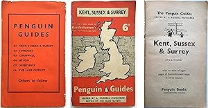
Paperback. Condición: Very Good for Age. Pre-WWII Penguin First Edition. 152 pp. clean & unmarked & only minor case shelfware, illustrated with Penguin line drawings, colour maps, and town plans in famous early Penguin 6d. Guide series, and the first of that series. Excellent condition for its age, and nowadays a rarity Size: Sm… 8vo. Maps, Line Drawings & 8pp. 3 Colour Bartholomew Maps (ilustrador). Pre-WWII Penguin Six Penny Ser.
Editorial: Meiklejohn & Son Ltd 1934
- Tapa dura
Librería: Stephen White Books, Bradford, Reino UnidoStephen White Books
Contactar con el vendedorVendedor de 5 estrellasCondición: Usado - Regular
EUR 23,46
Envío por EUR 38,52Se envía de Reino Unido a Estados Unidos de AmericaCantidad disponible: 1 disponibles
Hardcover. Condición: Acceptable. Ex-library book, usual markings. Well read with some wear but still very useable. Broken spine, does not affect reading good for its age. Quick dispatch from UK seller.

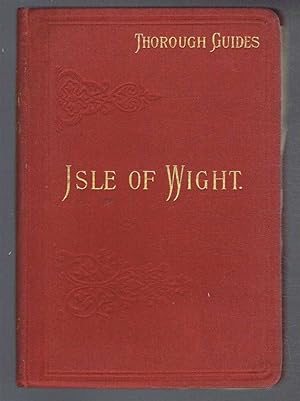
Thorough Guide Series | The Isle of Wight Including Notes for Geologists
Ward, C. S. [Maps and Plans by Bartholomew]. Revised and Enlarged by Ernest A. Baker.
Editorial: Published by Thomas Nelson and Sons Ltd., 35-36 Paternoster Row, London New and Revised Edition . 1913. 1913
- Tapa dura
Librería: Little Stour Books PBFA Member, Canterbury, Reino UnidoLittle Stour Books PBFA Member
Contactar con el vendedorVendedor de 5 estrellasMiembro de asociación: PBFA
Condición: Usado - Aceptable
EUR 29,84
Envío por EUR 34,76Se envía de Reino Unido a Estados Unidos de AmericaCantidad disponible: 1 disponibles
Condición: Good. Publisher's original scarlet cloth covered limp boards with rounded corners, gilt title and author lettering to the spine and to the upper panel, lemon front end paper map, red speckled page edges. 8vo. 6½'' x 4½''. Contains [xvi], xviii, 86 pp [36 pages illustrated advertisements] with 8 fold-out colour maps an…d plans all present and correct, cycling and motoring route map to the early pink pages. Publisher's pink correction slip tipped to the title page, name to the front free end paper, light rubbing to the covers and in Good clean condition, priced 2/6 to the foot of the spine. Member of the P.B.F.A. ISLE OF WIGHT.
Penetration of Arabia: A Record of the Development of Western, Knowledge Concerning the Arabian Peninsula (Khayats Oriental Reprint No. 22)
David George Hogarth (author); J. G. Bartholomew (illustrations from drawings, photographs and maps).
Editorial: Beirut: Khayats 1966
- Tapa dura
Librería: Saul54, Lynn, MA, Estados Unidos de AmericaSaul54
Contactar con el vendedorVendedor de 5 estrellasCondición: Usado - Muy bueno
EUR 66,73
Envío por EUR 7,02Se envía dentro de Estados Unidos de AmericaCantidad disponible: 1 disponibles
Hardcover. Condición: Near Fine. Beirut: Khayats (1966). 59 illustrations. XIII + 559 pages. AsNew Hardcover (IndianRed cloth,Gilt spine title, no dj). No Wear. A name on the Flyleaf otherwise 7.9"x5.0"x1.25". be25197.
 Más imágenes
Editorial: Published by Dulua and Co, London 1884
- Tapa dura
Librería: Keoghs Books, Skipton, Reino UnidoKeoghs Books
Contactar con el vendedorVendedor de 5 estrellasMiembro de asociación: PBFA
Condición: Usado
EUR 47,74
Envío por EUR 32,44Se envía de Reino Unido a Estados Unidos de AmericaCantidad disponible: 1 disponibles
, [4], 3, [3], xxxii, 216, xxiv pages, 13 coloured maps (mostly folding), also includes a section from the Lake District Defence Society, a price list for train tickets and adverts to rear Third Edition , corners and spine rubbed, areas of boards and spine faded, bleeding from colour of boards onto endpapers and first leaves at…the front, damp marks to top corner of other leaves, binding firm, good condition , original red cloth with blindstamped décor and gilt titles to front and spine, map to front endpapers , small octavo, 17 cm x 12 cm Hardback ISBN.
 Más imágenes
Editorial: Adam and Charles Black, Edingburgh 1868
- Tapa dura
Librería: Dark and Stormy Night Books, Newburyport, MA, Estados Unidos de AmericaDark and Stormy Night Books
Contactar con el vendedorVendedor de 5 estrellasCondición: Usado - Muy bueno
EUR 81,38
Envío por EUR 7,02Se envía dentro de Estados Unidos de AmericaCantidad disponible: 1 disponibles
Hard Cover. Condición: Near Fine. Second Edition. Possibly Second Edition. (Third edition was 1874.) Hard cover 16mo, in the original green cloth blindstamped in a geometric pattern (Blanck type Z) within double ruled borders in blind, the title blocked in gilt around a central vignette design featuring in image of Shakespeare's… head and three shields. Titles blocked to spine, rear board with only the blind stamped pattern. A printed map of England appears on the endpaper highlighted with a gold heart showing Warwarkshire area. A "Distance by Rail" feature in a starburst shape on the ffep., is also highlighted with gold. Frontispiece engraving of Kenilworth Castle appears opposite title page. Two fold-out maps detailing rail lines. and two smaller maps within text. **Contains a paginated 48pp." Black's Guide-book Advertiser" section (dated 1869) at the rear with "hotels in alphabetical order," and many charmingly engraved illustrations of the premises. Other useful travel products include Keating's Cough Lozenges and Insect Killing Powders, (hopefully not to be confused.) Rear end papers printed in violet, dated 1869 with titles for the 48 -item Black's Guide Book Series, with this item priced at 2s 6 d. J. Bartholomew, engraver, Edinburgh (maps) (ilustrador). Book.
 Más imágenes
Nile Quest, The Story of Exploration a record of Nile & it's Basin
Sir Harry Johnston, President of the African Soceity, frontispiece of Speke, illusts from drawings & photographs by author & others, maps by J. G. Bartholomew
Editorial: Frederick A. Stokes, 1903 1903
- Tapa dura
- Primera edición
Librería: Bluff Park Rare Books, LONG BEACH, CA, Estados Unidos de AmericaBluff Park Rare Books
Contactar con el vendedorVendedor de 4 estrellasMiembro de asociación: IOBA
Condición: Usado - Bueno
EUR 131,11
Envío por EUR 7,77Se envía dentro de Estados Unidos de AmericaCantidad disponible: 1 disponibles
Hardcover. Condición: Very Good. No Jacket. 1st Edition. Hard Cover. No Jacket. First Edition. HBNODJ, decorated green cloth,former owner name, October 1903, 1st edition stated,( 341pgs., 72 illustrations, 1 folding map at rear,notes, appendix ) VG+, AS-IS, NODJ.
Editorial: John Bartholomew and Co., Edinburgh
Librería: sonalsorises, los angeles, CA, Estados Unidos de Americasonalsorises
Contactar con el vendedorVendedor de 2 estrellasCondición: Usado - Excelente
EUR 81,38
Envío por EUR 6,14Se envía dentro de Estados Unidos de AmericaCantidad disponible: 1 disponibles
Condición: Fine. Unusual in this nice condition. Large fold-out map of London. Blue wrappers in excellent condition. Maps (ilustrador).
 Más imágenes
Editorial: Published by Oliver and Boyd Ltd., Tweeddale Court, Edinburgh | Simpkin, Marshall, and Co. Stationers Hall Court and Paternoster Row, London . 1881. 1881
- Tapa dura
Librería: Little Stour Books PBFA Member, Canterbury, Reino UnidoLittle Stour Books PBFA Member
Contactar con el vendedorVendedor de 5 estrellasMiembro de asociación: PBFA
Condición: Usado
EUR 238,68
Envío por EUR 34,76Se envía de Reino Unido a Estados Unidos de AmericaCantidad disponible: 1 disponibles
Hard back binding in publisher's original brick red cloth covered boards, blocked and lettered gilt back, charcoal black end papers. Thick 12mo. 7½'' x 5¼''. Contains pp. iv, 465 lexicon in double column followed by 32 single-sided double-page colour maps. Cloth rebacked preserving the original spine, text block particularly cle…an and without any age toning or foxing to the paper. Member of the P.B.F.A. CARTOGRAPHY, MAPS, PLANS.

Editorial: Alston Rivers, Limited, London 1905
- Tapa dura
- Primera edición
Librería: RareNonFiction, IOBA, Ladysmith, BC, CanadaRareNonFiction, IOBA
Contactar con el vendedorVendedor de 5 estrellasMiembro de asociación: IOBA
Condición: Usado - Aceptable
EUR 271,21
Envío por EUR 17,55Se envía de Canada a Estados Unidos de AmericaCantidad disponible: 1 disponibles
Hardcover. Condición: Good. First Edition. xl, 451, 4 [ads] pages. Two large colour fold-out maps of North American drainage basins by J.G. Bartholomew; Black and white photographic plates and diagrams. "In the following pages an attempt has been made to set forth in order the chief facts relating to the discovery and exploratio…n of the northeastern part of the continent of North America." - Preface. Professionally rebacked using original cloth. Unmarked with average wear. Small tape repair to first fold-out map. Second fold-out map loose but present with minor loss to one corner. A sound copy. MORLEY [Ontario] p.7, MORLEY [Atlantic] p.3. Size: 8vo - over 7¾" - 9¾" tall. Bartholomew, J.G. [Maps] (ilustrador).
Editorial: George Newnes Limited, London
Librería: Excalibur Books, Penzance, Reino UnidoExcalibur Books
Contactar con el vendedorVendedor de 3 estrellasCondición: Usado - Aceptable
EUR 71,60
Envío por EUR 24,33Se envía de Reino Unido a Estados Unidos de AmericaCantidad disponible: 1 disponibles
Disbound. Condición: Good. Undated Edition, circa early 1900s. Frontis illustrated with Flags. Maps printed in Colour and on one side of the paper. 156 Pages of Maps + the 134 Page Gazetteer. 14" Tall, 2.5 Kilos. Disbound. First few pages loose but the rest of the text block is firm. Number and Name of all Maps niceluy hand writ…ten on the blank preliminary pages. Some additional interesting Material either pasted on blank pages or slipped in. Atlas weighs 2.5 Kilos so Shipping Outside UK will be extra. Please ask if you would like more Pictures, Information or a Shipping Quote. Size: Folio - over 12" - 15" tall.


