Importe total (1 artículo artículos):
Destino del pedido:

lotter tobias conrad (250 resultados)
Comentarios
Ir a los resultados principales
Filtros de búsqueda
Tipo de artículo
- Todos los tipos de productos
- Libros (108)
- Revistas y publicaciones (No hay ningún otro resultado que coincida con este filtro.)
- Cómics (No hay ningún otro resultado que coincida con este filtro.)
- Partituras (No hay ningún otro resultado que coincida con este filtro.)
- Arte, grabados y pósters (78)
- Fotografías (No hay ningún otro resultado que coincida con este filtro.)
- Mapas (64)
- Manuscritos y coleccionismo de papel (No hay ningún otro resultado que coincida con este filtro.)
Encuadernación
Más atributos
Idioma (3)
Gastos de envío gratis
Ubicación del vendedor
Valoración de los vendedores
-
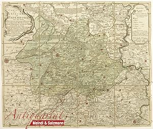
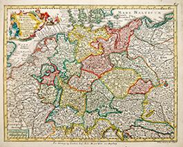
"Carte le l Eveché de Paderborn avec une Partie de Westphalie . dressée par Mr. Charlet de la Roziere.".
Publicado por Augsburg, Lotter, 1762., 1762
Librería: Antiquariat MEINDL & SULZMANN OG, Wien - Vienna, Austria
Calificación del vendedor: 4 de 5 estrellas

EUR 65,00
Convertir monedaEUR 20,00 gastos de envío desde Austria a EspańaCantidad disponible: 1 disponibles
Ańadir al carritoCa. 46 x 55 cm.- In 12 Segmenten auf Leinen aufgezogen u. faltbar eingerichtet. Zeigt das Bistum Paderborn. Oben links muschelförmige Kartusche mit Autorenangabe, Verlegeradresse, Druckort und Datierung. Oben rechts Kartusche mit Erklärungen der Kartensymbole, darunter 2 verschiedene Meilenzeiger.- Guter Erhaltungszustand.
-
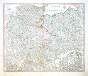
Alte Karte Episcopatus Hildesiensis Hildesheim Lotter C.T. (1717 - 1777) Koloriert!
Publicado por oA/oA/oA
Librería: Bücherhandel-im-Netz/Versandantiquariat, Hildesheim, NI, Alemania
Calificación del vendedor: 5 de 5 estrellas

EUR 171,00
Convertir monedaEUR 16,00 gastos de envío desde Alemania a EspańaCantidad disponible: 1 disponibles
Ańadir al carritoweicher Einband. Kartenmaß ca. 56,5 cm breit x 48 cm hoch. (Blattgröße ca. 61 cm breit x 54 cm hoch.) Kartenmaß ca. 56,5 cm breit x 48 cm hoch. (Blattgröße ca. 61 cm breit x 54 cm hoch.) EPISCOPATUS HILDESIENSIS CUM ADJACENTIBUS PROVINCIIS AC ATATIBUS MAPPA GEOGRAPHICA REPRAESENTATUS Studio et Impensis TOB: CONRADI LOTTER* GEOGRAPHI Cum Privil. Sac. Rom. Imp. Vicariat. // (Tobias Conrad Lotter, geboren 1717, verstorben 1777. Kupferstecher, Kartograph, Verleger aus Augsburg.) Sprache: Deutsch (unbesetzt) 1100 gr.
-
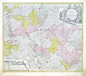
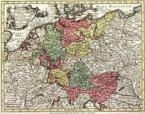
Archiepiscopatus et Electoratus Moguntinus, ut et
Publicado por Lotter, Tobias Conrad, Augsburg, 1750
Librería: Antikvariat Krenek, Prag, Republica Checa
Miembro de asociación: ILAB
Calificación del vendedor: 5 de 5 estrellas
EUR 216,68
Convertir monedaEUR 12,50 gastos de envío desde Republica Checa a EspańaCantidad disponible: 1 disponibles
Ańadir al carrito"Archiepiscopatus et Electoratus Moguntinus, ut et Comitatus Uterq. Catimelibocens, Wertheimensis Erpacens . accuratißime delineatae". Altkol. Kupf.-Kte. von T. C. Lotter (1717-1777), Augsburg, ca. 1750. Mit gr. herald. und figur. Titelkart. oben rechts und figur. Kart. mit Erklärungen und Meilenanzeiger unten links. 49:57,5 cm. Dekorative Karte mit Frankfurt am Main in der Mitte, Speyer, Mannheim und Heidelberg unten, Wetzlar oben, Mainz und Kreuznach links, Wertheim rechts und viele andere Städte.
-
Novissimum Astronomiae, Geographia Ac Gnomonicae, Compendium Theoreticum aque ac practicu, unacu figuris, earu explicatione et usu, in unius mappae geographicae philyram Collectum Ao 179. -
Publicado por Augsburg: Matthäus Seutter., 1749
Librería: Antiquariat Tautenhahn, Lübeck, Alemania
Miembro de asociación: GIAQ ILAB VDA
Calificación del vendedor: 5 de 5 estrellas
Arte / Grabado / Póster
EUR 300,00
Convertir monedaEUR 35,00 gastos de envío desde Alemania a EspańaCantidad disponible: 1 disponibles
Ańadir al carritoAltkolorierter Kupferstich 49 x 56,5 cm, Blattgröße 49 x 59 cm. Der altkolorierte Kupferstich von Tobias Conrad Lotter zeigt "eine Lehrtafel zur Funktionsweise und Anfertigung von Sonnenuhren sowie deren astronomischen und geographischen Grundlagen. Neben ausführlichen schriftlichen Erläuterungen in Latein werden die komplexen Zusammenhänge durch Zeichnungen einer sogenannten Quadrantenuhr und einer Universaluhr sowie durch weitere illustrierende Skalen und figürliche Abbildungen veranschaulicht." ( siehe Ritter, Die Welt aus Augsburg Nr. 11). Der Text ist auf den Geographen Johannes Scherer (1628 - 1704) zurückzuführen. - Tobias Conrad Lotter 1717 - 1777, Kupferstecher und Verleger in Augsburg, erbte 1756 zusammen mit Albrecht Seutter und Probst die Firma seines Schwiegervaters Matthias Seutter. - Am oberen und unteren Blattrand eng beschnitten, mittig im Falz leicht wasserfleckig. Am oberen Blattrand an mehreren Stellen berieben, dadurch kleine Verluste im Titel. Rückseitig im unteren Drittel mit Leinen verstärkt, darüber Spuren alter Montage. Der Druck klar, die Zeichnungen in einer ausdrucksvollen Farbigkeit. Ein schönes, interessantes Blatt.
-
Atlante geografico portatile ad uso di Eugenio Ardente
Publicado por Auguste Vindel, 1750
Idioma: Francés
Librería: Rossignol, Paris, Francia
Calificación del vendedor: 2 de 5 estrellas

EUR 2.800,00
Convertir monedaEUR 15,00 gastos de envío desde Francia a EspańaCantidad disponible: 1 disponibles
Ańadir al carritoCouverture rigide. Condición: Trčs bon. Bel atlas de poche format in24 oblong (14,5 x 12 cm), en reliure d'époque plein cuir vert ŕ décors romantiques, trois tranches dorées, gardes marbrées. Belle planche allégorique gravée en frontispice et 31 cartes gravées pleine page par Tobias Lobeck ou Tobias Conrad Lotter, en coloris d'époque, éditées par Auguste Vindel. Toutes les cartes portent leur nom en marge inférieure. Lotter est l'un des cartographes allemands les plus connus du XVIIIe sičcle. Il a gravé plusieurs des cartes publiées par Matthaus Seutter, son beau-pčre. Il a repris l'entreprise de Seutter en 1756. A son décčs, son fils lui succéde dans l'entreprise. Exemplaire ayant appartenu ŕ la bibliothčque de M. Eugčne Ardente, la page de titre porte son nom, et ses initiales "G.A." ont été gravées en caractčres gothiques dorés au centre de chaque plat. Liste des cartes: Mappemonde céleste, Mappemonde terrestre, Europe, Asie, Afrique, Amérique, Espagne Portugal, France, Italie, Rép. de Gęnes, Etats Ecclésiastiques, Isles Britanniques, carte des XVII Provinces, Allemagne inférieure, Suisse, Allemagne ou empire Romain, Autriche, Baviere Souabe Franconie, Pays-Bas Flandres Luxembourg, Saxe, Boheme Moravie Silesie, Italie du nord, Italie centre nord, Bohčme, Pologne, Prusse, Danemark, Scandinavie, Russie, Hongrie, Grčce Balkans.
-

Recens Edita totius Novi Belgii, in America Septentrionali siti, delineatio cura et sumtibus Tob. Conr. Lotteri, Sac. Caes. Maj. Geographi August. Vind
Publicado por Tobias Conrad Lotter, Augsburg, 1760
Librería: Donald A. Heald Rare Books (ABAA), New York, NY, Estados Unidos de America
Miembro de asociación: ABAA ILAB
Calificación del vendedor: 3 de 5 estrellas

Mapa
EUR 2.540,23
Convertir monedaEUR 30,83 gastos de envío desde Estados Unidos de America a EspańaCantidad disponible: 1 disponibles
Ańadir al carritoCopper-engraved map, full hand-colouring, with integral uncoloured vignette view of "Neu Jorck". In good condition, but with a small embossed owner's stamp in lower right corner and expertly restored centerfold. An example of the second state of this map to carry Lotter's imprint: an important map of the American northeast with an inset view of New York City This is the fifth state (with the 'Boston' reading) of a map originally issued by Matthaeus Seutter (1678-1757) in 1730, but is also a fine example of one of the much-pirated Jansson-Visscher New England series of maps, first published by Visscher in 1651. The present Seutter/Lotter plate `is the first map in the [Jansson-Visscher] series to show . the boundaries of Massachusetts, New England, New York, New Jersey and Pennsylvania'. There are three states with Seutter's imprint, and after his death in 1757 his son-in-law, Tobias Conrad Lotter, inserted his own name and three further states were published. This is the second of those three states with the spelling of Boston corrected. To this map of the northeast is added the famous 'Restitutio View' of New York City, which celebrated the brief return to Dutch governance from late 1672 until February of 1674. This is one of the earliest views of the city. Adorning the inset view is a very elaborate tableau in which the Emperor, Charles VI, is shown attended by Hermes, god of commerce, Athena, goddess of wisdom, and Hera, who is standing over a chest of gold coins. Behind the divine beings, dark-skinned workers of the world carry nature's products to lay at the Emperor's feet. The Seutter / Lotter dynasty was one of the most important of all eighteenth-century German map-making firms. The business was established by Lotter's father-in-law who had trained under the renowned cartographer Johann Baptiste Homann in Nuremberg. By 1731 Seutter had been appointed Geographer to the Imperial Court. On his death, Lotter continued in the same post, and with his son Mathais Albrecht Lotter produced cartographical works of a consistently high quality throughout the 18th century. Manhattan in Maps pp.46-47; cf. McCorkle New England 730.5 (1st state, but briefly noting later states); cf. Stokes & Phelps The Iconography of Manhattan Island 1498-1909 I, plate 16b and p.223 (1st state); R.V. Tooley The Mapping of America p.291, #27.
-
Atlas Geographicus portatilis
Publicado por Lobeck, Augsburg, 1750
Librería: Antikvariat Krenek, Prag, Republica Checa
Miembro de asociación: ILAB
Calificación del vendedor: 5 de 5 estrellas
Ejemplar firmado
EUR 1.666,80
Convertir monedaEUR 12,50 gastos de envío desde Republica Checa a EspańaCantidad disponible: 1 disponibles
Ańadir al carritoHardcover. Condición: Gut bis sehr gut. Lotter, Tobias Conrad - Lobeck, Tobias. "Atlas Geographicus portatilis XXIX mappis orbis habitabilis regna exhibens". Augsburg: Lobeck, ca. 1750. Oblong 12mo. Engraved frontispiece and title, 35 old coloured copperplate maps, engraved 'Index mapparum Geographicarum', 72 pages ("Kurzgefasste Geographie in sich haltend . Entwurf aller Theile des bewohnten Erdbodens, nebst . Land-Charten, welche einen kleinen Sack-Atlas ausmachen"). Orig. full-leather binding from the time. Includes, among others, a map of the World and maps of 4 continents. - To the original 29 maps listed in Index (signed 'Tobias Lobeck del. et exc. A .V. - Tob. Conr. Lotter fc. Aug. Vind') 6 more maps (Lower and Upper Silesia, Saxony, Lower and Upper Saxony, Westphalia; signed 'Tobais Lobeck Scupsit delinea et excudit Augusta Vinde') are bound in this copy. - Binding somewhat rubbed, the map of Swabia with a brown stain (see photo), otherwise well preserved. Signatur des Verfassers.
-

Atlas Geographicus Portatilis, XXIX. mappis orbis habitabilis regna exhibens.
Publicado por vendit in ejus aedib. in suburb. Jacobaeo, in reg. Paradisi, [Augsburg], 1762
Librería: Jeffrey H. Marks, Rare Books, ABAA, Rochester, NY, Estados Unidos de America
Miembro de asociación: ABAA ILAB
Calificación del vendedor: 5 de 5 estrellas
EUR 5.896,97
Convertir monedaEUR 31,71 gastos de envío desde Estados Unidos de America a EspańaCantidad disponible: 1 disponibles
Ańadir al carritoDouble-page engraved frontispiece; engraved illustrated title page, 37 double-page engraved maps, and double-page Index at rear, listing only 29 maps as found in most copies. Some copies include 72 pages of text after the Index; this is one of the copies with no text. Approx. 4-1/2 x 3-1/4 inches, old (18th c.?) full leather, elaborately blindstamped. Phillips 630. Shallow chip at the bottom of the spine; leather rubbed; contents fine. This is the Schweitzer family copy, with "Schweitzer 1884" in the pastedown, and a signed presentation inscription from Albert Schweitzer to his only child, Rhena Schweitzer [Miller] in 1948. There is a later pencil notation by the owner who obtained this Atlas from Rhena, and and earlier ink ownership signature.
-
Atlas geographicus portabilis XXXIX mappis orbis habitabilis regna exhibens (atlas de poche de Conrad Lotter)
Publicado por Tobias Conrad Lotter, Tobias Lobeck
Librería: Abraxas-libris, Bécherel, Francia
Miembro de asociación: ILAB
Calificación del vendedor: 5 de 5 estrellas
EUR 1.540,00
Convertir monedaEUR 7,95 gastos de envío desde Francia a EspańaCantidad disponible: 1 disponibles
Ańadir al carritoRelié. Magnifique petite atlas de poche comprenant 39 cartes, dont une planisphčre, une carte du ciel et 37 cartes, une carte de l'Afrique, une carte de l'Asie, une carte de l'Europe, une carte des Amérique, puis de l'Europe toutes aquarellées ŕ la main ŕ l'époque. Il manque malheureusement ŕ ce tout petit atlas sa page de titre et son frontispice gravés. Il n'en reste pas moins que l'ensemble est complet des cartes indiquées dans l'index (bien présent en fin d'ouvrage). Certains exemplaires plus tardifs contenaient d'autres cartes de l'allemagne. L'absence de ces cartes laisse penser qu'il s'agirait d'un tirage proche de la premičre édition (1747) ; trčs jolie petite reliure décorée de motifs floraux entourant un oiseau sous un dais. Dos fatigué, coiffes manquantes, coins usés, intérieur trčs frais. Livraison a domicile (La Poste) ou en Mondial Relay sur simple demande. Tobias Conrad Lotter.
-
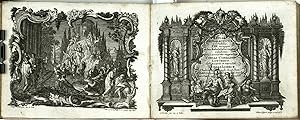
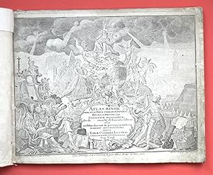
Atlas minor praecipua Orbis terrarum Imperia, Regna et Provincias, Germanić potissimum, tabelli exacte delineatis sistens usui militić ducum ac peregrinantium maxime accommodatus opera Tobiae Conradi Lotteri, Chalcographi et Geographi Aug. Vind.
Publicado por [Augsburg: Tobias Conrad Lotter, 1744], 1744
Librería: Andarto B., Pamplona, NA, Espańa
Miembro de asociación: AILA ILAB
Calificación del vendedor: 5 de 5 estrellas
EUR 2.500,00
Convertir monedaGratis gastos de envío en EspańaCantidad disponible: 1 disponibles
Ańadir al carritoEncuadernación de tapa blanda. Condición: Bien. [Para pedidos desde fuera de Espańa, por favor, consulte las condiciones de venta y envío, tipo A. / For orders to be delivered outside Spain, please, let you see our sale and shipping terms, type A. / Pour les commandes ŕ livrer hors d'Espagne, s'il vous plait, voyez les conditions de vente et de livraison, type A].- // (220x290mm.); portada galcográfica firmada 'Jacob Christoph Weyerman, inv. et delin., Martin Gottfrid Grophius, sculps.'; 20 mapas grabados coloreados a mano, dibujados por A.C. Seutter, grabados por Andreas Silbereisen o por Tobias Lotter, e impresos por Tobias Lotter, huella (209x270mm).- // Cubierta rústica de época en papel de aguas; tejuelo de papel de época en plano delantero. Márgenes de las cubiertas reforzadas de época; puntas rozadas; papel oscurecido; última plancha, con el cuadro de distancias entre las principales poblaciones de Alemania, 'pegada' a la cubierta trasera.- // Proc.: De la biblioteca del Château de La Chaux. Libros.
-
Atlas Novus Sive Tabulae Geographicae Totius Orbis Faciem, Partes, Imperia, Regna et Provincias exhibentes, exactissima cura iuxta recentissimas observation. Aeri incisae et venum expositae a Tibia Conrado Lotter, Calcogr. et Geographo
Publicado por Tobia Conrado Lotter, 1772
Librería: Librería Miguel Miranda, Lope de Vega n.ş XIX, Madrid, M, Espańa
Miembro de asociación: AILA ILAB
Calificación del vendedor: 5 de 5 estrellas
Mapa
EUR 18.000,00
Convertir monedaEUR 3,95 gastos de envío en EspańaCantidad disponible: 1 disponibles
Ańadir al carritoCondición: Fair / Aceptable. Augustae Vindelicorum [Augsburgo]: Tobia Conrado Lotter, [ca. 1772].- Portada in frontis grabada al cobre + 1 "planisphaeriun coeleste" a doble página también grabado al cobre e iluminado a mano + 1 "Mapa Totius Mundi" a doble página, grabado al cobre e iluminado a mano + 34 preciosos mapas a doble página, iluminados a mano y grabados al cobre. En total, sin incluir el frontis, suman la cantidad de 36 mapas a doble página, todos grabados en la prensa del cartógrafo Tobia Conrado Lotter, menos el último de [U.S.A.] que fue publicado y grabado por Mathieu [Matthäus] Albert Lotter, muchos de los mapas están grabados por Matthäus Albert Lotter (1741-1810) que era hijo de Tobías Conrado Lotter; In Folio imperial (53,5 x 36 cm.); Magníficas estampaciones sobre grueso papel de hilo; Enc. en Plena Piel época sin dorados.- PASO AHORA A DESCRIBIR CADA MAPA, todos a doble página de 52,5 x 66,8 cm. aproximadamente: (A), Frontis grabado al cobre a página completa y sin iluminar. (B), Planisphaerium Coeleste. (C), Mapa Totius Mundi. (1), EUROPA delineata juxta Observationes Excellorum Virorum Academiae Ragalis Scientiarum et nonnulloraliorum et juxta recentissimas annotationes per G. de L'Isle. (2), ASIA Concinata Secundum Observationes Academiae Regalis Scientiarum et nónnullas alias et juxta annotationes recentissimas per G. de L'Isle. (3), AFRICA Concinata Secundum Observationes. per G. de L'Isle. (4), AMERICA SEPTENTRIONALIS Concinata jusxta Observationes. et juxta annotationes recentisimas per G. de L'Isle. (5), AMERICA MERIDIONALIS Concinata juxta Observationes.et annotationes recentissimas per G. de L'Isle. (6), REGNA PORTUGALLIAE ET ALGARBIAE, cum adjacentibus Hispaniae Orivinciis. Quibus in peculiari et minori mapa adjuntum ast Brasiliae Regnum. (7), HISPANIA es Arehetypo Roderici Mendez Sylvae et variis relationibus etchartis manu scriptis.obsevationes per G. de L'Isle. (8), LE ROYAUME DE LA FRANCE et les conquetes de Louis le Grand. (9) LA GRANDE BRETAGNE O LES ROYAUMES D'ANGLETERRE ET D'ESCOSSE comme ausi le Royaume D'IRLANDE devisée par Provinces. (10), XVII PROVINCIAE BELGII sive GERMANIA INFERIORIS priscis temporib CIRCULO BURGUNDICO S. R. I. anumeratae quarum X hodie maximam partem HISPANIARUM non nullae Gallia Regis ditioni subjacent VII vero sub nomme FEDERETARUM PROVINCIAE liberatae gaudent Studio et Opera. (11), BELGICA FEDERATA complectens SEPTEM PROVINCIAS, DUCATUM GELDRIAE et ZEELANDIAE DIOEC, TRAJECT, TRANSISUL, GRONINGAM et FRISIAM et circumjacentes Provincias. (12), ITALIA anexis Insulis SICILIA, SARDINIA et COSICA. (13), NAPOLIS REGNUM quo continentur Aprutium Ulterius et Citerius, Comitatus Molisius, Terra Laboris, Capitaniata Principat. Ulterior et Citerior, Barianus et Hydruntinus Ager Basilicata, Calabria Citerior et Ulterior. (14), Novissima et Accuratissima HELVETIAE, Rhaeriae, Valesiae et Partis Sabaudiae, tabula. (15), GERMANIA Secundum Observationes Tychonis de Brahe, Kepleri, Snellii, Zeileri.Autorum veterum et novorum concinnata per G. de L'Isle. (16), Mapa Geographica exhibens POSTAS omnes tam vehiculares quam veredarias TOTIUS GERMANIAE cum earum accurata distantia Diligentissime propriis sumptibus excudit. (17), Mappa Geographica REGNUM BOHEMIA cum adiunctis DUCATU SILESIAE, et MARCHIONATIB, MORAVIAE, et LUSATIAE. (18), Marchionatus BRANDERBURGENSIS, Ducatus POMERANIAE, et Ducatus MECKLENBURGICUS. (19), DANIAE REGNUM cum Ducatu HOLSATIAE, et SLESVICI, nec Insulae DANICAE, et IUTLA cum partes SCANIAE. (20), REGNUM NORWEGIAE accurata et novissima Deline atione juxta V. Praefecturas Generales Aggerusiensem, Bergensem, Nodrosiens, Wardhusiens et Bahus. (22), MAGNI DUCATUS FINLANDIAE, RUSSIAE partim, partim SUECIAE subjecti, SINUS item BOTHNICI ac FINNICI nova et accurata delineatio. (23), Spatiosissimum IMPERIUM RUSSIAE MAGNAE juxta recentissimus Observationes MAPPA GEOGRAPHICA. (24), LIVONIAE et CURLANDIAE DUCATUS, cum Insulis adjacentiib. Mappa Geaographica. (25), BORUSSIAE REGNUM, complectens Circulos.
-
Atlas Geographicus portatilis XXIX mappis orbis habitabilis regna exhibens.
Publicado por [Augsburg: Johann Michael Wagner, ca 1760]., 1760
Librería: Arader Galleries - AraderNYC, New York, NY, Estados Unidos de America
Calificación del vendedor: 5 de 5 estrellas
EUR 2.494,87
Convertir monedaEUR 30,83 gastos de envío desde Estados Unidos de America a EspańaCantidad disponible: 1 disponibles
Ańadir al carritoOblong 12mo., (4 1/8 x 5 4/8 inches). Engraved index at end. Engraved allegorical title-page by Tobias Lobeck after G. Eichler, 29 fine engraved maps with original hand-colour in full by Lotter after Lobeck (some close cropped). Contemporary maroon roan backed, marbled paper boards, green roan corners (extremities a little scuffed). Provenance: With the near contemporary ownership inscription of Valentine Germano on the front endpapers. First published by Lotter (Mattheus Seutter's son-in-law) and Lobeck in 1747 with an accompanying almanac. This attractive and detailed little atlas was re-issued for many years, with the maps reprinted and with new maps added, but the title-page continued to report 29 maps as here. The maps included are: a fine double-hemisphere world map "Planisphaerium Globi Terrestris", a double-hemisphere celestial map "Hemisphaerium Boreali" [and] "Hemisphaeriusm Australe"; maps of each continent including a fine map of North and South America, the map of Asia shows the northernmost coastline of Australia; and a series of comprehensive maps of Europe, each with the title within a fine cartouche. [cf. Nordenskiold 2, 135; Phillips Atlases 632]. Catalogued by Kate Hunter.
-
Imperium Romano-GermanicumÖ
Publicado por Augsburg,, 1750
Librería: libreria antiquaria perini Sas di Perini, Verona, VR, Italia
Miembro de asociación: ALAI ILAB
Calificación del vendedor: 5 de 5 estrellas
Arte / Grabado / Póster
EUR 130,00
Convertir monedaGratis gastos de envío desde Italia a EspańaCantidad disponible: 1 disponibles
Ańadir al carritoIncisione in rame, colorata d'epoca, mm 197x260, tratta da "Atlas minor". Lotter, incisore e geografo tedesco, dopo aver lavorato per Seutter, suo suocero, ne rilevÚ l'attivit? alla sua morte mantenendo alto il livello artistico della sua produzione. Ottimo esemplare fascinoso, con cartiglio decorativo nell'angolo sin. superiore. Nr.cat: P5280011.
-
Regnum BohemiaeÖ
Publicado por Augsburg,, 1750
Librería: libreria antiquaria perini Sas di Perini, Verona, VR, Italia
Miembro de asociación: ALAI ILAB
Calificación del vendedor: 5 de 5 estrellas
Arte / Grabado / Póster
EUR 150,00
Convertir monedaGratis gastos de envío desde Italia a EspańaCantidad disponible: 1 disponibles
Ańadir al carritoIncisione in rame, colorata d'epoca, mm 195x255, tratta da "Atlas minor". Lotter, incisore e geografo tedesco, dopo aver lavorato per Seutter, suo suocero, ne rilevÚ l'attivit? alla sua morte mantenendo alto il livello artistico della sua produzione. Ottimo esemplare fascinoso, con cartiglio decorativo nell'angolo destro superiore, raffigurante cavalieri. Nr.cat: P5280012.
-
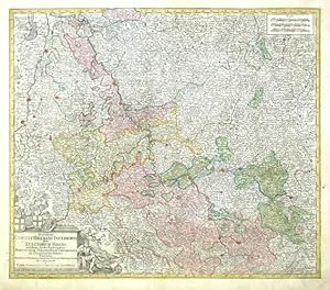
Synopsis Rhenani Inferioris, Sive Electorum Rheni
Publicado por Lotter, Tobias Conrad, Augsburg, 1760
Librería: Antikvariat Krenek, Prag, Republica Checa
Miembro de asociación: ILAB
Calificación del vendedor: 5 de 5 estrellas
EUR 150,01
Convertir monedaEUR 12,50 gastos de envío desde Republica Checa a EspańaCantidad disponible: 1 disponibles
Ańadir al carrito"Synopsis Rhenani Inferioris, Sive Electorum Rheni, exhibens Archi-Episcopatum Moguntium, Coloniensem, Trevirensem et Palatinatum Rheni, Comitatus Beilstein, Newenaer, Isenburg Infer. et Reifferscheid; ob oculos posita". Altkol. Kupfer-Karte. bei T. C. Lotter, Augsburg, ca. 1760. Mit herld. Titelkart. und Kartusche mit Meillenanzeiger ("Scalae"). 49,5:58 cm. Karte von Rheinlände von Heidelberg und Speyer im Süden bis zu Düsseldorf im Norden.
-
Regni Hungariae.
Publicado por Augsburg,, 1750
Librería: libreria antiquaria perini Sas di Perini, Verona, VR, Italia
Miembro de asociación: ALAI ILAB
Calificación del vendedor: 5 de 5 estrellas
Arte / Grabado / Póster
EUR 170,00
Convertir monedaGratis gastos de envío desde Italia a EspańaCantidad disponible: 1 disponibles
Ańadir al carritoIncisione in rame, colorata d'epoca, mm 200x265, tratta da "Atlas minor". Lotter, incisore e geografo tedesco, dopo aver lavorato per Seutter, suo suocero, ne rilevÚ l'attivit? alla sua morte mantenendo alto il livello artistico della sua produzione. Ottimo esemplare fascinoso, con cartiglio decorativo nell'angolo destro superiore. Nr.cat: P5280018.
-
IMPERIUM ROMANO GERMANICUM in suos CIRCULOS ELECTET STATUS
Publicado por Augsberg. c1760, 1760
Librería: Peter Harrington. ABA/ ILAB., London, Reino Unido
Miembro de asociación: ABA ILAB PBFA
Calificación del vendedor: 5 de 5 estrellas
EUR 164,95
Convertir monedaEUR 11,86 gastos de envío desde Reino Unido a EspańaCantidad disponible: 1 disponibles
Ańadir al carritoDetailed map of Germany coloured by region, decorative cartouche at top left Copper engraving. In excellent condition Original colour. Size: 25.5 x 20 cm.
-

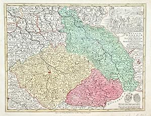
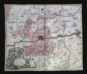
Mappa Geographica Totius Regni Bohemiae in XII Circulos annexis Comitatu Glacensi et Districtu Egerano nec non aliis principatib finitimis. Noviter et exactissime elaborata. Cura et sumptibus Tobiae Conradi Lotter, Calcogr. Aug. Vindel. Grenz- und Flächenkolorierte Kupferstichkarte. Blattgröße: 51 cm x 60 cm.
Ańo de publicación: 1758
Librería: Antiquariat am St. Vith, Mönchengladbach, Alemania
Calificación del vendedor: 5 de 5 estrellas
Mapa
EUR 162,00
Convertir monedaEUR 16,00 gastos de envío desde Alemania a EspańaCantidad disponible: 1 disponibles
Ańadir al carritoHardcover. gefaltet, im weißen Rand geringf. fleckig, gutes Exemplar. mit 2 Kartuschen, 1 kl. Ansicht von Prag und 1 Meilenanzeiger.
-
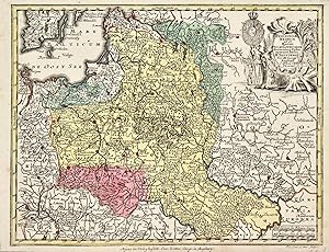
Saxoniae Inferioris Circulus
Publicado por Lotter, Tobias Conrad, Augsburg, 1750
Librería: Antikvariat Krenek, Prag, Republica Checa
Miembro de asociación: ILAB
Calificación del vendedor: 5 de 5 estrellas
EUR 166,68
Convertir monedaEUR 12,50 gastos de envío desde Republica Checa a EspańaCantidad disponible: 1 disponibles
Ańadir al carrito"Saxoniae Inferioris Circulus exhibens Ducatus Brunswic. Lüneburg. Magdeburg. Bremens. Mechlinoburg. et Holsat. nec non Marchionatum Brandenburg: cum aliis Statibus et Principatibus atque Regionibus adjacentibus". Orig. copperplate engraving, T. C. Lotter (1717-1777), Augsburg, ca. 1750. Orig. old colouring. With figure title-cartouche and ornamental cartouche with the scale of map and explanatory notes. 48,5:57,5 cm (19 x 22 3/4 inch.). A map of northern part of Germany.
-

Eposcopatius Hildensiensis cum adjacentibus provinciis ac statibus mappa geographica repraesentatus studio et imprensis Tob. Conradi Lotter.
Publicado por Augsburg, Tobias Cornad Lotter, (ca. 1760)., 1760
Librería: Biblion Antiquariat, Zürich, ZH, Suiza
Miembro de asociación: GIAQ ILAB VEBUKU
Calificación del vendedor: 5 de 5 estrellas
EUR 180,00
Convertir monedaEUR 15,00 gastos de envío desde Suiza a EspańaCantidad disponible: 1 disponibles
Ańadir al carritoPlattengrösse: 49x57,5cm. Blattgrösse: 55,5x63,5 cm. Kolor. gestoch. Karte, gefaltet. Vgl. Sammlung Ryhiner 5206,57 (Seutter). - Titelkartusche unten rechts. - (Hs. Notiz oben links. Unten links etwas wasserrandig).
-
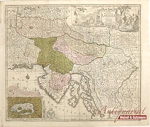
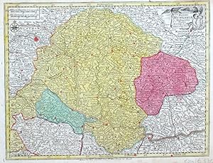
"Exactissima Ducatus Carniolae et Histriae delineatio cura et caelo Tob. Conr. Lotter, Geogr. Aug. Vind.".
Publicado por Augsburg, Lotter, (um 1760)., 1760
Librería: Antiquariat MEINDL & SULZMANN OG, Wien - Vienna, Austria
Calificación del vendedor: 4 de 5 estrellas
EUR 180,00
Convertir monedaEUR 20,00 gastos de envío desde Austria a EspańaCantidad disponible: 1 disponibles
Ańadir al carritoBlattgröße ca. 53,5 x 62,5 cm. Bildausschnitt ca. 49 x 57 cm. Die Karte zeigt Istrien und Slowenien und Teile der dalmatinischen Küste. In der rechten oberen Ecke große, dekorative Titelkartusche. In der linken unteren Ecke Insetkarte vom Zirknitzer See: "Der Czirknizer See ist ein kleiner District Landes im hohen Gebürg 6 Meilwegs von Laibach entlegen, worinnen in einem Jahr reichlich gefischet und allerhand wilde Thiere gejaget.". Im westlichen Bereich der Golf von Triest und im Norden auch die Umgebungen von Klagenfurt und Villach eingezeichnet. Mittelfalz geglättet. Winzige Fehlstelle im Bereich der Kartusche hinterlegt.
-
Nouvelle Carte du Cercle de Bourgogne ou l' on voit toutes les possessions de la maison d'Autriche dans les Pays Bas
Publicado por Augsburg, 1750
Librería: libreria antiquaria perini Sas di Perini, Verona, VR, Italia
Miembro de asociación: ALAI ILAB
Calificación del vendedor: 5 de 5 estrellas
Arte / Grabado / Póster
EUR 200,00
Convertir monedaGratis gastos de envío desde Italia a EspańaCantidad disponible: 1 disponibles
Ańadir al carrito -
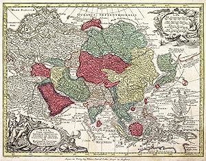
Asia cum omnibus Imperiis provinciisÖ
Publicado por Augsburg,, 1750
Librería: libreria antiquaria perini Sas di Perini, Verona, VR, Italia
Miembro de asociación: ALAI ILAB
Calificación del vendedor: 5 de 5 estrellas
Arte / Grabado / Póster
EUR 200,00
Convertir monedaGratis gastos de envío desde Italia a EspańaCantidad disponible: 1 disponibles
Ańadir al carritoIncisione in rame, colorata d'epoca, mm 195x255, tratta da "Atlas minor". Lotter, incisore e geografo tedesco, dopo aver lavorato per Seutter, suo suocero, ne rilevÚ l'attivit? alla sua morte mantenendo alto il livello artistico della sua produzione. Ottimo esemplare fascinoso, con cartigli decorativi negli angoli. Nr.cat: Cod 7448.
-

XVII Provinciae Belgii sive Germaniae inferiorisÖ
Publicado por Augsburg,, 1750
Librería: libreria antiquaria perini Sas di Perini, Verona, VR, Italia
Miembro de asociación: ALAI ILAB
Calificación del vendedor: 5 de 5 estrellas
Arte / Grabado / Póster
EUR 200,00
Convertir monedaGratis gastos de envío desde Italia a EspańaCantidad disponible: 1 disponibles
Ańadir al carritoIncisione in rame, colorata d'epoca, mm 197x256, tratta da "Atlas minor". Raffigura Belgio e Germania inferiore. Lotter, incisore e geografo tedesco, dopo aver lavorato per Seutter, suo suocero, ne rilevÚ l'attivit? alla sua morte mantenendo alto il livello artistico della sua produzione. Ottimo esemplare fascinoso, con cartiglio decorativo in alto a sinistra raffigurante gli stemmi. Nr.cat: P5280010.
-
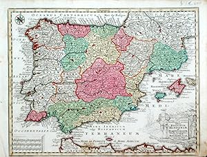
Novissima et accuratissima Regnorum Hispaniae et PortugalliaeÖ
Publicado por Augsburg,, 1750
Librería: libreria antiquaria perini Sas di Perini, Verona, VR, Italia
Miembro de asociación: ALAI ILAB
Calificación del vendedor: 5 de 5 estrellas
Arte / Grabado / Póster
EUR 200,00
Convertir monedaGratis gastos de envío desde Italia a EspańaCantidad disponible: 1 disponibles
Ańadir al carritoIncisione in rame, colorata d'epoca, mm 197x260, tratta da "Atlas minor". Lotter, incisore e geografo tedesco, dopo aver lavorato per Seutter, suo suocero, ne rilevÚ l'attivit? alla sua morte mantenendo alto il livello artistico della sua produzione. Ottimo esemplare fascinoso, margine inferiore breve, cartiglio decorativo nell'angolo destro in basso. Nr.cat: P5280009.
-
Poloniae regnum et magni Ducat Lithuaniae accuratiss. Delin.
Publicado por Augsburg, 1750
Librería: libreria antiquaria perini Sas di Perini, Verona, VR, Italia
Miembro de asociación: ALAI ILAB
Calificación del vendedor: 5 de 5 estrellas
Arte / Grabado / Póster
EUR 200,00
Convertir monedaGratis gastos de envío desde Italia a EspańaCantidad disponible: 1 disponibles
Ańadir al carritoIncisione in rame, colorata díepoca, 196x258, tratta da ěAtlas minorî. Bellíesemplare. Nr.cat: 1057.
-
Poloniae regnum ut et Magni ducat LithuaniaÖ
Publicado por Augsburg, 1750
Librería: libreria antiquaria perini Sas di Perini, Verona, VR, Italia
Miembro de asociación: ALAI ILAB
Calificación del vendedor: 5 de 5 estrellas
Arte / Grabado / Póster
EUR 200,00
Convertir monedaGratis gastos de envío desde Italia a EspańaCantidad disponible: 1 disponibles
Ańadir al carritoIncisione in rame, colorata d'epoca, mm 197x255, tratta da "Atlas minor". Lotter, incisore e geografo tedesco, dopo aver lavorato per Seutter, suo suocero, ne rilevÚ l'attivit? alla sua morte mantenendo alto il livello artistico della sua produzione. Ottimo esemplare fascinoso, con cartiglio decorativo nell'angolo destro superiore. Nr.cat: P5280016.
-

Superioris Atque Inferioris Alsatiae Tabula
Publicado por Lotter, Tobias Conrad, Augsburg, 1750
Librería: Antikvariat Krenek, Prag, Republica Checa
Miembro de asociación: ILAB
Calificación del vendedor: 5 de 5 estrellas
Mapa
EUR 189,12
Convertir monedaEUR 12,50 gastos de envío desde Republica Checa a EspańaCantidad disponible: 1 disponibles
Ańadir al carrito"Superioris Atque Inferioris Alsatiae Tabula". Orig. copper-engraving, T. C. Lotter (1717-1777), Augsburg, ca. 1750. Orig. old colouring. With figure title-cartouche with 2 coats-of-arms and the scale of map. 56:49 cm (22 x 19 1/4 inch.). A decorative map centered on Strasbourg. - Handwritten notes from the early 19th century on left margin.
-

La Gouvernement de Champagne. i.e. Praefectura Generalis Camapniae
Publicado por T. C. Lotter, Augsburg
Librería: Argosy Book Store, ABAA, ILAB, New York, NY, Estados Unidos de America
Miembro de asociación: ABAA ILAB
Calificación del vendedor: 5 de 5 estrellas
EUR 181,45
Convertir monedaEUR 36,99 gastos de envío desde Estados Unidos de America a EspańaCantidad disponible: 1 disponibles
Ańadir al carritoMap. Hand colored engraving. 26 1/2" x 21" This 18th century regional map depicts the Champagne region of France. The wine region within the historical province of Champagne in the northeast of France is best known for the production of champagne, the sparkling white wine that bears the region's name. Elaborate cartouche illustration with cherubs drinking Champagne in a wreath of grapes. Many cities, towns, villages, and political divisions are labeled, including the important cities of Chalons, Reims, Vitry-le-Francois and Sainte Menehould. Vineyards, chateaus, and topography are depicted pictorially. The region is hand colored with a blue-green wash, and cities are highlighted with red pigment. An inset depicting the environs of Paris is included in the upper left corner. The map is in very good condition, with minor toning along the centerfold, some bleeding of the red pigment in the lower left quadrant, and a minor abrasion over the city of "Bal-le-Duc", along the right side of the centerfold. Some major cities are underlined or circled in black ink. Tobias Conrad Lotter was a German mapmaker based in Augsburg. His work dates to the revival of mapmaking in 18th century Germany that was spurred in large part by the work of Matthaus Seutter. Lotter, who married Seutter's daughter, worked on behalf of the Seutter firm as a master engraver and took over half of the printing house upon Seutter's death. His individual work, combined with his republication of Seutter's maps under his own imprint, allowed Lotter to match, if not surpass, his predecessor's reputation as one of the most prominent German cartographers of the period.
-
Territorium Sca. Rom. Imp. Lib. Civitatis Francofurti ad Moenum cum magna parte Archiepiscopatus Moguntini, Comitatus Hanoviensis, aliarumq regionum finitimarum, accuratissime delineavit Tob. Conradum Lotter.
Publicado por (Augsburg, Matthäus Seutter, ca. 1740)., 1740
Librería: Biblion Antiquariat, Zürich, ZH, Suiza
Miembro de asociación: GIAQ ILAB VEBUKU
Calificación del vendedor: 5 de 5 estrellas
EUR 200,00
Convertir monedaEUR 15,00 gastos de envío desde Suiza a EspańaCantidad disponible: 1 disponibles
Ańadir al carrito49x56,5 cm. Kolor. gestoch. Karte, gefaltet. Titelkartusche unten links. - (Fehlstelle oben links, ca. 12x6 cm. Ränder hinterlegt).