
Importe total (1 artículo artículos):
Destino del pedido:

indian navy (15 resultados)
Ir a los resultados principales
Filtros de búsqueda
Tipo de artículo
- Todos los tipos de productos
- Libros (14)
- Revistas y publicaciones (No hay ningún otro resultado que coincida con este filtro.)
- Cómics (No hay ningún otro resultado que coincida con este filtro.)
- Partituras (No hay ningún otro resultado que coincida con este filtro.)
- Arte, grabados y pósters (No hay ningún otro resultado que coincida con este filtro.)
- Fotografías (No hay ningún otro resultado que coincida con este filtro.)
- Mapas (1)
- Manuscritos y coleccionismo de papel (No hay ningún otro resultado que coincida con este filtro.)
Condición Más información
- Nuevo (7)
- Como nuevo, Excelente o Muy bueno (No hay ningún otro resultado que coincida con este filtro.)
- Bueno o Aceptable (1)
- Regular o Pobre (No hay ningún otro resultado que coincida con este filtro.)
- Tal como se indica (7)
Encuadernación
Más atributos
- Primera edición (4)
- Firmado (No hay ningún otro resultado que coincida con este filtro.)
- Sobrecubierta (1)
- Con imágenes (10)
- No impresión bajo demanda (10)
Idioma (2)
Gastos de envío gratis
Ubicación del vendedor
Valoración de los vendedores
-

Kanvashram- A lost Heritage, Birth place of Emperor Bharat and Vedic Culture
Librería: California Books, Miami, FL, Estados Unidos de America
Calificación del vendedor: 5 de 5 estrellas

EUR 13,71
Gastos de envío gratis
Se envía dentro de Estados Unidos de AmericaCantidad disponible: Más de 20 disponibles
Ańadir al carritoCondición: New.
-
Kanvashram- A lost Heritage, Birth place of Emperor Bharat and Vedic Culture
Librería: Books Puddle, New York, NY, Estados Unidos de America
Calificación del vendedor: 4 de 5 estrellas

EUR 12,43
Envío por EUR 3,32
Se envía dentro de Estados Unidos de AmericaCantidad disponible: 4 disponibles
Ańadir al carritoCondición: New.
-
Kanvashram- A lost Heritage, Birth place of Emperor Bharat and Vedic Culture
Librería: Majestic Books, Hounslow, Reino Unido
Calificación del vendedor: 4 de 5 estrellas
EUR 8,11
Envío por EUR 7,48
Se envía de Reino Unido a Estados Unidos de AmericaCantidad disponible: 4 disponibles
Ańadir al carritoCondición: New. Print on Demand.
-
Kanvashram- A lost Heritage, Birth place of Emperor Bharat and Vedic Culture
Librería: Biblios, Frankfurt am main, HESSE, Alemania
Calificación del vendedor: 4 de 5 estrellas
EUR 9,08
Envío por EUR 9,95
Se envía de Alemania a Estados Unidos de AmericaCantidad disponible: 4 disponibles
Ańadir al carritoCondición: New. PRINT ON DEMAND.
-

Suez Thrombosis: Causes and Prospects
Publicado por Vikas Delhi 1969, 1969
Librería: Andrew Barnes Books / Military Melbourne, Melbourne, VIC, Australia
Calificación del vendedor: 4 de 5 estrellas
Original o primera edición
EUR 62,56
Envío por EUR 16,64
Se envía de Australia a Estados Unidos de AmericaCantidad disponible: 1 disponibles
Ańadir al carrito1st edition hardback with dust jacket Nice copy octavo 159pp., frontis., b/w plates, colour fldg. maps,appends., bibliog. index, Deals with causes of the Arab-Jewish hostility from antiquity to the present. Consequences of tampering with the world's strategic waterways are considered from the legal as well as pragmatic viewpoint. Very scarce.
-
The Great Battles of the British Navy.
Publicado por George Routledge and Sons., 1872
Librería: Banfield House Booksellers, Gympie, QLD, Australia
Calificación del vendedor: 5 de 5 estrellas
Original o primera edición
EUR 134,90
Envío por EUR 14,56
Se envía de Australia a Estados Unidos de AmericaCantidad disponible: 1 disponibles
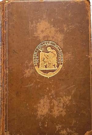
Ańadir al carritoHardcover. Condición: Very Good. 1st Edition. 496 pages plus seven preliminary pages plus seven full coloured illustrations reproduced by Leighton Brothers. Full calf with six gilt decorated compartments, raised bands, gilt ruled covers, marbled eddpapers and edges, gilt embossed medallion of Scotch College Melbourne. School prize award certificate dated 1875. Externally rubbed and bumped, but internally sound with reinforced front hingeing, clean text and illustrations.
-
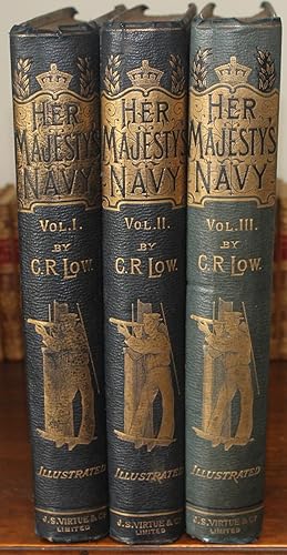
Her Majesty's Navy, including its Deeds and Battles.
Publicado por London: J. S. Virtue -1893, 1890
Librería: Bristow & Garland, Shaftesbury, Reino Unido
Calificación del vendedor: 4 de 5 estrellas
EUR 296,19
Envío por EUR 16,10
Se envía de Reino Unido a Estados Unidos de AmericaCantidad disponible: 1 disponibles
Ańadir al carritoThree volumes. Chromolitho. frontispieces, extra chromolitho. titles and 40 chromolitho. plates with tissue guards. The plates by W. Christian Symonds and W. Fred. Mitchell. Three volumes 4to (11 1/4 x 9 inches), pages: xi:(1):348; vii:(1):352; & vii:(1):352, each volume with 4-pages of publisher's advertisements at end. Volume 3 with tipped-in printed notice "To Officers of the Navy" offering the original drawings for this work at 10 to 12 guineas each. Original pebble grain green cloth blocked in gilt and colours, all edges gilt. Some tiny spits to headbands, overall an excellent and clean set. Contemporary signature and address on verso of front free endpapers.
-
![Imagen del vendedor de Regulations for the Royal Indian Navy. volume II (provisional) 1938 [1942 reprint, corrected up to 1st April 1942] a la venta por McLaren Books Ltd., ABA(associate), PBFA](https://pictures.abebooks.com/inventory/md/md20079738752.jpg)
Regulations for the Royal Indian Navy. volume II (provisional) 1938 [1942 reprint, corrected up to 1st April 1942]
Publicado por Delhi Government of India Defence Department, 1942
Librería: McLaren Books Ltd., ABA(associate), PBFA, Largs, Reino Unido
Miembro de asociación: ABA ILAB PBFA
Calificación del vendedor: 5 de 5 estrellas
EUR 296,19
Envío por EUR 18,35
Se envía de Reino Unido a Estados Unidos de AmericaCantidad disponible: 1 disponibles
Ańadir al carritoppvii 685 + one single leaf and three pamphlets of amendments in back pocket. original printed boards rather stained and rubbed, but sound. internally clean. includes general regulations, ceremonies and distinctions, rank and command, training, courts-martial and disciplinary matters, messing and canteens, navy band, collision regulations, prize money and salvage, instructions to officers, navigation and pilotage, gunnery, signalling, medical, extensive appendices, etc., etc. in fact so comprehensive, that I'm not sure what would have been in volume one.
-
Collection of Hand Drawn Crests of Indian Naval Vessels.
Publicado por Bombay/Mumbai, c. 1980?, 1980
Librería: Michael S. Kemp, Bookseller, Sheerness, KENT, Reino Unido
Miembro de asociación: PBFA
Calificación del vendedor: 4 de 5 estrellas
EUR 398,08
Envío por EUR 23,01
Se envía de Reino Unido a Estados Unidos de AmericaCantidad disponible: 1 disponibles
Ańadir al carrito9 large hand painted crests, 280 x 225 mm. The borders and outlines printed by Central Reproduction Drawing Office in Bombay, the titles and individual crests hand painted. Possibly created to illustrate a book on Indian naval vessels, these are attractive images in their own right.
-

"Off Linga, Persian Gulf". Original watercolour.
Publicado por [Bandar Lengeh, Iran, ca. 1904]., 1904
Librería: Antiquariat INLIBRIS Gilhofer Nfg. GmbH, Vienna, A, Austria
Miembro de asociación: ILAB VDA VDAO
Calificación del vendedor: 5 de 5 estrellas
EUR 3.500,00
Envío por EUR 30,00
Se envía de Austria a Estados Unidos de AmericaCantidad disponible: 1 disponibles
Ańadir al carritoWatercolour on paper, 135 x 230 mm, matted, framed and glazed (frame 260 x 378 mm). A lovely nautical watercolour of three ships off "Linga", that is Bandar Lengeh on the Iranian shore of the Gulf, situated directly north of the United Arab Emirates on the Arabian shore. One ship is particularly European, likely British, its unidentified flag flying limp in the still air of the quiet Gulf. The city of Bandar Lengeh was at one point a major trading port which did much of its business with Oman. It was also attacked by British forces, which used a naval bombardment to shell the city in 1809, having alleged that it was a haven for pirates. The sloping seaside hills of Persia are shaded with deft brushstrokes, and the delicate rigging and masts of the ships are picked out with a careful hand. - T. H. H. Hand was the son of Captain Henry Hand RN and Anna McCheane. In 1888 he was recorded as a lieutenant; he subsequently joined the Royal Indian Marine and qualified as a master in the merchant services in Bombay in 1902. This lovely historic view of the Gulf was likely created in the early years of the 20th century, when Hand was involved in the Marine Survey of India and the Gulf coast. - Light foxing, a hint of toning around edges. In good condition, not examined out of frame. - With pencil ownership inscription of M[ilverton] Hall, Milverton (near Leamington Spa), on the reverse of frame.
-

Travels in Arabia. LACKING FOLDING MAP OF OMAN.
Ańo de publicación: 1838
Librería: Maggs Bros. Ltd ABA, ILAB, PBFA, London, Reino Unido
Miembro de asociación: ABA ILAB PBFA
Calificación del vendedor: 5 de 5 estrellas
Original o primera edición
EUR 2.961,92
Envío por EUR 31,06
Se envía de Reino Unido a Estados Unidos de AmericaCantidad disponible: 1 disponibles
Ańadir al carritoVol. I. Oman and Nakab El Hajar. [Vol. II. Sinai; Survey of the Gulf of Akabah; Coasts of Arabia and Nubia, &c.&c.&c.] First edition. 2 vols. 4 maps (2 folding) & 7 lithograph plates. LACKING THE FOLDING MAP OF OMAN. 8vo. Recent blue cloth, gilt. xvi, 446; x, 472pp. London, John Murray. The entire first volume relates to Wellsted's experiences in Oman, and is the fullest account by far of this territory then published, indeed he adds to the title of his Map of Oman the comment "A Country Hitherto Wholly Unknown to Europeans". Following two surveying expeditions between 1830 and 1884 to the Red Sea and the coast of Arabia Wellsted obtained leave in November 1835 to travel to Oman. Arriving in Muscat his party were kindly received by the Imam, however having reached Sib in late January they were struck down with fever and unable to progress for a month. It was during his second attempt to explore Oman that Wellsted was taken ill and whilst delirious shot himself. The injuries he received forced him to retire in 1839 his health shattered and his mind gone. He died at the early age of 42 some three years later in England. Macro, 2282.
-
Exploration of the valley of the Amazon, made under direction of the Navy Department 1853 [Leather Bound]
Ańo de publicación: 2024
Librería: Gyan Books Pvt. Ltd., Delhi, India
Calificación del vendedor: 5 de 5 estrellas
EUR 30,39
Gastos de envío gratis
Se envía de India a Estados Unidos de AmericaCantidad disponible: Más de 20 disponibles
Ańadir al carritoLeather Bound. Condición: New. Language: English. Presenting an Exquisite Leather-Bound Edition, expertly crafted with Original Natural Leather that gracefully adorns the spine and corners. The allure continues with Golden Leaf Printing that adds a touch of elegance, while Hand Embossing on the rounded spine lends an artistic flair. This masterpiece has been meticulously reprinted in 2024, utilizing the invaluable guidance of the original edition published many years ago in 1853. The contents of this book are presented in classic black and white. Its durability is ensured through a meticulous sewing binding technique, enhancing its longevity. Imprinted on top-tier quality paper. A team of professionals has expertly processed each page, delicately preserving its content without alteration. Due to the vintage nature of these books, every page has been manually restored for legibility. However, in certain instances, occasional blurriness, missing segments, or faint black spots might persist. We sincerely hope for your understanding of the challenges we faced with these books. Recognizing their significance for readers seeking insight into our historical treasure, we've diligently restored and reissued them. Our intention is to offer this valuable resource once again. We eagerly await your feedback, hoping that you'll find it appealing and will generously share your thoughts and recommendations. Lang: - English, Pages: : - 414, Print on Demand. If it is a multi-volume set, then it is only a single volume. We are specialised in Customisation of books, if you wish to opt different color leather binding, you may contact us. This service is chargeable. Product Disclaimer: Kindly be informed that, owing to the inherent nature of leather as a natural material, minor discolorations or textural variations may be perceptible. Explore the FOLIO EDITION (12x19 Inches): Available Upon Request. 414.
-
Karachi Harbour, surveyed by Lieut. A. M. Grieve, I.N. Assisted by Lieuts. Constable and Barker.
Ańo de publicación: 1854
Librería: Geographicus Rare Antique Maps, Brooklyn, NY, Estados Unidos de America
Miembro de asociación: ABAA ESA ILAB
Calificación del vendedor: 5 de 5 estrellas
Mapa Original o primera edición
EUR 5.758,49
Envío por EUR 14,14
Se envía dentro de Estados Unidos de AmericaCantidad disponible: 1 disponibles
Ańadir al carritoVery good. Modest soiling. Two sheets, unjoined, as issued. Size 53 x 56 Inches. A seminal 1854 large-scale Indian Navy Albany M. Grieve nautical map of Karachi Harbor, in the Sindh region of what is today Pakistan. This is the second and certainly the largest map of Karachi, and the first as an East India Company port. It was issued in the same year that marked Karachi Harbor's opening to EIC traders and the completion of the connecting Napier Mole causeway - illustrated here. A Closer Look Scope of coverage is roughly the same as the 1838 / 1844 Thomas Greer Carless map (Geographicus: Karachi-carless-1838), but this is where the similarities end. The Grieve chart is a far more monumental and comprehensive work, entailing extensive new hydrographic and terrestrial surveys over temperamental and inhospitable terrain. The city of Karachi itself, here identified as 'Old Town', is beginning to take form, with a rough street grid as well as important buildings identified. These include new constructions by the EIC, among them various administrative buildings and warehouses. We also note the completed Napier Gore, an important causeway that gave access to the newly constructed deep water port on Baba Channel, some 2.25 miles south of the city. The 'Fakeers Tank' that appeared on the Carless map - where early travelers to the region, including Leopold Von Orlich, writing in 1845, claimed that the fakirs kept some 30 alligators which were trained 'like so many dogs.' - is here correctly identified as Ram Talao, a long-gone holy site then disputed between Sikhs and Hindus. Karachi, An East India Company City The British East India Company had its eye on Karachi from at least 1838, when Thomas Greer Carless and this map's primary maker, Albany M. Grieve, performed a preliminary hydrographic survey of the harbor (see Geographicus: Karachi-carless-1838). Karachi, at that time, was a minor but diverse fishing and trading town of about 14,000. However, it had a strategic defensible location on the Arabian Sea with access to the Indus River Delta, Central Asia, and the Punjab hinterland. Although adventurers and the India Navy occasionally visited Karachi, it was not occupied by the British East India Company until February 1839, and did not fall fully under British suzerainty until after the 1843 Battle of Miani, in which the EIC effectively took control of Sindh. One year later, in 1844, as the EIC began to implement its grand plans for Karachi, the Carless survey was finally published - only one example of which survives (sold previously by Geographicus). In the decade between 1844, this map's 1854 publication, and Karachi's opening as a port in the same year, we recognize significant advancement, both in terms of the cartographic and hydrographic understanding of the coastal plain and infrastructure development. Significantly, this map appeared in the year Karachi opened as an East India Company Port and the Napier Mole was completed. The 'Mole' was a long causeway connecting the Old Town with the most inland point on what is today Baba Channel, capable of receiving deep draft trading vessels. There, they built docks, fortifications, and warehouses. In the Old Town, this map illustrates the beginnings of British colonial infrastructure, with established market areas, a hospital, schools, a customs house, and a goal. The survey reveals a highly defensible port. With a low water depth of only 1 or 2 feet close to the city, it was largely inaccessible to enemy ships and, if even marginally defended, overland invaders. As long as goods could be immediately transported the 2.25 miles between the docks and the Old Town warehouses, they were, for all intents and purposes, secure against piracy or invasion. Of course, the British had much grander plans that included the complete dredging of the mud flats surrounding Karachi, which, by the late 1860s, successfully converted the city into a modern port. Today Karachi is a major Indian Ocean port.
-

Tracing the Undersea Dragon
Librería: moluna, Greven, Alemania
Calificación del vendedor: 4 de 5 estrellas
EUR 50,29
Envío por EUR 48,99
Se envía de Alemania a Estados Unidos de AmericaCantidad disponible: Más de 20 disponibles
Ańadir al carritoCondición: New. Dieser Artikel ist ein Print on Demand Artikel und wird nach Ihrer Bestellung fuer Sie gedruckt. Amit Ray is a Captain serving in the Indian Navy and a Naval Architect by specialisation. He has been involved in repairs, construction, design, and trials of a variety of submarines for over two decades. His academic qualifications include M.Tech.
-

Tracing the Undersea Dragon
Librería: moluna, Greven, Alemania
Calificación del vendedor: 4 de 5 estrellas
EUR 162,64
Envío por EUR 48,99
Se envía de Alemania a Estados Unidos de AmericaCantidad disponible: Más de 20 disponibles
Ańadir al carritoGebunden. Condición: New. Dieser Artikel ist ein Print on Demand Artikel und wird nach Ihrer Bestellung fuer Sie gedruckt. Amit Ray is a Captain serving in the Indian Navy and a Naval Architect by specialisation. He has been involved in repairs, construction, design, and trials of a variety of submarines for over two decades. His academic qualifications include M.Tech.


![Imagen del vendedor de Exploration of the valley of the Amazon, made under direction of the Navy Department 1853 [Leather Bound] a la venta por Gyan Books Pvt. Ltd.](https://pictures.abebooks.com/inventory/md/md31424395252.jpg)
