Importe total (1 artículo artículos):
Destino del pedido:

illustrated folding maps (25 resultados)
Ir a los resultados principales
Filtros de búsqueda
Tipo de artículo
- Todos los tipos de productos
- Libros (25)
- Revistas y publicaciones (No hay ningún otro resultado que coincida con este filtro.)
- Cómics (No hay ningún otro resultado que coincida con este filtro.)
- Partituras (No hay ningún otro resultado que coincida con este filtro.)
- Arte, grabados y pósters (No hay ningún otro resultado que coincida con este filtro.)
- Fotografías (No hay ningún otro resultado que coincida con este filtro.)
- Mapas (No hay ningún otro resultado que coincida con este filtro.)
- Manuscritos y coleccionismo de papel (No hay ningún otro resultado que coincida con este filtro.)
Condición Más información
- Nuevo (No hay ningún otro resultado que coincida con este filtro.)
- Como nuevo, Excelente o Muy bueno (1)
- Bueno o Aceptable (19)
- Regular o Pobre (1)
- Tal como se indica (4)
Encuadernación
Más atributos
Idioma (3)
Gastos de envío gratis
Ubicación del vendedor
Valoración de los vendedores
-

A Pictorial and Descriptive Guide to Inverness, Strathpeffer, The Black Isle, The Caledonian Canal, Nairn, Forres & Elgin
Publicado por Ward, Lock [1913], London, 1913
Librería: Vashon Island Books, Vashon, WA, Estados Unidos de America
Calificación del vendedor: 5 de 5 estrellas

EUR 17,82
Envío por EUR 4,32
Se envía dentro de Estados Unidos de AmericaCantidad disponible: 1 disponibles
Ańadir al carritoPaperback. Condición: Good+. Illustrated by Illus; 3 Folding maps. Ilustrador. Third Edition. Good+ in cloth over flex. boards (fold to board, frayed, worn) three fold out maps (one plan missing) 8vo 128+96pp+ads Charming pre-WWI guide to Scotland's Inverness region. Size: 8vo - over 7ľ" - 9ľ" tall. Book.
-
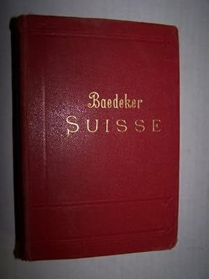
SUISSE
Publicado por Baedeker, Leipzig, 1907
Librería: Antiquarian Bookshop, Washington, DC, Estados Unidos de America
Calificación del vendedor: 5 de 5 estrellas
EUR 22,22
Envío por EUR 5,15
Se envía dentro de Estados Unidos de AmericaCantidad disponible: 1 disponibles
Ańadir al carritoHardcover. Condición: Very Good. Illustrated by Maps, Plans & Folding Plates Ilustrador. A nice copy of the French edition of the baedeker Guide for Switzerland. Plates & Maps in good condition. Verlag Karl Baedeker, founded by Karl Baedeker in 1827, is a German publisher that pioneer worldwide travel guides. Usually referred to simply as "Baedekers", these excellent guidebooks contain important introductions to various regions of the world, along with specific information about routes and travel facilities; and historical descriptions of important buildings, sights, attractions and museums. For the convenience of travellers, they contain many reliable maps and town plans all bound in a convenient pocket format.; Experience the pleasure of reading and appreciating this actual printed item. It has its own physical history that imbues it with a character lacking in ephemeral electronic renderings.
-
A Guide to the Geology and Oil Fields of the Los Angeles and Ventura Regions
Publicado por Pacific Section, AAPG, 1958
Librería: Zubal-Books, Since 1961, Cleveland, OH, Estados Unidos de America
Calificación del vendedor: 5 de 5 estrellas
EUR 18,71
Envío por EUR 3,89
Se envía dentro de Estados Unidos de AmericaCantidad disponible: 1 disponibles
Ańadir al carritoCondición: Good. 204 pp., hardcover, ex library, else text clean and binding tight. - If you are reading this, this item is actually (physically) in our stock and ready for shipment once ordered. We are not bookjackers. Buyer is responsible for any additional duties, taxes, or fees required by recipient's country.
-
CHAMBERS'S ENCYCLOPAEDIA Volume IV, (G to Kidneys) A Dictionary of Universal Knowledge for the People, with maps and numerous engarvings, REVISED EDITION, unaltered and unabridged
Publicado por Collier, New York, 1887
Librería: Walk A Crooked Mile Books, Williamsburg, PA, Estados Unidos de America
Calificación del vendedor: 3 de 5 estrellas

EUR 31,18
Envío por EUR 4,28
Se envía dentro de Estados Unidos de AmericaCantidad disponible: 1 disponibles
Ańadir al carritoHardcover. Condición: Good. Estado de la sobrecubierta: No Dust Jacket. illustrated entries throughout including color folding maps of German Empire, England and Wales, Scotland, Ancient Greece, India or Hudustan, Ireland, Italy and Ancient Italy Ilustrador. OLD 040014 CARP Full leather, Volume 4 only of this 8 volume work. The volume is still well bound in spite of cracking along the rear spine. The leather spine cover is attached to the front board but loose from the rear board at the hinge. We have reglued to protect further damage. The black title label is chipped and portions of three letters are missing. Front board is still well attached. Boards are rubbed through along some edges. Book is big and heavy and may require extra postage.
-
CHAMBERS'S ENCYCLOPAEDIA Volume III, (Darnley to Fyzabad) A Dictionary of Universal Knowledge for the People, with maps and numerous engarvings, REVISED EDITION, unaltered and unabridged
Publicado por Collier, New York, 1887
Librería: Walk A Crooked Mile Books, Williamsburg, PA, Estados Unidos de America
Calificación del vendedor: 3 de 5 estrellas
EUR 31,18
Envío por EUR 4,28
Se envía dentro de Estados Unidos de AmericaCantidad disponible: 1 disponibles
Ańadir al carritoHardcover. Condición: Good. Estado de la sobrecubierta: No Dust Jacket. illustrated entries throughout including color folding maps of Denmark and 2 maps of Europe Ilustrador. OLD 040013 CARP Full leather, Volume 3 only of this 8 volume work. The volume is still well bound in spite of cracking along the front spine. The leather spine cover is attached to the back board but loose from the front board at the hinge. We have reglued to protect further damage. The black title label is chipped and portions of three letters are missing. Front board is still well attached. Boards are rubbed through along some edges. Book is big and heavy and may require extra postage.
-
CHAMBERS'S ENCYCLOPAEDIA Volume V, (Kidron to Ox-Eye) A Dictionary of Universal Knowledge for the People, with maps and numerous engarvings, REVISED EDITION, unaltered and unabridged
Publicado por Collier, New York, 1887
Librería: Walk A Crooked Mile Books, Williamsburg, PA, Estados Unidos de America
Calificación del vendedor: 3 de 5 estrellas
EUR 31,18
Envío por EUR 4,28
Se envía dentro de Estados Unidos de AmericaCantidad disponible: 1 disponibles
Ańadir al carritoHardcover. Condición: Very Good. Estado de la sobrecubierta: No Dust Jacket. illustrated entries throughout including color folding maps of Holland and Belgium and New Zealand Ilustrador. OLD 040003 CARP Full leather, Volume 5 only of this 8 volume work. The volume is still well bound and there is NO cracking along the front spine. The black title label is chipped but no letters are missing. Front board is still well attached. Boards are scuffed through the top layer of leather but not down to cardboard. Book is big and heavy and may require extra postage.
-
CHAMBERS'S ENCYCLOPAEDIA Volume VI, (Oxford to Ruvigado) A Dictionary of Universal Knowledge for the People, with maps and numerous engarvings, REVISED EDITION, unaltered and unabridged
Publicado por Collier, New York, 1887
Librería: Walk A Crooked Mile Books, Williamsburg, PA, Estados Unidos de America
Calificación del vendedor: 3 de 5 estrellas
EUR 31,18
Envío por EUR 4,28
Se envía dentro de Estados Unidos de AmericaCantidad disponible: 1 disponibles
Ańadir al carritoHardcover. Condición: Good. Estado de la sobrecubierta: No Dust Jacket. illustrated entries throughout including color folding maps of Palestine, Prussia, Queensland, Roman Empire Ancient and Russia in Europe Ilustrador. OLD 039941 CARP Full leather, Volume 6 only of this 8 volume work. The volume is still well bound in spite of cracking along the front spine. The leather spine cover is attached to the back board but loose from the front board at the hinge. We have reglued to protect further damage. The black title label is chipped and portions of three letters are missing. Front board is still well attached. Boards are rubbed through along some edges. Book is big and heavy and may require extra postage.
-
Baedeker's Belgium and Holland: A Handbook For Travelers
Publicado por Karl Baedeker, 1897
Librería: Sequitur Books, Boonsboro, MD, Estados Unidos de America
Miembro de asociación: IOBA
Calificación del vendedor: 5 de 5 estrellas
EUR 31,18
Envío por EUR 4,30
Se envía dentro de Estados Unidos de AmericaCantidad disponible: 1 disponibles
Ańadir al carritoHardcover. Condición: Good. 7th Ed. 1897 printing. Bound in publisher's red cloth. Hardcover. Good binding and cover. Shelf wear. Light water damage to edges of front end pages (does not affect text). Founded in 1827, Baedeker guides gained popularity during the second half of the 19th century (so much so that Baedekering became part of everyday language). They were an invaluable and essential part of civilized travel in the fin-de-siecle. Baedeker guides were known for both their accuracy and attention to detail. Included in each are intricate colored fold-out maps and floor plans. Baedekers comments and recommendations open a fascinating window into the mores of a world now past.
-
Baedeker's Belgium and Holland: A Handbook For Travelers
Publicado por Karl Baedeker, 1910
Librería: Sequitur Books, Boonsboro, MD, Estados Unidos de America
Miembro de asociación: IOBA
Calificación del vendedor: 5 de 5 estrellas
EUR 31,18
Envío por EUR 4,30
Se envía dentro de Estados Unidos de AmericaCantidad disponible: 1 disponibles
Ańadir al carritoHardcover. Condición: Good. 7th Ed. 15th Edition. 489p., maps. Bound in publishers red cloth. Good binding and cover. Shelfwear. Library markings. Founded in 1827, Baedeker guides gained popularity during the second half of the 19th century. The guides contain, among other things, maps and introductions; information about routes and travel facilities; and descriptions of noteworthy buildings, sights, attractions and museums, written by specialists.
-
Baedeker's Belgium and Holland, including the grand-duchy of Luxembourg; handbook for travellers,
Publicado por Karl Baedeker, 1910
Librería: Sequitur Books, Boonsboro, MD, Estados Unidos de America
Miembro de asociación: IOBA
Calificación del vendedor: 5 de 5 estrellas
EUR 35,63
Envío por EUR 4,30
Se envía dentro de Estados Unidos de AmericaCantidad disponible: 2 disponibles
Ańadir al carritoHardcover. Condición: Very Good. 7th Ed. Red cloth. 15 ed. lxxxii, 489 pages 19 maps (some folded) 45 plans (some folded) 16 cm. With 19 maps, 37 plans of towns, and 8 ground plans. Hardcover. Good binding and cover. Clean, unmarked pages. Ships daily. Founded in 1827, Baedeker guides gained popularity during the second half of the 19th century (so much so that Baedekering became part of everyday language). They were an invaluable and essential part of "civilized travel" in the fin-de-siecle. Baedeker was known for both its accuracy and attention to detail. Included in each are intricate colored fold-out maps and floor plans. Baedeker's comments and recommendations open a fascinating window into the mores of a world now past. An interesting side note: Literary references to Baedeker's abound, from E. M. Forester's A Room with a View to Mark Twain's A Tramp Abroad. T.E. Lawrence is reputed to have used Baedeker's guide to Palestine during his Doctoral work in the Levant and prompted his Allied superiors to make facsimile copies during WWI. During the Luftwaffe's Vergeltungsangriffe the guides were important enough to be reportedly cited by Gustav Braun von Stumm, that "We shall go out and bomb every building in Britain marked with three stars in the Baedeker Guide."[3] In the so-called "Baedeker Blitz" of 1942 the English cities of Exeter, Bath, Norwich, York, and Canterbury were bombed.
-

Jenkinsons Practical Guide to North Wales
Publicado por Edward Stanford, 1887
Librería: Lavender Fields Books PBFA, Gloucestershire, Reino Unido
Miembro de asociación: PBFA
Calificación del vendedor: 5 de 5 estrellas
Original o primera edición
EUR 11,88
Envío por EUR 28,83
Se envía de Reino Unido a Estados Unidos de AmericaCantidad disponible: 1 disponibles
Ańadir al carritoHardcover. Condición: Very Good. Illustrated And with Four Maps (one Folding in Pocket in front) Ilustrador. 1st Edition. All books outside UK sent airmail. All books sent tracked. Paypal accepted.Name etc on map pocket wallet and two tears on wallet. Original dark green cloth, gilt titling. A few indentations on front. All four maps are present, folding map as frontispiece and three others in pocket.
-

A Short History of Sherborne from 705 AD
Publicado por F Bennett, 1911
Librería: Lavender Fields Books PBFA, Gloucestershire, Reino Unido
Miembro de asociación: PBFA
Calificación del vendedor: 5 de 5 estrellas
EUR 11,88
Envío por EUR 28,83
Se envía de Reino Unido a Estados Unidos de AmericaCantidad disponible: 1 disponibles
Ańadir al carritoSoft cover. Condición: Very Good. Illustrated and Folding Maps Ilustrador. 3rd Edition. All books outside UK sent airmail. All books sent tracked. Paypal accepted. History of Dorset town. Original green cloth. End papers browned.
-

Glympton
Publicado por Oxford University Press, 1923
Librería: Lavender Fields Books PBFA, Gloucestershire, Reino Unido
Miembro de asociación: PBFA
Calificación del vendedor: 5 de 5 estrellas
Original o primera edición
EUR 23,76
Envío por EUR 28,83
Se envía de Reino Unido a Estados Unidos de AmericaCantidad disponible: 1 disponibles
Ańadir al carritoHardcover. Condición: Very Good. illustrated with plates fascimilies and folding maps - all present as listed Ilustrador. 1st Edition. All books outside UK sent airmail and over Ł30 sent tracked and inside UK sent signed for. PayPal accepted. First Edition. The history of an Oxfordshire Manor. Original blue cloth, a ring mark on front cover and a little marked on end papers.
-

The Turn of the Road
Publicado por Chatto and Windus, 1946
Librería: Lavender Fields Books PBFA, Gloucestershire, Reino Unido
Miembro de asociación: PBFA
Calificación del vendedor: 5 de 5 estrellas
Original o primera edición
EUR 14,25
Envío por EUR 28,83
Se envía de Reino Unido a Estados Unidos de AmericaCantidad disponible: 1 disponibles
Ańadir al carritoCondición: Near Fine. Estado de la sobrecubierta: Pictorial Dustwrapper. Illustrated with Folding Maps Ilustrador. First Edition. All books outside UK send airmail. All dustwrappers are film protected. Story of Navy in Algeria and Morocco in the Second World War on 8th November 1942.
-

A Ride to Khiva
Publicado por Cassell Peter and Galpin, 1877
Librería: Lavender Fields Books PBFA, Gloucestershire, Reino Unido
Miembro de asociación: PBFA
Calificación del vendedor: 5 de 5 estrellas
EUR 29,70
Envío por EUR 28,83
Se envía de Reino Unido a Estados Unidos de AmericaCantidad disponible: 1 disponibles
Ańadir al carritoHardcover. Condición: Fair. Illustrated with coloured map frontispiece and with two other maps, one a large folding map of Turkistan which has a couple of tears at the folds but is ni good order otherwise Ilustrador. All books outside UK sent airmail and over Ł30 tracked and inside UK signed for. PayPal accepted. Eleventh edition. Illustrated with maps. Pictorial covers are worn as is the spine and faded too but a scarce acceptable copy. Hinges are tender and front cover is partially detached.
-

The Shropshire Yeomanry MDCCXCV - MCMXLV
Publicado por The Whitethorn Press, 1953
Librería: Lavender Fields Books PBFA, Gloucestershire, Reino Unido
Miembro de asociación: PBFA
Calificación del vendedor: 5 de 5 estrellas
Original o primera edición
EUR 29,70
Envío por EUR 28,83
Se envía de Reino Unido a Estados Unidos de AmericaCantidad disponible: 1 disponibles
Ańadir al carritoHardcover. Condición: Very Good. Illustrated in Colour and black and White and with Folding Maps Ilustrador. 1st Edition. All books outside UK sent airmail. All books sent tracked. PayPal accepted. With a foreword by Lt. General Sir oliver Leese Hon. Colonel of the Regiment. Original blue cloth, gilt decorated to front. Quarter bound spine with gilt titling on blue background.
-
Baedeker's Belgium and Holland: A Handbook For Travelers
Librería: PearlPress, Camperdown, NSW, Australia
Calificación del vendedor: 4 de 5 estrellas

EUR 39,96
Envío por EUR 13,62
Se envía de Australia a Estados Unidos de AmericaCantidad disponible: 1 disponibles
Ańadir al carritoHardcover. Condición: Good. Illustrated By Illustrated, Folding Maps. Ilustrador. Book is pre-owned, vintage - please see photos. Explore Belgium and Holland with the historical insight of Karl Baedeker's travel guide from 1910. This original edition, bound in a robust water-resistant bookbinder's cloth, promises to be a durable companion for your journey through time. Written in German, it offers authentic information and recommendations that are just as relevant for the modern traveller interested in the rich history and culture of Europe. Baedeker, renowned for his meticulous attention to detail, provides invaluable guidance on the sights and experiences that are worth mentioning in these captivating regions. Whether for academic study, personal interest, or a unique addition to your collection, this travel guide is a portal to the past, ready to be discovered by you.
-

The American Gazetteer, Exhibiting A Full Account Of The Civil Divisions, Rivers, Harbours, Indian Tribes, &C. Of The American Continent, Also Of The West India And Other Appendant Islands; With A Particular Description Of Louisiana. Third Edition, Revised And Corrected. (Lacking The Rare "General Atlas Of The World"
Idioma: Inglés
Publicado por Thomas & Andrews, Boston Ma, 1810
Librería: Arroyo Seco Books, Pasadena, Member IOBA, Pasadena, CA, Estados Unidos de America
Miembro de asociación: IOBA
Calificación del vendedor: 5 de 5 estrellas
EUR 149,23
Envío por EUR 6,92
Se envía dentro de Estados Unidos de AmericaCantidad disponible: 1 disponibles
Ańadir al carritoHardcover. Condición: Good. Illustrated With 2 Folding Maps But Lacking The Separate Atlas Volume Ilustrador. 3rd Edition. Third And Best Edition. Full Sheep With Red Morocco Spine Label Lettered In Git. Unpaginated, Two Column Format. Massive Alphabetical Geography Of The Western Hemisphere. Quite Worn But Intact, Morocco Spine Label Complete With Bright Gilt. Folding Maps Of North America (With Caribbean) And South America, Worn And With Tears Along Creases But Intact. Lacking The Rare Atlas Volume. Front Free Endpaper With Attached Slip Of Paper With Ownership Signatures Of Jabez Harding (1813-1897), Sturbridge Ms, Jan 25, 1836, Reverse With Signature Of Cynthia A. Harding, Sturbridge Mass.
-
History of The Corps of Royal Canadian Engineers, volume 1, 1749 - 1939
Publicado por Military Engineers of Canada, Ottawa, 1962
Librería: Ken Saunders, Stirling, ON, Canada
Calificación del vendedor: 1 de 5 estrellas

EUR 48,74
Envío por EUR 16,35
Se envía de Canada a Estados Unidos de AmericaCantidad disponible: 1 disponibles
Ańadir al carritoCondición: very good in torn dust jacket. illustrated & folding maps Ilustrador. maps drawn by P. Heinrichs.
-
FRIENDLY ARCTIC
Publicado por MacMillan Company Publisher 1921,1922, NY, 1921
Librería: WONDERFUL BOOKS BY MAIL, CHICO-CA, CA, Estados Unidos de America
Calificación del vendedor: 5 de 5 estrellas
Ejemplar firmado
EUR 106,91
Envío por EUR 3,24
Se envía dentro de Estados Unidos de AmericaCantidad disponible: 1 disponibles
Ańadir al carritoHARDCOVER. Condición: Very Good. Illustrated by Glossy Photos,folding Maps Ilustrador. HARDCOVER. VERY GOOD Condition Blue Clothbond; SIGNED BY AUTHOR ON FRONT WHITE ENDPAPER; 784ps + 2 Maps pages; 2 Maps in rear Pocket. Gold Spine & cover titles, all bright, sound. Nice Copy. (1 map torn on folds). SIGNED BY AUTHOR."inscribed for Professor W. Mulford, .Berkeley january 18, 1924." (Vera & Walter Mulford Bookplate Afixed To Ep. ); Signed by Author.
-
A HANDBOOK FOR TRAVELLERS OF DEVON
Publicado por John Murray, London, 1895
Librería: Antic Hay Books, Asbury Park, NJ, Estados Unidos de America
Miembro de asociación: ABAA ILAB
Calificación del vendedor: 5 de 5 estrellas
EUR 111,37
Envío por EUR 6,49
Se envía dentro de Estados Unidos de AmericaCantidad disponible: 1 disponibles
Ańadir al carritoIllustrated with all maps, including folding map and map in rear cover pocket. Ilustrador. Very Good (covers bright with light stain rear cover; contents clean & tight). 12mo., gilt-stamped red cloth; 291 pages plus 78 pages index and catelogues Eleventh Edition. Useful information for travelers about transportation, hotels and other useful information.
-
Llyfr Gweddi Gyffredin : A gweinidogaeth y Sacramentau : A Chynheddfau a Seremoniau eraill yr Eglwys : Yn ol arfer Eglwys Loegr : ynghyd a'r Sallwyr neu Salmau Dafydd : Wedi eu Nodi megis ag y maent i'w Canu neu i'w Dywedyd mewn Eglwysydd
Publicado por Joseph Bentham, Caer-Grawnt [Cambridge], 1746
Librería: Mike's Library LLC, Plymouth, PA, Estados Unidos de America
Calificación del vendedor: 5 de 5 estrellas
EUR 133,59
Gastos de envío gratis
Se envía dentro de Estados Unidos de AmericaCantidad disponible: 1 disponibles
Ańadir al carritoHardcover. Condición: Good. Estado de la sobrecubierta: No Dust Jacket. Illustrated by Folding Maps Ilustrador. Edgeworn, missing clasps, joints started, leather cracking, toned with random foxing, a few pages with tattered edges, corner folding, owner's genealogy and signatures, wear. Still solid hardcover. ; Full leather binding. Four works with separate title pages, all printed by Joseph Bentham in 1746 and bound as one: (1) Llyfr Gweddi Gyffredin : A gweinidogaeth y Sacramentau [Book of Common Prayer: And the Ministry of the Sacraments]; (2) Y Bibl Cyssegr-lan; sef, Yr Hen Destament a'r Newydd [The Sacred Bible; namely, The Old Testament and the New]; (3) Testament Newydd ein harglwydd a'n hiachawdwr Iesu Grist [The New Testament of our lord and savior Jesus Christ]; and (4) Llyfry Salmau : Wedi eu Cyfieithu, A'u Cyfansoddi Ar Fesur Cerdd, yn Gymraeg. Drwy Waith Edmund Prys, Arch-diacon Meirionnydd [Book of Psalms: Translated, and Composed to the Measure of Music, in Welsh. Through the Work of Edmund Prys, Archdeacon of Meirionnydd]. Contains two folding maps: (1) Teithiau Plant Israel Yn Yr Anialwch : Rhodd Wm. Iones Esqr. F R S J'r Cymru : N Hill Sculp [The Children of Israel's Journeys In The Wilderness]; and Teithiau yr Apostolion : Rhodd Wm Iones J'r Cymru : Nath'l Hill Sculp [The Journeys of the Apostles]. Nathaniel Hill was a London-based engraver and globemaker.; Unpaginated pages.
-

History of the Duke of Wellington's Regiment ( 1st and 2nd Battalions) 1881 - 1923
Publicado por Medici Society, 1927
Librería: Lavender Fields Books PBFA, Gloucestershire, Reino Unido
Miembro de asociación: PBFA
Calificación del vendedor: 5 de 5 estrellas
EUR 53,45
Envío por EUR 28,83
Se envía de Reino Unido a Estados Unidos de AmericaCantidad disponible: 1 disponibles
Ańadir al carritoCondición: Very Good. Illustrated with 32 Plates, One Folding and 18 Maps, Two Folding All are Present as Listed. Ilustrador. All books outside UK sent airmail. PayPal accepted. Slight spotting to end papers and one marginal nick not affecting text. Original red cloth faded slightly at spine with a small nick at head and marked on covers but overall very acceptable of a very scarce book.
-
Charles Eliot Landscape Architect A Lover Of Nature And Of His Kind Who Trained Himself For A New Profession Practised It Happily And Through It Wrought Much Good
Publicado por Houghton Mifflin and Company
Librería: Brainerd Phillipson Rare Books, Holliston, MA, Estados Unidos de America
Miembro de asociación: SNEAB
Calificación del vendedor: 4 de 5 estrellas
Original o primera edición
EUR 178,18
Envío por EUR 12,97
Se envía dentro de Estados Unidos de AmericaCantidad disponible: 1 disponibles
Ańadir al carritoIllustrated with a photographic frontispiece of Eliot, many plates (7 double-page & 2 with onlays) & text illus. Two folding maps of the Metropolitan district of Boston inserted in front and rear pockets. Ilustrador. Handsomely bound in vertically ribbed green cloth stamped in gold on the front panel and on the spine. At 770 pages, the book is substantial and has some wear to the top and bottom of the spine ends and at the corners. Discrete name in ink. Only 1,000 copies printed. Charles Eliot's (1859-1897) landscape writings are in the American grain, influenced by Thoreau's persuasive philosophy of transcendentalism and rooted in the 19th century spirit of place. Don't be intimidated by this 700 page comprehensive homage collected by his father Charles W. Eliot, President of Harvard. First edition with matching date of 1902 on the title and copyright pages and "Published June, 1902".
-
Travels Through the Interior Parts of North America in the Years 1766, 1767, and 1768
Publicado por Printed for C. Dilly, in the Poultry; H. Payne, in Pall-mall; and J. Phillips, in George-Yard, Lombard-Street, London, 1781
Librería: THE HERMITAGE BOOKSHOP, Denver, CO, Estados Unidos de America
Miembro de asociación: IOBA RMABA
Calificación del vendedor: 5 de 5 estrellas
EUR 2.672,76
Envío por EUR 6,05
Se envía dentro de Estados Unidos de AmericaCantidad disponible: 1 disponibles
Ańadir al carritoIllustrated with frontis portrait, two hand-colored folding maps, and five copper plate engravings, including four hand-colored. Ilustrador. Third and best edition. Small quarto. 246pp, [index]. Collated and complete. Carver penetrated farther into the West than any other English explorer before the Revolution. Like his French predecessor -Verendrye- he was seeking a transcontinental waterway, but, aside from exploring some tributaries of the Mississippi, he made no substantial contributions to geographical knowledge; his book, however, stimulated curiosity concerning routes to the Pacific, later satisfied by Mackenzie and Lewis and Clark. - Howes, U.S. Iana. [Howes C215; Sabin 11184]. An expertly restored, fine copy in custom slipcase. Period tree calf boards, rebacked with modern sympathetic speckled calf.