Holland capt (6 resultados)
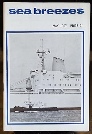
Sea Breezes May 1967 A Digest of Ships and the Sea / T M Haddow "Clyde Pilots" / J H Isherwood "Royal Holland Lloyd Liner "Frisia" of 1909" / John Leslie "Salving the "Wanganella" / Robert Simper "Square-Riggers and Sailing Barges" / John Young "Fast Japanese Cargo Liners" / T E Hughes "112 Years of the Donaldson Line (1)" / E W Argyle "Portuguese Naval Vessels" / John Mannering "Loss Of The "Kent" / Capt. N A Holmberg "Last Voyage of the "Favell" (1)"
Craig J M Carter (Editor) / T M Haddow "Clyde Pilots" / J H Isherwood "Royal Holland Lloyd Liner "Frisia" of 1909" / John Leslie "Salving the "Wanganella" / Robert Simper "Square-Riggers and Sailing Barges" / John Young "Fast Japanese Cargo Liners" / T E Hughes "112 Years of the Donaldson Line (1)" / E W Argyle "Portuguese Naval Vessels" / John Mannering "Loss Of The "Kent" / Capt. N A Holmberg "Last Voyage of the "Favell" (1)"
Editorial: The Journal of Commerce and Shipping Telegraph Ltd 1967
- Tapa blanda
- Publicación periódica
Librería: Shore Books, London, Reino UnidoShore Books
Contactar con el vendedorVendedor de 5 estrellasCondición: Usado - Bueno
EUR 2,99
Envío por EUR 12,75Se envía de Reino Unido a Estados Unidos de AmericaCantidad disponible: 1 disponibles
Soft cover. Condición: Very Good. 88 pages. Illustrated. T M Haddow "Clyde Pilots" / J H Isherwood "Royal Holland Lloyd Liner "Frisia" of 1909" / John Leslie "Salving the "Wanganella" / Robert Simper "Square-Riggers and Sailing Barges" / John Young "Fast Japanese Cargo Liners" / T E Hughes "112 Years of the Donaldson Line (1)" /… E W Argyle "Portuguese Naval Vessels" / John Mannering "Loss Of The "Kent" / Capt. N A Holmberg "Last Voyage of the "Favell" (1)" (SL#49).

Holland, Capt Vivian Ernest - Queens Hussars - An Original Antique Photographic Portrait
HOLLAND , CAPT V. E. - An Original Photographic Antique Portrait.
Idioma: Inglés
Librería: K Books Ltd ABA ILAB, York, YORKS, Reino UnidoK Books Ltd ABA ILAB
Contactar con el vendedorVendedor de 5 estrellasCondición: Usado - Bueno
EUR 29,84
Envío por EUR 22,60Se envía de Reino Unido a Estados Unidos de AmericaCantidad disponible: 1 disponibles
No Binding. Condición: Very Good. A fine original photographic portrait of a Rugbeian who died during the Great War. Mounted and ready to frame. Decorative and attractive. This is an excellent opportunity to purchase a portrait of this eminent personage. 7TH QUEEN'S OWN HUSSARS MESOPOTAMIA CAMPAIGN.
 Más imágenes
Editorial: Seeley, Service & Co., London
- Tapa dura
- Primera edición
Librería: Kerr & Sons Booksellers ABA, Cartmel, CMA, Reino UnidoKerr & Sons Booksellers ABA
Contactar con el vendedorVendedor de 5 estrellasCondición: Usado - Bueno
EUR 59,67
Envío por EUR 34,76Se envía de Reino Unido a Estados Unidos de AmericaCantidad disponible: 1 disponibles
Hardcover. Condición: Very Good. 1st Edition. Five Books. Normandy & Brittany; Paris; Chateaux Country; Provence; & The Riviera. Mixed dates, 1920's/30's. Illustrated. Each in the publisher's blue cloth, gilt. Minor rubbing and soiling. Spotting to text-blocks. Overall a 'Very Good' group.
7TH (PRINCESS ROYAL'S) DRAGOON GUARDS THE STORY OF THE REGIMENT 1688-1902
THOMPSON Col C W & CAMPBELL Major N D H , WHETHLY Capt W S & HOLLAND Capt J E D
Editorial: The "Daily Post" Printers Liverpool 1st edn 1913
- Tapa dura
Librería: E.J Morten Booksellers BA, MANCHESTER, Reino UnidoE.J Morten Booksellers BA
Contactar con el vendedorVendedor de 4 estrellasCondición: Usado
EUR 143,22
Envío por EUR 14,48Se envía de Reino Unido a Estados Unidos de AmericaCantidad disponible: 1 disponibles
Hb in orig maroon cloth 169pp plates plans maps This is actually 2 books in 1 The 1st part covers The Regiment up to the Boer War in Campaigns such as the War of Austrian Succession South Africa 1846 & Eygpt 1882 The 2nd part covers The Regiment during the Boer War "On the Heels of De Wet" A Vg copy of uncommon title.
Editorial: Butler & Tanner Ltd. (Printers), London 1927
- Tapa blanda
- Primera edición
Librería: RareNonFiction, IOBA, Ladysmith, BC, CanadaRareNonFiction, IOBA
Contactar con el vendedorVendedor de 5 estrellasMiembro de asociación: IOBA
Condición: Usado - Regular
EUR 447,57
Envío por EUR 17,55Se envía de Canada a Estados Unidos de AmericaCantidad disponible: 1 disponibles
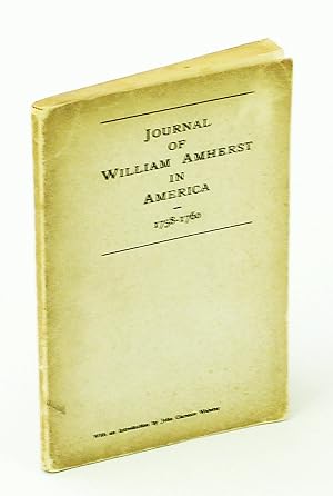
Paperback. Condición: Fair. First Edition. "The original journal, which is now published for the first time, was found by the late Earl Amherst among the papers of his ancestor, Jeffery Amherst, in Montreal House, Kent, three years ago. It consists of four small volumes in William Amherst's handwriting, which is, for the most pa…rt, well preserved and easily read. It covers the period from 16th March 1758, the day of Amherst's departure from England for Nova Scotia, to 8th September, 1760, the day Montreal surrendered. The author's close association with his brother Jeffery, Commander-in-Chief in America, gives additional value to his most interesting personal record. His account of the Siege of Louisbourg is one of the most important which has been written by a participant in the campaign." - Foreword. pp. [2 frontis], 82. Five-panel fold-out map illustrates the attack on Louisbourg in 1758. Considerable foxing to first few leaves. Unmarked. Binding intact. 8.5" x 5.5" in grey card covers. A sound copy. ; Map; 8vo. Illustrated by Holland, Capt.-Lieut. Samuel (ilustrador).

Editorial: London 1775
Librería: Trillium Antique Prints & Rare Books, Franklin, TN, Estados Unidos de AmericaTrillium Antique Prints & Rare Books
Contactar con el vendedorVendedor de 3 estrellasCondición: Usado - Excelente
EUR 11.302,27
Envío por EUR 8,78Se envía dentro de Estados Unidos de AmericaCantidad disponible: 1 disponibles
Condición: Fine. About the map:This is an importonat map of New England, of particular note for its insets of: A plan of the City of New York, A chart of the Mouth of Hudson's River, and A Plan of Amboy.About the work:This rare, historic map is Thomas Jefferys's The American Atlas; or, a Geographical Description of the Whole Con…tinent of America; Wherein are Delineated at Large its Several Regions, Countries, States, and Islands; and Chiefly the British Colonies. The map was published in London in 1775 by R. Sayer and J. Bennett.Robert Sayer and John Bennett were Jefferys's successors and compiled this 1775 edition of The American Atlas. It is considered the most important 18th century atlas of America, showing the colonies at the time of the American Revolution.Ristow noted of the atlas that it was a "geographical description of the whole continent of America, as portrayed in the best available maps in the latter half of the eighteenth century . as a major cartographic reference work it was, very likely, consulted by American, English, and French civilian administrators and military officers during the Revolution."The atlas was of particular note for including Brassier's map of Lake Champlain, Braddock Meade's 'A Map of the Most Inhabited Parts of New England' (largest and most detailed to that date), Samuel Holland's 'The Provinces of New York and New Jersey', William Scull's 'A Map of Pennsylvania' (first to include the western portion), Joshua Fry and Peter Jefferson's 'A Map of the Most Inhabited Part of Virginia' (best to date for the Chesapeake Region), Lt. Ross's 'Course of the Mississippi' (first chart of the river based on English sources), and 'A new Map of the Province of Quebec'.Thomas Jefferys (1719-1771) was a leading English cartographer. He produced some of the most significant maps of the English / American colonies and the early American landscape. He was the appointed Geographer to the Prince of Wales and eventually to the King (1761). His official appointments granted him access to some of the very best surveys and were often considered "official work" for England. --- The work is in very good to excellent condition overall. There may be some faint toning of the paper from age. There may be some faint offset due to the fold out nature of the plate. There may be a few minor imperfections or faint marks to be expected with age. Please review the image carefully for condition and contact us with any questions. (Some of the pictures are digitially stitched to show how the plate would appear joined.) --- Paper Size Image ~ 26 1/2" by 52 3/4". Capt. Samuel Holland (ilustrador).


