Blondel rougery (31 resultados)
 Más imágenes
Editorial: Pijollet vers 1920?, La Rochelle 1920
- Tapa dura
Librería: librairie sciardet, ALLEMANS-DU-DROPT, Francialibrairie sciardet
Contactar con el vendedorVendedor de 3 estrellasCondición: Usado
EUR 10,00
Envío por EUR 22,10Se envía de Francia a Estados Unidos de AmericaCantidad disponible: 1 disponibles
Añadir al carritoCondición: Bel état. Voir photo. Une grande carte dépliante de 60x76cm environ, sous couverture cartonnée.

Librería: booksforcomfort, Comfort, Estados Unidos de Americabooksforcomfort
Contactar con el vendedorVendedor de 3 estrellasCondición: Usado - Aceptable
EUR 15,61
Envío por EUR 4,94Se envía dentro de Estados Unidos de AmericaCantidad disponible: 1 disponibles
Añadir al carritoNo Binding. Condición: Good. Eiffel Shopping by Blondel La Rougery, Paris, France, 1959. Edition Not Stated. No DJ. Condition: Good. Chipping at fold marks. 2 pgs + pattern. Map of Paris, France. Folds out to 12-1/4'' X 16''. Description text copyright 2003 BooksForComfort. Item ID 6564. book.

Idioma: Francés
Editorial: Quiberon, Agence Générale Level et Robert, 1928
- Tapa blanda
Librería: Libresso Antiquariat, Jens Hagedorn, Harsefeld, AlemaniaLibresso Antiquariat, Jens Hagedorn
Contactar con el vendedorVendedor de 5 estrellasCondición: Usado
EUR 23,40
Envío por EUR 38,00Se envía de Alemania a Estados Unidos de AmericaCantidad disponible: 1 disponibles
Añadir al carritoKartoniert. [8] Blätter, 16 Seiten [Begleittext und Werbung der Zeit]; 1 Faltkarte (55 x 65 cm); --- Umschlag etwas angestaubt, leichte Gebrauchsspuren Sprache: Französisch Gewicht in Gramm: 160.

- Tapa blanda
Librería: Antiquariaat Clio / cliobook.nl, Odijk, HolandaAntiquariaat Clio / cliobook.nl
Contactar con el vendedorVendedor de 5 estrellasCondición: Usado
EUR 15,00
Envío por EUR 27,00Se envía de Holanda a Estados Unidos de AmericaCantidad disponible: 1 disponibles
Añadir al carritoParis, l'Aérophile, 1939; 30x24 cm. Softcover, magazines, stapled (sl.wear, folds through covers); No 4: pp. 73-96, No. 5: pp. 97-120, No. 6: pp. 121-144. Illustrated, covers in colour, all issues with large sections of ads from aviation industries. Good. Setprice (3 vols.).
 Más imágenes
Idioma: Francés
Editorial: Blondel la Rougery, Editeur, Paris 1944
- Tapa blanda
- Mapa
Librería: Dendera, London, Reino UnidoDendera
Contactar con el vendedorVendedor de 5 estrellasCondición: Usado - Muy bueno
EUR 47,70
Envío por EUR 28,94Se envía de Reino Unido a Estados Unidos de AmericaCantidad disponible: 1 disponibles
Añadir al carritoSoft cover. Condición: Near Fine. Estado de la sobrecubierta: Fair. Colour map 105x70cm folding down and inserted loosely in its original colour illustrated paper wallet 19x26cm. Map near fine, neatly folded. Wallet fair only, worn with minor loss, and internal tape repair. Drawn in 1944, this presents a Mercator projected warti…me map of the World on a 1/40M scale at the Equator. Unusually centred on the Americas, details include a dense network of air routes with distances in Km. Time zones are illustrated with a row of clocks across the top, and there is a text box about the Mercator projection. Institutionally rare.

Idioma: Francés
Editorial: Agence Générale Level et Robert, Quiberon 1928
- Tapa blanda
Librería: Librairie Guimard, Nantes, FranciaLibrairie Guimard
Contactar con el vendedorVendedor de 4 estrellasCondición: Usado - Muy bueno
EUR 46,00
Envío por EUR 30,00Se envía de Francia a Estados Unidos de AmericaCantidad disponible: 1 disponibles
Añadir al carritoCondición: bon état. BLONDEL LA ROUGERY E. Quiberon Agence Générale Level et Robert 1928 -in-8 broché un guide, broché (agraphé) format in-octavo (paperback in-octavo) (20,5 de haut x 13,5 cm de large) éditeur, dos muet (spine - no title), dos et couverture grise imprimés (grey spine and cover printed), légères rousseurs sur la…couverture (lightly redness marks on the cover), première de couverture d'une carte de belle-ile en noir, 5 pages de texte illustré de photos en noir + 12 pages de publicité de belle-ile sur papier blanc ou bleu avec illustration en noir (photo ou dessin) + une grande carte dépliante de Belle-Ile (dépliée : 70 cm x 60 cm), tirage en trois couleurs - échelle 1/25000ème, 1928 Quiberon Agence Générale Level et Robert Editeurs, bon état en bon état malgré le petit défaut signalé (very good condition in spite of the small defect indicated.
 Más imágenes
Editorial: Paris Ed. Blondel La Rougery 1925 1925
Librería: Christian White Rare Books Ltd, Ilkley, Reino UnidoChristian White Rare Books Ltd
Contactar con el vendedorVendedor de 3 estrellasCondición: Usado - Muy bueno
EUR 29,81
Envío por EUR 23,15Se envía de Reino Unido a Estados Unidos de AmericaCantidad disponible: 1 disponibles
Añadir al carritoCondición: Near Fine. Carte-Guide Campbell No 2, published in association with the French Federation of Automobile Clubs. This large coloured map covers the north east of France and part of Belgium where the most important battles of World War I took place and clearly shows the line of the Western Front as it existed in March an…d the end of June 1918. The 1 to 320,000 map is printed on glossy paper on one side only, with bright colours, no rubbing or tears, a couple of nicks to one edge. Its protective buff printed envelope is a little creased and has a couple of ink marks. Overall near fine. Near Fine Please contact Christian White Rare Books Ltd for more information or images of this item.

Editorial: IMP. BLONDEL LA ROUGERY 1942
- Tapa blanda
Librería: Le-Livre, SABLONS, FranciaLe-Livre
Contactar con el vendedorVendedor de 5 estrellasCondición: Usado - Muy bueno
EUR 30,90
Envío por EUR 42,00Se envía de Francia a Estados Unidos de AmericaCantidad disponible: 1 disponibles
Añadir al carritoCouverture souple. Condición: bon. RO80029374: Août 1942. In-4. Broché. Bon état, Couv. convenable, Dos satisfaisant, Intérieur frais. Paginé de 193 à 212. Quelques dessins, schémas et photos en noir et blanc dans le texte. . . . Classification Dewey : 629.1-Aviation.

Editorial: IMP. BLONDEL LA ROUGERY 1942
- Tapa blanda
Librería: Le-Livre, SABLONS, FranciaLe-Livre
Contactar con el vendedorVendedor de 5 estrellasCondición: Usado - Muy bueno
EUR 30,90
Envío por EUR 42,00Se envía de Francia a Estados Unidos de AmericaCantidad disponible: 1 disponibles
Añadir al carritoCouverture souple. Condición: bon. RO80029373: Sept. 1942. In-4. Broché. Bon état, Couv. convenable, Dos satisfaisant, Intérieur frais. Paginé de 213 à 233. Quelques dessins, schémas et photos en noir et blanc dans le texte. . . . Classification Dewey : 629.1-Aviation.
Editorial: L'Illustration 1940
Librería: Abraxas-libris, Bécherel, FranciaAbraxas-libris
Contactar con el vendedorVendedor de 5 estrellasCondición: Usado
EUR 26,40
Envío por EUR 28,95Se envía de Francia a Estados Unidos de AmericaCantidad disponible: 1 disponibles
Añadir al carritoCarte. Carte en couleurs (74,5 x 55,5 cm) de l'Europe, dressée par Blondel La Rougery, échelle 1:7.500.000, supplément au numéro de l'Illustration du 6 janvier 1940 ; carte fendue le long des pliures en 4 endroits, par ailleurs assez bon état général. Livraison a domicile (La Poste) ou en Mondial Relay sur simple demande.

Editorial: CHEZ L AUTEUR. Non daté
- Tapa blanda
- Mapa
Librería: Le-Livre, SABLONS, FranciaLe-Livre
Contactar con el vendedorVendedor de 5 estrellasCondición: Usado - Muy bueno
EUR 35,80
Envío por EUR 42,00Se envía de Francia a Estados Unidos de AmericaCantidad disponible: 1 disponibles
Añadir al carritoCouverture souple. Condición: bon. R150168872: Non daté. In-Plano. Broché. Bon état, Couv. convenable, Dos satisfaisant, Pliures. Carte en couleurs de 56 cm / 76 cm. . . . Classification Dewey : 912-Atlas, cartes et plans.

Editorial: Blondel la Rougery, Parigi 1936
Librería: LibriSenzaData, Milano, ItaliaLibriSenzaData
Contactar con el vendedorVendedor de 4 estrellasCondición: Usado
EUR 30,00
Envío por EUR 28,00Se envía de Italia a Estados Unidos de AmericaCantidad disponible: 1 disponibles
Añadir al carritoBrossura, testo in francese su due colonne, illustrazioni in b/n nel testo, una tavola del planisfero ripiegata fuori testo con le linee aeree attive nel mondo, 42 pagine pubblicitarie anche su carta azzurra, normali segni d'uso alla brossura (ma senza strappi o mancanze, escluso un restauro con pecetta al contropiatto posterior…e), all'interno in ottimo stato. cm 24x31 pp. (24), 117, (43).

Editorial: MARITIMES & D'OUTRE-MER 1969
Librería: Le-Livre, SABLONS, FranciaLe-Livre
Contactar con el vendedorVendedor de 5 estrellasCondición: Usado - Muy bueno
EUR 30,90
Envío por EUR 42,00Se envía de Francia a Estados Unidos de AmericaCantidad disponible: 1 disponibles
Añadir al carritoPas de couverture. Condición: bon. RO80060405: 1969. In-Plano. En feuillets. Bon état, Couv. convenable, Dos satisfaisant, Intérieur acceptable. Carte dépliante en couleurs, de 105 / 75 cm, rangée dans une pochette souple, rempliée. . . . Classification Dewey : 386-Marine.
 Más imágenes
Editorial: Paris, France: Blondel La Rougery, [ca. 1940]. 1940
- Manuscrito
Librería: Wittenborn Art Books, San Francisco, Estados Unidos de AmericaWittenborn Art Books
Contactar con el vendedorVendedor de 5 estrellasCondición: Usado - Aceptable
EUR 66,55
Envío por EUR 8,61Se envía dentro de Estados Unidos de AmericaCantidad disponible: 1 disponibles
Añadir al carritoCondición: Good. Rolled Color Map. 99 x 63.5 cm. (39" x 25"). Good with small tears at edges. En Francais.
 Más imágenes
Editorial: Paris, France: Blondel La Rougery. 1956
- Manuscrito
Librería: Wittenborn Art Books, San Francisco, Estados Unidos de AmericaWittenborn Art Books
Contactar con el vendedorVendedor de 5 estrellasCondición: Usado - Aceptable
EUR 66,55
Envío por EUR 8,61Se envía dentro de Estados Unidos de AmericaCantidad disponible: 1 disponibles
Añadir al carritoCondición: Good. Rolled Color Map. 99 x 63.5 cm. (39" x 25"). Good with tiny tears at edges. En Francais.

Editorial: MARITIMES & D'OUTRE-MER 1971
Librería: Le-Livre, SABLONS, FranciaLe-Livre
Contactar con el vendedorVendedor de 5 estrellasCondición: Usado - Muy bueno
EUR 35,80
Envío por EUR 42,00Se envía de Francia a Estados Unidos de AmericaCantidad disponible: 1 disponibles
Añadir al carritoPas de couverture. Condición: bon. RO80060400: 1971. In-Plano. En feuillets. Bon état, Couv. convenable, Dos satisfaisant, Intérieur frais. Carte dépliante en couleurs, de 105 / 75 cm, rangée dans une pochette souple, rempliée. . . . Classification Dewey : 386-Marine.

- Mapa
Librería: New World Cartographic, Chicago, Estados Unidos de AmericaNew World Cartographic
Contactar con el vendedorVendedor de 4 estrellasCondición: Usado
EUR 57,67
Envío por EUR 2,58Se envía dentro de Estados Unidos de AmericaCantidad disponible: 1 disponibles
Añadir al carritoBy: Blondel la RougeryDate: 1948, FranceDimensions: 9.5 x 12 inches (24 x 30 cm)This pictorial map of the European continent is a fine example of the work of Blondel la Rougery, a leading cartography company in twentieth century France. Produced in 1948, Blondel la Rougery's map is a wonderful example of pictorial cartography.Th…e European continent takes up the center of the map, with eastern Turkey and North Africa also pictured. The map highlights important cities of the region like London, Stockholm, and Madrid. Around the print are vignettes of historical scenes and figures. The lower left hand corner shows King Charlemagne of France baptizing the Saxons; any Saxon who refused to be baptized would be put to death, which resulted in around 4,500 casualties. Also pictured are soldiers in the Crusades; the Tomb of Theodoric in Ravenna, Italy, and the Arc de Triomphe in Orange, France.The map is in full color with beautiful detail and finely produced illustrations. With its fascinating historical detail, this map by Blondel la Rougery is a beautiful example of mid-century mapmaking and pictorial cartography.Condition: Map is in A condition with full margins and bright colors.Inventory #121111200 W. 35th Street #425 Chicago, IL 60609 | P: (312) 496 - 3622.

- Mapa
Librería: New World Cartographic, Chicago, Estados Unidos de AmericaNew World Cartographic
Contactar con el vendedorVendedor de 4 estrellasCondición: Usado
EUR 57,67
Envío por EUR 2,58Se envía dentro de Estados Unidos de AmericaCantidad disponible: 1 disponibles
Añadir al carritoBy: Blondel la RougeryDate: 1948, FranceDimensions: 9.5 x 12 inches (24 x 30 cm)This pictorial map of Australia is a fine example of the work of Blondel la Rougery, a leading cartography company in twentieth century France. Produced in 1948, Blondel la Rougery's map is a wonderful example of pictorial cartography.The map shows t…he entire island of Australia, highlighting important cities like Sydney, Melbourne, Brisbane, and Perth. Around the print are vignettes of historical scenes and figures. In the lower left corner is an illustration of rabbit hunting, because rabbits bred in exponential numbers after they were introduced to Australia by British colonists who wanted the land to more closely resemble England. Also included are animals like the cockatoo, platypus, emu, and kangaroo; and portraits of aboriginal peoples, Ferdinand Magellan, James Cook, and Abel Tasman.The map is in full color with beautiful detail and finely produced illustrations. With its fascinating historical detail, this map by Blondel la Rougery is a beautiful example of mid-century mapmaking and pictorial cartography.Condition: Map is in A condition with full margins and bright colors.Inventory #121301200 W. 35th Street #425 Chicago, IL 60609 | P: (312) 496 - 3622.
Idioma: Francés
Librería: Librairie Guimard, Nantes, FranciaLibrairie Guimard
Contactar con el vendedorVendedor de 4 estrellasCondición: Usado
EUR 39,50
Envío por EUR 30,00Se envía de Francia a Estados Unidos de AmericaCantidad disponible: 1 disponibles
Añadir al carrito1950 carte dépliante in-octavo dans une chemise illustrée en bleu et rouge, format déplié : 72,5 centimètres de large par 54,5 centimètres de haut, sans date (1930 environ) Paris Blondel La Rougery Editeur, "collection des cartes départementales de la france au 200 000 ème N° 44 ", carte trés intéressante car on peut y voir le p…etit chemin de fer départemental qui a été supprimé depuis belle lurette. en bon état (very good condition).

Editorial: MARITIMES ET D'OUTRE-MER 1970
Librería: Le-Livre, SABLONS, FranciaLe-Livre
Contactar con el vendedorVendedor de 5 estrellasCondición: Usado - Muy bueno
EUR 45,80
Envío por EUR 42,00Se envía de Francia a Estados Unidos de AmericaCantidad disponible: 1 disponibles
Añadir al carritoPas de couverture. Condición: bon. R160127635: 1970. In-Plano. En feuillets. Bon état, Couv. convenable, Dos satisfaisant, Intérieur frais. 1 carte dépliante en couleurs. Echelle de 1/100 000 ème a la latitude moyenne de 44° 40'. 112 cm x 88cm. . . . Classification Dewey : 386-Marine.

Cartes départementale au 1:200 000e - N°64 - Extrait Agrandi des cartes Campbell - BASSES PYRENEES -
Editorial: Blondel La Rougery
- Mapa
Librería: Le-Livre, SABLONS, FranciaLe-Livre
Contactar con el vendedorVendedor de 5 estrellasCondición: Usado - Muy bueno
EUR 55,50
Envío por EUR 42,00Se envía de Francia a Estados Unidos de AmericaCantidad disponible: 1 disponibles
Añadir al carritoPas de couverture. Condición: bon. RO80207165: Non daté. In-Plano. En feuillets. Etat d'usage, Couv. convenable, Dos satisfaisant, Déchirures. 1 carte des basses Pyrénées au 1.200.000e. . . . Classification Dewey : 912-Atlas, cartes et plans.

Editorial: BLONDEL LA ROUGERY 1928
Librería: Le-Livre, SABLONS, FranciaLe-Livre
Contactar con el vendedorVendedor de 5 estrellasCondición: Usado - Muy bueno
EUR 85,00
Envío por EUR 42,00Se envía de Francia a Estados Unidos de AmericaCantidad disponible: 1 disponibles
Añadir al carritoPas de couverture. Condición: bon. RO30126533: 1928. In-Plano. En feuillets. Parfait état, Couv. convenable, Dos satisfaisant, Intérieur frais. 1 page de dimensions : environ 78 cm X 56 cm -. . . . Classification Dewey : 908.443-Régionalisme : Champagne-Ardennes.

Editorial: Paris. 1933
Librería: Antiquariat Bebuquin (Alexander Zimmeck), Pegau OT Werben, AlemaniaAntiquariat Bebuquin (Alexander Zimmeck)
Contactar con el vendedorVendedor de 4 estrellasCondición: Usado
EUR 100,00
Envío por EUR 60,00Se envía de Alemania a Estados Unidos de AmericaCantidad disponible: 1 disponibles
Añadir al carrito24 Hefte in 1 Bd. 4°. 384 S. mit sehr zahlr. Bildern. HLdr der Zeit mit goldgeprägtem Rücken auf 6 Bünden. gutes Ex. = 41. Jg. seltene frühe Zeitschrift. Sprache: französisch.

Editorial: Paris. 1931
Librería: Antiquariat Bebuquin (Alexander Zimmeck), Pegau OT Werben, AlemaniaAntiquariat Bebuquin (Alexander Zimmeck)
Contactar con el vendedorVendedor de 4 estrellasCondición: Usado
EUR 100,00
Envío por EUR 60,00Se envía de Alemania a Estados Unidos de AmericaCantidad disponible: 1 disponibles
Añadir al carrito24 Hefte in 1 Bd. 4°. 384 S. mit sehr zahlr. Bildern. HLdr der Zeit mit goldgeprägtem Rücken auf 6 Bünden. feines Ex. = 39. Jg. seltene frühe Luftfahrt-Zeitschrift. Sprache: französisch.
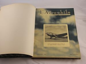
Editorial: Paris. 1939
Librería: Antiquariat Bebuquin (Alexander Zimmeck), Pegau OT Werben, AlemaniaAntiquariat Bebuquin (Alexander Zimmeck)
Contactar con el vendedorVendedor de 4 estrellasCondición: Usado
EUR 150,00
Envío por EUR 60,00Se envía de Alemania a Estados Unidos de AmericaCantidad disponible: 1 disponibles
Añadir al carrito12 Hefte in 1 Bd. Gr. 4°. 284 S. mit sehr zahlr. Bildern und über 100 Seiten Fiches Aeronautiques. HLn der Zeit mit goldgeprägtem Rücken und mit eingebundenem OEinband des 1. Heftes. feines Ex. = 47. Jg. seltene frühe Zeitschrift. Sprache: französisch.
Editorial: Edouard Blondel la Rougery, Paris 1954
- Mapa
Librería: Alexandre Antique Prints, Maps & Books, Toronto, CanadaAlexandre Antique Prints, Maps & Books
Contactar con el vendedorVendedor de 5 estrellasCondición: Usado - Bueno
EUR 510,19
Envío por EUR 5,17Se envía de Canada a Estados Unidos de AmericaCantidad disponible: 1 disponibles
Añadir al carritoCondición: Very Good. Detailed map of Central Paris from the mid-20th century published by the French Government, Ministry of Tourism. The map shows major tourism attractions in Paris., Size : 667x1085 (mm), 26.26x42.72 (Inches), Printed in Color with Some Hand Coloring.
Librería: Librairie Laurencier, Bordeaux, FranciaLibrairie Laurencier
Contactar con el vendedorVendedor de 4 estrellasCondición: Usado
EUR 80,00
Envío por EUR 10,00Se envía de Francia a Estados Unidos de AmericaCantidad disponible: 1 disponibles
Añadir al carritoCartes du Monde Entier.Carte dans sa pochette.Couleurs. BE.

- Mapa
Librería: Geographicus Rare Antique Maps, Brooklyn, Estados Unidos de AmericaGeographicus Rare Antique Maps
Contactar con el vendedorVendedor de 4 estrellasCondición: Usado
EUR 248,44
Envío por EUR 14,64Se envía dentro de Estados Unidos de AmericaCantidad disponible: 1 disponibles
Añadir al carritoVery good. Light wear along original fold lines. Size 21.5 x 29.75 Inches. This is a 1948 Blondel la Rougery and Imprimerie Gaillac-Monrocq pictorial map of Le Havre, France. Published within a few years of the end of World War II (1939 - 1945), this map acts more as a summary of all the history that was lost during the war than… as a practical guide to getting around the city. A Closer Look The map depicts central Le Havre with its port at the bottom. The city's churches, schools, theatres, city hall, railroad station, and military barracks are highlighted with profile illustrations, and orange text identifies each one. Orange text and color highlight government buildings, factories, schools, shops, hospitals, and numerous other locations throughout the city. Le Havre's 13 tram lines are highlighted as well. An extensive index of Le Havre's streets, docks, squares, bridges, and other locations frame the map on 3 sides. Rebuilding a City Before World War II, Le Havre was one of the biggest ports in Europe. During the war, Le Havre endured 132 Allied bombing raids that killed 5,000 people, injured as many as 80,000, and destroyed 12,500 buildings. The Hotel de Ville (City Hall), the Bourse (Stock Exchange), and the museum (all of which are highlighted here) were destroyed by the bombing campaign, along with the churches of Notre Dame and St. Michel. Thus, as this map was published in May 1948, it is more of a summary of what was lost during the war than a practical guide for getting around the city. Publication History and Census This map was created by Éditions Blondel la Rougery and published by the Imprimerie Gaillac-Monrocq in Paris in 1948. Blondel la Rougery began publishing editions of this map in 1890, with subsequent editions appearing in at least 1918 and 1924.

Carte Touristique de Cannes et des environs Massiv de L'Esterel.
1925 Blondel la Rougery Map of the French Riviera: St. Tropez, Cannes, Nice
- Mapa
Librería: Geographicus Rare Antique Maps, Brooklyn, Estados Unidos de AmericaGeographicus Rare Antique Maps
Contactar con el vendedorVendedor de 4 estrellasCondición: Usado
EUR 795,01
Envío por EUR 14,64Se envía dentro de Estados Unidos de AmericaCantidad disponible: 1 disponibles
Añadir al carritoVery Good. Some wear and verso reinforcement at original fold intersections and along edges. A few old blue pencil marks related to a voyage - cold be erased. Size 37.25 x 40.75 Inches. A spectacular c. 1920 large-scale chromolithograph map of the French Riviera by Blondel la Rougery. The map, a lavish production meant to highli…ght the Cannes region for tourists, was issued as part of the Syndicat d'Initiative de Cannes's ongoing and outrageously successful mission to turn the French Riviera into a playground for the elite. Its issue corresponds with the Rivera's, and specifically Cannes', emergence as a mecca for the intelligentsia, hosting Scott and Zelda Fitzgerald, Pablo Picasso, Francis Picabia, and Jean Cocteau, among countless others. A Closer Look The map is drawn on a large scale with coverage embracing the Côte d'Azur from San Tropez to Ventimiglia (IT), including St. Raphaël, Cannes, Nice, Monaco, Monte Carlo, and Menta, along with other smaller cities. Coverage extends inland towards the Alpes-Maritimes, to include the Var River valley as far as, roughly, Puget-Théniers and Annot. The map offers meticulous detail, illustrating roads and other transportation networks, forests, ruins, and mountains with subtle topographical shading. An inset in the lower right details Cannes, with important buildings, particularly hotels, highlighted in red. Monumental structures, including the Casino Municipal, churches, and the railway station, are illustrated pictorially. There is manuscript annotation in blue pencil by a previous owner recording travels through the region. Romanticizing the French Riviera In the 1920s, Cannes and the French Riviera emerged as glamorous destinations for the international elite, transforming from quaint coastal towns into vibrant hubs of luxury and leisure. The region attracted aristocrats, artists, and Hollywood stars who flocked to its sun-drenched shores, drawn by the stunning Mediterranean landscapes and the burgeoning social scene. Cannes, in particular, became synonymous with opulence, where grand hotels, such as the Carlton and the Martinez, hosted lavish parties and soirées. The French Riviera's allure was further immortalized in the works of authors like F. Scott Fitzgerald, who captured the era's spirit of excess and carefree indulgence, marking the 1920s as a golden age for this enchanting stretch of the French coastline. Much of the work in romanticizing the French Riviera was accomplished by its stunning natural beauty; the rest can be attributed to the sponsor of this map, the Syndicat d'Initiative de Cannes (SIC; 1894 - present). The SIC played a pivotal role in transforming Cannes into a world-renowned tourist destination. Originally founded to promote Cannes and its surrounding areas, the SIC was part of a broader movement in France aimed at developing local tourism through organized efforts. This organization was responsible for enhancing the city's appeal to visitors by improving infrastructure, promoting cultural events, and offering information services to tourists. The organization's efforts were instrumental in establishing Cannes as a premier destination on the French Riviera, particularly during the Interwar Period. The SIC also contributed to the city's cultural identity by supporting events such as the Cannes Film Festival, which further cemented the city's status as a glamorous and culturally rich location. Chromolithography Chromolithography, sometimes called oleography, is a color lithographic technique developed in the mid-19th century. The process uses multiple lithographic stones, one for each color, to yield a rich composite effect. Generally, a chromolithograph begins with a black basecoat upon which subsequent colors are layered. Some chromolithographs used 30 or more separate lithographic stones to achieve the desired effect. Chromolithograph color can be blended for even more dramatic results. The process became extremely popular in the late 19th and early.
 Más imágenes
- Firmado
- Mapa
Librería: Geographicus Rare Antique Maps, Brooklyn, Estados Unidos de AmericaGeographicus Rare Antique Maps
Contactar con el vendedorVendedor de 4 estrellasCondición: Usado
EUR 944,07
Envío por EUR 14,64Se envía dentro de Estados Unidos de AmericaCantidad disponible: 1 disponibles
Añadir al carritoGood. Dissected and mounted on linen in 32 panels. Old tape residue on verso. Areas of scuffing to corners and in top and bottom edges in printed title and copyright. Size 29.25 x 39.5 Inches. This is a c. 1942 Editions Blondel la Rougery city plan or map of Paris, France. The map illustrates Paris during the World War II (1939…- 1945) Nazi occupation. The name on the back, Capt. Franklin G. Fischrist (or possibly Tischrist), suggests it was used by an English or American officer after the war. A Closer Look Depicting Paris from the Seine east to the Chateau de Vincennes and from St. Ouen south to Gentilly, Ivry, and Montrouge, buildings throughout Paris are illustrated and shaded orange. These structures range from monuments such as the Eiffel Tower, the Arc de Triomphe, Notre Dame, and the Louvre to train stations, hospitals, and schools. The Jardin des Tuileries, the Jardin du Luxembourg, the Jardin des Plantes, the Parc des Buttes Chaumont, the Bois de Boulogne, and the Bois de Vincennes appear as open green spaces. Streets, roads, and alleys are labeled. The Paris Métro appears as bold blue lines, with blue text and numbers marking each stop. We have dated this map using the Paris Métro based on the extent of construction. An Unknown Provenance On the verso, Captain Franklin G. Tischrist (sp?) signed just above the Editions Blondel la Rougery bookplate. Unfortunately, we have been unable to trace this Captain, making it impossible to know his story. Publication History and Census This map was published between July 1939, when Métro Line 10 was extended to the Gare d'Austerlitz (not explicitly labeled here, but the extension is printed) and October 1942, when Métro Line 8 was extended from Porte de Charenton to Charenton-Écoles, which appears here as a dashed line indicating that it remains under construction. We have been unable to locate any other verifiable examples of the present edition. Blondel la Rougery published numerous editions of this map beginning as early as 1916 using the same title, making differentiating challenging. Nonetheless, we note an example of the 1944 edition with the Line 8 extension illustrated as a solid blue line at the Bibliothèque nationale de France.


