Nat geo maps (Más de 2400 resultados)

Librería: Rarewaves USA, OSWEGO, IL, Estados Unidos de AmericaRarewaves USA
Contactar con el vendedorVendedor de 5 estrellasCondición: Nuevo
EUR 9,86
Gastos de envío gratisSe envía dentro de Estados Unidos de AmericaCantidad disponible: 1 disponibles
Map. Condición: New. . Waterproof . Tear-Resistant . Travel MapNational Geographic's City Destination map of Munich is an invaluable tool for exploring the capital of Bavaria. The comprehensive street map on the front side provides exceptional detail of the city. Points of interest, hotels, places of worship, notable buildings,…theaters, parks, information centers, and more are easy to find with the multi-language legend. Transportation aids such as subway and regional railway stations and parking areas are shown as well.Information on various points of interest are included on the reverse side, along with maps of the region and the extravagant palace of Schloss Nymphenburg. The Romantic Road and Bavarian Alps map provides detail of the Romantic, Alpine, Castle and Thuringia, and Alpine-Baltic roads. Handy diagrams of Munich (Franz Josef Strauss) International Airport and the U-Bahn (subway) and S-Bahn (suburban trains) transit systems will help you navigate the city quickly and efficiently.Every Destination Map is printed on durable synthetic paper, making them waterproof, tear-resistant and tough - capable of withstanding the rigors of any kind of travel.

Librería: Rarewaves USA, OSWEGO, IL, Estados Unidos de AmericaRarewaves USA
Contactar con el vendedorVendedor de 5 estrellasCondición: Nuevo
EUR 9,86
Gastos de envío gratisSe envía dentro de Estados Unidos de AmericaCantidad disponible: 1 disponibles
Map. Condición: New. 2022nd ed. . Waterproof . Tear-Resistant . Travel MapThe national's capital and home to many of the country's most treasured monuments and museums, Washington D. C. is a popular destination for business and leisure travelers. National Geographic's City Destination map of Washington D. C. is a comprehensive g…uide to the city, combining an easy-to-read road map with an informative and well researched travel guide. The map covers the city from Georgetown, through the White House, National Mall and Capitol, to the Washington Navy Yard, along with parts of Northern Virginia, the Potomac River and its many bridges.Pinpointed on the map are hundreds of points of interest, including monuments, hotels, places of worship, parks, police stations, hospitals, notable buildings and metro stations. Many of the city's most popular attractions are depicted in 3D, including the Lincoln Memorial, Washington Monument and White House. An inset map outlines the neighboring area of Old Town Alexandria. A comprehensive metro map along with diagrams of Dulles and Reagan National Airports are shown along with background information of the transit system. To assist in your navigation of the area, a user friendly index of streets, government buildings, monuments, museums, parks, hotels and metro stations is also provided.Every Destination Map is printed on durable synthetic paper, making them waterproof, tear-resistant and tough - capable of withstanding the rigors of any kind of travel.

Librería: Rarewaves USA, OSWEGO, IL, Estados Unidos de AmericaRarewaves USA
Contactar con el vendedorVendedor de 5 estrellasCondición: Nuevo
EUR 9,86
Gastos de envío gratisSe envía dentro de Estados Unidos de AmericaCantidad disponible: 1 disponibles
Map. Condición: New. . Waterproof . Tear-Resistant . Travel MapNational Geographic's City Destination map of Orlando is both a comprehensive map and travel guide for the city for business and leisure travelers alike. The city is presented using various maps with different levels of detail. A road map of the entire state of Flori…da shows the city's position in the center of the state and a regional map shows the roads leading in a out of the city. A city map of the Orlando area shows the city and its suburbs and inset maps of the Walt Disney Resort, International Drive and Downtown provide unparalleled detail of these popular areas. Pinpointed on the maps are hundreds of hotels, theaters, churches, parks, train stations, churches, notable buildings and points of interest.Each inset map is accompanied by an easy to use index of cities and towns, roads, hotels, attractions, golf courses, parks and other points of interest, which will aid in planning your route and arriving at your destination. A diagram of Orlando Airport will allow you to navigate this travel hub quickly and efficiently. Background information about the city, an overview of the public transit system and descriptions of top attractions in and around the city are also provided. Every Destination Map is printed on durable synthetic paper, making them waterproof, tear-resistant and tough - capable of withstanding the rigors of any kind of travel.

Librería: Rarewaves USA, OSWEGO, IL, Estados Unidos de AmericaRarewaves USA
Contactar con el vendedorVendedor de 5 estrellasCondición: Nuevo
EUR 9,86
Gastos de envío gratisSe envía dentro de Estados Unidos de AmericaCantidad disponible: 1 disponibles
Map. Condición: New. 2024th ed. . Waterproof . Tear-Resistant . Travel MapNational Geographic's Virginia Guide Map is an unparalleled and expertly researched guide to the 'Old Dominion.' The main map shows the road network, with clear designations for free access and toll highway; interstate, state and country routes; other pave…d and unpaved roads; and scenic drives with their waysides stops. Major highways are shown with mileage markers. Pinpointed are hundreds of points of interest, national and state recreation areas, visitor centers, ski areas, hospital and airports. An index of counties, cities and towns will assist in finding your destination quickly. Inset maps cover some of the largest cities and metropolitan areas, including the Washington DC area, Richmond, Charlottesville, Roanoke, Lynchburg, Colonial National Historical Park and Hampton Roads. Visitor information and inset maps are shown for Shenandoah National Park and the Blue Ridge Parkway scenic drive. Other popular points of interest, a chart of national park services and a calendar of events are also provided along with contact details for all listings.Every State Guide Map is printed on durable synthetic paper, making them waterproof, tear-resistant and tough - capable of withstanding the rigors of any kind of travel.

Librería: Rarewaves USA, OSWEGO, IL, Estados Unidos de AmericaRarewaves USA
Contactar con el vendedorVendedor de 5 estrellasCondición: Nuevo
EUR 9,86
Gastos de envío gratisSe envía dentro de Estados Unidos de AmericaCantidad disponible: 3 disponibles
Map. Condición: New. 2025th ed. . Waterproof . Tear-Resistant . Travel MapNational Geographic's North Carolina Guide Map is designed to meet the needs of travelers with detailed and accurate cartography and loads of helpful information about the state's many attractions. Hundreds of points of interest are shown, along with natio…nal and state parks, public campsites, visitor information centers, airports, ski areas, hospitals, and more. Cities and towns are clearly indicated and easy to find in the user-friendly index. Highways, roadways, toll roads, scenic routes, and other roads, as well as ferry routes are clearly designated. Distances in miles are noted on major highways so travelers can easily plan their best route. A chart of park service sites and climate information will be particularly helpful to travelers taking in the many outdoor activities in North Carolina. Inset maps of Raleigh-Durham, Asheville, Charlotte, Winston-Salem-Greensboro, Fayetteville, Wilmington, and Western North Carolina provide greater detail of key areas of the state. Maps and information about Blue Ridge Parkway and Great Smoky Mountains National Park highlight some of the extraordinary beauty to be found in the state.Every State Guide Map is printed on durable synthetic paper, making them waterproof, tear-resistant and tough - capable of withstanding the rigors of any kind of travel.

Librería: Rarewaves USA, OSWEGO, IL, Estados Unidos de AmericaRarewaves USA
Contactar con el vendedorVendedor de 5 estrellasCondición: Nuevo
EUR 9,86
Gastos de envío gratisSe envía dentro de Estados Unidos de AmericaCantidad disponible: 2 disponibles
Map. Condición: New. . Waterproof . Tear-Resistant . Travel MapWhether you're seeking the jazz and nightlife of the French Quarter or want to take in the many museums and galleries in the Warehouse/Arts District, National Geographic's City Destination map of New Orleans will help you make the most of your visit. The front side o…f this map is loaded with information on points of interest in and around New Orleans including a map of Louisiana plantations. A map of the region and a diagram of Louis Armstrong New Orleans International Airport provide additional tools for navigating the area.A detailed street map of the city is shown on the reverse side. Hundreds of points of interest including monuments, parks, theaters, churches, hotels, visitor centers, and more are easy to find with the multi-language legend. Transportation aids such streetcars, shuttles, and ferries will prove invaluable in traversing the city using public transit. Additional services such as police stations, post offices, and hospitals are included as well.Every Destination Map is printed on durable synthetic paper, making them waterproof, tear-resistant and tough - capable of withstanding the rigors of any kind of travel.

Librería: Rarewaves USA, OSWEGO, IL, Estados Unidos de AmericaRarewaves USA
Contactar con el vendedorVendedor de 5 estrellasCondición: Nuevo
EUR 9,86
Gastos de envío gratisSe envía dentro de Estados Unidos de AmericaCantidad disponible: 2 disponibles
Map. Condición: New. . Waterproof . Tear-Resistant . Travel MapNational Geographic's City Destination map of London combines a city map and travel guide, making it the ultimate traveling companion to this leading tourism destination. The reverse side presents an easy-to-read road map with hundreds of points of interest including… 3D depictions of many top attractions, like the London Eye, Buckingham Palace and the Tower of London. Pinpointed are underground (tube) stops, rail stations, river bus stops, theaters, hotels, places of worship, notable buildings, police stations, hospitals, parks, pedestrian areas and other points of interest. Also displayed is a full map of the London underground. The front side has a regional map and descriptions of the city, many popular attractions and the transit system. A user-friendly index of streets, hotels and points of interest along with diagrams of Heathrow and Gatwick Airports will help you arrive at your destination quickly. An inset map of Hyde Park and Kensington provides details of this very popular area. With all of this specialized content, this map is the perfect complement to National Geographic's London Traveler Guide. Every Destination Map is printed on durable synthetic paper, making them waterproof, tear-resistant and tough - capable of withstanding the rigors of any kind of travel.

Librería: Rarewaves USA, OSWEGO, IL, Estados Unidos de AmericaRarewaves USA
Contactar con el vendedorVendedor de 5 estrellasCondición: Nuevo
EUR 9,86
Gastos de envío gratisSe envía dentro de Estados Unidos de AmericaCantidad disponible: 6 disponibles
Map. Condición: New. 2026th ed. . Waterproof . Tear-Resistant . Travel MapNational Geographic's City Destination map of Buenos Aires combines a city map and travel guide, making it the ultimate traveling companion to Argentina's capital city. Featured on the front side are a regional map and inset map of Isla Martin Garcia. Maps… of Ezeiza Airport and the subway (subte) along with an overview of the public transit system will help you travel around the city efficiently. Find your destination and plan your route using the user friendly index of streets, hotels, parks, metro stations, points of interest and public buildings. Information about the most popular points of interest in and around the city is also provided.The main street map of the city is on the reverse side. In addition to road network designations for through routes, main and secondary roads, and one ways streets, the map also pinpoints hundreds of points of interest, public transit stations, monuments, theaters, places of worship, hotels, notable buildings and parks, along with a multi-language legend. Inset maps show the Belgrano and La Boca neighborhoods. Every Destination Map is printed on durable synthetic paper, making them waterproof, tear-resistant and tough - capable of withstanding the rigors of any kind of travel.

Librería: Rarewaves USA, OSWEGO, IL, Estados Unidos de AmericaRarewaves USA
Contactar con el vendedorVendedor de 5 estrellasCondición: Nuevo
EUR 10,18
Gastos de envío gratisSe envía dentro de Estados Unidos de AmericaCantidad disponible: 6 disponibles
Map. Condición: New. . Waterproof . Tear-Resistant . Travel MapNational Geographic's City Destination map of Paris is a complete travel guide to this top tourist destination, with valuable information not found in traditional maps. The front side presents an easy-to-read map of the city with its road network and features 3D depi…ctions of many top attractions, like Arc de Triomphe, Eiffel Tower and The Louvre. Hundreds of points of interest are displayed with the aid of a multi-language legend, including metro and train stations, hotels, parks, hospitals, police stations, places of worship, theaters and pedestrian areas.The reverse side has a regional map and descriptions of the city, many popular attractions and the transit system. A user-friendly index of streets, metro stations, hotels and points of interest along with a metro map and diagrams of Charles de Gaulle and Orly Airports will help you arrive at your destination quickly. With all of this specialized content, this map is the perfect companion to National Geographic's Paris Traveler Guide. Every City Destination Map is printed on durable synthetic paper, making them waterproof, tear-resistant and tough - capable of withstanding the rigors of any kind of travel.

Librería: Rarewaves USA, OSWEGO, IL, Estados Unidos de AmericaRarewaves USA
Contactar con el vendedorVendedor de 5 estrellasCondición: Nuevo
EUR 10,28
Gastos de envío gratisSe envía dentro de Estados Unidos de AmericaCantidad disponible: 1 disponibles
Map. Condición: New. 2022nd ed. . Waterproof . Tear-Resistant . Travel MapNational Geographic's Washington Guide Map is designed to meet the needs of travelers with detailed and accurate cartography and loads of helpful information about the state's many attractions. Cities and towns are clearly indicated and easy to find in the… user-friendly index. A complete road network of highways, tollways, and other roads, along with distances noted in miles for major highways, will help you find the route that's right for you. National and state parks, public campsites, visitor information centers, airports, ski areas, ports of entry, and more are shown.Inset maps of Olympia, Yakima, Spokane, and Seattle provide greater detail of these urban centers. Olympic, Mount Rainier, and North Cascades national parks, and Mount Adams Scenic Drive are highlighted with maps and additional information to help visitors take advantage of the many sites and recreation activities available in these regions. A handy chart of park service sites and climate information are also included. Whether your travels in Washington bring you to its cities or its most remote wilderness areas, you'll find this map to be an invaluable tool for exploring all the state has to offer.Every State Guide Map is printed on durable synthetic paper, making them waterproof, tear-resistant and tough - capable of withstanding the rigors of any kind of travel.

Librería: Rarewaves USA, OSWEGO, IL, Estados Unidos de AmericaRarewaves USA
Contactar con el vendedorVendedor de 5 estrellasCondición: Nuevo
EUR 11,27
Gastos de envío gratisSe envía dentro de Estados Unidos de AmericaCantidad disponible: 2 disponibles
Map. Condición: New. . Waterproof . Tear-Resistant . Travel MapResting on the Nazca tectonic plate in the eastern Pacific Ocean approximately 600 miles west of Ecuador, the actively volcanic Galápagos Islands were discovered in 1535 by the bishop of Panama, Tomás de Berlanga, when his ship drifted off course. In 1835, naturalist… Charles Darwin, aboard the H.M.S Beagle, arrived in the Galápagos and spent 5 weeks collecting geological and biological specimens from several islands, noting his surprise at the variety of birds, tortoises, iguanas and other creatures-all without fear of humans. Darwin's short visit inspired, in part, his 1859 theory of evolution by natural selection and led to the declaration of Galápagos as a national park 100 years later in 1959. Galápagos was declared the first UNESCO World Heritage site in 1978.Now, National Geographic has created a map of this island chain that is so remote that many of the species who live here can be found nowhere else on earth. The front of the map includes an overview of the entire island chain to help with context since the islands are spread over a large swath of ocean. On the back of the map, each major island has a description including the endemic species (animals or plants living only on the Galápagos), facts about the human history of each island, and other facts that are important to travelers.Every Adventure Map is printed on durable synthetic paper, making them waterproof, tear-resistant and tough - capable of withstanding the rigors of international travel.

Librería: Rarewaves USA, OSWEGO, IL, Estados Unidos de AmericaRarewaves USA
Contactar con el vendedorVendedor de 5 estrellasCondición: Nuevo
EUR 11,27
Gastos de envío gratisSe envía dentro de Estados Unidos de AmericaCantidad disponible: 2 disponibles
Map. Condición: New. . Waterproof . Tear-Resistant . Travel MapBusiness and leisure travelers alike will find National Geographic's City Destination map of Los Angeles is an invaluable tool for exploring this diverse global city. A unique combination of city map and travel guide, this is the ultimate travel companion.The front s…ide includes inset maps of Westside, Long Beach and Anaheim along with a regional map and diagrams of Los Angeles (LAX) and John Wayne Airports. Provided also are general information about the city and surrounding areas, descriptions of popular points of interest and an overview of public transit system. The reverse side features the main map of the entire city from the Santa Monica Mountains to Chino Hills along with an inset map of the downtown area. The easy to read street map shows road designations for freeways, toll roads, main streets, secondary roads and one way streets. Pinpointed are hundreds of points of interest, including subway and train stations, hotels, theaters, churches, notable buildings and parks. A user friendly index of cities and towns, neighborhoods, roads and streets, hotels and points of interest will help you find your destination and plan your route quickly and efficiently.Every Destination Map is printed on durable synthetic paper, making them waterproof, tear-resistant and tough - capable of withstanding the rigors of any kind of travel.

Librería: Rarewaves USA, OSWEGO, IL, Estados Unidos de AmericaRarewaves USA
Contactar con el vendedorVendedor de 5 estrellasCondición: Nuevo
EUR 11,27
Gastos de envío gratisSe envía dentro de Estados Unidos de AmericaCantidad disponible: 3 disponibles
Map. Condición: New. 2026th ed. . Waterproof . Tear-Resistant . Travel MapWhether traveling for business or leisure, let National Geographic's Florida Guide Map lead you on your visit to the 'Sunshine State.' Coverage is unparalleled with one large road map encompassing the entire state and several detailed city and metropolitan… area inset maps, including Jacksonville, Miami, Tampa-St. Petersburg, Orlando, Tallahassee, Fort Myers-Cape Coral, Gainesville, Melbourne-Kennedy Space Center, Dayton Beach, Pensacola, Panama City and Key West. Pinpointed are hundreds points of interest, national and state recreation lands, campgrounds, visitor centers, airports and hospitals. Visitor information is given for Miami/Miami Beach, Orlando and Key West along as well as Everglades National Park and the Florida Panhandle scenic drive. Descriptions of many popular points of interest, a calendar of events, a chart of services at national parks and a convenient index of counties, cities and towns will help you plan your itinerary.Every State Guide Map is printed on durable synthetic paper, making them waterproof, tear-resistant and tough - capable of withstanding the rigors of any kind of travel.

Librería: Rarewaves USA, OSWEGO, IL, Estados Unidos de AmericaRarewaves USA
Contactar con el vendedorVendedor de 5 estrellasCondición: Nuevo
EUR 11,27
Gastos de envío gratisSe envía dentro de Estados Unidos de AmericaCantidad disponible: 5 disponibles
Map. Condición: New. 2026th ed. . Waterproof . Tear-Resistant . Travel MapExpertly researched and loaded with helpful information, National Geographic's Texas Guide Map is a must-have for travelers exploring 'The Lone Star State.' In addition to a state map, inset maps provide detail on the Texas Panhandle and the cities of Dall…as, Fort Worth, Houston, Amarillo, Abilene, Lubbock, Waco, Laredo, Beaumont, El Paso, Odessa-Midland, McAllen, Corpus Christi, San Antonio, and Austin. Cities and towns are easy to find with the map's helpful index and hundreds of attractions are noted. Road network designations are clear and distances in miles on major highways are shown.Additional information and maps feature the recreation activities available in Big Bend National Park and the attractions along the Hill Country scenic drive. The Alamo, the Space Center Houston, the San Antonio Riverwalk, and Guadalupe Mountains National Park are just some of the many points of interest that are highlighted. A handy chart of park service sites and climate information are also included.Every State Guide Map is printed on durable synthetic paper, making them waterproof, tear-resistant and tough - capable of withstanding the rigors of any kind of travel.

Librería: Rarewaves USA, OSWEGO, IL, Estados Unidos de AmericaRarewaves USA
Contactar con el vendedorVendedor de 5 estrellasCondición: Nuevo
EUR 11,30
Gastos de envío gratisSe envía dentro de Estados Unidos de AmericaCantidad disponible: 4 disponibles
Map. Condición: New. 2026th ed. . Waterproof . Tear-Resistant . Travel MapCovering the country from Philadelphia to the Florida Keys and west to the Mississippi River, National Geographic's Southeastern USA Guide Map is designed to meet the needs of all travelers to this part of the country. The main map displays a comprehensive… interstate highway network, complete with mileage markers and designations for toll and free access roads, as well as smaller state highways and county roads. Points of interest, national parks and forests, airports and state capitals are pinpointed. An index of cities and towns will help you quickly locate your destination. More than 20 metropolitan areas can be found on inset maps, providing extra detail of each area's road network and points of interest. Inset maps are also provided for the Everglades, Shenandoah and Great Smoky Mountains National Parks. Traveling information is given about the Deep South, Coastal South, southern Appalachian Mountain and Chesapeake Bay areas, Florida and many national parks.Every State Guide Map is printed on durable synthetic paper, making them waterproof, tear-resistant and tough - capable of withstanding the rigors of any kind of travel.

Librería: Rarewaves USA, OSWEGO, IL, Estados Unidos de AmericaRarewaves USA
Contactar con el vendedorVendedor de 5 estrellasCondición: Nuevo
EUR 11,30
Gastos de envío gratisSe envía dentro de Estados Unidos de AmericaCantidad disponible: 3 disponibles
Map. Condición: New. 2026th ed. . Waterproof . Tear-Resistant . Travel MapNational Geographic's Colorado Guide Map is designed to meet the needs of travelers with detailed and accurate cartography and loads of helpful information about the state's many attractions. Cities and towns are easy to find with the map's helpful index.…Highways, roadways, toll roads, scenic routes, and other roads are clearly designated. Distances in miles are noted on major highways so travelers can easily plan their best route. Hundreds of points of interest are shown, along with national and state parks, public campsites, visitor information centers, airports, ski areas, hospitals, and more.Inset maps of Denver, Colorado Springs, Pueblo, Fort Collins, Mesa Verde National Park, and Rocky Mountain National Park provide greater detail of key areas of the state. A map of the San Juan Skyway highlights one of Colorado's many scenic drives. The information provided about points of interest, Denver, and Rocky Mountain and Mesa Verde national parks will help you take advantage of many sites and recreation activities the state has to offer. A handy chart of park service sites and climate information are also included.Every State Guide Map is printed on durable synthetic paper, making them waterproof, tear-resistant and tough - capable of withstanding the rigors of any kind of travel.

Librería: Rarewaves USA, OSWEGO, IL, Estados Unidos de AmericaRarewaves USA
Contactar con el vendedorVendedor de 5 estrellasCondición: Nuevo
EUR 11,30
Gastos de envío gratisSe envía dentro de Estados Unidos de AmericaCantidad disponible: 5 disponibles
Map. Condición: New. 2026th ed. . Waterproof . Tear-Resistant . Travel MapLet National Geographic's City Destination map of Florence guide you as you explore this historic city that was the birthplace of the Renaissance and is still considered a world center for fashion, art and culture. Featured on the map's front side is a cle…arly marked road network complete with designations for through routes, main and secondary roads, one way streets and pedestrian zones. Along with a multi-language legend, hundreds of points of interest are pinpointed, including notable buildings, places of worship, hotels, theaters, parking areas, rail stations, parks, police stations and hospitals. Many of the city's top attractions are displayed with 3D images, including Santa Maria del Fiore, Palazzo Vecchio and Ponte Vecchio.The reverse side has a regional map, showing the city's location on the heart of Tuscany. An insert map of Centro Storico provides extra detail of the remarkable city center. A user-friendly index of streets, hotels and points of interest, will ensure you find your destination quickly. A travel guide gives background information about the city, its most popular destinations and an overview of the public transit system, including a diagram of Amerigo Vespucci airport. With such an abundance of specialized content that is not available in traditional maps, this destination map is the perfect complement to National Geographic's Florence and Tuscany Traveler Guide.Every Destination Map is printed on durable synthetic paper, making them waterproof, tear-resistant and tough - capable of withstanding the rigors of any kind of travel.

Librería: Rarewaves.com USA, London, LONDO, Reino UnidoRarewaves.com USA
Contactar con el vendedorVendedor de 5 estrellasCondición: Nuevo
EUR 11,52
Gastos de envío gratisSe envía de Reino Unido a Estados Unidos de AmericaCantidad disponible: 1 disponibles
Map. Condición: New. . Waterproof . Tear-Resistant . Travel MapNational Geographic's City Destination map of Munich is an invaluable tool for exploring the capital of Bavaria. The comprehensive street map on the front side provides exceptional detail of the city. Points of interest, hotels, places of worship, notable buildings,…theaters, parks, information centers, and more are easy to find with the multi-language legend. Transportation aids such as subway and regional railway stations and parking areas are shown as well.Information on various points of interest are included on the reverse side, along with maps of the region and the extravagant palace of Schloss Nymphenburg. The Romantic Road and Bavarian Alps map provides detail of the Romantic, Alpine, Castle and Thuringia, and Alpine-Baltic roads. Handy diagrams of Munich (Franz Josef Strauss) International Airport and the U-Bahn (subway) and S-Bahn (suburban trains) transit systems will help you navigate the city quickly and efficiently.Every Destination Map is printed on durable synthetic paper, making them waterproof, tear-resistant and tough - capable of withstanding the rigors of any kind of travel.

Librería: Rarewaves USA, OSWEGO, IL, Estados Unidos de AmericaRarewaves USA
Contactar con el vendedorVendedor de 5 estrellasCondición: Nuevo
EUR 12,86
Gastos de envío gratisSe envía dentro de Estados Unidos de AmericaCantidad disponible: 18 disponibles
Map. Condición: New. . Waterproof . Tear-Resistant . Travel MapCreated in cooperation with Instituto Geografico Nacional, National Geographic's Costa Rica Adventure Map is designed to meet the needs of all adventure travelers in this tropical tourist hotspot. Indexes of towns and protected areas, such as National Wildlife Refuge…s and Parks, wetlands, nature reserves and other natural attractions as well as pinpointed recreational, ecological, cultural, and historic destinations are combined with the clearly mapped road network of primary and secondary roads, to help you explore on and off the beaten path. Such specialized content, not available on traditional road maps, makes the map the perfect companion to National Geographic's Costa Rica Traveler Guide or any other guidebook.Coverage includes the country in its entirety along with many of its islands including an inset map of Cocos Island (Isla de Coco), the UNESCO World Heritage Site. An inset of capital San Jose, provides in-depth detail of the capital, including notable buildings, churches, embassies, parks and churches. Recreation and adventure activities marked along the country's shorelines including areas for surfing, diving and fishing as well as labeled natural features, such as freshwater and saltwater swamps, mangroves and reefs. Background information about the region, traveling regulations and a conservation overview will further enhance your trip preparation.Every Adventure Map is printed on durable synthetic paper, making them waterproof, tear-resistant and tough - capable of withstanding the rigors of international travel.

Librería: Rarewaves USA, OSWEGO, IL, Estados Unidos de AmericaRarewaves USA
Contactar con el vendedorVendedor de 5 estrellasCondición: Nuevo
EUR 12,86
Gastos de envío gratisSe envía dentro de Estados Unidos de AmericaCantidad disponible: Más de 20 disponibles
Map. Condición: New. . Waterproof . Tear-Resistant . Travel MapLet National Geographic's Iceland Adventure Map guide you as you discover the pristine nature and unique scenery on this Nordic island. The expertly researched map, with its accurate and detailed information, is designed to meet the needs of adventure travelers. In a…ddition to a clearly marked road network, with distances and destinations of both major and main roads, the map also delivers an abundance of specialized content not found in traditional road maps. An index of cities and towns will help you arrive at your destination quickly. Recreational, ecological, cultural, and historic points of interest as well as secondary roads, remote tracks, secluded paths and ferry routes will aid in your exploration both on and off the beaten path. Among the pinpointed points of interest are hot springs, geysers, waterfalls, caves, museums, lighthouses, swimming pools, golf courses, campsites and scenic viewpoints. Also labeled are the UNESCO World Heritage Sites, Thingvellir National Park and the volcanic island of Surtsey. The shaded relief map details the entire island, contour lines are drawn, peaks and summits are labeled with elevations, forested areas are shaded, water features are shown and boundaries of National Parks and nature reserves are color-coded, making it the perfect companion to any guidebook. Every Adventure Map is printed on durable synthetic paper, making them waterproof, tear-resistant and tough - capable of withstanding the rigors of international travel.

Librería: Rarewaves USA, OSWEGO, IL, Estados Unidos de AmericaRarewaves USA
Contactar con el vendedorVendedor de 5 estrellasCondición: Nuevo
EUR 12,86
Gastos de envío gratisSe envía dentro de Estados Unidos de AmericaCantidad disponible: 7 disponibles
Map. Condición: New. 2022nd ed. . Waterproof . Tear-Resistant . Topographic MapNational Geographic's Trails Illustrated map of Yellowstone National Park is designed to meet the needs of outdoor enthusiasts by combining valuable information with unmatched detail of America's first national park. Expertly researched and created in… partnership with local land management agencies, this map features key points of interest including Mammoth Hot Springs, Canyon Village, Yellowstone Lake, Yellowstone Falls, Grant Village, and Old Faithful geyser area.With over 1,000 miles of mapped trails, the Yellowstone National Park map can guide you off the beaten path and back again. The clearly marked trails include mileages between intersections. Trail summaries provide elevation, duration, and difficulty for a variety of suggested hikes. The map base includes contour lines and elevations for summits, passes and many lakes. The bathymetry of Yellowstone Lake is shown with both contours and hill shading. Some of the many recreation features include: campgrounds, trailheads, boat ramps, marinas, scenic overlooks and interpretive trails.Every Trails Illustrated map is printed on 'Backcountry Tough' waterproof, tear-resistant paper. A full UTM grid is printed on the map to aid with GPS navigation.Other features found on this map include: Absaroka-Beartooth Wilderness, Beartooth Mountains, Big Game Ridge, Buffalo Plateau, Colter Peak, Craig Pass, Crowfoot Ridge, Custer National Forest, Eagle Peak, Emigrant Peak, Gallatin National Forest, Grand Teton National Park, Granite Peak, Granite Range, Grouse Mountain, Heart Lake, Hurricane Mesa, Jedediah Smith Wilderness, John D. Rockefeller, Jr. Memorial Parkway, Lake Plateau, Lamar River, Lee Metcalf Wilderness, Lewis Lake, Lower Falls of the Yellowstone River, Mount Hancock, Mount Holmes, Mount Sheridan, Mount Wallace, Mount Washburn, North Absaroka Wilderness, Pilot Peak, Pitchstone Plateau, Ramshorn Peak, Red Mountains, Saddle Mountain, Shoshone Lake, Shoshone National Forest, Targhee National Forest, Teton National Forest, Teton Wilderness, Thorofare Plateau, Washakie Wilderness, Yellowstone Lake, Yellowstone National Park.

Librería: Rarewaves USA, OSWEGO, IL, Estados Unidos de AmericaRarewaves USA
Contactar con el vendedorVendedor de 5 estrellasCondición: Nuevo
EUR 13,27
Gastos de envío gratisSe envía dentro de Estados Unidos de AmericaCantidad disponible: 6 disponibles
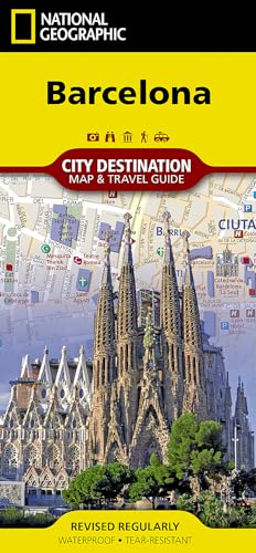
Map. Condición: New. . Waterproof . Tear-Resistant . Travel MapNational Geographic's City Destination map of Barcelona combines a city map and travel guide, making it the ultimate traveling companion to this popular destination on Spain's Mediterranean coast. The easy-to-read road map covers the city from the Les Corts and Sants…-Montjuic districts in the south and west to Sant Marti in the northeast. Included are hundreds of points of interest, such as metro and railway stations, places of worship, notable buildings, parks, police stations and hospitals, along with 3D depictions of many top attractions. The front side has a regional map and descriptions of the city, many popular points of interest and the transit system. A user-friendly index of streets, hotels, train stations and points of interest along with a diagram of Barcelona Airport and a comprehensive metro map will help you plan your route and arrive at your destination quickly. An inset map of Ciutat Vella district provides detail of this very popular area which is the oldest part of the city. With all of this specialized content, this map is the perfect complement to National Geographic's Barcelona Traveler Guide. Every Destination Map is printed on durable synthetic paper, making them waterproof, tear-resistant and tough - capable of withstanding the rigors of any kind of travel.
Librería: Grand Eagle Retail, Bensenville, IL, Estados Unidos de AmericaGrand Eagle Retail
Contactar con el vendedorVendedor de 5 estrellasCondición: Nuevo
EUR 13,29
Gastos de envío gratisSe envía dentro de Estados Unidos de AmericaCantidad disponible: 1 disponibles
Folded. Condición: new. Folded. In addition to the easy-to-read map on the front, the back includes: Regional map - Inset map of Ciutat Vella - Points of interest - Airport diagram - Metro map - Information on transportation, tipping, museums, and more - Multi-language legend National Geographic's City Destination map of Barcelo…na combines a city map and travel guide, making it the ultimate traveling companion to this popular destination on Spain's Mediterranean coast. Shipping may be from multiple locations in the US or from the UK, depending on stock availability.

Librería: Rarewaves USA, OSWEGO, IL, Estados Unidos de AmericaRarewaves USA
Contactar con el vendedorVendedor de 5 estrellasCondición: Nuevo
EUR 13,37
Gastos de envío gratisSe envía dentro de Estados Unidos de AmericaCantidad disponible: 1 disponibles
Map. Condición: New. 2018th ed. . Waterproof . Tear-Resistant . Topographic MapThe Colorado Trail North Topographic Map Guide has been designed as the perfect traveling companion when navigating the north section of The Colorado Trail. In a state known for its trails, The Colorado Trail is Colorado's premier long distance trail.… Conceived in 1973 and completed in 1987, the trail runs 486 miles between Denver and Durango, traversing some of the most spectacular scenery in the state. The Colorado Trail is often started at its north terminus in Waterton Canyon just outside of Denver. When traveling from north to south the trail follows the South Platte River and quickly climbs into the Lost Creek Wilderness. From here the trail crosses into Holy Cross Wilderness near Leadville. The trail then skirts the eastern slope of the Sawatch Range and passes beneath Mount Elbert, the highest mountain in Colorado. Next comes the Collegiate Peaks Wilderness with its multiple 14ers before finally joining with the Collegiate Loop near Monarch Pass. The Colorado Trail from Monarch to Durango is then picked up on the south Topographic Map Guide. Each page is centered on the trail and overlaps with adjacent pages so there is little chance of getting lost. Along the bottom of each page is a trail profile that shows the distance between passes, camping areas, and trail access points. The map and trail profile provide a step by step visual guide to hiking the trail, mile by rugged mile.Expertly researched and created in partnership with local land management agencies including The Colorado Trail Foundation, this map guide provides detailed topographic maps, interesting history, bike detour maps, and a resupply location chart shows distances, and services available at each resupply point.More convenient and easier to use than folded maps, but just as compact and lightweight, National Geographic's Topographic Map Guide booklets are printed on 'Backcountry Tough' waterproof, tear-resistant paper with stainless steel staples. A full UTM grid is printed on the map to aid with GPS navigation.

Librería: Rarewaves USA, OSWEGO, IL, Estados Unidos de AmericaRarewaves USA
Contactar con el vendedorVendedor de 5 estrellasCondición: Nuevo
EUR 13,37
Gastos de envío gratisSe envía dentro de Estados Unidos de AmericaCantidad disponible: Más de 20 disponibles
Map. Condición: New. 2025th ed. . Waterproof . Tear-Resistant . Topographic MapThe Wonderland Trail encircles Mount Rainier and was completed in 1915 by volunteers and designated a National Recreation Trail in 1981. The Wonderland Trail is known for its undulating terrain with a striking cumulative 22,000 feet of elevation gains… and losses. The Topographic Map Guide is arranged for clockwise travel around the Wonderland Trail starting at the Sunrise trailhead. Each map page has a detailed trail profile that shows the elevation changes you will encounter. Also, the Wonderland Trail is highlighted and centered on each page so you can easily track your progress. The Topographic Map Guide also includes information about Mt Rainier National Park as well as wilderness regulations and other important facts and tips to help make your journey on this amazing trail both successful and memorable.More convenient and easier to use than folded maps, but just as compact and lightweight, National Geographic's Topographic Map Guide booklets are printed on 'Backcountry Tough' waterproof, tear-resistant paper with stainless steel staples. A full UTM grid is printed on the map to aid with GPS navigation.

Librería: Rarewaves USA, OSWEGO, IL, Estados Unidos de AmericaRarewaves USA
Contactar con el vendedorVendedor de 5 estrellasCondición: Nuevo
EUR 13,37
Gastos de envío gratisSe envía dentro de Estados Unidos de AmericaCantidad disponible: 3 disponibles
Map. Condición: New. 2025th Revised ed. . Waterproof . Tear-Resistant . Topographic MapNational Geographic's Trails Illustrated map of Saguaro National Park and surrounding areas to the east and west of Tucson, is the perfect map for hiking, biking, exploring, climbing, riding, camping, and sightseeing in this beautiful desert w…ilderness. Created in partnership with local land management agencies, this expertly researched map highlights key areas of interest including Tucson Mountain Park, Sweetwater Preserve, Robles Pass, Saguaro Wilderness, Tanque Verde Ridge, and Hope Camp, Yetman, and Petroglyphs trails. This map features detailed topography with shaded relief, elevations, and clearly defined, color-coded boundaries for parks, public lands, and wilderness areas. With miles of mapped trails including a portion of the Arizona Trail, this map can guide you off the beaten path and back again in some of the most iconic scenery in the desert southwest. The clearly marked trails include mileage between intersections and handy hiking and trailhead summaries will help you choose the path that's right for you. Recreation features are clearly marked, including campgrounds, interpretive trails, rifle and archery ranges, scenic drives, picnic areas, and points of interest.Every Trails Illustrated map is printed on 'Backcountry Tough' waterproof, tear-resistant paper. A full UTM grid is printed on the map to aid with GPS navigation.Other features found on this map include: Coronado National Forest, Rincon Mountain Wilderness, Rincon Mountains, Saguaro National Park, Spud Rock, Tucson Mountains.

Librería: Rarewaves USA, OSWEGO, IL, Estados Unidos de AmericaRarewaves USA
Contactar con el vendedorVendedor de 5 estrellasCondición: Nuevo
EUR 13,37
Gastos de envío gratisSe envía dentro de Estados Unidos de AmericaCantidad disponible: 15 disponibles
Map. Condición: New. . Waterproof . Tear-Resistant . Travel MapExplore the rich cultural history and many recreation activities available in Canada's eastern territories with National Geographic's Canada East Adventure Map. Designed to meet the needs of adventure travelers with its detailed, accurate information, this map includ…es the location of cities and towns with a user-friendly index and a clearly marked road network complete with distances and designations for roads, motorways, and expressways. Secondary routes are also included for those seeking to explore the stark wilderness of Newfoundland, the fertile farms of Prince Edward Island, or Nova Scotia's hidden coves and beaches. This map contains hundreds of diverse and unique recreational, ecological, cultural, and historic destinations. Whether you seek the quaint harbor gem of Halifax, the majestic city life of Toronto, or the old world charm of Montreal and Quebec City, you'll find it a perfect companion to a guidebook.On the front side of the print map you'll find routes leading to the stunning Niagara Falls, Canada's largest city of Toronto, Algonquin Provincial Park (Canada's largest national park), and the northern regions of Ontario and the Labrador Peninsula. The far eastern provinces on the reverse side are playgrounds for active exploring and scenic beauty, including Quebec, New Brunswick, Prince Edward Island, Nova Scotia, Newfoundland, and the mighty St. Lawrence River.Every Adventure Map is printed on durable synthetic paper, making them waterproof, tear-resistant and tough - capable of withstanding the rigors of international travel.

Librería: Rarewaves USA, OSWEGO, IL, Estados Unidos de AmericaRarewaves USA
Contactar con el vendedorVendedor de 5 estrellasCondición: Nuevo
EUR 13,37
Gastos de envío gratisSe envía dentro de Estados Unidos de AmericaCantidad disponible: 3 disponibles
Map. Condición: New. . Waterproof . Tear-Resistant . Travel MapHome to Mount Kilimanjaro and some of Africa's most popular safaris, Tanzania has bountiful opportunities for adventure travelers. Covering the region with unparalleled detail is National Geographic's Tanzania, Rwanda and Burundi Adventure Map. This expertly research…ed map combines topographical information, points of interest and a road network, making it the most comprehensive map available and the perfect compliment to any guidebook. The map's front side covers the western half of Tanzania and the entirety of Rwanda and Burundi, along with Lakes Victoria and Tanganyika, and Serengeti and Ruaha National Parks. While the reverse side covers the country's eastern half to its Indian Ocean shoreline as well as the islands of Mafia, Zanzibar and Pemba, the cities of Dar es Salaam and Dodoma, Selous Game Reserve, Ngorongoro Conservation Area and Kilimanjaro National Park.Find cities, towns and protected areas quickly with a user-friendly index. A mapped transportation network of major and secondary roads, tracks, border crossings, harbors, railway lines and ferry routes will help you get to your destination. Pinpointed on the map are national parks and reserves, kopjes, swamps, mangroves, areas of forest cover, scenic viewpoints, archeological sites, caves, churches, mosques, rock engravings, museums, hotels, lodges, campsites, beaches, diving areas, coral reefs and shipwrecks along with many other cultural, historical, ecological and adventure points of interest, including many hidden gems.Every Adventure Map is printed on durable synthetic paper, making them waterproof, tear-resistant and tough - capable of withstanding the rigors of international travel.

Librería: Rarewaves USA, OSWEGO, IL, Estados Unidos de AmericaRarewaves USA
Contactar con el vendedorVendedor de 5 estrellasCondición: Nuevo
EUR 13,37
Gastos de envío gratisSe envía dentro de Estados Unidos de AmericaCantidad disponible: 13 disponibles
Map. Condición: New. . Waterproof . Tear-Resistant . Travel MapNational Geographic's New Zealand Adventure Map is an expertly researched, comprehensive map, designed to meet the needs of adventure travelers. With accurate and detailed information of the area, the map pinpoints hundreds of diverse and unique recreational, ecologi…cal, cultural, and historic destinations, including many lesser known ones. This information is not available in traditional road maps, such as areas for camping, surfing, skiing, playing golf and fishing, as well as airports and airfields, harbors, beaches, waterfalls and hot springs. In addition to this special content, the map also includes an index with the locations of cities and towns and a clearly marked road network complete with distances and designations for for roads and highways, as well as secondary routes for those seeking to travel off the beaten path. The map covers the North and South Islands, Stewart Island and inset maps show many of the numerous outlying islands, including Chatham, Campbell, Antipodes, Kermadec and Auckland Islands. The North Island map includes Auckland, Bay of Islands, The Coromandel and Waitomo Caves, while the South Island map includes such popular destinations as Mount Cook National Park and the Southern Alps, Milford Sound, Abel Tasman National Park. All this information makes the map a perfect companion to National Geographic's New Zealand Traveler's Guide or any other guidebook. Every Adventure Map is printed on durable synthetic paper, making them waterproof, tear-resistant and tough - capable of withstanding the rigors of international travel.

Librería: Rarewaves USA, OSWEGO, IL, Estados Unidos de AmericaRarewaves USA
Contactar con el vendedorVendedor de 5 estrellasCondición: Nuevo
EUR 13,37
Gastos de envío gratisSe envía dentro de Estados Unidos de AmericaCantidad disponible: 3 disponibles
Map. Condición: New. . Waterproof . Tear-Resistant . Travel MapNational Geographic's Pyrenees and Andorra Adventure Map provides global travelers with the perfect combination of detail and perspective in a highly functional travel tool. This map includes the locations of cities and towns with a user-friendly index, plus a clearl…y marked road network complete with distances and designations for roads and highways. Beaches and yachting harbors dot Spain and France's Mediterranean coastlines while the location of golf courses, camping sites, waterfalls, caves, and ski areas make it easy to enjoy the region's abundant outdoor activities. National parks, World Heritage sites, scenic viewpoints, antiquity sites, museums, and more are included, making it invaluable to travelers hoping to experience all the history, art, and culture the region has to offer.The front side of the print map shows the country of Andorra and the eastern half of the Pyrenees including the cities of Narbonne, Carcassone, Pamiers, St-Gaudens, St-Girons, Perpignan in France, and Balaguer, Manresa, and Figueres in Spain. The reverse side of the map stretches from the city of Biarritz on the Bay of Biscay eastward to include Pamplona and Huesca, Spain, and Pau, Tarbes, and the famed pilgrimage site of Lourdes, France. Popular for alpine skiing and mountaineering, the Pyrenees are a scenic mountain range which form a natural boundary between Spain and France. Stages of two of cycling's epic grand tours - the Tour de France and the Vuelta a España - traverse the Pyrenees and three long-distance footpaths run the length of the mountain range. Nestled in the center of the Pyrenees is the ruggedly beautiful Andorra, the sixth smallest country in Europe which is roughly two and a half times the size of Washington, D.C. Its picturesque mountain vistas and easy charm have made Andorra a favorite destination for savvy travelers. Every Adventure Map is printed on durable synthetic paper, making them waterproof, tear-resistant and tough - capable of withstanding the rigors of international travel.


