Worcester's Ancient Atlas
Usado
Soft cover
Librería:
Panoply Books, Lambertville, NJ, Estados Unidos de America
Calificación del vendedor: 5 de 5 estrellas
![]()
Vendedor de AbeBooks desde 22 de septiembre de 2008
Este ejemplar en concreto ya no está disponible. Estas algunas de las coincidencias similares para Worcester's Ancient Atlas.
Descripción
Descripción:
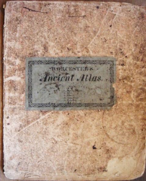
Book condition: fair, well worn copy with no title page but contains all five maps of the Roman Empire, Italy, Greece, Asia Minor and Palestine, extensive wear to lower right front but all maps in very good condition, slightly darkened with only a few spots, all maps published by Cummings & Hilliard, 10 X 12 inches. * Postage for oversized and international shipping will be calculated by size and weight. AbeBooks shipping quotes are ESTIMATES only. If actual shipping cost is less than the AbeBooks estimate, it is our practice to REFUND the difference to the buyer. * NOAMZ. N° de ref. del artículo 003143
Detalles bibliográficos
Título: Worcester's Ancient Atlas
Encuadernación: Soft cover
Condición: Fair
Los mejores resultados en AbeBooks

Worcester's Ancient Classical and Scripture Atlas
Publicado por
Phillips Sampson Boston
Antiguo o usado
Soft cover
Librería: Antique Emporium, Eau Claire, WI, Estados Unidos de America
Calificación del vendedor: 5 de 5 estrellas
![]()
Soft cover. Condición: Good. No Jacket. Illustrated Edition. 4to size softbound atlas with 10 maps. 1 2 page 3 full page 6 are on 2 sheets. Complete with some toning to paper and a ink stain to back cover. Circa 1850's. Nş de ref. del artículo: 1118
Comprar usado
EUR 56,66
Envío por EUR 4,65
Se envía dentro de Estados Unidos de America
Se envía dentro de Estados Unidos de America
Cantidad disponible: 1 disponibles
Worcester's Ancient Classical and Scripture Atlas
Publicado por
Phillips, Sampson & Co, Boston, 1850
Antiguo o usado
Paperback
Librería: Classic Books and Ephemera, IOBA, Lansdowne, PA, Estados Unidos de America
Calificación del vendedor: 5 de 5 estrellas
![]()
Paperback. Condición: Good +. "Improved edition." 1 atlas of 7 leaves containing 10 hand-colored maps; 32 cm. Yellow wrappers with wrapper title printed in black within a Greek key pattern border. No date of publication; the firm published as Phillips, Sampson & Co. from 1850 to 1859. Contains 1 double-leaf map: Roman Empire; 3 full-leaf maps: Ancient Italy, Ancient Greece, and Asia Minor; and 6 smaller maps on 2 leaves. The larger maps have the imprint: Lewis & Sampson, Boston. Publisher's advertisement on back wrapper within a Greek key pattern border. Stamped along fore-edge of front wrapper: "From Central S.D.A. Church, 21st & Fairmount Ave." Inscribed on first blank leaf: "To Bessie from Dagmar." In Good+ Condition: wrapper is soiled; 2-cm. closed tear from lower edge of front wrapper; lower corner of front wrapper and first 2 leaves creased with chipping; a few ink marks in the map of the Roman Empire; one ink spot on the map of Asia Minor; otherwise, clean and bright. Nş de ref. del artículo: 004464
Comprar usado
EUR 68,65
Envío por EUR 3,98
Se envía dentro de Estados Unidos de America
Se envía dentro de Estados Unidos de America
Cantidad disponible: 1 disponibles
Worcester's Ancient Classical and Scripture Atlas - A juvenile biblical and historical reference atlas from the mid-19th century.
Publicado por
c. 1846, 1846
Antiguo o usado
Librería: Curtis Wright Maps, Berwyn, IL, Estados Unidos de America
Calificación del vendedor: 4 de 5 estrellas
![]()
Condición: Very Good. "This short, but informational, atlas presents a quick geographic overview of areas of particular importance to Classical and Biblical education. Hand-colored engraved maps of the Roman Empire, ancient Italy, ancient Greece, and Asia Minor are accompanied by a double-page composite sheet outlining various regions from the Old and New Testaments. Examples include the Journey of the Israelites through Canaan, Ancient Jerusalem with the Land of Moriah, and Map Illustrative of the Travels of St. Paul. Compiled by Joseph Worcester and published in Boston, probably during the mid-1840s, by Lewis & Sampson. I've found examples of the 'Improved Edition' published variously under Lewis & Sampson, Phillips, Sampson & Co., and Lewis & Phillips. Worcester, the chief competitor to Noah Webster, authored a number of dictionaries, textbooks, grammar primers, and other instructional materials between 1817 and his death in 1865. Source." Sheet Width (in) 9.4 Sheet Height (in) 11.8 Condition Description Ten maps (1 double-page, 4 single page, 5 on one double-sheet) with original hand color, bound with string in original yellow paper wraps. Covers are worn and soiled and the spine is mostly separated. Maps are in good condition, with minor to moderate offsetting on paper that has toned from age. Old owner's inscription on the front page. About good condition overall. Nş de ref. del artículo: 5182
Comprar usado
EUR 74,10
Envío por EUR 10,16
Se envía dentro de Estados Unidos de America
Se envía dentro de Estados Unidos de America
Cantidad disponible: 1 disponibles

Worcester's Ancient Classical and Scripture Atlas: Containing the Following Maps:.Improved Edition.
Publicado por
David H. Williams, Boston & Paris, 1839
Antiguo o usado
Soft Cover
Librería: Certain Books, ABAA, Bolivia, NC, Estados Unidos de America
Calificación del vendedor: 5 de 5 estrellas
![]()
Soft Cover. Condición: Good. Improved Edition. 10 maps, some with several to the sheet; with handcolored maps including: Roman Empire; Italy; Greece; Asia Minor; The World, exhibiting the Countries mentioned in the Old Testament; Journeyings of the Israelites from Egypt to Canaan; Judah and Israel, with the Division of the Twelve Tribes; Palestine, or the Holy Land; Ancient Jerusalem, with its Environs; Map Illustrative of the Travels of St. Paul; approx. 9 1/2" x 11 1/2" size; yellow printed paper coverd paper stock binding; covers very worn, chipped & stained; maps are on a softer paper; detached from the binding and occasionally foxed, some edgewear; overall, maps in good condition and an interesting early American Christian religion & education atlas. Nş de ref. del artículo: 17778
Comprar usado
EUR 108,97
Envío por EUR 9,31
Se envía dentro de Estados Unidos de America
Se envía dentro de Estados Unidos de America
Cantidad disponible: 1 disponibles