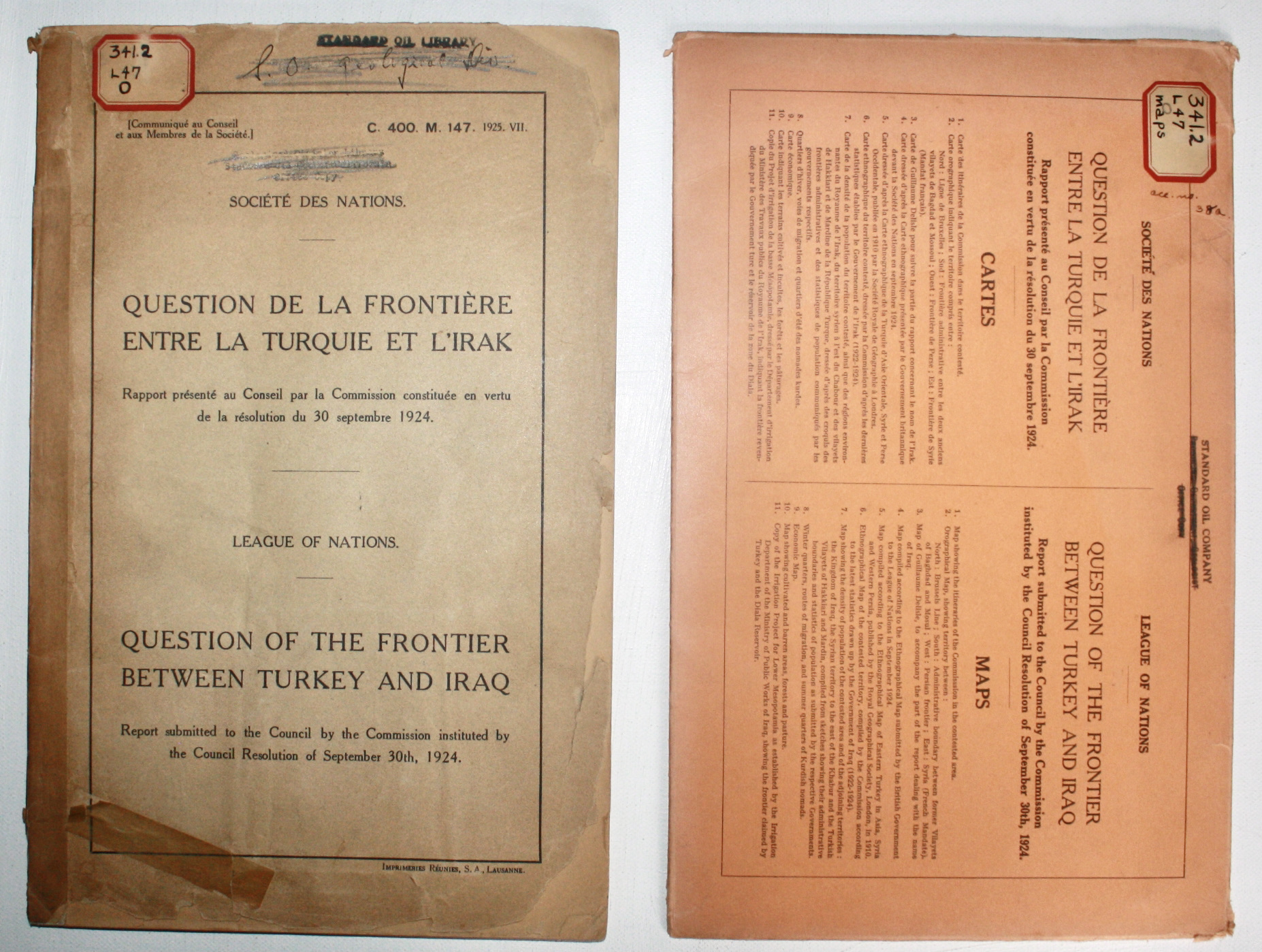
Question of the Frontier between Turkey and Iraq - Report submitted to the Council by the Commission institution by the Council Resolution of September 30th, 1924 / Question de la Frontiere entre la Turquie et l'Irak - Rapport presente au Conseil par la Commission constituee en vertu de la resolution du 30 septembre 1924

Editorial: League of Nations / Societe des Nations, Geneva / Geneve, 1925

  • Tapa blanda
  • Usado
Ver todos los detalles
Imagen del artículo 1 de 5.

Librería: Dendera, London, Reino UnidoDendera

Vendedor de 5 estrellas

Vendedor de AbeBooks desde 28 de marzo de 2013

Ver los artículos de este vendedor
Tapa blanda

Condición: Usado - Aceptable

EUR 2227,06

Envío por EUR 50,26 
Se envía de Reino Unido a Estados Unidos de America

Cantidad disponible: 1 disponibles

Añadir al carrito

Descripción del artículo del vendedor

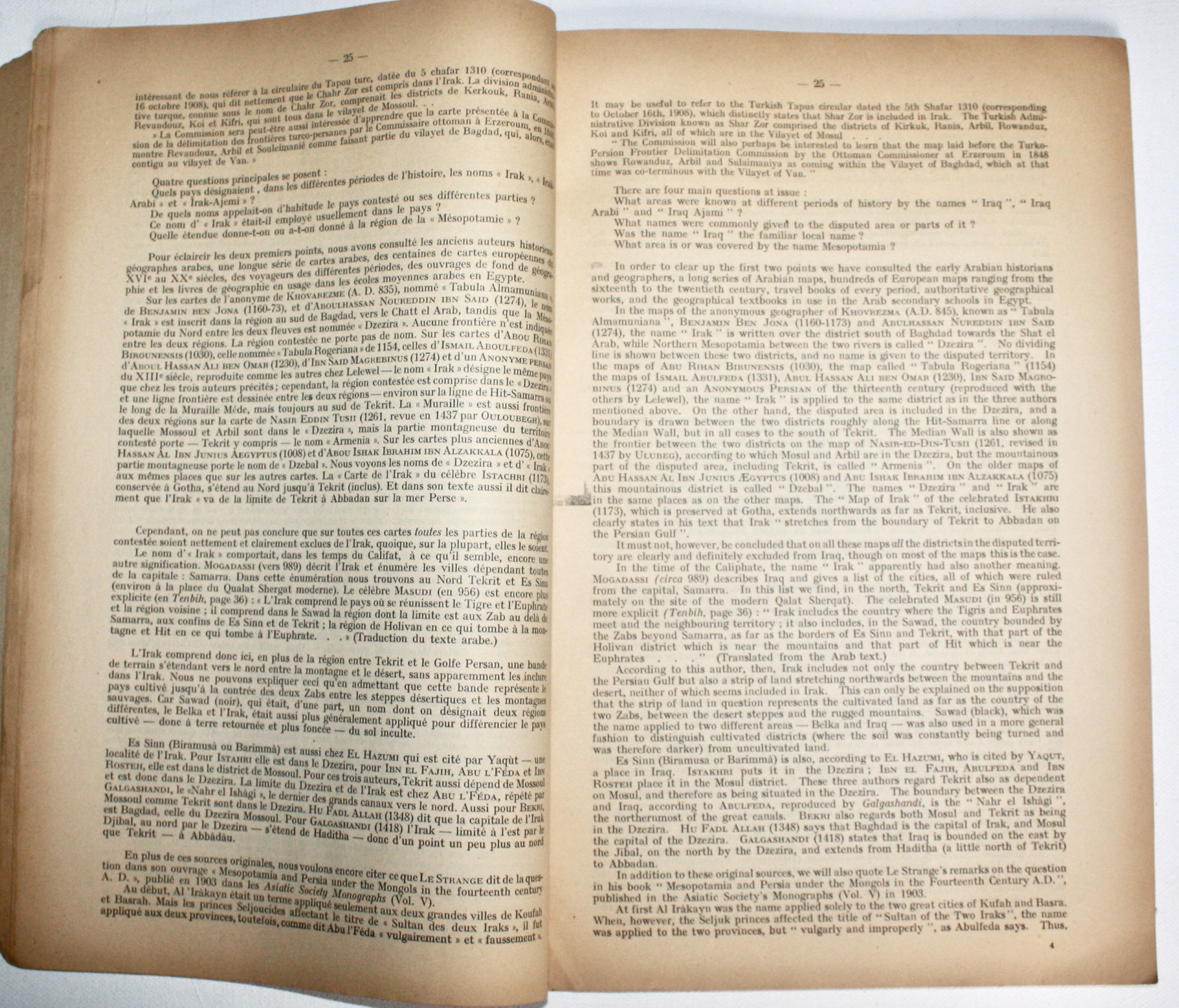
A complete set comprising the text and map volumes. The text is in original printed wraps 21x33cm, printed at the Imperimeries Reunies, Lausanne, 90pp English + 90pp French presented in parallel. The loose folding maps, all 11 present as called for, are housed in a stiff orange card envelope 21x33cm printed with detailed contents list of contents with 2pp Errata also laid in. This copy belonged to Standard Oil / the Standard Oil Company of California (Socal), with many of its ink stamps, shelf marks and redactions identifying it as a Geological Division Library Office Copy, or a Producing Department, Geologist, Office Copy. The wraps are fair only, brittle, chipped and torn at the edges with old tape repair, and reinforcements to hinges. The interiors are good or better, tanned with some creasing. The maps are neatly folded. Rare in commerce. This report was prepared under the terms of the Treaty of Lausanne (1923), which recognised Turkey's independence and offered a generous territorial settlement conditional upon Turkey renouncing its claims to Arab lands. Pending final agreement on it, the former northern border the Mosul Vilayet served provisionally as the Iraq-Turkey frontier. The British and Turks were unable to reach agreement during their talks in 1924, so referred it to the League of Nations. The League's Council formed a Commission in Geneva on 13 Nov 1924 to gather information to inform its decision. Its President was Swedish Minister Plenipotentiary M. af Wirsen, and it included Hungary's former Prime Minister Count Teleki, and Colonel Paulis (Belgium). After reviewing available documents, the Commission decided to visit the contested area to gather information locally. It first met with senior British and Turkish officials including Mustapha Kemal, before travelling across the Syrian Desert to Baghdad to obtain the views of King Faisal. It then travelled around the contested region by car, air, horse, and on foot, finishing in Mosul in March 1925. It reconvened in Geneva in April to draft this report, which details the Commission's work, and discussions with and the positions of the British, Turks and Iraqis. The main part presents the geographic, ethnic, historic, economic, strategic and political arguments. In response, the League proposed the "Brussels line" (essentially the old Mosul Vilayet line), which the British and Turks accepted with minor modifications in the Treaty of Ankara (5 June 1926). The MAPS, several of which credited to the Royal Hungarian Geographical Institute, show (1) the Commission's itineraries 1:1.8M 23x32cm; (2) Geographical Map showing territory between Brussels Line, Administration boundary between the former Vilayets of Baghdad and Mosul, the Persian frontier, and Syria (French Mandate) 1:1M 68x61cm; (3) Guillaume Delisle's map to support the part of the report dealing with the name of Iraq 38x56cm; (4) Map compiled from the Ethnological Map submitted by the British Govt Sept 1924 1:1M 50x39cm; (5) Map compiled from the RGS Map of Eastern Turkey in Asia, Syria and Western Persia 1910 1:1M 50x39cm; (6) Ethnographical Map of the contested territory compiled by the Commission 1:1M 50x39cm; (7) Map showing Density of Population of the Contested Area and of the Adjoining Territories 1:3M 32x45cm; (8) Winter Quarters, Routes of Migration and Summer Quarters of Kurdish Nomads with colour printed acetate onlays attached 1:2M 31x33cm; (9) Economic Map 1:2M 26x31cm; (10) Map showing Cultivated and Barren Areas, Forests and Pasture 1:2M 28x31cm; (11) Copy of the Irrigation Project for Lower Mesopotamia showing the Frontier claimed by Turkey and Dyalah Reservoir.

N° de ref. del artículo 5091

Detalles bibliográficos

Título
Question of the Frontier between Turkey and Iraq - Report submitted to the Council by the Commission institution by the Council Resolution of September 30th, 1924 / Question de la Frontiere entre la Turquie et l'Irak - Rapport presente au Conseil par la Commission constituee en vertu de la resolution du 30 septembre 1924
Autor
League of Nations Special Commission: Count Teleki; M. af Wirsen; Colonel Paulis
Editorial
League of Nations / Societe des Nations, Geneva / Geneve
Año de publicación
1925
Estado
Good
Encuadernación
Soft cover

Dendera

London, Reino Unido

Vendedor de 5 estrellas

Vendedor de AbeBooks desde 28 de marzo de 2013

Tarifas de envío de Reino Unido a Estados Unidos de America

ArtículoDe 7 a 10 días hábilesDe 15 a 30 días hábiles
Primer artículoEUR 50,26EUR 50,26
Los plazos de entrega los establecen los vendedores y varían según el transportista y la ubicación. Los pedidos que pasan por la aduana pueden sufrir retrasos y los compradores son responsables de los aranceles o tarifas asociadas. Los vendedores pueden ponerse en contacto con usted en relación con cargos adicionales para cubrir cualquier aumento en los costes de envío de los artículos.

Métodos de pago

VisaMastercardAmerican ExpressCarte BleueApple PayGoogle Pay

Descripción de la tienda

My interests include travel, exploration, and art. Books, reports, maps, photographs, posters, correspondence, ephemera, souvenirs, and related items.

Especialidad

Primarily travel, exploration and art related.