


OFFICIAL HISTORICAL ATLAS MAP OF TULARE COUNTY.COMPILED, DRAWN AND PUBLISHED FROM PERSONAL EXAMINATIONS AND SURVEYS.
Thompson, Thomas H.
Editorial: [Tulare, Ca.?], 1892
Usado
Librería:
William Reese Company, New York, NY, Estados Unidos de America
Calificación del vendedor: 5 de 5 estrellas
![]()
Vendedor de AbeBooks desde 13 de julio de 2006
Este ejemplar en concreto ya no está disponible. Estas algunas de las coincidencias similares para OFFICIAL HISTORICAL ATLAS MAP OF TULARE COUNTY.COMPILED, DRAWN AND PUBLISHED FROM PERSONAL EXAMINATIONS AND SURVEYS. de Thompson, Thomas H..
Descripción
Descripción:
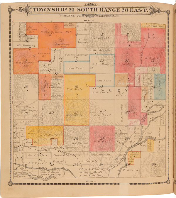
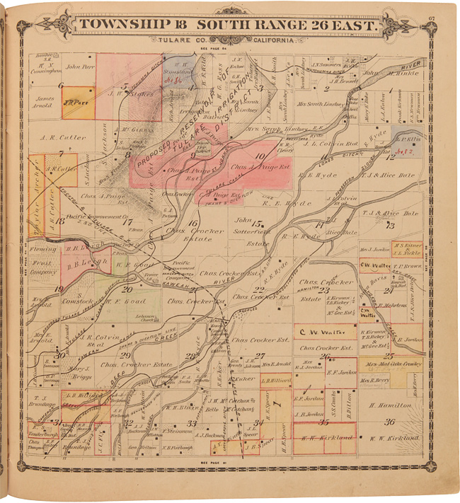
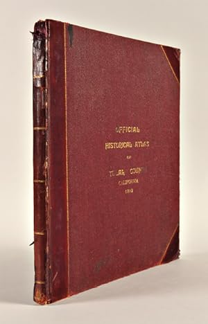
4pp. Double-sheet key map plus 108 township maps (many partially colored). Folio. Original three-quarter calf and cloth, front board gilt. Spine extremities rather rough and worn. One free endpaper torn, the other wrinkled. Titlepage a bit dust soiled, else generally clean internally. Overall very good. A detailed subdivision and township atlas of Tulare County, in the southern Central Valley of California. Large lots are labeled with names of the owners, and in this copy many changes of ownership are noted in pencil. Although the preface and contents mention illustrations and portraits, there are none in this copy. A fine, detailed township atlas for a California county. ROCQ 15171. NORRIS CATALOGUE 3965. N° de ref. del artículo WRCAM25656
Detalles bibliográficos
Título: OFFICIAL HISTORICAL ATLAS MAP OF TULARE ...
Editorial: [Tulare, Ca.?]
Ańo de publicación: 1892
Los mejores resultados en AbeBooks

OFFICIAL HISTORICAL ATLAS MAP OF TULARE COUNTY.COMPILED, DRAWN AND PUBLISHED FROM PERSONAL EXAMINATIONS AND SURVEYS.
Publicado por
[Tulare, Ca.?] 1892., 1892
Antiguo o usado
Librería: William Reese Company, New York, NY, Estados Unidos de America
Calificación del vendedor: 5 de 5 estrellas
![]()
A detailed subdivision and township atlas of Tulare County, in the southern Central Valley of California. Large lots are labeled with names of the owners, and in this copy many changes of ownership are noted in pencil. Although the preface and contents mention illustrations and portraits, there are none in this copy. A fine, detailed township atlas for a California county. ROCQ 15171. NORRIS CATALOGUE 3965. 4pp. Double-sheet key map plus 108 township maps (many partially colored). Folio. Original three-quarter calf and cloth, front board gilt. Spine extremities rather rough and worn. One free endpaper torn, the other wrinkled. Titlepage a bit dust soiled, else generally clean internally. Overall very good. Nş de ref. del artículo: 25656
Comprar usado
EUR 1.325,51
Gastos de envío:
EUR 12,01
A Estados Unidos de America
Cantidad disponible: 1 disponibles