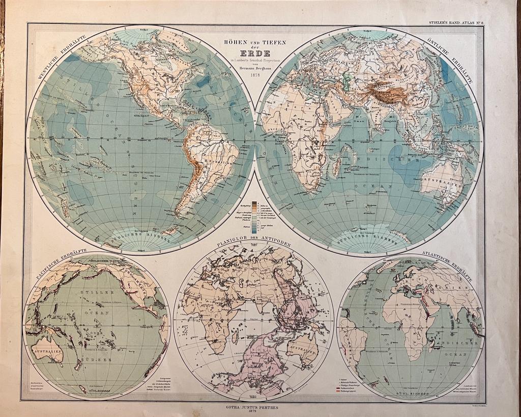
Cartography World 1879 | Coloured world map: Höhen und tiefen der Erde in Lambert's Zenithal Projection von Hermann Berghaus 1879, 1 p.
Berghaus, Hermann.
Condición: Usado
Vendido por Antiquariaat Arine van der Steur / ILAB, Den Haag, Holanda
Miembro de asociación:
Vendedor de AbeBooks desde 15 de octubre de 2014
Calificación del vendedor: 5 de 5 estrellas
![]()
Usado
Precio:
EUR 72,60
Convertir moneda
EUR 17,00
gastos de envío desde Holanda a Espańa
Destinos, gastos y plazos de envío
Cantidad disponible: 1 disponibles
Ańadir al carrito