BATTLE OF YOUNG'S BRANCH; OR, MANASSAS PLAIN, FOUGHT JULY 21, 1861. WITH MAPS OF THE BATTLEFIELD MADE BY ACTUAL SURVEY.ALSO, AN ACCOUNT OF THE BATTLE.WITH GENERAL BEAUREGARD'S REPORT OF SAID BATTLE
Warder, T.B., and James M. Catlett
Librería:
William Reese Company - Americana, New Haven, CT, Estados Unidos de America
Calificación del vendedor: 3 de 5 estrellas
![]()
Vendedor de AbeBooks desde 13 de julio de 2006
Descripción
Descripción:
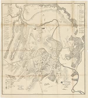
[3]-156,[1, errata],[2]pp., plus two folding maps laid in. 16mo. Dbd. A touch of light tanning. First map with several separations and a few old repairs at folds, second map with evidence of previous mounting, two small closed tears at top margin. About very good. In a folding cloth case. A paramount Civil War item, with ".[m]uch local color and numerous incidents. The action of each Confederate command is followed in detail" (Douglas Southall Freeman). Howes notes some copies were issued with only one map and some copies were issued with two, as in the present case. "The maps are the best which appear in any Confederate book" - Harwell. This copy includes the maps titled, "Battle Field of Young's Branch, or Manassas Plains" and "Map of the country occupied by the Federal and Confederate Armies." The first is a very detailed illustration of the battlefield, drawn by James L. Bowen, and lithographed by Hoyer and Ludwig of Richmond for inclusion in the official report of the battle. The second, also by Hoyer and Ludwig, depicts troop positions and movements, roads, railroads, houses, and other significant geographical features. HOWES W101, "aa." CONFEDERATE HUNDRED 96. CORNERSTONES OF CONFEDERATE COLLECTING 5. CRANDALL 2662. PARRISH & WILLINGHAM 5100. N° de ref. del artículo WRCAM49927
Detalles bibliográficos
Título: BATTLE OF YOUNG'S BRANCH; OR, MANASSAS PLAIN...
Editorial: Enquirer Book and Job Press., Richmond
Año de publicación: 1862
Los mejores resultados en AbeBooks
BATTLE OF YOUNG'S BRANCH; OR, MANASSAS PLAIN, FOUGHT JULY 21, 1861. WITH MAPS OF THE BATTLEFIELD MADE BY ACTUAL SURVEY.ALSO, AN ACCOUNT OF THE BATTLE.WITH GENERAL BEAUREGARD'S REPORT OF SAID BATTLE
Librería: Jim Crotts Rare Books, LLC, Clemmons, NC, Estados Unidos de America
156 pp. Softcover in original wraps (though lacking the rear wrap). First edition, interior tight, lacks the 2 maps as is often the case, minor soiling, wraps soiled and scuffed at margins, minor tears and creases, a few brown water spots on front wrap. . A paramount Civil War item, with ".[m]uch local color and numerous incidents. The action of each Confederate command is followed in detail" (Douglas Southall Freeman). SCARCE. HOWES W101, "aa." CONFEDERATE HUNDRED 96. CORNERSTONES OF CONFEDERATE COLLECTING 5. CRANDALL 2662. PARRISH & WILLINGHAM 5100. Nº de ref. del artículo: 100339
Cantidad disponible: 1 disponibles
BATTLE OF YOUNG'S BRANCH; OR, MANASSAS PLAIN, FOUGHT JULY 21, 1861. WITH MAPS OF THE BATTLEFIELD MADE BY ACTUAL SURVEY.ALSO, AN ACCOUNT OF THE BATTLE.WITH GENERAL BEAUREGARD'S REPORT OF SAID BATTLE.
Librería: William Reese Company - Americana, New Haven, CT, Estados Unidos de America
[3]-156,[1, errata],[2]pp., plus two folding maps laid in. 16mo. Dbd. A touch of light tanning. First map with several separations and a few old repairs at folds, second map with evidence of previous mounting, two small closed tears at top margin. About very good. In a folding cloth case. A paramount Civil War item, with ".[m]uch local color and numerous incidents. The action of each Confederate command is followed in detail" (Douglas Southall Freeman). Howes notes some copies were issued with only one map and some copies were issued with two, as in the present case. "The maps are the best which appear in any Confederate book" - Harwell. This copy includes the maps titled, "Battle Field of Young's Branch, or Manassas Plains" and "Map of the country occupied by the Federal and Confederate Armies." The first is a very detailed illustration of the battlefield, drawn by James L. Bowen, and lithographed by Hoyer and Ludwig of Richmond for inclusion in the official report of the battle. The second, also by Hoyer and Ludwig, depicts troop positions and movements, roads, railroads, houses, and other significant geographical features. HOWES W101, "aa." CONFEDERATE HUNDRED 96. CORNERSTONES OF CONFEDERATE COLLECTING 5. CRANDALL 2662. PARRISH & WILLINGHAM 5100. Nº de ref. del artículo: 49927
Cantidad disponible: 1 disponibles


