Artículos relacionados a Pictorial Maps (Art Reference)
Sinopsis
Concerning the history and making of pictorial maps, a graphic form found increasingly in today's newspapers, magazines and television reporting, this book includes new Robinson projections that have solved many distortion problems, the computer's role in mapmaking and pictorial symbols. It begins with a history of pictorial maps through the ages, the use of pictorial maps in America, in the world, in war and news coverage and in weather reporting. The second half of the book concetrates on the mapmaking process itself in which Holmes shows how to achieve the various kinds of map projections in the age-old struggle to find a satisfactory way to show the entire surface of a 3-dimensional sphere on a a flat piece of paper. Included are the new Robinson projections that have solved many distortional problems, the computer's role in mapmaking, how to represent mountainous terrain convincingly, pictorial symbols used in maps and how to draw maps for friends.
"Sinopsis" puede pertenecer a otra edición de este libro.
Reseńa del editor
Concerning the history and making of pictorial maps, a graphic form found increasingly in today's newspapers, magazines and television reporting, this book includes new Robinson projections that have solved many distortion problems, the computer's role in mapmaking and pictorial symbols. It begins with a history of pictorial maps through the ages, the use of pictorial maps in America, in the world, in war and news coverage and in weather reporting. The second half of the book concetrates on the mapmaking process itself in which Holmes shows how to achieve the various kinds of map projections in the age-old struggle to find a satisfactory way to show the entire surface of a 3-dimensional sphere on a a flat piece of paper. Included are the new Robinson projections that have solved many distortional problems, the computer's role in mapmaking, how to represent mountainous terrain convincingly, pictorial symbols used in maps and how to draw maps for friends.
"Sobre este título" puede pertenecer a otra edición de este libro.

Resultados de la búsqueda para Pictorial Maps (Art Reference)

Imagen de archivo
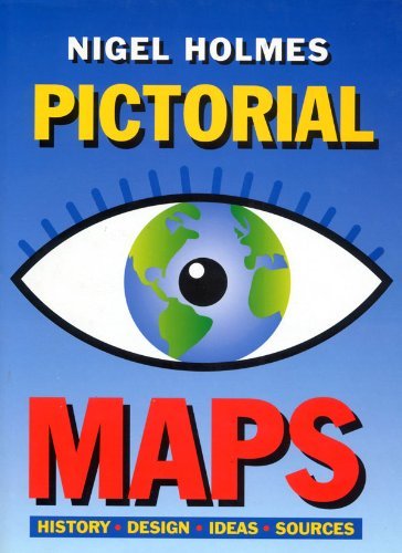
Pictorial Maps (Art Reference)
Publicado por
The Herbert Press, 1992
ISBN 10: 1871569435
ISBN 13: 9781871569438
Antiguo o usado
Tapa dura
Librería: WorldofBooks, Goring-By-Sea, WS, Reino Unido
Calificación del vendedor: 5 de 5 estrellas
![]()
Hardback. Condición: Fair. Color And B/w Illustrations Ilustrador. A readable copy of the book which may include some defects such as highlighting and notes. Cover and pages may be creased and show discolouration. Nş de ref. del artículo: GOR006841754
Cantidad disponible: 2 disponibles
Imagen del vendedor
Pictorial Maps
Publicado por
The Herbert Press, 1992
ISBN 10: 1871569435
ISBN 13: 9781871569438
Antiguo o usado
Tapa dura
Librería: Oopalba Books, Sale, MANCH, Reino Unido
Calificación del vendedor: 5 de 5 estrellas
![]()
Hardcover. Condición: Very Good. Estado de la sobrecubierta: Very Good. Color And B/w Illustrations Ilustrador. VG/VG. This book is for graphic artists especially infographics artists and for anyone with an interest in maps and mapmaking. Full colour illustrations . History, Design, Ideas and Sources. UK Delivery only due to weight. Book. Nş de ref. del artículo: ab93yaz
Cantidad disponible: 1 disponibles
Imagen de archivo
Pictorial Maps (Art Reference)
Publicado por
Bloomsbury Publishing PLC, United Kingdom, London, 1992
ISBN 10: 1871569435
ISBN 13: 9781871569438
Antiguo o usado
Paperback
Librería: WorldofBooks, Goring-By-Sea, WS, Reino Unido
Calificación del vendedor: 5 de 5 estrellas
![]()
Paperback. Condición: Very Good. Color And B/w Illustrations Ilustrador. Concerning the history and making of pictorial maps, a graphic form found increasingly in today's newspapers, magazines and television reporting, this book includes new Robinson projections that have solved many distortion problems, the computer's role in mapmaking and pictorial symbols. It begins with a history of pictorial maps through the ages, the use of pictorial maps in America, in the world, in war and news coverage and in weather reporting. The second half of the book concetrates on the mapmaking process itself in which Holmes shows how to achieve the various kinds of map projections in the age-old struggle to find a satisfactory way to show the entire surface of a 3-dimensional sphere on a a flat piece of paper. Included are the new Robinson projections that have solved many distortional problems, the computer's role in mapmaking, how to represent mountainous terrain convincingly, pictorial symbols used in maps and how to draw maps for friends. The book has been read, but is in excellent condition. Pages are intact and not marred by notes or highlighting. The spine remains undamaged. Nş de ref. del artículo: GOR003737121
Cantidad disponible: 2 disponibles
Imagen de archivo
Pictorial Maps
Publicado por
The Herbert Press, 1992
ISBN 10: 1871569435
ISBN 13: 9781871569438
Antiguo o usado
Tapa dura
Original o primera edición
Librería: Vashon Island Books, Vashon, WA, Estados Unidos de America
Calificación del vendedor: 5 de 5 estrellas
![]()
Hardcover. Condición: Very Good. Estado de la sobrecubierta: Very Good. Color and b/w Illustrations Ilustrador. First Edition. In color pictorial jacket, 4to, 191pp. illustrated profusely. Size: 4to - over 9ľ" - 12" tall. Book. Nş de ref. del artículo: 0830618
Cantidad disponible: 1 disponibles
Imagen del vendedor
Pictorial Maps
Publicado por
Herbert Press Ltd, London, 1992
ISBN 10: 1871569435
ISBN 13: 9781871569438
Antiguo o usado
Tapa dura
Original o primera edición
Librería: Linda Corrigan, Knutsford, Reino Unido
Calificación del vendedor: 4 de 5 estrellas
![]()
Board. Condición: Near Fine. Estado de la sobrecubierta: Near Fine. Holmes, Nigel Ilustrador. 1st Edition. A near fine copy in a near fine dust jacket of this lavishly illustrated study of pictorial maps. Dust Jacket: pictorial, laminated, with colour map of Europe and black lettering to all faces, all on a white ground; in excellent condition; very clean and bright; no fading; no visible sign of shelf wear not price clipped (now protected). Cover: blue laminated boards with silver lettering to spine; in excellent condition; very clean and bright, no visible signs of shelf wear. Internally: very clean and tightly bound; no inscriptions or book plates; looks unread. Illustrated throughout in colour and black and white. 192 pp. Nş de ref. del artículo: 002459
Cantidad disponible: 1 disponibles