Artículos relacionados a Computing in Geographic Information Systems
Sinopsis
Capable of acquiring large volumes of data through sensors deployed in air, land, and sea, and making this information readily available in a continuous time frame, the science of geographical information system (GIS) is rapidly evolving. This popular information system is emerging as a platform for scientific visualization, simulation, and computation of spatio-temporal data. New computing techniques are being researched and implemented to match the increasing capability of modern-day computing platforms and easy availability of spatio-temporal data. This has led to the need for the design, analysis, development, and optimization of new algorithms for extracting spatio-temporal patterns from a large volume of spatial data.
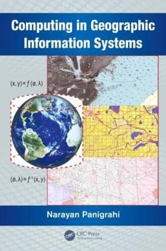
Computing in Geographic Information Systems
considers the computational aspects, and helps students understand the mathematical principles of GIS. It provides a deeper understanding of the algorithms and mathematical methods inherent in the process of designing and developing GIS functions. It examines the associated scientific computations along with the applications of computational geometry, differential geometry, and affine geometry in processing spatial data. It also covers the mathematical aspects of geodesy, cartography, map projection, spatial interpolation, spatial statistics, and coordinate transformation. The book discusses the principles of bathymetry and generation of electronic navigation charts.The book consists of 12 chapters. Chapters one through four delve into the modeling and preprocessing of spatial data and prepares the spatial data as input to the GIS system. Chapters five through eight describe the various techniques of computing the spatial data using different geometric and statically techniques. Chapters nine through eleven define the technique for image registration computation and measurements of spatial objects and phenomenon.
- Examines cartographic modeling and map
"Sinopsis" puede pertenecer a otra edición de este libro.
Acerca del autor
Dr. Narayan Panigrahi is a practicing geo-spatial scientist in the Centre for Artificial Intelligence and Robotics (CAIR), Bangalore, India. He obtained his master's degree from the J.K. Institute of Applied Physics and Technology, University of Allahabad, his M Tech from the Indian Institute of Technology (IIT), Kharagpur, and his PhD from IIT, Bombay, India. His current research interests include geographical information science, design and optimization of algorithms for computation of spatial data in vector and raster form obtained through different sensors, and application of GIS for resource mapping and operation planning.
"Sobre este título" puede pertenecer a otra edición de este libro.

EUR 141,51
EUR 28,62 gastos de envío desde Reino Unido a Estados Unidos de America
Destinos, gastos y plazos de envíoComprar nuevo
Ver este artículo
EUR 92,92
EUR 3,43 gastos de envío en Estados Unidos de America
Destinos, gastos y plazos de envío
Resultados de la búsqueda para Computing in Geographic Information Systems
Imagen de archivo
Computing in Geographic Information Systems
Publicado por
Taylor & Francis Group, 2014
ISBN 10: 1482223147
ISBN 13: 9781482223149
Nuevo
Tapa dura
Librería: Books Puddle, New York, NY, Estados Unidos de America
Calificación del vendedor: 4 de 5 estrellas
![]()
Condición: New. pp. 304. Nş de ref. del artículo: 2697290696
Cantidad disponible: 1 disponibles
Imagen de archivo
Computing in Geographic Information Systems
Publicado por
Taylor & Francis Group, 2014
ISBN 10: 1482223147
ISBN 13: 9781482223149
Nuevo
Tapa dura
Librería: Majestic Books, Hounslow, Reino Unido
Calificación del vendedor: 5 de 5 estrellas
![]()
Condición: New. pp. 304 10 color figures in a 6 page insert follows page 117 This item is printed on demand. Nş de ref. del artículo: 96155159
Gastos de envío:
EUR 7,44
De Reino Unido a Estados Unidos de America
Destinos, gastos y plazos de envío
Cantidad disponible: 1 disponibles
Imagen de archivo
Computing in Geographic Information Systems
Publicado por
Taylor & Francis Group, 2014
ISBN 10: 1482223147
ISBN 13: 9781482223149
Nuevo
Tapa dura
Librería: Biblios, Frankfurt am main, HESSE, Alemania
Calificación del vendedor: 5 de 5 estrellas
![]()
Condición: New. pp. 304. Nş de ref. del artículo: 1897290690
Gastos de envío:
EUR 9,95
De Alemania a Estados Unidos de America
Destinos, gastos y plazos de envío
Cantidad disponible: 1 disponibles
Imagen de archivo
Computing in Geographic Information Systems
Librería: Chiron Media, Wallingford, Reino Unido
Calificación del vendedor: 4 de 5 estrellas
![]()
Hardcover. Condición: New. Nş de ref. del artículo: 6666-TNFPD-9781482223149
Gastos de envío:
EUR 17,73
De Reino Unido a Estados Unidos de America
Destinos, gastos y plazos de envío
Cantidad disponible: 5 disponibles
Imagen de archivo
Computing in Geographic Information Systems
Librería: Mispah books, Redhill, SURRE, Reino Unido
Calificación del vendedor: 4 de 5 estrellas
![]()
Hardcover. Condición: Like New. Like New. Ships from Multiple Locations. book. Nş de ref. del artículo: ERICA75814822231475
Gastos de envío:
EUR 28,62
De Reino Unido a Estados Unidos de America
Destinos, gastos y plazos de envío
Cantidad disponible: 1 disponibles
Imagen del vendedor
Computing in Geographic Information Systems
Librería: moluna, Greven, Alemania
Calificación del vendedor: 4 de 5 estrellas
![]()
Condición: New. Dr. Narayan Panigrahi is a practicing geo-spatial scientist in the Centre for Artificial Intelligence and Robotics (CAIR), Bangalore, India. He obtained his master s degree from the J.K. Institute of Applied Physics and Technology, Unive. Nş de ref. del artículo: 596053916
Gastos de envío:
EUR 48,99
De Alemania a Estados Unidos de America
Destinos, gastos y plazos de envío
Cantidad disponible: Más de 20 disponibles
Imagen del vendedor
Computing in Geographic Information Systems
Librería: AHA-BUCH GmbH, Einbeck, Alemania
Calificación del vendedor: 5 de 5 estrellas
![]()
Buch. Condición: Neu. Neuware - This book explores key concepts in GIS such as geodesy; the coordinate or referencing system for referring objects on Earth's surface. It explains how the spatial data and 3D surface of Earth are projected on to a flat surface to make a map through different map projection methods. It examines how three different types of geometry help in the analysis of spatial data. It also discusses the mathematical formulations of how to compute physical parameters of geometric and spatial quantities using different spatial data. Nş de ref. del artículo: 9781482223149
Gastos de envío:
EUR 62,38
De Alemania a Estados Unidos de America
Destinos, gastos y plazos de envío
Cantidad disponible: 2 disponibles