
Artículos relacionados a Atlantic Pilot Atlas: Including the Caribbean &...
Sinopsis
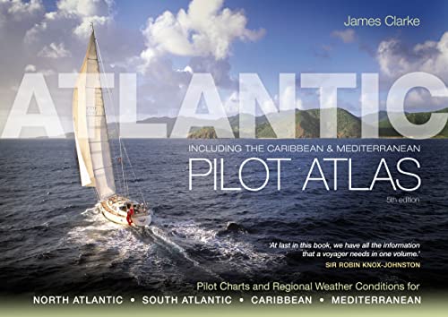
The Atlantic Pilot Atlas provides a complete guide to the weather of the North and South Atlantic, the Mediterranean and the Caribbean.
Now revised for the fifth edition, it includes weather forecasting, global warming and hurricane avoidance information as well as wind and current charts, wave heights, tropical cyclone tracks and shipping routes. Any skipper contemplating an ocean crossing needs to know what conditions he is likely to meet en route, in order to plan a safe and comfortable passage, and this book provides exactly what is needed.
40 specially drawn colour charts show detailed information on the winds, currents, gale frequencies, rough sea conditions, hurricane tracks and recommended sailing routes for each month of the year for all these oceans.
'This is what every yachtsman contemplating an extended cruise needs in one book... No serious offshore bookshelf should be without one.' Yachting Monthly
'Without doubt the most useful guide for anyone planning a Transatlantic voyage.' Ships & Ports
"Sinopsis" puede pertenecer a otra edición de este libro.
Acerca del autor
James Clarke is an Ocean Yachtmaster Instructor. During his circumnavigation, he recognised the need for an easily accessible routeing guide that contained everything sailors would need to know to sail the Atlantic, Caribbean and Mediterranean at any time of the year. The Atlantic Pilot Atlas is the result of his painstaking work to compile such a reference.
"Sobre este título" puede pertenecer a otra edición de este libro.
Resultados de la búsqueda para Atlantic Pilot Atlas: Including the Caribbean &...

Imagen de archivo
Atlantic Pilot Atlas
Publicado por
Adlard Coles, 2010
ISBN 10: 1408122472
ISBN 13: 9781408122471
Antiguo o usado
Spiral-bound
Librería: Midtown Scholar Bookstore, Harrisburg, PA, Estados Unidos de America
Calificación del vendedor: 5 de 5 estrellas

Spiral-bound. Condición: Good. Jumbo-sized. Good - Bumped and creased book with tears to the extremities, but not affecting the text block, may have remainder mark or previous owner's name - GOOD. Nº de ref. del artículo: M1408122472Z3
Comprar usado
EUR 56,33
Envío por EUR 5,35
Se envía dentro de Estados Unidos de America
Se envía dentro de Estados Unidos de America
Cantidad disponible: 5 disponibles
Imagen de archivo
Atlantic Pilot Atlas
Publicado por
Adlard Coles, 2010
ISBN 10: 1408122472
ISBN 13: 9781408122471
Antiguo o usado
paperback
Librería: Duru Media, Tallahassee, FL, Estados Unidos de America
Calificación del vendedor: 5 de 5 estrellas
paperback. Condición: Good. Nº de ref. del artículo: 01KRDVA55SNN2GB
Comprar usado
EUR 59,08
Envío por EUR 2,68
Se envía dentro de Estados Unidos de America
Se envía dentro de Estados Unidos de America
Cantidad disponible: 1 disponibles
Imagen de archivo
Atlantic Pilot Atlas
Publicado por
Adlard Coles, 2010
ISBN 10: 1408122472
ISBN 13: 9781408122471
Antiguo o usado
Spiral-bound
Librería: Midtown Scholar Bookstore, Harrisburg, PA, Estados Unidos de America
Calificación del vendedor: 5 de 5 estrellas
Spiral-bound. Condición: Acceptable. JUMBO. Jumbo-sized. Acceptable - This is a significantly damaged book. It should be considered a reading copy only. Please order this book only if you are interested in the content and not the condition. May be ex-library. PAPERBACK. Nº de ref. del artículo: M1408122472Z4
Comprar usado
EUR 67,70
Envío por EUR 5,35
Se envía dentro de Estados Unidos de America
Se envía dentro de Estados Unidos de America
Cantidad disponible: 1 disponibles
Imagen de archivo
Atlantic Pilot Atlas
Publicado por
Adlard Coles, 2010
ISBN 10: 1408122472
ISBN 13: 9781408122471
Antiguo o usado
paperback
Librería: Book Gurus, Tallahassee, FL, Estados Unidos de America
Calificación del vendedor: 5 de 5 estrellas
paperback. Condición: Fair. Nº de ref. del artículo: 01KX3VMTYG8AWGH
Comprar usado
EUR 70,45
Envío por EUR 2,68
Se envía dentro de Estados Unidos de America
Se envía dentro de Estados Unidos de America
Cantidad disponible: 1 disponibles
Imagen de archivo
Atlantic Pilot Atlas
Publicado por
Bloomsbury Publishing PLC, 2011
ISBN 10: 1408122472
ISBN 13: 9781408122471
Nuevo
Tapa blanda
Librería: Kennys Bookshop and Art Galleries Ltd., Galway, GY, Irlanda
Calificación del vendedor: 5 de 5 estrellas
Condición: New. 2011. 5th Edition. Spiral-bound. A guide to the weather of the North and South Atlantic, the Mediterranean and the Caribbean - 40 colour charts show likely winds, currents, gale frequencies, rough sea conditions, hurricane tracks and recommended sailing routes for each month of the year. Num Pages: 80 pages, Over 40 colour charts and diagrams. BIC Classification: 1QSA; TRLN; WSSN. Category: (G) General (US: Trade). Dimension: 431 x 296 x 60. Weight in Grams: 1050. 80 pages, Over 40 colour charts and diagrams. A guide to the weather of the North and South Atlantic, the Mediterranean and the Caribbean - 40 colour charts show likely winds, currents, gale frequencies, rough sea conditions, hurricane tracks and recommended sailing routes for each month of the year. Cateogry: (G) General (US: Trade). BIC Classification: 1QSA; TRLN; WSSN. Dimension: 431 x 296 x 60. Weight: 1050. . . . . . Nº de ref. del artículo: V9781408122471
Comprar nuevo
EUR 82,98
Envío por EUR 9,50
Se envía de Irlanda a Estados Unidos de America
Se envía de Irlanda a Estados Unidos de America
Cantidad disponible: 1 disponibles
Imagen de archivo
Atlantic Pilot Atlas
Librería: Brook Bookstore On Demand, Napoli, NA, Italia
Calificación del vendedor: 5 de 5 estrellas
Condición: new. Nº de ref. del artículo: 4996dbe20a92a0051486443d6d2b4ad0
Comprar nuevo
EUR 86,84
Envío por EUR 11,00
Se envía de Italia a Estados Unidos de America
Se envía de Italia a Estados Unidos de America
Cantidad disponible: 5 disponibles
Imagen del vendedor
Atlantic Pilot Atlas
Publicado por
Bloomsbury Publishing PLC, GB, 2011
ISBN 10: 1408122472
ISBN 13: 9781408122471
Nuevo
Paperback
Librería: Rarewaves USA, HEBRON, KY, Estados Unidos de America
Calificación del vendedor: 5 de 5 estrellas
Paperback. Condición: New. The Atlantic Pilot Atlas provides a complete guide to the weather of the North and South Atlantic, the Mediterranean and the Caribbean.Now revised for the fifth edition, it includes weather forecasting, global warming and hurricane avoidance information as well as wind and current charts, wave heights, tropical cyclone tracks and shipping routes. Any skipper contemplating an ocean crossing needs to know what conditions he is likely to meet en route, in order to plan a safe and comfortable passage, and this book provides exactly what is needed.40 specially drawn colour charts show detailed information on the winds, currents, gale frequencies, rough sea conditions, hurricane tracks and recommended sailing routes for each month of the year for all these oceans.'This is what every yachtsman contemplating an extended cruise needs in one book. No serious offshore bookshelf should be without one.' Yachting Monthly 'Without doubt the most useful guide for anyone planning a Transatlantic voyage.' Ships and Ports. Nº de ref. del artículo: LU-9781408122471
Comprar nuevo
EUR 101,14
Gastos de envío gratis
Se envía dentro de Estados Unidos de America
Se envía dentro de Estados Unidos de America
Cantidad disponible: 20 disponibles
Imagen de archivo
Atlantic Pilot Atlas
Librería: PBShop.store UK, Fairford, GLOS, Reino Unido
Calificación del vendedor: 5 de 5 estrellas
PAP. Condición: New. New Book. Shipped from UK. Established seller since 2000. Nº de ref. del artículo: HU-9781408122471
Comprar nuevo
EUR 93,35
Envío por EUR 8,10
Se envía de Reino Unido a Estados Unidos de America
Se envía de Reino Unido a Estados Unidos de America
Cantidad disponible: 1 disponibles
Imagen de archivo
Atlantic Pilot Atlas: Including the Caribbean & Mediterranean
Publicado por
Adlard Coles 2011-02-28, 2011
ISBN 10: 1408122472
ISBN 13: 9781408122471
Nuevo
Paperback
Librería: Chiron Media, Wallingford, Reino Unido
Calificación del vendedor: 5 de 5 estrellas
Paperback. Condición: New. Brand new book, sourced directly from publisher. Dispatch time is 5-6 days from our warehouse. Book will be sent in robust, secure packaging to ensure it reaches you securely. Nº de ref. del artículo: 6666-HCE-9781408122471
Comprar nuevo
EUR 90,56
Envío por EUR 11,97
Se envía de Reino Unido a Estados Unidos de America
Se envía de Reino Unido a Estados Unidos de America
Cantidad disponible: 1 disponibles
Imagen de archivo
Atlantic Pilot Atlas
Publicado por
A & C Black Publishers Ltd., 2010
ISBN 10: 1408122472
ISBN 13: 9781408122471
Nuevo
Tapa blanda
Librería: Majestic Books, Hounslow, Reino Unido
Calificación del vendedor: 4 de 5 estrellas

Condición: New. pp. 80. Nº de ref. del artículo: 6802713
Comprar nuevo
EUR 101,73
Envío por EUR 7,79
Se envía de Reino Unido a Estados Unidos de America
Se envía de Reino Unido a Estados Unidos de America
Cantidad disponible: 3 disponibles