Artículos relacionados a The Image of the World: 20 Centuries of World Maps
Sinopsis
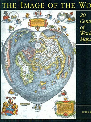
This study explores world mapping from man's earliest pictures of his environment to the exploration of the most remote reaches of the globe in the 20th century. Drawing on a wealth of cartographic images, this text analyzes a wide range of maps as historical, cultural and geographical documents, and places them in the context of the wider history of ideas. Several of the maps illustrated, previously known only in black and white, have been hand-coloured in the style of the period.
"Sinopsis" puede pertenecer a otra edición de este libro.
Reseńa del editor
This study explores world mapping from man's earliest pictures of his environment to the exploration of the most remote reaches of the globe in the 20th century. Drawing on a wealth of cartographic images, this text analyzes a wide range of maps as historical, cultural and geographical documents, and places them in the context of the wider history of ideas. Several of the maps illustrated, previously known only in black and white, have been hand-coloured in the style of the period.
"Sobre este título" puede pertenecer a otra edición de este libro.
Otras ediciones populares con el mismo título

Resultados de la búsqueda para The Image of the World: 20 Centuries of World Maps

Imagen del vendedor
The Image of the World : Twenty Centuries of World Maps
Publicado por
British Library, 1997
ISBN 10: 0712345329
ISBN 13: 9780712345323
Antiguo o usado
Soft cover
Librería: Neo Books, Sidcup, KENT, Reino Unido
Calificación del vendedor: 5 de 5 estrellas
![]()
Soft cover. Condición: Good. No Jacket. Some wear to covers and spine, mainly edges and corners, corners creased and worn, internally in good condition, pages crisp and clear. Nş de ref. del artículo: 038755
Cantidad disponible: 1 disponibles
Imagen de archivo
THE IMAGE OF THE WORLD. 20 Centuries of World Maps.
Publicado por
London The British Library Reprinted, 1997
ISBN 10: 0712345329
ISBN 13: 9780712345323
Antiguo o usado
Soft cover
Librería: Handsworth Books PBFA, Woodford Green, Reino Unido
Calificación del vendedor: 4 de 5 estrellas
![]()
Soft cover. Condición: Very Good. 28.5cm x 26cm, PAPERBACK (Very Good), 144pp, Numerous Colour & Black-and-White Illustrations. No Signatures or Annotations. Nş de ref. del artículo: 13729
Cantidad disponible: 1 disponibles
Imagen del vendedor
The Image of the World 20 Centuries of World Maps
Publicado por
British Library, 1997
ISBN 10: 0712345329
ISBN 13: 9780712345323
Antiguo o usado
Tapa blanda
Librería: PEMBERLEY NATURAL HISTORY BOOKS BA, ABA, Iver, Reino Unido
Calificación del vendedor: 5 de 5 estrellas
![]()
Condición: Very Good. viii, 144, col illus. 285x260mm. PB. Vg. From the library of Prof. J. Green (1928-2016) with his signature to endpaper. Reprint. First published 1994. [9780712345323]. Nş de ref. del artículo: S41859
Cantidad disponible: 1 disponibles
Imagen del vendedor
The image of the world : twenty centuries of world maps
Publicado por
London : British Library, 1997
ISBN 10: 0712345329
ISBN 13: 9780712345323
Antiguo o usado
Tapa blanda
Librería: MW Books Ltd., Galway, Irlanda
Calificación del vendedor: 5 de 5 estrellas
![]()
Second Edition. Very good paperback copy; edges somewhat dust-dulled and nicked. Remains quite well-preserved overall. Physical description: 160p. : col. ill., maps ; 29cm. Subjects: Cartography History. Historical geography ; Maps. Maps History. Genre: Art history. Language: English. 1 Kg. Nş de ref. del artículo: 362201
Cantidad disponible: 1 disponibles
Imagen de archivo
The Image of the World. 20 Centuries of World Maps.
Publicado por
The British Library, London, 1997
ISBN 10: 0712345329
ISBN 13: 9780712345323
Antiguo o usado
Soft Cover
Librería: Lawrence Jones Books, Ashmore, QLD, Australia
Calificación del vendedor: 5 de 5 estrellas
![]()
Soft Cover. Condición: Very Good. Second Paperback Edition. viii, 144pp, index, bibliography, num bw & col ills.Or card covers. Bottom front corner creased, slight sticker residue on front blank page. From Bishop Isidore's simplistic T-O desing for a world map, through the elaborately decorated manuscript and printed maps of the 17th and 18th centuries, to scientific maps showing the ocean floor, the author examines the history of world mapmaking through 70 outstanding examples. Size: 4to. Nş de ref. del artículo: 033257
Cantidad disponible: 1 disponibles