Descripción
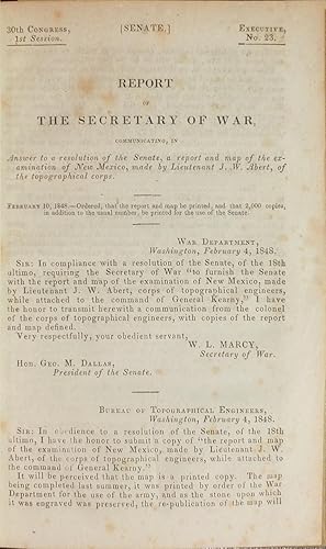
8vo., (9 1/8 x 5 ¾ inches). Fine folding lithographed map of New Mexico, 24 lithographed plates (some spotting). Modern quarter brown morocco, brown cloth, spine lettered in gilt. Provenance: From the important cartographical library of Warren Heckrotte, his sale, Rare Cartography, Exploration and Voyages, Part II, December 3, 2015, Lot 2. First Senate edition. Though this report also appears in the House edition of Emory's "Notes of a Military Reconnaissance," Wagner-Camp asserts that this is the first edition (Wagner-Camp 143). Original wrappers not present, but the Streeter catalogue states that some copies were issued without wrappers (Streeter). This fascinating report ". describes his trip from Fort Leavenworth over the SFT via Bent's Fort, his survey of the northern part of New Mexico, and his return trip over the Trail" (Rittenhouse). In 1843, Abert joined the Corps of Topographical Engineers, which was headed by his father. He joined several expeditions into the west, including John Frémont's third expedition, illustrating the expedition reports with beautiful sketches of local people, flora, and fauna. He was also put in charge of a detachment to map the Canadian River. In 1846 he joined General Kearney's troops in the war with Mexico, returning to Fort Leavenworth in the following year. It was during this time that he discovered a new species of bird, which was named the Abert's Towhee in his honor. "A basic SFT document" (Rittenhouse). Howes A-11, Wagner-Camp 143, Graff 5, Rittenhouse 2, Flake 726. Streeter 168. N° de ref. del artículo 72MMS360
Contactar al vendedor
Denunciar este artículo
![]()


