


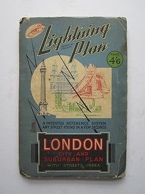
Lightning Plan Patent No. 394936: London City and Suburban Plan with Street Index.
The Lightning Cities & Road Map Co. Ltd.:
Editorial: The Lightning Cities & Road Map Co. Ltd., London, 1933
Usado
Soft cover
Librería:
Angelika C. J. Friebe Ltd. - MapWoman, Dorking, Reino Unido
Calificación del vendedor: 5 de 5 estrellas
![]()
Vendedor de AbeBooks desde 6 de julio de 2017
Este ejemplar en concreto ya no está disponible. Estas algunas de las coincidencias similares para Lightning Plan Patent No. 394936: London – City and Suburban Plan with Street Index..
Descripción
Descripción:
colour printed folding map; overall 49 x 278 cm; some wear and tear; some smaller marginal tears; some folds browned; o/w vg cond. paper cover, 25 x 16,5 cm, some wear and tear, o/w g cond. booklet with how-to-use explanation and a 63 pp street index.- This is the largest map, I have ever purchased! A very detailed plan of London and suburbs, which is in fact two maps on a contiuous strip with a dividing centre line, North London being to the left hand section (Hornsey to Westminster, Wembley to Barking) and South London (the Oval to Crystal Palace, Kew Gardens to Plumstead) the right hand section.- The practicality is quite questionable! There were two edition in this format which can be identified by the different price before the publisher adopted a book format. N° de ref. del artículo 4791
Detalles bibliográficos
Título: Lightning Plan Patent No. 394936: London ...
Editorial: The Lightning Cities & Road Map Co. Ltd., London
Ańo de publicación: 1933
Encuadernación: Soft cover
Condición: Good
Los mejores resultados en AbeBooks

London City And Suburban Plan With Street Index: Lightning Plan Patent No. 394936
Publicado por
The Lightning Cities & Road Map Co Ltd, 1935
Antiguo o usado
Paperback
Original o primera edición
Librería: Uprights, Northampton, MA, Estados Unidos de America
Calificación del vendedor: 4 de 5 estrellas
![]()
Paperback. Condición: Very Good. First Edition. Now in a removable archival protective clear mylar cover. A very cool vintage book from 1935 with black and white and color maps. Cover has minor scuffing along edges, corners, and spine, slightly creasing to corners, toning is slightly aged. ; black and white and color maps; 0.5 x 10.0 x 6.8 inches. Nş de ref. del artículo: 9961
Cantidad disponible: 1 disponibles