Descripción
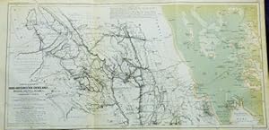
In German: 1) Originalkarte der Nord-Abbesinischen Grenzlande: Bogos, Mensa, Marea, under der Umliegenden Gebiete. Hauptsachlich nach den Aufnahmen und Arbeiten der Deutschen Expedition unter von Heuglin, Kinzelbach, Munzinger & Steudner, 1861. Entworfen von A. Petermann, bearbeitet & gezeichnet von B. Hassenstein. A period shaded topographic map, with the mainland portions in black and white, and the Red Sea and its coastlines colored. Includes soundings of the depths of the Red Sea. Includes routes from 7 addition expeditions. Condition notes: 21.5" wide X 10.4" high, in 3 panels (folded twice), modestly toned, more so at edges. 2) Originalkarte von Hamasen, Sarae, Adiabo, etc. in Nord-Abbesinien. Nach den Arbeiten und Aufnahmen von Heuglin, Werner, Munzinger, A. d?Abbadie. Entworfen von A. Petermann, bearbeitet und gezeichnet von B. Hassenstein. A period shaded topographic map, in black and white, with the expedition route in red. Condition notes: 21.5" wide X 10.4" high, in 3 panels (folded twice), modestly toned, more so at edges. 3) Originalkarte von Nord-Abbesinien und den Landern am Mareb, Barka & Anseba Ein Ergebnifs der Deutschen Expedition 1861 & 1862 und zwar vorzugsweise der Arbeiten von Werner Munzinger, ferner derjenigen von Th. V. Heuglin & Th. Kinzelbach mit Benutzung der Bestimmungen von Antioine d?Abbadie, 1838-1848 u. Anderer. Entworfen von A. Petermann, bearbeitet von B. Hassenstein. A period map on 2 sheets, in black and white, with the expedition route in Orange. On sheet 1 are also in color are the routes of 7 other expeditions. On sheet 2 boundaries are delineated in pastel colors. Condition notes: 21.2" wide X 18.0" high, in 6 panels (folded horizontally once and vertically twice), modestly toned, more so at edges and folds. 4) Rundsicht vom Hochsten Gipfel des Sewan bei Keren, aufgenommen vom Th. V. Heuglin, 7 October 1861. A product of the German Expedition of east Africa, 1861. Period sepia tinted drawing of the granite mountains surrounding Keren, located in modern day Eritrea on heavy paper. Condition notes: 22.0" wide X 10.4" high, in 3 panels (Folded vertically twice) modestly toned. All from "Mittheilungen aus Justus Perthes' Geographischer Anstalt uber Wichtige Neue Erforschungen auf dem Gessammtgebiete der Geographie von Dr. A. Petermann, 1864." Roughly: "Communications from Justus Perthes' Geographical Institute Concerning Important New Studies in the Whole Field of Geography by Dr. Augustus Petermann, 1864.". N° de ref. del artículo 038043
Contactar al vendedor
Denunciar este artículo
Detalles bibliográficos
Título: 3 Maps and 1 Drawing from the German ...
Editorial: Justus Perthes, Gotha
Año de publicación: 1864
Encuadernación: No Binding
Ilustrador: Heinrich August Petermann
Condición: Collectible-Very Good (-)
![]()


