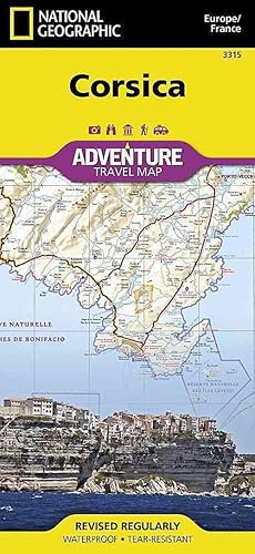
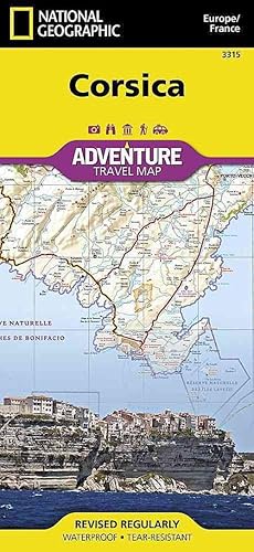
9781566956062 - CORSICA 1/150.000: Travel Maps International Adventure Map: 3315 (ADVENTURE MAP - 1/150.000) de Maps, National Geographic (24 resultados)
ComentariosFiltros de búsqueda
Tipo de artículo
- Todos los tipos de productos
- Libros (22)
- Revistas y publicaciones (No hay ningún otro resultado que coincida con este filtro.)
- Cómics (No hay ningún otro resultado que coincida con este filtro.)
- Partituras (No hay ningún otro resultado que coincida con este filtro.)
- Arte, grabados y pósters (No hay ningún otro resultado que coincida con este filtro.)
- Fotografías (No hay ningún otro resultado que coincida con este filtro.)
- Mapas (2)
- Manuscritos y coleccionismo de papel (No hay ningún otro resultado que coincida con este filtro.)
Condición
Encuadernación
- Todas
- Tapa dura (No hay ningún otro resultado que coincida con este filtro.)
- Tapa blanda (2)
Más atributos
- Primera edición (No hay ningún otro resultado que coincida con este filtro.)
- Firmado (No hay ningún otro resultado que coincida con este filtro.)
- Sobrecubierta (No hay ningún otro resultado que coincida con este filtro.)
- Con imágenes (10)
- No impresión bajo demanda (24)
Gastos de envío gratis
Valoración de los vendedores
-
Corsica (Adventure Map)
Publicado por National Geographic Maps, 2012
ISBN 10: 1566956064 ISBN 13: 9781566956062
Librería: Save With Sam, North Miami, FL, Estados Unidos de America
map. Condición: New. Brand New!.
-
Corsica [france] (Sheet Map, Folded)
Publicado por National Geographic Maps 1/1/2019, 2019
ISBN 10: 1566956064 ISBN 13: 9781566956062
Librería: BargainBookStores, Grand Rapids, MI, Estados Unidos de America
Sheet Map, Folded. Condición: New. Corsica [france] 0.2. Book.
-
Corsica Map [France] (National Geographic Adventure Map, 3315)
Publicado por Natl Geographic Society Maps, 2019
ISBN 10: 1566956064 ISBN 13: 9781566956062
Librería: California Books, Miami, FL, Estados Unidos de America
Condición: New.
-
Corsica Map [France] (National Geographic Adventure Map, 3315) [Map] National Geographic Maps
Publicado por Natl Geographic Society Maps, 2019
ISBN 10: 1566956064 ISBN 13: 9781566956062
Librería: Lakeside Books, Benton Harbor, MI, Estados Unidos de America
Condición: New. Brand New! Not Overstocks or Low Quality Book Club Editions! Direct From the Publisher! We're not a giant, faceless warehouse organization! We're a small town bookstore that loves books and loves it's customers! Buy from Lakeside Books!.
-
Corsica Map [France] (National Geographic Adventure Map, 3315)
Publicado por Natl Geographic Society Maps, 2019
ISBN 10: 1566956064 ISBN 13: 9781566956062
Librería: GF Books, Inc., Hawthorne, CA, Estados Unidos de America
Condición: Very Good. Book is in Used-VeryGood condition. Pages and cover are clean and intact. Used items may not include supplementary materials such as CDs or access codes. May show signs of minor shelf wear and contain very limited notes and highlighting. 7.
-
Corsica Map [France] (National Geographic Adventure Map, 3315)
Publicado por Natl Geographic Society Maps, 2019
ISBN 10: 1566956064 ISBN 13: 9781566956062
Librería: Book Deals, Tucson, AZ, Estados Unidos de America
Condición: Good. Good condition. This is the average used book, that has all pages or leaves present, but may include writing. Book may be ex-library with stamps and stickers. 7.
-
Corsica Map [France] (National Geographic Adventure Map, 3315)
Publicado por Natl Geographic Society Maps, 2019
ISBN 10: 1566956064 ISBN 13: 9781566956062
Librería: Books Unplugged, Amherst, NY, Estados Unidos de America
Condición: New. Buy with confidence! Book is in new, never-used condition 7.
-
Corsica Map [France] (National Geographic Adventure Map, 3315)
Publicado por Natl Geographic Society Maps, 2019
ISBN 10: 1566956064 ISBN 13: 9781566956062
Librería: Book Deals, Tucson, AZ, Estados Unidos de America
Condición: New. New! This book is in the same immaculate condition as when it was published 7.
-
Corsica Map [France]
Publicado por National Geographic Maps, 2019
ISBN 10: 1566956064 ISBN 13: 9781566956062
Librería: PBShop.store US, Wood Dale, IL, Estados Unidos de America
UNK. Condición: New. New Book. Shipped from UK. Established seller since 2000.
-
Corsica Map [France] (National Geographic Adventure Map, 3315)
Publicado por Natl Geographic Society Maps, 2019
ISBN 10: 1566956064 ISBN 13: 9781566956062
Librería: Ergodebooks, Houston, TX, Estados Unidos de America
No binding. Condición: New. Waterproof Tear-Resistant Travel MapExplore the most mountainous island in the Mediterranean and discover while it's called the "isle of beauty" with National Geographic's Corsica Adventure Map. Cities and towns are clearly indicated and easy to find in the user-friendly index. A road network complete with distances and designations for major roads, expressways, scenic routes, and secondary roads will help you find the route that's right for you. The popular GR 20 trail is noted for advanced hikers looking to traverse one of the most beautiful mountain trails in Europe.With specialty content to include hundreds of diverse and unique recreational, ecological, cultural, and historical destinations, this map is a perfect companion to a guidebook. Beaches, winter sports resorts, golf courses, spas, castles, churches, camping areas, and UNESCO World Heritage sites are clearly indicated so travelers can take advantage of Corsica's many natural attractions and activities. The locations of airports, airfields, harbors, marinas, and ferry routes take the guesswork out of travel around the island.The front side of the print map details the northern region of this island country; bordering Golfe de Sagone and Golfe de Porto to the west, Tyrrhenian Sea to the east, and the Ligurian Sea and Golfe de St.-Florent to the north. The reverse side of the map shows the southern region; from its border with the Bouches de Bonifacio to the south, to the Tyrrhenian Sea, Golfe de Santa-Manza and Golfe de Porto-Vecchio to the east, and the Mediterranean Sea, Golfe de Sagone, Golfe de Valinco and Golfe d' Ajaccio to the west. This island is located west of Italy, southeast of the French mainland and north of the Italian island of Sardinia.Every Adventure Map is printed on durable synthetic paper, making them waterproof, tear-resistant and tough - capable of withstanding the rigors of international travel. Map Scale = 1:150,000 Sheet Size = 25.5" x 37.75" Folded Size = 4.25" x 9.25" 0.3045.
-
Corsica [France] (National Geographic Adventure Map, 3315)
Publicado por Natl Geographic Society Maps, 2019
ISBN 10: 1566956064 ISBN 13: 9781566956062
Librería: Russell Books, Victoria, BC, Canada
Map. Condición: New. 2019th Edition. Special order direct from the distributor.
-
Corsica Map [France]
Publicado por National Geographic Maps, 2019
ISBN 10: 1566956064 ISBN 13: 9781566956062
Librería: PBShop.store UK, Fairford, GLOS, Reino Unido
UNK. Condición: New. New Book. Shipped from UK. Established seller since 2000.
-
National Geographic Corsica (France) Map: Travel Maps International Adventure Map
Publicado por National Geographic Maps, 2011
ISBN 10: 1566956064 ISBN 13: 9781566956062
Librería: Revaluation Books, Exeter, Reino Unido
Mapa
Sheet map. Condición: Brand New. fol map edition. 2 pages. 9.25x4.25x0.25 inches. In Stock.
-
Corsica Map [France] (National Geographic Adventure Map, 3315)
Publicado por Natl Geographic Society Maps, 2019
ISBN 10: 1566956064 ISBN 13: 9781566956062
Librería: Ergodebooks, Houston, TX, Estados Unidos de America
No binding. Condición: Fine. Waterproof Tear-Resistant Travel MapExplore the most mountainous island in the Mediterranean and discover while it's called the "isle of beauty" with National Geographic's Corsica Adventure Map. Cities and towns are clearly indicated and easy to find in the user-friendly index. A road network complete with distances and designations for major roads, expressways, scenic routes, and secondary roads will help you find the route that's right for you. The popular GR 20 trail is noted for advanced hikers looking to traverse one of the most beautiful mountain trails in Europe.With specialty content to include hundreds of diverse and unique recreational, ecological, cultural, and historical destinations, this map is a perfect companion to a guidebook. Beaches, winter sports resorts, golf courses, spas, castles, churches, camping areas, and UNESCO World Heritage sites are clearly indicated so travelers can take advantage of Corsica's many natural attractions and activities. The locations of airports, airfields, harbors, marinas, and ferry routes take the guesswork out of travel around the island.The front side of the print map details the northern region of this island country; bordering Golfe de Sagone and Golfe de Porto to the west, Tyrrhenian Sea to the east, and the Ligurian Sea and Golfe de St.-Florent to the north. The reverse side of the map shows the southern region; from its border with the Bouches de Bonifacio to the south, to the Tyrrhenian Sea, Golfe de Santa-Manza and Golfe de Porto-Vecchio to the east, and the Mediterranean Sea, Golfe de Sagone, Golfe de Valinco and Golfe d' Ajaccio to the west. This island is located west of Italy, southeast of the French mainland and north of the Italian island of Sardinia.Every Adventure Map is printed on durable synthetic paper, making them waterproof, tear-resistant and tough - capable of withstanding the rigors of international travel. Map Scale = 1:150,000 Sheet Size = 25.5" x 37.75" Folded Size = 4.25" x 9.25" 0.3045.
-
Corsica Map (France): Travel Maps International Adventure Map (National Geographic Adventure Map)
Publicado por National Geographic Maps, United States, Evergreen, 2012
ISBN 10: 1566956064 ISBN 13: 9781566956062
Librería: WorldofBooks, Goring-By-Sea, WS, Reino Unido
Paperback. Condición: Very Good. AdventureMaps provide global travellers with the perfect combination of detail and perspective, highlighting hundreds of points of interest and the diverse and unique destinations within the country. Each map is printed on durable synthetic paper, making them waterproof and tear-resistant. They also include the locations of cities and towns with a user-friendly index, plus a clearly marked road network complete with distances and designations for major highways, main roads and tracks and trails for those seeking to explore more remote regions. The book has been read, but is in excellent condition. Pages are intact and not marred by notes or highlighting. The spine remains undamaged.
-
Corsica Map [France]
Publicado por Map Link Jan 2019, 2019
ISBN 10: 1566956064 ISBN 13: 9781566956062
Librería: BuchWeltWeit Ludwig Meier e.K., Bergisch Gladbach, Alemania
Karte. Condición: Neu. Neuware -AdventureMaps provide global travellers with the perfect combination of detail and perspective, highlighting hundreds of points of interest and the diverse and unique destinations within the country. Each map is printed on durable synthetic paper, making them waterproof and tear-resistant. They also include the locations of cities and towns with a user-friendly index, plus a clearly marked road network complete with distances and designations for major highways, main roads and tracks and trails for those seeking to explore more remote regions. 2 pp. Englisch.
-
Corsica Map [France]
Publicado por Map Link Jan 2019, 2019
ISBN 10: 1566956064 ISBN 13: 9781566956062
Librería: Rheinberg-Buch Andreas Meier eK, Bergisch Gladbach, Alemania
Karte. Condición: Neu. Neuware -AdventureMaps provide global travellers with the perfect combination of detail and perspective, highlighting hundreds of points of interest and the diverse and unique destinations within the country. Each map is printed on durable synthetic paper, making them waterproof and tear-resistant. They also include the locations of cities and towns with a user-friendly index, plus a clearly marked road network complete with distances and designations for major highways, main roads and tracks and trails for those seeking to explore more remote regions. 2 pp. Englisch.
-
Corsica Map [France]
Publicado por Map Link Jan 2019, 2019
ISBN 10: 1566956064 ISBN 13: 9781566956062
Librería: AHA-BUCH GmbH, Einbeck, Alemania
Mapa
Karte. Condición: Neu. Neuware - AdventureMaps provide global travellers with the perfect combination of detail and perspective, highlighting hundreds of points of interest and the diverse and unique destinations within the country. Each map is printed on durable synthetic paper, making them waterproof and tear-resistant. They also include the locations of cities and towns with a user-friendly index, plus a clearly marked road network complete with distances and designations for major highways, main roads and tracks and trails for those seeking to explore more remote regions.
-
Corsica [France] (National Geographic Adventure Map, 3315)
Publicado por Natl Geographic Society Maps, 2019
ISBN 10: 1566956064 ISBN 13: 9781566956062
Librería: Pieuler Store, Suffolk, Reino Unido
Condición: good. 2019. 100% Customer Satisfaction Guaranteed ! The book shows some signs of wear from use but is a good readable copy. Cover in excellent condition. Binding tight. Pages in great shape, no tears. Not contain access codes, cd, DVD.
-
Corsica [France] (National Geographic Adventure Map, 3315)
Publicado por Natl Geographic Society Maps, 2019
ISBN 10: 1566956064 ISBN 13: 9781566956062
Librería: Pieuler Store, Suffolk, Reino Unido
Condición: new. 2019. Book is in NEW condition. Satisfaction Guaranteed! Fast Customer Service!!.
-
Corsica (Folded)
Publicado por National Geographic Maps, Evergreen, 2012
ISBN 10: 1566956064 ISBN 13: 9781566956062
Librería: CitiRetail, Stevenage, Reino Unido
Folded. Condición: new. Folded. National Geographic's Corsica Adventure Map is designed to meet the unique needs of adventure travelers with its durability and accurate information. This folded map provides global travelers with the perfect combination of detail and perspective, highlighting hundreds of points of interest and the diverse and unique destinations within the country. The map includes the locations of cities and towns with a user-friendly index, plus a clearly marked road network complete with distances and designations for major highways, main roads, and tracks and trails for those seeking to explore more remote regions. The front side of the Corsica map details the northern region of this island country; bordering Golfe de Sagone and Golfe de Porto to the west, Tyrrhenian Sea to the east, and the Ligurian Sea and Golfe de St.-Florent to the north. The reverse side of the map details the southern region; from its border with the Bouches de Bonifacio to the south, to the Tyrrhenian Sea, Golfe de Santa-Manza and Golfe de Porto-Vecchio to the east, and the Mediterranean Sea, Golfe de Sagone, Golfe de Valinco and Golfe d' Ajaccio to the west. This island is located west of Italy, southeast of the French mainland and north of the Italian island of Sardinia. Every Adventure Map is printed on durable synthetic paper, making them waterproof, tear-resistant and tough capable of withstanding the rigors of international travel. Each is two-sided and can be folded to a packable size of 235 x 108 mm; unfolded size is 965 x 660 mm. Shipping may be from our UK warehouse or from our Australian or US warehouses, depending on stock availability.
-
Corsica
Publicado por National Geographic Maps, 2013
ISBN 10: 1566956064 ISBN 13: 9781566956062
Librería: moluna, Greven, Alemania
Condición: New. wasser- und reissfest Sehenswuerdigkeiten mit Naturschutzgebieten und historischen AttraktionenAdventureMaps provide global travellers with the perfect combination of detail and perspective, highlighting hundreds of points of interest and the diverse an.
-
Corsica (Folded)
Publicado por National Geographic Maps, Evergreen, 2012
ISBN 10: 1566956064 ISBN 13: 9781566956062
Librería: AussieBookSeller, Truganina, VIC, Australia
Folded. Condición: new. Folded. National Geographic's Corsica Adventure Map is designed to meet the unique needs of adventure travelers with its durability and accurate information. This folded map provides global travelers with the perfect combination of detail and perspective, highlighting hundreds of points of interest and the diverse and unique destinations within the country. The map includes the locations of cities and towns with a user-friendly index, plus a clearly marked road network complete with distances and designations for major highways, main roads, and tracks and trails for those seeking to explore more remote regions. The front side of the Corsica map details the northern region of this island country; bordering Golfe de Sagone and Golfe de Porto to the west, Tyrrhenian Sea to the east, and the Ligurian Sea and Golfe de St.-Florent to the north. The reverse side of the map details the southern region; from its border with the Bouches de Bonifacio to the south, to the Tyrrhenian Sea, Golfe de Santa-Manza and Golfe de Porto-Vecchio to the east, and the Mediterranean Sea, Golfe de Sagone, Golfe de Valinco and Golfe d' Ajaccio to the west. This island is located west of Italy, southeast of the French mainland and north of the Italian island of Sardinia. Every Adventure Map is printed on durable synthetic paper, making them waterproof, tear-resistant and tough capable of withstanding the rigors of international travel. Each is two-sided and can be folded to a packable size of 235 x 108 mm; unfolded size is 965 x 660 mm. Shipping may be from our Sydney, NSW warehouse or from our UK or US warehouse, depending on stock availability.
-
Corsica
Publicado por Turq Press, 2012
ISBN 10: 1566956064 ISBN 13: 9781566956062
Librería: Collectors Bookstore, Antwerpen, Belgica
Paperback. Condición: Fine. Corsica by National Geographic. Published by Turq Press in 2012. Paperback. ISBN:9781566956062. Collectible item in very fine condition.


![Imagen del vendedor de Corsica [france] (Sheet Map, Folded) a la venta por BargainBookStores](https://pictures.abebooks.com/inventory/md/md31997237929.jpg)
![Imagen del vendedor de Corsica Map [France] a la venta por BuchWeltWeit Ludwig Meier e.K.](https://pictures.abebooks.com/inventory/md/md31503653232.jpg)
![Imagen del vendedor de Corsica Map [France] a la venta por Rheinberg-Buch Andreas Meier eK](https://pictures.abebooks.com/inventory/md/md31814011393.jpg)
![Imagen del vendedor de Corsica Map [France] a la venta por AHA-BUCH GmbH](https://pictures.abebooks.com/inventory/md/md30934113955.jpg)
![Imagen del vendedor de Corsica [France] (National Geographic Adventure Map, 3315) a la venta por Pieuler Store](https://pictures.abebooks.com/inventory/md/md31372468010.jpg)
![Imagen del vendedor de Corsica [France] (National Geographic Adventure Map, 3315) a la venta por Pieuler Store](https://pictures.abebooks.com/inventory/md/md31372489049.jpg)


