Descripción
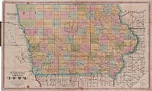
Handcolored folding map, 23 1/2 x 37 inches. Folding into original 16mo green cloth boards, stamped in gilt and blind. Cloth rubbed and stained, worn at extremities. A few old stains on the map, small splits at a few cross-folds, closed two-inch tear along one fold (where affixed to boards). Very good. Frst edition of this township map of Iowa published by Henn, Williams Company and R.L. Barnes. Subsequent editions were issued in 1855 and 1856. Commenting on the first three editions of this map, Thomas Streeter wrote: "These three maps show clearly the rapid growth of the settlement in Iowa over just a three-year period. In 1854 [the present first edition] there was practically no settlement in the three tiers of northwestern counties. By 1855 [the second edition] Kossuth County had absorbed Bancroft and Humboldt, and.had a county seat.The northwestern counties are further developed by 1856 [the third edition], with Nebraska counties.being shown for the first time." When this map was printed in 1854, Nebraska had just become an organized incorporated territory of the United States created by the Kansas-Nebraska Act of 1854, and as development of Nebraska had yet to really begin, the Nebraska portion of the map includes only Omaha city, Nebraska City, Old Fort Kearney, the Great Western Mail & Emigrant route to the Pacific, Belleview Mission, and the location of the Omaha and Pawnee reservations. A large and important early map of Iowa. STREETER SALE 3893, 3901 (note). GRAFF 1856. PHILLIPS, MAPS, p.337. N° de ref. del artículo WRCAM62690
Contactar al vendedor
Denunciar este artículo
![]()

