Descripción
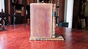
3 volumes: 2 volumes, text 8vo., (8 2/8 x 5 1/8 inches). Contemporary American sheep, covers decorated with a border of triple gilt fillets, smooth spines gilt decorated in six compartments, black morocco lettering-piece in one, supra libros of Julia de Forest in another, the others gilt-decorated with small tools (joints and corners strengthened); atlas volume 8vo., ((8 2/8 x 5 1/8 inches). Two tinted lithographic views, 7 engraved maps or plans, all but one folding (one or two short tears at the mounts). Contemporary half sheep, marbled paper boards (rebacked to style, corners strengthened). Provenance: Ownership inscriptions of Julia de Forest (1848-1898) on the title-page of each volume. First American edition, first published in Paris the same year. Julia DeForest Tuttle was a businesswoman who originally owned much of the land upon which the city of Miami, Florida was developed, she is often referred to as the Mother of Miami. She first visited the Biscayne Bay region of Southern Florida in 1875 to see her father's 167 acre estate. In 1886 her husband died and left her the iron foundry he owned. In 1891 her father died and left her his Florida land. She sold her iron foundry and moved to Biscayne Bay and purchased an additional 640 acres of land along the Miami River. In 1895 she persuaded Henry Flagler of the Florida East Coast Railway to build a route through her area. This lead to a rapid growth in population and in 1896, the incorporation of the new city of Miami. In 1799 Alexander von Humboldt went to Spain and received from the king permission to visit and make scientific investigations in all the Spanish possessions in Europe, America, with privileges never before granted to any traveller. From 1799 to 1804, Humboldt was accompanied by the French botanist Aime Bonpland, and together they made observations on geology, geography, zoology, botany and the political and social character of the regions. His exploration of Orinoco River was the first to furnish any positive knowledge of that river. In 1802, in exploring the volcanoes of Ecuador, he ascended heights that had not previously been attained, and on Chimborazo reached the altitude of 19,286 feet. Afterward he made a profile of Mexico from sea to sea--this was the first profile ever given of an entire country. After his return to Paris, and over a period of about two decades, Humboldt undertook to publish the results of his study in the monumental 29-volume Voyage aux regions equinoxiales du Nouveau Continent. This work comprised the first scientific description of the American Southwest and includes a wealth of new information on California and Texas. The atlas includes plates of volcanoes, land profiles, a map of the southern part of North America, maps of Mexico and many of its parts, and most importantly, Humboldt's two-sheet "Carte Generale du Royaume de la Nouvelle Espagne." This map contained the most up-to-date geographic depiction of Texas, California and the rest of Mexico, and it became the prototype rendering for much of the region for the next several decades. Carl Wheat called the map a "truly magnificent cartographic achievement." Cowan p. 296 (another edition); Graff 2009; Hill p. 149 (another edition); Phillips 2682; Reese & Miles Creating America 23; Ramsey 328; Sabin 33756; Streeter I:195; Streeter Texas 1042 note; Wagner-Camp-Becker 7a:3, 7a:3a:1; Wheat Mapping the Transmississippi West 302-. N° de ref. del artículo 001973
Contactar al vendedor
Denunciar este artículo
![]()


