Descripción
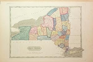
4to., 10 x 13 ½ inches. 63 engraved maps, several of which are folding, complete as issued, with title page, and list of maps, maps colored in early hand, and numbered in ink manuscript in upper right corners (both title page and list of maps pages torn with rough repairs, heavy foxing affecting some maps, short tears). Original half parchment on marbled paste boards (some splitting, staining on boards including early ink stain on bottom edge, shelf wear). Provence: Manuscript ownership inscriptions on title page "1805". Purchased at Freeman's: April 2016, Sale 1540, Lot 408. On the map of North America the outline of an imagined Nebraska territory is written in a 19th century hand. "FOR PINKERTON'S GEOGRAPHY" added in early manuscript hand to title page. First edition, second issue of Arrowsmith and Lewis's important atlas, with the correct complement of 63 maps called for in the list of contents (the first issue of the same year incorrectly listed 65). The maps are the same in both of the issues. CONTAINS THE FIRST PRINTED MAP OF THE STATE OF OHIO. The original thirteen states are included, and also the District of Maine, Vermont, Kentucky, Tennessee, Ohio (which had been admitted to the Union in 1803), Mississippi Territory, and Louisiana. This complete atlas additionally has maps that cover the known world. "This is a gathering of maps by Arrowsmith and by Lewis. The maps by Arrowsmith are taken from Pinkerton's Modern Geography, London, 1802. Lewis' maps are those of the States and territories. The map of Louisiana is important. The map of Ohio is one of first of state. Wheat, curiously, was unaware of Pinkerton's book." (W. Heckrotte-TW 259). Wheat lists four of the maps included in this atlas and considers them to be significant - Louisiana (Wheat 259), British Possessions in America (Wheat 260), Spanish Dominions in North America (Wheat 261) and North America (Wheat 262) - and says of them collectively "When considered together the four afford a remarkably clear epitome of the knowledge of the West at the moment when Meriwhether Lewis and William Clark were poised for the take-off of their history-making expedition." References: P-LG 702. W-TW 259, 260, 261, 262. Location note: For inquiries please contact Greg McMurray, MLS, Director, Rare Books. N° de ref. del artículo 72GM13
Contactar al vendedor
Denunciar este artículo
Detalles bibliográficos
Título: A New and Elegant General Atlas, comprising ...
Editorial: Philadelphia; Baltimore; Washington City; Petersburg; Norfolk: John Conrad & Co., et al., 1804.
Encuadernación: Encuadernación de tapa dura
Edición: 1ª Edición
![]()


