Descripción
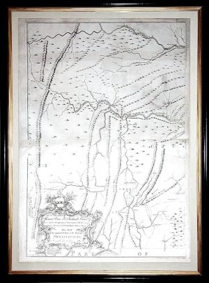
6 sheets joined in pairs to make three maps (each map size: 31 x 22 inches; each framed size: 36 x 26 4/8 inches). EXCEPTIONALLY FINE engraved map of Pennsylvania, the title within an elaborate asymmetrical rococo cartouche lower left, a large compass rose centre right, showing Pennsylvania extending west to the Allegheny Mountains and beyond Fort Cumberland in north central Maryland, bounded by Maryland along the bottom edge and New Jersey on the right. "THE FIRST MAP OF PENNSYLVANIA TO BE PUBLISHED IN AMERICA [AND] THE MOST AMBITIOUS CARTOGRAPHICAL WORK TO COME FROM AN AMERICAN SOURCE BEFORE THE REVOLUTION" (Wroth) The first state, before the addition of text by Nelson's Ferry at the southern end of the Susquehanna River, and VERY RARE. This was the first map of Pennsylvania to be published in America and arguably the most ambitious cartographical work to come from an American source before the Revolution. Nicholas Scull, Jr. (1687-1761) was born in Philadelphia to Nicholas Scull, Sr. the surveyor and mapmaker, who had been apprenticed to William Penn's surveyor, Thomas Holme. In 1719, he became deputy surveyor of Philadelphia County, eventually ascending to the Surveyor Generalship of Pennsylvania in 1748. A bibliophile, he was an original member of Benjamin Franklin's Junto. Scull was intimately involved with Indian relations for the colony, having travelled amongst the tribes to survey the western counties. He was knowledgeable in several local Native languages. But in the dispute that arose about the infamous Walking Purchase of 1737, at which he was present, his recollections favored the Proprietors. This is hardly surprising but it no doubt put him in a good position with the Penn family, and it is thought that this may have led to the publication of this impressive map. It was the first map of Pennsylvania since Thomas Holme s 1687 map of the then much smaller settlement, and represents a vast amount of on-site surveying. Dedicated to the Penn brothers, Scull's map is among the largest and finest maps produced in America in the 18th century. It was an extraordinary achievement. The map depicts Philadelphia, Bucks, Northampton, Berks, Chester, Lancaster, Cumberland, and York Counties, and is based on Scull s own surveys, as well as the contributions of several others (whom he acknowledges). Some information was gleaned from printed sources, including Fry-Jefferson's important map, evidenced by a printed footnote concerning the location of Fort Cumberland and the Maryland-Pennsylvania border. Elevation is accurately depicted, much in the style of Fry-Jefferson, by neat hachuring marks. The eastern counties include a wealth of detail, such as churches, meeting houses, inns, iron forges, mills and the manors of significant residents; roads, Indian paths, Indian towns and forts: all clearly shown throughout. Although generally quite accurate, it is curious that Scull included Fort Granville on his map, which had been destroyed by the French and Delaware Indians in 1756. Nevertheless, the importance and accuracy of this large- scale map is underscored by the fact that a copy of it was among the maps hung by the Board of War at Philadelphia in August 1776, twenty years after the map s publication (as noted by John Adams in his letter to his wife dated 13 August 1776). The map was engraved by James Turner (d. 1759), a Philadelphia silversmith and protege of Benjamin Franklin. Turner had previously worked on map engraving during the production of James Parker's 1747 maps of New Jersey, a project for which he had been recommended by Franklin. Little is known about the printer John Davis. Although he had no shop, he appears to have specialized in large copperplate engravings of maps, as he is the printer identified in the imprint of the 1756 Philadelphia first edition of Joshua Fisher s important chart of Delaware Bay. That map and the present one are his only known works. Nicholas Scull s grandson William Scull revised and. N° de ref. del artículo 72map274
Contactar al vendedor
Denunciar este artículo
![]()
