Descripción
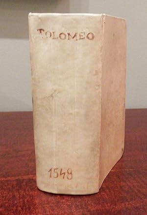
8vo (6 6/8 x 4 2/8 inches). Decorative woodcut side-borders to title-page, fine woodcut portrait of Ptolemy observing the heavens, 60 fine double-page copper-engraved maps by Giacomo Gastaldi, including 2 world maps (Shirley 87 and 88), embellished with sea-monsters, mermaids, ships, wild and unusual animals such as elephants and leopards, descriptive letterpress text and map numbers on rectos and versos of maps, woodcut illustrations and diagrams throughout, initials, and Pederzano's large woodcut device on colophon leaf 2D7r and verso of final leaf [Vaccaro Marche p.318, fig. 427]. With blank 2D8 (lacking the four leaves of index in the first signature, the first three leaves including title and blank tipped-in, two ownership inscriptions excised from title the whole backed with laid paper, resulting in minor gum stains to woodcut portrait of Ptolemy on proximate leaf, browning to sig. A, tear to top edge D7-E2, loss at lower corner of Y8, mild foxing and damp-staining throughout; maps with old restoration, some with later additions in pencil, centerfolds of many maps strengthened and restored, worming at upper gutter of no. 16-17 and 19-23 affecting maps, small hole to map 42 affecting "E" in the heading "ASIE, wormhole to h7-8, i.e. the final leaves, affecting a few words). 19th-century vellum over paste-board, title in manuscript on the spine, all edges blue. PROVENANCE: from the library of Bruce McKinney, founder of Americana Exchange/Rare Book Hub and bibliophile, on the front paste-down, his sale Bloomsbury Auctions, New York, 3rd December 2009, lot 24. "THE VERY FIRST ATLAS OF THE NEW WORLD" (Nordenskiold). First edition in Italian of Ptolemy's Geographia, a compilation of what was known about the world's geography in the Roman Empire during his time (ca. 90-168 AD). The earliest known manuscripts of Ptolemy's Geographia date to about 1300. The first printed version was published in 1477, then 1488, and in Ulm in 1482. However, these are all very large format atlases. This is the first small format atlas and therefore the first to be widely used by travelers. All maps of the present edition were engraved on copper by Giacomo Gastaldi (ca. 1500-1565), Cosmographer to the Venetian Republic. He sought the most up to date geographical information available and became one of the greatest cartographers of the sixteenth century" (Burden). Gastaldi spent two years putting together the maps for Pietro Andrea Mattioli's new Italian translation of Ptolemy's geography. Although the colophon is dated 1547, Gastaldi's preface is dated 1548, and apart from the twenty-six Ptolemaic maps, Gastaldi included thirty-four modern maps. These latter were very influential, being entirely new works engraved on copper. Nodenskiöld states that 26 of the maps are Ptolemy's based on the woodcuts by Munster which illustrated the Basel edition of 1540, and the remaining 34 were after Gastaldi's own design. "This edition of Ptolemy's Geography was the most comprehensive atlas produced between Martin Waldseemuller's Geographiae of 1513 and the Abraham Ortelius Theatrum of 1570. "It was the first to contain maps of the American continent" (Burden). The seven maps relating to the Americas are the modern World map (map 59); "Carta marina", the first sea chart depicting the modern world (map 60); "Tierra nova", the first separate map of the South American Continent (map 54); "Nueva Hispania", the earliest separate map of the Gulf Coast, Mexico, and the present south-western United States (map 55); and "Tierra nueva [del Bacalaos]", the earliest individual map of the east coast of North America (map 56), showing the discoveries of Verrazzano and Cartier. These last five maps are the earliest printed American regional maps. The work also includes the first separate map devoted to Arabia and the first reference to Singapore on a printed map. The translation by the celebrated botanist Pietro Andrea Mattioli (1501-1577) appears only in this edition; it was s. N° de ref. del artículo 72lib1349
Contactar al vendedor
Denunciar este artículo
![]()


