Descripción
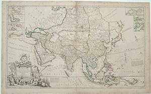
Copper-engraved map, with original outline colour, slightly toned, marginal foxing, centerfold reinforced. A fine example of Moll's intriguing map of Asia, depicting the continent just before the greatest era of European imperial expansion. This sensational map embraces the entire Asiatic landmass, as conceived by Europeans in the first quarter of the eighteenth-century. During this period, rival powers, including Britain, France, the Netherlands and Portugal vied for trade dominance in this region rich in spices and precious gems. Most of India was ruled by the Mughal Empire; China was then under the Qing Dynasty; and the mighty Shogun ruled Japan. The British were the dominant traders in India and the Dutch held the lead in the Spice Islands. The map features cartographic insets detailing some of the most commercially important Asiatic locales including; the Hellespont, connecting the Black Sea to the Mediterranean, running past the Ottoman capital of Istanbul; the harbour of Bombay; the Hoogly River, running past modern day Kolkata in Bengal; the Chinese trading islands of Amoy and Chusan; as well as an inset of the Arctic coast of Asia, which some still hoped would one day reveal a 'Northeastern Passage' from Europe to the Far East. The general map shows that parts of the continent lying to the northeast of Honshu, Japan were scarcely known. "Iessu," or Hokkaido has a nebulous shape, connected to an equally mysterious Siberia. This map includes an important feature for mariners, the directions and annual times of the Monsoons in the Indian Ocean and the South China Sea, winds and currents that either greatly aid or hinder the direction of sailing vessels. The sensational title cartouche depicts figures in exotic Asian costume, surrounded by various riches, including jewelry and Ming porcelain. The present map was part of Herman Moll's magnificent folio work, a New and Compleat Atlas. Moll was the most important cartographer working in London during his era, a career that spanned over fifty years. His origins have been a source of great scholarly debate; however, the prevailing opinion suggests that he hailed from the Hanseatic port city of Bremen, Germany. Joining a number of his countrymen, he fled the turmoil of the Scanian Wars for London, and in 1678 is first recorded as working there as an engraver for Moses Pitt on the production of the English Atlas. It was not long before Moll found himself as a charter member of London's most interesting social circle, which congregated at Jonathan's Coffee House at Number 20 Exchange Alley, Cornhill. It was at this establishment that speculators met to trade equities (most notoriously South Sea Company shares). Moll's coffeehouse circle included the scientist Robert Hooke, the archaeologist William Stuckley, the authors Jonathan Swift and Daniel Defoe, and the intellectually-gifted pirates William Dampier, Woodes Rogers and William Hacke. From these friends, Moll gained a great deal of privileged information that was later conveyed in his cartographic works, some appearing in the works of these same figures. Moll was highly astute, both politically and commercially, and he was consistently able to craft maps and atlases that appealed to the particular fancy of wealthy individual patrons, as well as the popular trends of the day. In many cases, his works are amongst the very finest maps of their subjects ever created with toponymy in the English language. Shirley, Maps in the Atlases of the British Library I, T.Moll-4b, 4; Cf. Reinhartz, The Cartographer and the Literati: Herman Moll and his Intellectual Circle. N° de ref. del artículo 21286
Contactar al vendedor
Denunciar este artículo
![]()
