
Importe total (1 artículo artículos):
Destino del pedido:

arizona de rand mcnally (123 resultados)
Ir a los resultados principales
Tipo de artículo
- Todo tipo de artículos
- Libros (117)
- Revistas y publicaciones
- Cómics
- Partituras
- Arte, grabados y pósters
- Fotografías
- Mapas (6)
-
Manuscritos y
coleccionismo de papel
Condición
Encuadernación
Más atributos
- Primera edición (4)
- Firmado
- Sobrecubierta
- Con imágenes del vendedor (32)
- Sin impresión bajo demanda (122)
Gastos de envío gratis
Ubicación del vendedor
Valoración de los vendedores
-

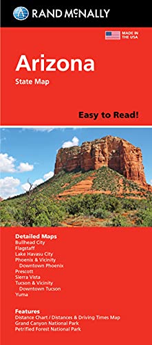
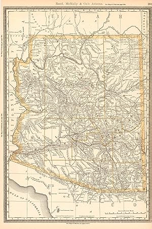
Rand Mcnally Easyfinder Phoenix & Vicinity Regional, Arizona
Publicado por Rand McNally, 2009
ISBN 10: 052887392XISBN 13: 9780528873928
Librería: HPB-Movies, Dallas, TX, Estados Unidos de America
Valoración del vendedor:

Libro
map. Condición: Very Good. Connecting readers with great books since 1972! Used books may not include companion materials, and may have some shelf wear or limited writing. We ship orders daily and Customer Service is our top priority!.
Más opciones de compra de otros vendedores en IberLibro
Usado desde EUR 2,47
-

Rand McNally Flagstaff Grand Canyon Arizona City Map
Publicado por Rand McNally, 1996
ISBN 10: 0528940724ISBN 13: 9780528940729
Librería: Copper News Book Store, Ajo, AZ, Estados Unidos de America
Valoración del vendedor:

Mapa
Map Fold. Condición: New.
-

Mobil Travel Guide -- 1982 -- California and the West -- Arizona / California / Nevada / Utah - 25 Anniversary Edition
Publicado por Rand McNally & Company, 1982
Librería: gigabooks, Spokane, WA, Estados Unidos de America
Valoración del vendedor:

Trade Paperback. Condición: Very Good. Trade Paperback -- Very Good -- Clean and tight with light wear -- 235 pages plus index.
-

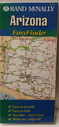
Rand Mcnally EasyFinder Arizona (Map)
Publicado por Rand McNally, 2013
ISBN 10: 052899719XISBN 13: 9780528997198
Librería: SecondSale, Montgomery, IL, Estados Unidos de America
Valoración del vendedor:
Libro
Condición: Good. Item in good condition. Textbooks may not include supplemental items i.e. CDs, access codes etc.
Más opciones de compra de otros vendedores en IberLibro
Nuevo desde EUR 89,96
Usado desde EUR 9,92
Encuentre también Tapa blanda
-

Rand McNally Easy To Fold: Arizona State Laminated Map
Publicado por Rand McNally, 2021
ISBN 10: 0528024736ISBN 13: 9780528024733
Librería: Lakeside Books, Benton Harbor, MI, Estados Unidos de America
Valoración del vendedor:
Libro
Condición: New. Brand New! Not Overstocks or Low Quality Book Club Editions! Direct From the Publisher! We're not a giant, faceless warehouse organization! We're a small town bookstore that loves books and loves it's customers! Buy from Lakeside Books!.
Más opciones de compra de otros vendedores en IberLibro
Nuevo desde EUR 7,55
Usado desde EUR 12,05
Encuentre también Tapa blanda
-
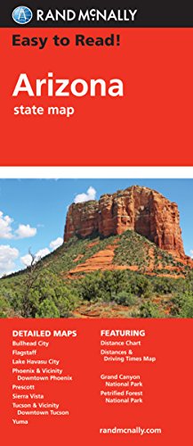
Rand McNally Easy to Read Folded Map: Arizona State Map
Publicado por Rand McNally, 2024
ISBN 10: 0528027743ISBN 13: 9780528027741
Librería: GF Books, Inc., Hawthorne, CA, Estados Unidos de America
Valoración del vendedor:
Libro
Condición: Good. Book is in Used-Good condition. Pages and cover are clean and intact. Used items may not include supplementary materials such as CDs or access codes. May show signs of minor shelf wear and contain limited notes and highlighting.
Más opciones de compra de otros vendedores en IberLibro
Nuevo desde EUR 12,35
Usado desde EUR 11,74
Encuentre también Tapa blanda
-
Easy To Read: Arizona State Map
Publicado por Rand McNally, 2013
ISBN 10: 0528881094ISBN 13: 9780528881091
Librería: Copper News Book Store, Ajo, AZ, Estados Unidos de America
Valoración del vendedor:
Libro
Map Fold. Condición: New.
Más opciones de compra de otros vendedores en IberLibro
Nuevo desde EUR 7,61
Usado desde EUR 8,70
Encuentre también Tapa blanda
-
Arizona (EasyFinder)
Publicado por Rand McNally, 1996
ISBN 10: 0528970461ISBN 13: 9780528970467
Librería: Bookmans, Tucson, AZ, Estados Unidos de America
Valoración del vendedor:
Libro
Map. Condición: Good. Satisfaction 100% guaranteed.
-
Arizona Topo (Arizona) (USA city maps - Arizona)
Publicado por GTR Mapping, 2007
ISBN 10: 1881262146ISBN 13: 9781881262145
Librería: WorldofBooks, Goring-By-Sea, WS, Reino Unido
Valoración del vendedor:
Libro
Paperback. Condición: Very Good. The book has been read, but is in excellent condition. Pages are intact and not marred by notes or highlighting. The spine remains undamaged.
-

Rand McNally Easy to Read Folded Map: Arizona State Map
Publicado por Rand McNally, 2021
ISBN 10: 0528024434ISBN 13: 9780528024436
Mapa
Map. Condición: Brand New. 9.45x4.09x0.24 inches. In Stock.
Más opciones de compra de otros vendedores en IberLibro
Nuevo desde EUR 19,79
-
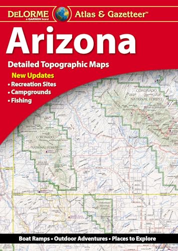
Delorme Atlas & Gazetteer: Arizona
Publicado por Delorme Mapping Company 2023-11-01, 2023
ISBN 10: 1946494771ISBN 13: 9781946494771
Libro
sheet map. Condición: New. Language: ENG.
Más opciones de compra de otros vendedores en IberLibro
Nuevo desde EUR 28,36
-
![Imagen del vendedor de Rand, McNally & Co.'s New Guide to the Pacific Coast: Santa Fe Route : California, Arizona, New . [LeatherBound] a la venta por True World of Books](https://pictures.abebooks.com/inventory/md/md31533708126.jpg)
Rand, McNally & Co.'s New Guide to the Pacific Coast: Santa Fe Route : California, Arizona, New . [LeatherBound]
Ańo de publicación: 2023
Libro Impresión bajo demanda
LeatherBound. Condición: New. LeatherBound edition. Condition: New. Reprinted from 1890 edition. Leather Binding on Spine and Corners with Golden leaf printing on spine. Bound in genuine leather with Satin ribbon page markers and Spine with raised gilt bands. A perfect gift for your loved ones. NO changes have been made to the original text. This is NOT a retyped or an ocr'd reprint. Illustrations, Index, if any, are included in black and white. Each page is checked manually before printing. As this print on demand book is reprinted from a very old book, there could be some missing or flawed pages, but we always try to make the book as complete as possible. Fold-outs, if any, are not part of the book. If the original book was published in multiple volumes then this reprint is of only one volume, not the whole set. Sewing binding for longer life, where the book block is actually sewn (smythe sewn/section sewn) with thread before binding which results in a more durable type of binding. Pages: 227 Language: English.
-
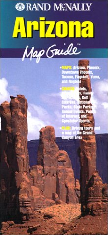
Rand McNally Arizona Map Guide
Publicado por Rand McNally, 1999
ISBN 10: 0528946226ISBN 13: 9780528946226
Librería: Robinson Street Books, IOBA, Binghamton, NY, Estados Unidos de America
Miembro de asociación: IOBA
Valoración del vendedor:
Mapa
Map. Condición: Very Good. Prompt shipment, with tracking. we ship in CLEAN SECURE BOXES NEW BOXES Fold out map. Very good.
-
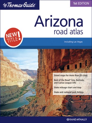
The Thomas Guide Arizona Road Atlas: Including Las Vegas
Publicado por Rand McNally, 2007
ISBN 10: 0528859374ISBN 13: 9780528859373
Librería: ThriftBooks-Dallas, Dallas, TX, Estados Unidos de America
Valoración del vendedor:
Libro
Paperback. Condición: Good. No Jacket. Pages can have notes/highlighting. Spine may show signs of wear. ~ ThriftBooks: Read More, Spend Less 1.7.
Más opciones de compra de otros vendedores en IberLibro
Nuevo desde EUR 236,94
Usado desde EUR 37,48
Encuentre también Tapa blanda
-
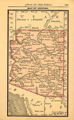
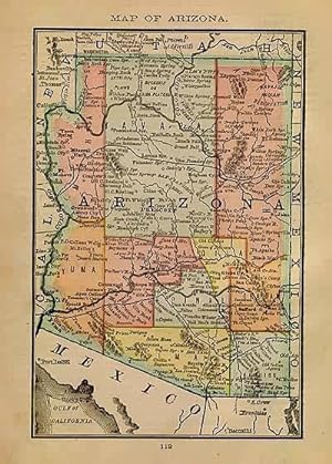
Map of Arizona
Ańo de publicación: 1885
Librería: Art Source International Inc., Boulder, CO, Estados Unidos de America
Valoración del vendedor:

With the 19th century innovations of publishing and technology, the world became a smaller place and one which anyone could become acquainted with. As these changes blossomed, the fledgling company of Rand McNally realized the interest in small accessible material, and produced a pocket atlas. These maps carry handy reference information, and were up to date for the period. They include cities, some towns as well as some roads. They have their own charm and would be great for framing, and decorative use. This map measures 5 inches by 3 inches.
-
MAP: "Arizona".from the New Indexed Atlas of the World
Publicado por Rand McNally & Co, Chicago, IL, 1887
Librería: Dorley House Books, Inc., Hagerstown, MD, Estados Unidos de America
Valoración del vendedor:
Original o primera edición
Unbound. Condición: Very Good. Handcolored Map Ilustrador. 1st. very nice w/decorative border; suitable for framing [2 scans=full image] Size: 20.5" x 11.25".
-
Map of Arizona
Ańo de publicación: 1884
Librería: Art Source International Inc., Boulder, CO, Estados Unidos de America
Valoración del vendedor:
This handsome map of Arizona , combines some of the best features of Rand McNally's accuracy, simplicity and attractive presentation, all in a smaller format. With the benefit of the latest information of the time, this map details of towns, cities, railroads and boundaries of this area, and would rival many larger publications. Condition of this map is good, with bold printed color. An uncommon map. This map measures 6.75 inches by 4.5 inches.
-
Map of Arizona
Ańo de publicación: 1887
Librería: Art Source International Inc., Boulder, CO, Estados Unidos de America
Valoración del vendedor:
With the 19th century innovations of publishing and technology, the world became a smaller place and one which anyone could become acquainted with. As these changes blossomed, the fledgling company of Rand McNally realized the interest in small accessible material, and produced a pocket atlas. These maps carry handy reference information, and were up to date for the period. They include cities, some towns as well as some roads. They have their own charm and would be great for framing, and decorative use. This map measures 5 inches by 3 inches.
-
Rand McNally Junior Auto Road Map of Arizona and New Mexico
Ańo de publicación: 1932
Librería: Art Source International Inc., Boulder, CO, Estados Unidos de America
Valoración del vendedor:
Rand McNally & Company, still a major name in map publishing to this day, began as a small print shop opened in Chicago in 1856 by William H. Rand. The shop originally printed guidebooks and directories. In 1858, Rand hired Andrew McNally who was later to become a partner. Within the next few years, the shop got into the railroad business by starting to print railway tickets and schedules, a key step in the development of the company. The ticket printing led to the publishing of railway guides, and by 1872 Rand McNally and Company had the capacity to publish maps. This map of Arizona and New Mexico came from Rand McNallys Commercial Atlas. A highly successful run of atlases that lasted over a decade. These maps were primarily used by business, because of their accurate listing of railroads in operation as well as tables of statistical information. This map is unique in several ways, their large format makes an impressive display, and offers additional room where many small towns and extra details are included. Additionally a list of every railroad operating in the state in 1932 is included. All railroad routes are shown on the map. This map includes all cities and towns, lakes, rivers, and bodies of water. All topographical features are also included as well as political features such as counties and Native American Indian reservations. This map measures 11 inches by 17 inches.
-
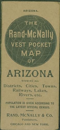
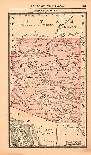
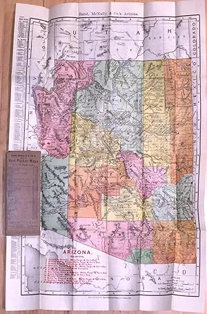
The Rand-McNally Vest Pocket Map of Arizona Showing All Districts, Cities, Towns, Railways, Lakes, Rivers, etc.
Publicado por Rand, McNally & Co, 1909
ISBN 10: 2811055614ISBN 13: 9782811055615
Librería: Eureka Books, Eureka, CA, Estados Unidos de America
Valoración del vendedor:
Libro
Trade Paperback. Map 12.25 X 19 inches on sheet 13.75 x 21.25 inches. Printed in yellow, pink, green, red, black and orange on white. Railroads identified by number in red. Very good copy in brown thick paper wrappers (paperback). Map has been folded to fit 'Vest Pocket,' 2.5 x 5.6 inches. Some tears at folds.
-
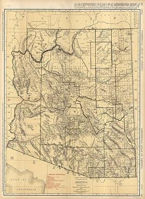
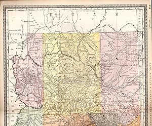
Standard Map of Arizona
Ańo de publicación: 1936
Librería: Art Source International Inc., Boulder, CO, Estados Unidos de America
Valoración del vendedor:
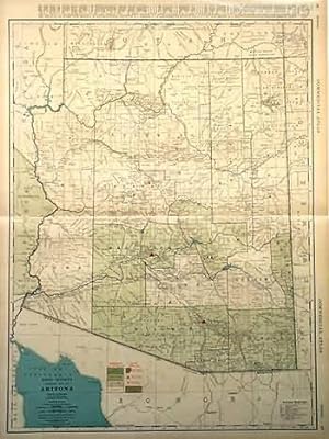
The 1936, sixty-seventh edition of the "Rand McNally Commercial Atlas and Marketing Guide" is unique in its inclusion of informative details concerning population sizes, district uses, the size of counties, and railroad routes. Cities and their populations are listed beside the map. Each map is brightly colored; predominantly in green and tan with blue oceans, lakes and rivers, and brown coloring of high density metropolitan areas. Arizona is illustrated on this large, double page map. The names of states, counties, important towns, lakes, rivers and mountain ranges are labeled. This map measures 26.5 inches by 19 inches.
-
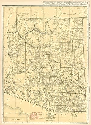
Rand McNally Standard Map of Arizona
Ańo de publicación: 1930
Librería: Art Source International Inc., Boulder, CO, Estados Unidos de America
Valoración del vendedor:
Original o primera edición
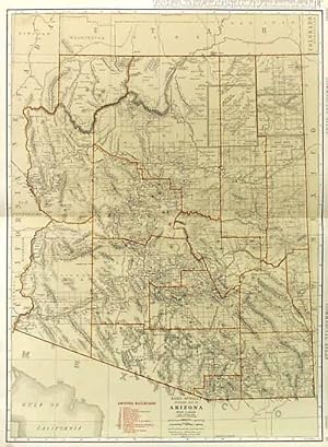
Rand McNally & Company, still a major name in map publishing to this day, began as a small print shop opened in Chicago in 1856 by William H. Rand. The shop originally printed guidebooks and directories. In 1858, Rand hired Andrew McNally who was later to become a partner. Within the next few years, the shop got into the railroad business by starting to print railway tickets and schedules, a key step in the development of the company. The ticket printing led to the publishing of railway guides, and by 1872 Rand McNally and Company had the capacity to publish maps. This map of Arizona came from Rand McNallys Commercial Atlas, sixty-first Edition dated 1930. A highly successful run of atlases that lasted over a decade. These maps were primarily used by business, because of their accurate listing of railroads in operation as well as tables of statistical information. This map is unique in several ways, their large format makes an impressive display, and offers additional room where many small towns and extra details are included. Additionally a list of every railroad operating in the state in 1930 is included. All railroad routes are shown on the map. This map includes all cities and towns, lakes, rivers, and bodies of water. All topographical features are also included as well as political features such as counties and Native American Indian reservations. This map measures 26 inches by 19 inches.
-
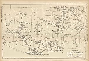
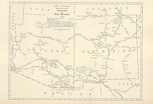
McNally's 1922 Mileage Map of Arizona and New Mexico
Ańo de publicación: 1922
Librería: Art Source International Inc., Boulder, CO, Estados Unidos de America
Valoración del vendedor:
This map of Arizona and New Mexico was produced by Rand McNally and Co. as part of its Commercial Atlas of America. The detail shown on each map is exceptional because of the map size. These maps were intended to be used by business for shipping, etc. Roads, railroads, and rivers are clearly shown. There is more detail on these maps than any others during this time period.The size of the map is 19 x 12.5.
-
Vest Pocket Map of ARIZONA (1904)
Publicado por Rand McNally & Co, Chicago, 1904
Librería: Carydale Books, Rhinebeck, NY, Estados Unidos de America
Valoración del vendedor:
Original wraps. Condición: Very good +. 16mo folded ca. 2.5" x 5.5" , stiff paper wraps with light wear, age darkened, contents very good or better, but somewhat age darkened, folding map present and attached to back cover, map is very good or better but may have some small tears along folds or small holes at corners of folds, but without loss. Scarce early Rand McNally Pocket map.
-
Official Road Map California Nevada [and Arizona] - Attractive road map of California, Nevada, and Arizona from 1934.
Ańo de publicación: 1934
Librería: Curtis Wright Maps, Berwyn, IL, Estados Unidos de America
Miembro de asociación: ESA MWABA
Valoración del vendedor:
Condición: Very Good. With a clear economic incentive to get motorists on the roads, oil companies were major producers of road maps from the earliest days of the automobile. This example covering three western states - California, Nevada, and Arizona - was issued by General Petroleum, a division of Socony Vacuum and producer of Mobilegas. (The distinctive Pegasus icon can be seen in each corner and within the compass rose). The image highlights main routes in red, with lesser degrees of paved, unpaved, or dirt roads also shown according to the accompanying legend. Many points of interest are named, and a mileage chart of Pacific states and index to towns and cities are provided at the bottom of the sheet. The verso shows a similar outline of the state of Arizona, plus three strip maps showing the route of the Pacific Coast Highway between Vancouver, British Columbia to Agua Caliente, Mexico. Published in Chicago by Rand McNally in 1934. Sheet Width (in) 17.75 Sheet Height (in) 23.75 Condition Description The sheet is slightly toned from age and has a bit of discoloration around the outer edges. Light wear and creasing along originally issued fold lines.
-
McNally's 1922 Map of Arizona
Ańo de publicación: 1922
Librería: Art Source International Inc., Boulder, CO, Estados Unidos de America
Valoración del vendedor:
This map of Arizona was produced by Rand McNally and Co. as part of its Commercial Atlas of America. The detail shown on each map is exceptional because of the map size. These maps were intended to be used by business for shipping, etc. Roads, railroads, and rivers are clearly shown. There is more detail on these maps than any others during this time period. This map measures 25.5 inches by 19 inches.
-
McNally's 1928 Map of Arizona
Ańo de publicación: 1928
Librería: Art Source International Inc., Boulder, CO, Estados Unidos de America
Valoración del vendedor:
This map was produced by Rand McNally and Co. as part of its 1928 Commercial Atlas of America. These maps are some of our favorite maps because of the large size of each map sheet. The detail shown on each map is exceptional because of the map size. These maps were intended to be used by business for shipping and other uses. Roads, railroads, rivers, and buildings are clearly shown. There is more detail on these maps than any others during this time period. This map measures 28 inches by 20.5 inches.
-
McNally's 1928 Railroad Map of Arizona & New Mexico
Ańo de publicación: 1928
Librería: Art Source International Inc., Boulder, CO, Estados Unidos de America
Valoración del vendedor:
This map was produced by Rand McNally and Co. as part of its 1928 Commercial Atlas of America. These maps are some of our favorite maps because of the large size of each map sheet. The detail shown on each map is exceptional because of the map size. These maps were intended to be used by business for shipping and other uses. Roads, railroads, rivers, and buildings are clearly shown. There is more detail on these maps than any others during this time period. This map measures 8.25 inches by 11 inches.
-
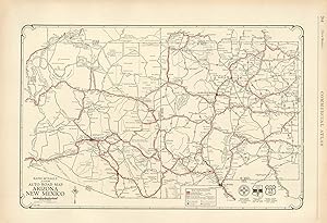
McNally's 1928 Auto Road Map of New Mexico and Arizona
Ańo de publicación: 1928
Librería: Art Source International Inc., Boulder, CO, Estados Unidos de America
Valoración del vendedor:
This map was produced by Rand McNally and Co. as part of its 1928 Commercial Atlas of America. These maps are some of our favorite maps because of the large size of each map sheet. The detail shown on each map is exceptional because of the map size. These maps were intended to be used by business for shipping and other uses. Roads, railroads, rivers, and buildings are clearly shown. There is more detail on these maps than any others during this time period. Without a doubt Rand McNally and Co. did the best job showing individual state maps dedicated to auto roads. This map measures 14 inches by 20.5 inches.
-
McNally's 1891 Map of Arizona
Ańo de publicación: 1891
Librería: Art Source International Inc., Boulder, CO, Estados Unidos de America
Valoración del vendedor:
Original o primera edición
We are proud to offer this map of Arizona, originally produced as part of Rand McNally's Enlarged Business Atlas dated 1891. Although the table of contents shows different editions starting in 1885, we believe this is the first edition of the Enlarged Atlas. Each of these maps accurately locates all cities, towns, post offices, railroad stations, villages, counties, parishes, islands, lakes, rivers, mountains and more. Until McNallyâ s enlarged Business Atlas, maps had never been produced that provided as much information as these do. Even today, we use these 130 year old maps to locate small towns, villages, and railroad routes that are no more. This map measures 19.75 inches by 13.25 inches.

![Imagen del vendedor de Official Road Map California Nevada [and Arizona] - Attractive road map of California, Nevada, and Arizona from 1934. a la venta por Curtis Wright Maps](https://pictures.abebooks.com/inventory/md/md31695376142.jpg)