
Importe total (1 artículo artículos):
Destino del pedido:

national geographic maps jan 2022 (67 resultados)
Ir a los resultados principales
Tipo de artículo
- Todo tipo de artículos
- Libros (44)
- Revistas y publicaciones
- Cómics
- Partituras
- Arte, grabados y pósters
- Fotografías
- Mapas (23)
-
Manuscritos y
coleccionismo de papel
Condición
- Todo
- Nuevos
- Antiguos o usados
Encuadernación
- Todo
- Tapa dura
- Tapa blanda
Más atributos
- Primera edición
- Firmado
- Sobrecubierta
- Con imágenes del vendedor (64)
- Sin impresión bajo demanda
Ubicación del vendedor
Valoración de los vendedores
-

Türkiye (Turkey) Map
Publicado por NATL GEOGRAPHIC MAPS Jan 2022, 2022
ISBN 10: 1566956110ISBN 13: 9781566956116
Librería: BuchWeltWeit Ludwig Meier e.K., Bergisch Gladbach, Alemania
Valoración del vendedor:

Libro
Karte. Condición: Neu. Neuware -AdventureMaps provide global travellers with the perfect combination of detail and perspective, highlighting hundreds of points of interest and the diverse and unique destinations within the country. Each map is printed on durable synthetic paper, making them waterproof and tear-resistant. They also include the locations of cities and towns with a user-friendly index, plus a clearly marked road network complete with distances and designations for major highways, main roads and tracks and trails for those seeking to explore more remote regions. 2 pp. Englisch.
Más opciones de compra de otros vendedores en IberLibro
Nuevo desde EUR 15,50
-

Zion National Park Map
Publicado por NATL GEOGRAPHIC MAPS Jan 2022, 2022
ISBN 10: 1566952972ISBN 13: 9781566952972
Librería: BuchWeltWeit Ludwig Meier e.K., Bergisch Gladbach, Alemania
Valoración del vendedor:
Libro
Karte. Condición: Neu. Neuware -National Geographic's Trails Illustrated Maps are the most detailed and up-to-date topographic recreation maps available for US National Parks, National Forests and other popular outdoor recreation areas. A necessity for exploring the outdoors, each map is printed on waterproof, tear-resistant material. They also contain key safety and contact information, GPS and compass coordinates, Leave No Trace ethical guidelines and hundreds of points-of-interest, including scenic viewpoints, campgrounds, boat launches, swimming areas, marine sanctuaries and wildlife refuges. 2 pp. Englisch.
Más opciones de compra de otros vendedores en IberLibro
Nuevo desde EUR 15,95
-

Southern France Map
Publicado por National Geographic Maps Jan 2022, 2022
ISBN 10: 1566956056ISBN 13: 9781566956055
Librería: BuchWeltWeit Ludwig Meier e.K., Bergisch Gladbach, Alemania
Valoración del vendedor:
Libro
Karte. Condición: Neu. Neuware -AdventureMaps provide global travellers with the perfect combination of detail and perspective, highlighting hundreds of points of interest and the diverse and unique destinations within the country. Each map is printed on durable synthetic paper, making them waterproof and tear-resistant. They also include the locations of cities and towns with a user-friendly index, plus a clearly marked road network complete with distances and designations for major highways, main roads and tracks and trails for those seeking to explore more remote regions. 2 pp. Englisch.
Más opciones de compra de otros vendedores en IberLibro
Nuevo desde EUR 15,95
-
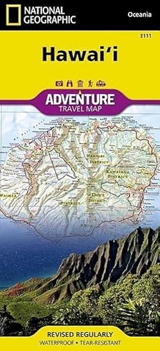
Hawaii Map
Publicado por NATL GEOGRAPHIC MAPS Jan 2022, 2022
ISBN 10: 156695651XISBN 13: 9781566956512
Librería: BuchWeltWeit Ludwig Meier e.K., Bergisch Gladbach, Alemania
Valoración del vendedor:
Libro
Karte. Condición: Neu. Neuware -AdventureMaps provide global travellers with the perfect combination of detail and perspective, highlighting hundreds of points of interest and the diverse and unique destinations within the country. Each map is printed on durable synthetic paper, making them waterproof and tear-resistant. They also include the locations of cities and towns with a user-friendly index, plus a clearly marked road network complete with distances and designations for major highways, main roads and tracks and trails for those seeking to explore more remote regions. 2 pp. Englisch.
Más opciones de compra de otros vendedores en IberLibro
Nuevo desde EUR 15,95
-
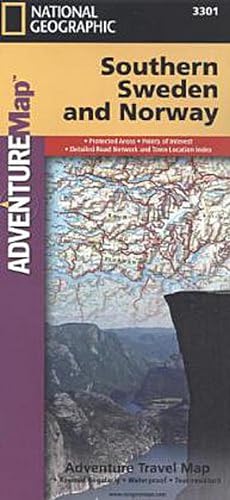
Southern Sweden and Norway Map
Publicado por National Geographic Maps Jan 2022, 2022
ISBN 10: 1566955335ISBN 13: 9781566955331
Librería: BuchWeltWeit Ludwig Meier e.K., Bergisch Gladbach, Alemania
Valoración del vendedor:
Libro
Karte. Condición: Neu. Neuware -AdventureMaps provide global travellers with the perfect combination of detail and perspective, highlighting hundreds of points of interest and the diverse and unique destinations within the country. Each map is printed on durable synthetic paper, making them waterproof and tear-resistant. They also include the locations of cities and towns with a user-friendly index, plus a clearly marked road network complete with distances and designations for major highways, main roads and tracks and trails for those seeking to explore more remote regions. 2 pp. Englisch.
Más opciones de compra de otros vendedores en IberLibro
Nuevo desde EUR 15,95
-
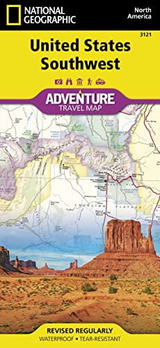
United States, Southwest Map
Publicado por National Geographic Maps Jan 2022, 2022
ISBN 10: 156695715XISBN 13: 9781566957151
Librería: Rheinberg-Buch Andreas Meier eK, Bergisch Gladbach, Alemania
Valoración del vendedor:

Libro
Karte. Condición: Neu. Neuware -- Waterproof - Tear-Resistant - Travel Map 2 pp. Englisch.
Más opciones de compra de otros vendedores en IberLibro
Nuevo desde EUR 15,95
-
![Imagen del vendedor de Sicily Map [Italy] a la venta por Rheinberg-Buch Andreas Meier eK](https://pictures.abebooks.com/inventory/md/md31814017034.jpg)
Sicily Map [Italy]
Publicado por NATL GEOGRAPHIC MAPS Jan 2022, 2022
ISBN 10: 1566955424ISBN 13: 9781566955423
Librería: Rheinberg-Buch Andreas Meier eK, Bergisch Gladbach, Alemania
Valoración del vendedor:
Libro
Karte. Condición: Neu. Neuware -AdventureMaps provide global travellers with the perfect combination of detail and perspective, highlighting hundreds of points of interest and the diverse and unique destinations within the country. Each map is printed on durable synthetic paper, making them waterproof and tear-resistant. They also include the locations of cities and towns with a user-friendly index, plus a clearly marked road network complete with distances and designations for major highways, main roads and tracks and trails for those seeking to explore more remote regions. 2 pp. Englisch.
Más opciones de compra de otros vendedores en IberLibro
Nuevo desde EUR 15,95
-
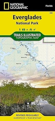
Everglades National Park Map
Publicado por National Geographic Maps Jan 2022, 2022
ISBN 10: 1566954096ISBN 13: 9781566954099
Librería: BuchWeltWeit Ludwig Meier e.K., Bergisch Gladbach, Alemania
Valoración del vendedor:
Libro
Karte. Condición: Neu. Neuware -This Trails Illustrated topographic map for Everglades National Park and surrounding area is the perfect map for hiking, boating, paddling, biking, fishing, exploring, camping, and sightseeing in this unique national treasure. This two-sided map includes the Key Largo, Everglades City, Chokoloskee, Everglades National Park, portions of Big Cypress National Preserve, Fakahatchee Strand State Preserve, Cape Romano Ten Thousand Islands Aquatic Preserve, Shark Valley Tram Road, Old Ingraham highway and campsite, North Nest Key, West Lake Canoe Trail, Snake Bight Trail, backcountry campsites, beach sites, ground sites, and chickees, and detailed insets of Flamingo, Whitewater Bay, Pineland Trails of the Long Pine Key area, and Nine Mile Pond. The map also shows the entire Wilderness Waterway, from the Gulf Coast Visitor Center near Everglades City to its terminus beyond the Flamingo Visitor Center. Includes UTM grids for use with your GPS unit. 2 pp. Englisch.
Más opciones de compra de otros vendedores en IberLibro
Nuevo desde EUR 16,00
-
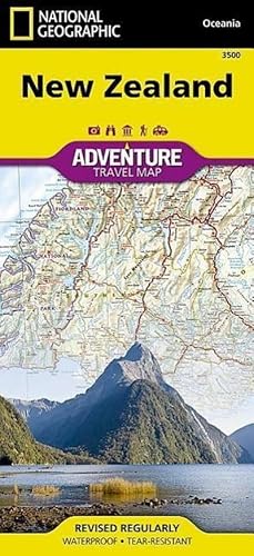
New Zealand Map
Publicado por National Geographic Maps Jan 2022, 2022
ISBN 10: 1566955491ISBN 13: 9781566955492
Librería: BuchWeltWeit Ludwig Meier e.K., Bergisch Gladbach, Alemania
Valoración del vendedor:
Libro
Karte. Condición: Neu. Neuware -AdventureMaps provide global travellers with the perfect combination of detail and perspective. The north side of the map details New Zealand's north island including Auckland, Wellington, Hauraki Gulf Maritime Park, Egmont National Park, Te Urewera National Park slands. The south side covers the south island and details places including Marlborough Sounds Maritime Park, Christ Church, Fiordland National Park, and Stewart Island. Six inset maps provide locations for islands off the coast of New Zealand, providing coverage for the entire country. 2 pp. Englisch.
Más opciones de compra de otros vendedores en IberLibro
Nuevo desde EUR 16,95
-

Slovenia Map
Publicado por National Geographic Maps Jan 2022, 2022
ISBN 10: 1566955432ISBN 13: 9781566955430
Librería: BuchWeltWeit Ludwig Meier e.K., Bergisch Gladbach, Alemania
Valoración del vendedor:
Libro
Karte. Condición: Neu. Neuware -AdventureMaps provide global travellers with the perfect combination of detail and perspective, highlighting hundreds of points of interest and the diverse and unique destinations within the country. Each map is printed on durable synthetic paper, making them waterproof and tear-resistant. They also include the locations of cities and towns with a user-friendly index, plus a clearly marked road network complete with distances and designations for major highways, main roads and tracks and trails for those seeking to explore more remote regions. 2 pp. Englisch.
Más opciones de compra de otros vendedores en IberLibro
Nuevo desde EUR 16,95
-
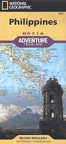
Philippines Map
Publicado por NATL GEOGRAPHIC MAPS Jan 2022, 2022
ISBN 10: 1566956153ISBN 13: 9781566956154
Librería: BuchWeltWeit Ludwig Meier e.K., Bergisch Gladbach, Alemania
Valoración del vendedor:
Libro
Karte. Condición: Neu. Neuware -AdventureMaps provide global travellers with the perfect combination of detail and perspective, highlighting hundreds of points of interest and the diverse and unique destinations within the country. Each map is printed on durable synthetic paper, making them waterproof and tear-resistant. They also include the locations of cities and towns with a user-friendly index, plus a clearly marked road network complete with distances and designations for major highways, main roads and tracks and trails for those seeking to explore more remote regions. 2 pp. Englisch.
Más opciones de compra de otros vendedores en IberLibro
Nuevo desde EUR 16,95
-

Yellowstone National Park Map
Publicado por National Geographic Maps Jan 2022, 2022
ISBN 10: 1566952956ISBN 13: 9781566952958
Librería: BuchWeltWeit Ludwig Meier e.K., Bergisch Gladbach, Alemania
Valoración del vendedor:
Libro
Karte. Condición: Neu. Neuware -Trails Illustrated topographic maps are the most detailed and up-to-date recreation maps available for these national parks, national forests and popular outdoor recreation areas. Detailed and accurate coverage for Yellowstone National Park, this map includes a detailed road network and popular trails, complete with use restrictions, mileages, elevation gains, and difficulty ratings. Popular attractions and park services are clearly identified. UTM and Latitude/Longitude grids ensure ease of use with GPS or compass navigation. 2 pp. Englisch.
Más opciones de compra de otros vendedores en IberLibro
Nuevo desde EUR 16,95
-
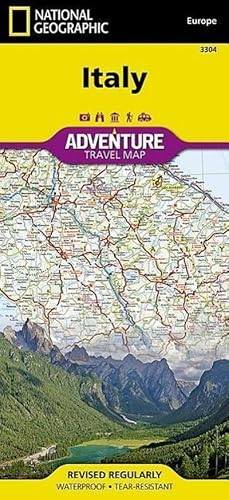
Italy Map
Publicado por NATL GEOGRAPHIC MAPS Jan 2022, 2022
ISBN 10: 156695536XISBN 13: 9781566955362
Librería: BuchWeltWeit Ludwig Meier e.K., Bergisch Gladbach, Alemania
Valoración del vendedor:
Libro
Karte. Condición: Neu. Neuware -AdventureMaps provide global travellers with the perfect combination of detail and perspective. The front side of the Italy map shows the northern half of the country from its borders with France, Switzerland, Austria, and Slovenia to its capital, Rome, and includes provinces such as Aosta Valley, Piedmont, Lombardy, Veneto, Tuscany, Lazio, Abruzzo, and Molise. The southern half of the country including the Mediterranean islands of Sicily and Sardinia, and the provinces of Campania, Apulia, Basilicata, and Calabria are covered on the reverse side of the map. 2 pp. Englisch.
Más opciones de compra de otros vendedores en IberLibro
Nuevo desde EUR 16,95
-
![Imagen del vendedor de Tuscany Map [Italy] a la venta por BuchWeltWeit Ludwig Meier e.K.](https://pictures.abebooks.com/inventory/md/md31503654102.jpg)
Tuscany Map [Italy]
Publicado por NATL GEOGRAPHIC MAPS Jan 2022, 2022
ISBN 10: 1566955378ISBN 13: 9781566955379
Librería: BuchWeltWeit Ludwig Meier e.K., Bergisch Gladbach, Alemania
Valoración del vendedor:
Libro
Karte. Condición: Neu. Neuware -AdventureMaps provide global travellers with the perfect combination of detail and perspective, highlighting hundreds of points of interest and the diverse and unique destinations within the country. Each map is printed on durable synthetic paper, making them waterproof and tear-resistant. They also include the locations of cities and towns with a user-friendly index, plus a clearly marked road network complete with distances and designations for major highways, main roads and tracks and trails for those seeking to explore more remote regions. 2 pp. Englisch.
Más opciones de compra de otros vendedores en IberLibro
Nuevo desde EUR 16,95
-
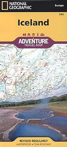
Iceland Map
Publicado por National Geographic Maps Jan 2022, 2022
ISBN 10: 1566955343ISBN 13: 9781566955348
Librería: BuchWeltWeit Ludwig Meier e.K., Bergisch Gladbach, Alemania
Valoración del vendedor:
Libro
Karte. Condición: Neu. Neuware -AdventureMaps provide global travellers with the perfect combination of detail and perspective. Iceland's western half is shown on the front side of the map including the cities of Reykjavik, Kpavogur, Mossfellsbaer, and Siglufj rdur. The reverse side covers the eastern portion of the country showing the cities of Akureyri, Egilsstadir, Eskifj rdur, Neskaupstadur, Hsavik, and H fn. Popular locations to ski, golf, camp, fish, and swim are marked, as are World Heritage sites, museums, churches, and other points of interest. 2 pp. Englisch.
Más opciones de compra de otros vendedores en IberLibro
Nuevo desde EUR 16,95
-
![Imagen del vendedor de Everest Base Camp Map [Nepal] a la venta por Rheinberg-Buch Andreas Meier eK](https://pictures.abebooks.com/inventory/md/md31824927220.jpg)
Everest Base Camp Map [Nepal]
Publicado por National Geographic Maps Jan 2022, 2022
ISBN 10: 156695519XISBN 13: 9781566955195
Librería: Rheinberg-Buch Andreas Meier eK, Bergisch Gladbach, Alemania
Valoración del vendedor:
Libro
Karte. Condición: Neu. Neuware -AdventureMaps provide global travellers with the perfect combination of detail and perspective, highlighting hundreds of points of interest and the diverse and unique destinations within the country. Each map is printed on durable synthetic paper, making them waterproof and tear-resistant. This Everest Base Camp map features a Trails Illustrated folded topographic map with trekking routes from Lukla to Everest Base Camp, Sagarmatha National Park. A full map of Nepal and detail map of Kathmandu is on the reverse side. 2 pp. Englisch.
Más opciones de compra de otros vendedores en IberLibro
Nuevo desde EUR 16,95
-
![Imagen del vendedor de Appalachian Trail: Mount Carlo to Pleasant Pond Map [Maine] a la venta por Rheinberg-Buch Andreas Meier eK](https://pictures.abebooks.com/inventory/md/md31786250219.jpg)
Appalachian Trail: Mount Carlo to Pleasant Pond Map [Maine]
Publicado por NATL GEOGRAPHIC MAPS Jan 2022, 2022
ISBN 10: 1597756490ISBN 13: 9781597756495
Librería: Rheinberg-Buch Andreas Meier eK, Bergisch Gladbach, Alemania
Valoración del vendedor:
Libro
Karte. Condición: Neu. Neuware -Waterproof, tear-resistant topographic map guide. The Mount Carlo to Pleasant Pond Topographic Map Guide makes a perfect traveling companion when traversing the southern Maine section of the Appalachian Trail. Each A.T. Topographic Map Guide includes detailed topographic maps at a detail of 1 inch equals 1 mile. Each page is centered on the A.T. and overlaps with the adjacent pages so there is little chance of getting lost. Along the bottom of each page is a trail profile that shows the distance between shelters, camping areas, and trail access points. 40 pp. Englisch.
Más opciones de compra de otros vendedores en IberLibro
Nuevo desde EUR 16,95
-
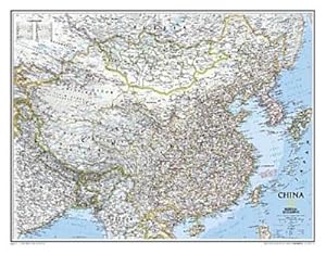
National Geographic China Wall Map - Classic (30.25 X 23.5 In)
Publicado por NATL GEOGRAPHIC MAPS Jan 2022, 2022
ISBN 10: 0792249615ISBN 13: 9780792249610
Librería: BuchWeltWeit Ludwig Meier e.K., Bergisch Gladbach, Alemania
Valoración del vendedor:
Libro
Karte. Condición: Neu. Neuware -National Geographic Wall Maps offer a special glimpse into current and historical events, and they inform about the world and environment. Offered in a variety of styles and formats, these maps are excellent reference tools and a perfect addition to any home, business or school. There are a variety of map options to choose from, including the world, continents, countries and regions, the United States, history, nature and space. 1 pp. Englisch.
Más opciones de compra de otros vendedores en IberLibro
Nuevo desde EUR 21,90
-
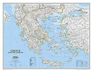
National Geographic Greece Wall Map - Classic (30.25 X 23.5 In)
Publicado por National Geographic Maps Jan 2022, 2022
ISBN 10: 0792249690ISBN 13: 9780792249696
Librería: BuchWeltWeit Ludwig Meier e.K., Bergisch Gladbach, Alemania
Valoración del vendedor:
Libro
Karte. Condición: Neu. Neuware -National Geographic Wall Maps offer a special glimpse into current and historical events, and they inform about the world and environment. Offered in a variety of styles and formats, these maps are excellent reference tools and a perfect addition to any home, business or school. There are a variety of map options to choose from, including the world, continents, countries and regions, the United States, history, nature and space. Englisch.
Más opciones de compra de otros vendedores en IberLibro
Nuevo desde EUR 21,90
-
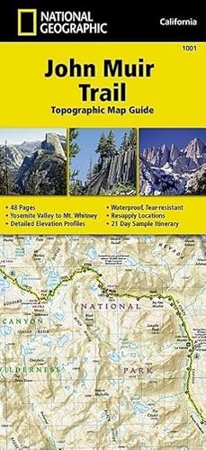
John Muir Trail Map
Publicado por National Geographic Maps Jan 2022, 2022
ISBN 10: 1566956897ISBN 13: 9781566956895
Libro
Karte. Condición: Neu. Neuware - National Geographic's Map Guide of the John Muir Trail is an indispensable tool for navigating one of the most famous trails in the United States. The maps start at the northern terminus in Yosemite Valley and progress along the ridge of the Sierra Nevada, past Devils Postpile, and end at the highest point in the lower 48 on the top of Mount Whitney. Along the way you will pass through; Yosemite National Park, Ansel Adams Wilderness, Devils Postpile National Monument, John Muir Wilderness, Kings Canyon National Park, and finally, Sequoia National Park & Mt Whitney.
-

Peru Map
Publicado por National Geographic Maps Jan 2022, 2022
ISBN 10: 1566955483ISBN 13: 9781566955485
Mapa
Karte. Condición: Neu. Neuware - AdventureMaps provide global travellers with the perfect combination of detail and perspective. The front side of this map shows the northern half of Peru, spanning from Peru's borders with Ecuador and Colombia on the north and Brazil on the east, down to the coastal city of Chimbote, covering the regions such as Loreto, Amazonas, La Libertad, and Ucayali. Many other regions, such as Tacna, Madre de Dios, Lima and Apurmac are included on the reverse. Provincial and political borders are clearly and accurate marked with coloured boundaries, as are the borders of national parks.
-
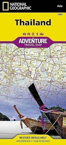
Thailand Map
Publicado por NATL GEOGRAPHIC MAPS Jan 2022, 2022
ISBN 10: 1566955262ISBN 13: 9781566955263
Mapa
Karte. Condición: Neu. Neuware - This Adventure Map highlights the diverse, unique, and exotic destinations within Thailand including national parks, , archaeological sites, scenic viewpoints, Buddhist temples, mosques, and monuments. The front side of the map shows the northern half of the country, extending to the capital city of Bangkok. Border crossings and many sites of interest in the neighbouring countries of Laos, Myanmar (Burma), and Cambodia, are noted. The reverse features the southern provinces located on the Malay Peninsula, a region popular for rock climbing, diving and snorkelling.
-
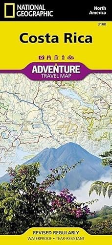
Costa Rica Map
Publicado por National Geographic Maps Jan 2022, 2022
ISBN 10: 1566953146ISBN 13: 9781566953146
Mapa
Karte. Condición: Neu. Neuware - AdventureMaps provide global travellers with the perfect combination of detail and perspective, highlighting hundreds of points of interest and the diverse and unique destinations within the country. Each map is printed on durable synthetic paper, making them waterproof and tear-resistant. This Costa Rica map contains detailed topographic information, plus useful traveling tips, regional information, and an inset map of the capital city of San Jos. Also includes the locations of popular diving, fishing, and surfing spots, plus comprehensive protected area boundaries and roads.
-
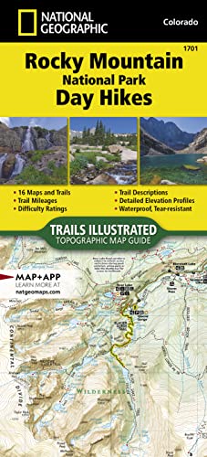
Rocky Mountain National Park Day Hikes Map
Publicado por National Geographic Maps Jan 2022, 2022
ISBN 10: 1566958008ISBN 13: 9781566958004
Libro
Karte. Condición: Neu. Neuware - - Waterproof - Tear-Resistant - Topographic Map.
-
![Imagen del vendedor de Canada [Map Pack Bundle] a la venta por BuchWeltWeit Ludwig Meier e.K.](https://pictures.abebooks.com/inventory/md/md31826110906.jpg)
Canada [Map Pack Bundle]
Publicado por National Geographic Maps Jan 2022, 2022
ISBN 10: 1597756032ISBN 13: 9781597756037
Librería: BuchWeltWeit Ludwig Meier e.K., Bergisch Gladbach, Alemania
Valoración del vendedor:
Libro
Karte. Condición: Neu. Neuware -- Waterproof - Tear-Resistant - Travel Map 6 pp. Englisch.
Más opciones de compra de otros vendedores en IberLibro
Nuevo desde EUR 35,50