Importe total (1 artículo artículos):
Destino del pedido:

vilhjalmur stefansson editor (12 resultados)
Ir a los resultados principales
Tipo de artículo
- Todo tipo de artículos
- Libros (12)
- Revistas y publicaciones
- Cómics
- Partituras
- Arte, grabados y pósters
- Fotografías
- Mapas
-
Manuscritos y
coleccionismo de papel
Condición
- Todo
- Nuevos
- Antiguos o usados
Encuadernación
Más atributos
- Primera edición (6)
- Firmado (1)
- Sobrecubierta (5)
- Con imágenes del vendedor (6)
- Sin impresión bajo demanda
Ubicación del vendedor
Valoración de los vendedores
-

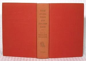
Great Adventures And Explorations - From Earliest Times To The Present As Told By The Exploreres Themselves
Publicado por The Dial Press
Librería: ThriftBooks-Atlanta, AUSTELL, GA, Estados Unidos de America
Valoración del vendedor:

Hardcover. Condición: Fair. No Jacket. Missing dust jacket; Readable copy. Pages may have considerable notes/highlighting. ~ ThriftBooks: Read More, Spend Less 2.05.
-
Great Adventures and Explorations - From the Earliest Times to the Present as Told By The Explorers Themselves
Publicado por The Dial Press, New York, 1952
Librería: you little dickens, Milwaukie, OR, Estados Unidos de America
Valoración del vendedor:
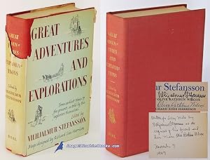
Hardcover. Condición: Very Good. Richard Edes Harrison - maps Ilustrador. "NEW EDITION 1952 (original was 1947)." Red boards lightly bumped. Spine faded. Clean unmarked pages. VERY GOOD+.
-
Great Adventures and Explorations
Publicado por Dial Press, New York, 1952
Librería: Canal Bookyard, Upper Black Eddy, PA, Estados Unidos de America
Valoración del vendedor:
Libro
Hardcover. Condición: Good. Estado de la sobrecubierta: Good. Gold titles on light red cloth, 788 pages including index and illustrated with a number of world maps showing explorations.This is the revised edition of material originally published in 1947. Some discoloration on inside of the back of the dust jacket.
-
Great Adventures and Explorations From the Earliest Times to the Present as Told By the Explorers Themselves
Publicado por The Dial Press, New York, 1952
Librería: 4 THE WORLD RESOURCE DISTRIBUTORS, Springfield, MO, Estados Unidos de America
Valoración del vendedor:
Original o primera edición
Hard Cover. Condición: Good. Estado de la sobrecubierta: Good. New Revised Edition Size: 8vo - over 7ľ" - 9ľ" tall.
-
Great Adventures and Explorations
Publicado por Dial Press, NY, 1952
Librería: Ken's Book Haven, Coopersburg, PA, Estados Unidos de America
Valoración del vendedor:
hardbound. Condición: NF/VG DJ. None Ilustrador. Revised Ed.
-
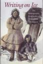
Writing on Ice - The Ethnographic Notebooks of Vilhjalmur Stefansson
Publicado por University Press of New England, Hanover, 2001
ISBN 10: 1584651199ISBN 13: 9781584651192
Librería: Monroe Street Books, Middlebury, VT, Estados Unidos de America
Valoración del vendedor:

Libro
Condición: Very Good. Estado de la sobrecubierta: Very Good. 351 pages. Grey cloth boards with white titles to black cloth spine. 15 pages of full page, full color illustrations & additional photos in black & white throughout. Bright dust jacket with only light marginal wear. Clean, unmarked copy. Record # 750919.
-
Great Adventures and Explorations; From the Earliest Times to the Present, as told by the Explorers Themselves
Publicado por The Dial Press, New York, 1947
Librería: Ground Zero Books, Ltd., Silver Spring, MD, Estados Unidos de America
Valoración del vendedor:
Original o primera edición
Hardcover. Condición: Good. Richard Edes Harrison (Maps) Ilustrador. Presumed First Edition, First printing. xii, 788 pages. Name and date in ink inside front cover. Cover has some wear and soiling. Slightly shaken. Some edge soiling. Illustrated endpapers. Includes Note on the Maps, Concerning the Use of Symbols in this Book. Maps. Introduction, Acknowledgments, and Index, as well as 18 chapters. Also includes 18 black and white illustrations, as well as a map of The Mediterranean Discovers the Arctic. The maps illustrating this book were designed primarily to place the various explorations in their proper world perspective. This was deemed more important to the reader than complete detail, some of which is necessarily sacrificed in the larger view. Accordingly, most of the maps are on the orthographic projection. This shows exactly a hemisphere, and proves a good visual impression of the globe. Vilhjalmur Stefansson (November 3, 1879 - August 26, 1962) was an Icelandic American Arctic explorer and ethnologist. Under the auspices of the American Museum of Natural History, New York, he and Dr. R. M. Anderson undertook the ethnological survey of the Central Arctic coasts of the shores of North America from 1908 to 1912. In 1908, Stefansson made a decision that would affect the rest of his time in Alaska: he hired the Inuk guide Natkusiak, who would remain with him as his primary guide for the rest of his Alaska expeditions. At the time he met Natkusiak, the Inuk guide was working for Capt. George B. Leavitt, a Massachusetts whaling ship captain and friend of Stefansson's who sometimes brought him replenishments of supplies from the American Museum of Natural History. Late in life, through his affiliation with Dartmouth College (he was Director of Polar Studies), he became a major figure in the establishment of the US Army's Cold Regions Research and Engineering Laboratory (CRREL) in Hanover, New Hampshire. CRREL-supported research, often conducted in winter on the forbidding summit of Mount Washington, was key to developing matériel and doctrine to support alpine conflict. Stefansson joined the Explorers Club in 1908, four years after its founding. He later served as Club President twice: 1919-1922 and 1937-1939. This book contains the great stories of explorations and tells them in the words of the discoverers themselves, their companions, or their contemporaries. The great tales which we are able to present are those of rediscovery. We can tell how the Greeks discovered the British Isles with the British already in them; how North Europeans discovered North America with the Indians there to meet them; how the Spaniards discovered the Pacific Ocean when the Chinese had already maintained on its shores a great empire through long ages; how modern navigators discovered islands a thousand miles from the nearest inhabited land to find living there the descendants of Stone Age navigators who had been the real discoverers. In our book you find some of history's big success stories, with merit finally and justly awarded, as in the case of the indomitable twenty-three-year struggle of Peary which led to his demonstrating that Greenland is an island, instead of being larger than Australia and thus a continent. This book, as the story of how man came to know his world, had endeavored to secure historical continuity by leading from one major narrative to the next through summaries of less important ones that belong in between, and by occasional passages of interpretations which seek to give the reader needed perspective. In a way, the book is an outline history of the world, told by its chief discoverers from Pytheas to Peary.
-
Harper's Magazine, July - December 1919, Volume CXXXIX (Vol. 139, July-Nov. 1919) + Volume CXL (Vol. 140, Dec. 1919)
Publicado por Harper & Brothers, New York, 1919
Librería: About Books, Henderson, NV, Estados Unidos de America
Valoración del vendedor:
Original o primera edición
Hardcover. Condición: Very Good condition. Estado de la sobrecubierta: No Dust Jacket. First Edition. New York: Harper & Brothers, 1919. Square, tight copy. NOT a library copy. No owner's name or bookplate. No underlining. No highlighting. No margin notes. Six consecutive monthly issues, bound together in sturdy brown cloth. Contains Vol. CXXXIX (5 issues, July-Nov 1919) + Vol. CXL (1 issue, Dec 1919). Includes: THROUGH GERMANY ON FOOT [parts I, II, III, IV] by Harry A. Franck; QUINCUNX, A POEM by Amy Lowell; SOLVING THE PROBLEM OF THE ARCTIC [parts IV, V, VI] by Vilhjalmur Stefansson; MY CAPTURE AND ESCAPE by Lieut. John O.W. Gilchrist; EASTERN NIGHTS AND FLIGHTS by Captain Alan Bott [parts I, II, III, IV]; BEULAH, A STORY by Alice Hegan Rice; I KNOW THE STARS by Sara Teasdale; THE REAL CONQUEST OF THE AIR by Buckner Speed; HOSTS AND GUESTS by Max Beerbohm; MARSHAL FOCH: AN INTIMATE PORTRAIT by Baron Andre De Maricourt; THE SECRET DOVE by Zona Gale; EIGHTY YEARS AND AFTER by W. D. Howells; WAR INVENTIONS THAT CAME TOO LATE by Frank Parker Stockbridge; Richard Le Gallienne; etc. . First Edition. Hard Cover. Very Good condition./No Dust Jacket. 8vo. 936pp. + 144pp. .
-
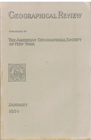
Geographical Review, January 1934. Vol. XXIV No. 1. Vol. 24. articles: Long Beach earthquake; A recent survey in Little Tibet (40 pages, several b/w illustrations and a large coloured map of the Eastern Karakoram); white settlement in Saba Island, Dutch West Indies; the population of the Malay Peninsula; Murray River basin; An Eskimo discovery of an island North of Alaska; Discovery of a new sketch of Cape Hudson in the Antarctic; Altitude and location of Minya Konka;
Publicado por The American Geographical Society of New York, New York, 1934
Libro Original o primera edición
Soft cover. Condición: Very Good. 1st Edition. p. 1- 176. Some articles: Long Beach earthquake; A recent survey in Little Tibet (40 pages, several b/w illustrations and a large coloured map of the Eastern Karakoram); white settlement in Saba Island, Dutch West Indies; the population of the Malay Peninsula; Murray River basin; An Eskimo discovery of an island North of Alaska; Discovery of a new sketch of Cape Hudson in the Antarctic; Altitude and location of Minya Konka; and other articles.
-
Great Adventures and Explorations: From the Earliest Times to the Present, as told by the Explorers Themselves
Publicado por The Dial Press, New York, 1947
Librería: Bluebird Books (RMABA, IOBA), Littleton, CO, Estados Unidos de America
Miembro de asociación: IOBA RMABA
Valoración del vendedor:
Original o primera edición
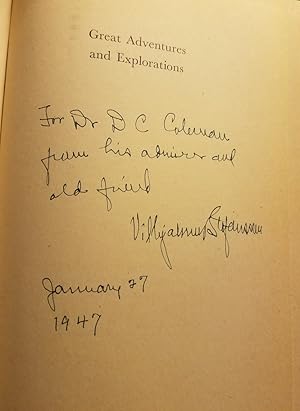
Hardcover. Condición: Very Good. Estado de la sobrecubierta: Fair. First Edition. Signed first edition. Notable explorations and expeditions in world history are detailed by editor Vilhjalmur Stefansson and his co-editor Olive Rathbun Wilcox, using the journals and writings of the explorers themselves. With black & white maps designed by Richard Edes Harrison, with his color maps of the northern and southern hemispheres to endpapers. Inscribed and signed on half title by Stefansson thus: "Written for (Siley Miles?) by / Vilhjalmur Stefansson at the / request of his friend and / her niece Olive Rathbun Wilcox / November 7 / 1947." Also signed on title page by both Stefansson and Wilcox. --- In full red cloth-covered boards with gilt-stamped spine titling. Wrapped in light green jacket with drawings of explorers to front panel. --- A tightly-bound, well-preserved copy, though with some age-toning to leaves. Fair-only jacket with large open tear at head of spine, other smaller chips and tears; wrapped in removable archival mylar protector.; Octavo - 8 to 9 in. tall; xii, 788 pages.
-
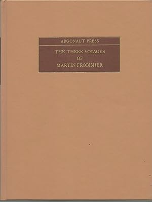
The Three Voyages of Martin Frobisher volume I-II
Publicado por N Israel/ Da Capo/ Argonaut Press, 1971
ISBN 10: 9060727126ISBN 13: 9789060727126
Libro
Hardcover. Condición: Fine. Argonaut Press. *** BOOK in fine condition, issued without dust jacket. This is the original two volumes published as one. Publisher's original fawn skivertex boards with gilt titles in dark brown panels on the spine and upper board. Top edge pale blue. This is a facsimile copy of the 1938 Argonaut Press work suffixed "In search of a passage to Cathay and India by the North-West, A.D. 1576-8. From the original 1578 text of George Best. Together with numerous other versions, Additions, etc. Now edited, with Preface, Introduction, Notes, Appendixes and Bibliography, . . . With the Collaboration of Eloise McCaskill, together with numerous maps and illustrations. cxxx (130) pages introduction, biography &c, then Volume I of 166 pages and Volume II of 293 pages, including 14 appendixes and index. Frontispiece, title page vignette, ( maps and illustrations - many of the maps are fold out and appear never to have been opened. Volume II has nine maps and illustrations. *** CONTENTS: This two volumes-in-one set describes the three voyages undertaken by Frobisher to Northern Canada to discover the North West Passage. Please note: this large and heavy book (packed weight just under 2kg) will be sent at default rates with the UK, and at Royal Mail rates and at Royal Mail rates overseas. Size: 255x200mm.
-
GREAT ADVENTURES AND EXPLORATIONS. From the Earliest Times to the Present, as Told by the Explorers
Publicado por The Dial Press, New York, 1947
Librería: Charles Agvent, est. 1987, ABAA, ILAB, Fleetwood, PA, Estados Unidos de America
Miembro de asociación: ABAA ILAB
Valoración del vendedor:
Original o primera edición Ejemplar firmado
Hardcover. First Edition. With the collaboration of Olive Rathbun Wilcox. Illustrated with maps designed by Richard Edes Harrison. INSCRIBED and SIGNED by Stefansson on the half-title page on 27 January 1947 "For Dr. D C Coleman/from his admirer and/old friend." Also SIGNED by Wilcox and Harrison by their printed names on the title page. Very Good, lacking the dustwrapper.