Importe total (1 artículo artículos):
Destino del pedido:

thames fishing map ravenstein e g (1 resultados)
Ir a los resultados principales
Tipo de artículo
- Todo tipo de artículos
- Libros (1)
- Revistas y publicaciones
- Cómics
- Partituras
- Arte, grabados y pósters
- Fotografías
- Mapas
-
Manuscritos y
coleccionismo de papel
Condición
- Todo
- Nuevos
- Antiguos o usados
Encuadernación
- Todo
- Tapa dura
- Tapa blanda
Más atributos
- Primera edición
- Firmado
- Sobrecubierta
- Con imágenes del vendedor
- Sin impresión bajo demanda
Ubicación del vendedor
Valoración de los vendedores
-
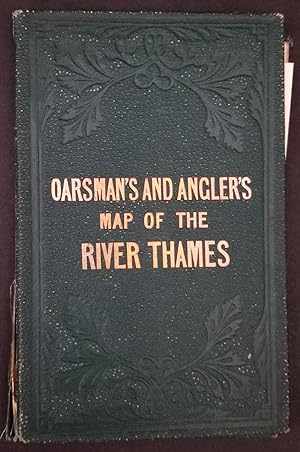
The Oarsman's and Angler's Map of the River Thames
Publicado por James Reynolds,174, Strand, London, 1881
Librería: Antipodean Books, Maps & Prints, ABAA, Garrison, NY, Estados Unidos de America
Miembro de asociación: ABAA ANZAAB ESA ILAB
Valoración del vendedor:

Condición: Very good overall. A long folding map of the Thames River, extending from Thames Head, down to the London Bridge, showing towns and villages along the river with historical and descriptive information, details of the locks and bridges, railroad lines near the river, toll charges and angling laws, the species of fish to be caught at each site, and a list describing fishing preserves, "as arranged by the Lord Mayor". One of the descriptions describes the beauty of the spot: "The Thames at Pangbourne has long been a favorite resort of the angler intent on perch fishing. The scenery in this neighbourhood is very beautiful; the hills are high and healthful, and command extensive views". Accompanied by the loosely inserted printed "Introductory Notes" sheet which describes boating, angling, the prohibition of netting, undersized fish, fence months and river keepers. Yellow paste down at front. Introductory notes sometimes appear pasted down to the front board, in this case loosely inserted. Dating is inconclusive, this map could be between 1870 and 1880. Original color on the river, the map backed onto linen, folds into original blind stamped green cloth covers, gilt title on upper cover. 95 x 6 in, folded in cover 4 1/4 x 6 3/4". Bookseller label of Murray, Frank, Bookseller, Moray House, Derby. Cloth slightly rubbed at spine, two inch closed split along spine and front board, otherwise bright. OCLC: 56771266.