Importe total (1 artículo artículos):
Destino del pedido:

paterson daniel edward mogg clement (1 resultados)
Ir a los resultados principales
Tipo de artículo
- Todo tipo de artículos
- Libros (1)
- Revistas y publicaciones
- Cómics
- Partituras
- Arte, grabados y pósters
- Fotografías
- Mapas
-
Manuscritos y
coleccionismo de papel
Condición
- Todo
- Nuevos
- Antiguos o usados
Encuadernación
- Todo
- Tapa dura
- Tapa blanda
Más atributos
- Primera edición
- Firmado
- Sobrecubierta
- Con imágenes del vendedor
- Sin impresión bajo demanda
Ubicación del vendedor
Valoración de los vendedores
-
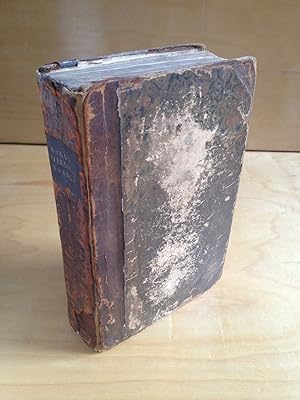
Paterson's Roads: Being an Entirely Original and Accurate Description of All the Direct and Principal Cross Roads in England and Wales, with Part of the Roads of Scotland
Publicado por Printed for C.J.G. and F. Rivington, q., London, 1828
Librería: DuBois Rare Books, New York, NY, Estados Unidos de America
Valoración del vendedor:

3/4 Calf Leather. Condición: Very Good. 18th Edition. pp. 6, *6, [7]-715. Appendix 1-44. Hardcover. Contemporary 3/4 Calf over marbled boards, title in gilt on black morocco spine label. Book Condition: Prior owners name label and Sutro Library Bookplate to front pastedown though there are no other library markings anywhere. Spine ends chipped with loss, covers cracked and worn, but very robust, no sign of starting hinges or the like. Lacking the large general map called for in front but complete with all others [as specified in Directions to the Binder page [6]]: The Holyhead Road Plate, to face page 179; The Other Plates to be Placed at the End of the Book in the Following Order: 1st. The Isle of Thanet, Plate I. 2nd: Route from Deal to Hythe, and from Hythe to Rye, Plates II and III. 3d. Route from Rye to Eastbourne, and from Eastbourne to Shoreham, Plates IV and V. 4th .Route from New Shoreham to Chichester, and from Chichester to Fareham. Plates VI and VII. 5th. The Country round Southampton, PLATE VIII. 6th. Isle of Wight. 7th. The Map of the Country comprehending the Lakes of Cumberland, Westmorland, and Lancashire. (for a total of 10 maps on 7 plates to be placed in the rear according to Directions to the Binder, plus two maps on two plates at the front and facing page 179). There is also a map called for facing the first page of the appendix: Map of the Banks of Wye, which is present and which brings the total maps called for to 13 maps on 10 plates. While this copy is lacking the 1st map called for at the beginning of the book, it is extra-illustrated with: 3 engravings depicting picturesque scenes along the way, each attached to the verso of a different map, a large folding "Railway Map of England and Wales 1838" with a 4 color manuscript map on tracing paper attached to the Railway Map's verso. The maps are all in VG condition or better with the exception of the final map in the rear of book ( The Map of the Country comprehending the Lakes of Cumberland, Westmorland, and Lancashire.) which has splitting and loss along one edge, and the extra Railway map which has splits along a few of the folds and one closed tear 2-3 inches in length. The hand-drawn manuscript map is in beautiful condition however. All in all a very satisfying copy.