
Importe total (1 artículo artículos):
Destino del pedido:

brooker janice knight judith (1 resultados)
Ir a los resultados principales
Tipo de artículo
- Todos los tipos de productos
- Libros
- Revistas y publicaciones
- Cómics
- Partituras
- Arte, grabados y pósters
- Fotografías
- Mapas (1)
- Manuscritos y coleccionismo de papel
Condición
- Todos los libros
- Nuevos (1)
- Antiguos o usados
Encuadernación
- Todas
- Tapa dura
- Tapa blanda
Más atributos
- Primera edición
- Firmado
- Sobrecubierta
- Con imágenes
- No impresión bajo demanda (1)
Gastos de envío gratis
- Gastos de Envío Gratis a EEUU
Ubicación del vendedor
Valoración de los vendedores
-
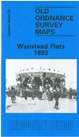
Wanstead Flats 1893: London Sheet 33.2 (Old Ordnance Survey Maps of London)
Publicado por Alan Godfrey Maps, 1986
ISBN 10: 0850540356ISBN 13: 9780850540352
Librería: GENERATIONS GONE BY, Manchester, Reino Unido
Valoración del vendedor:

Mapa
No Binding. Condición: New. No Jacket. Here are the details of maps for Wanstead Flats: London Sheet 33.2 Wanstead Flats 1893 - published 1986; intro by Janice Brooker. ISBN.978-0-85054-035-2 London Sheet 33.3 Wanstead Flats 1915 - published 1992; intro by Isobel Watson. ISBN.978-0-85054-510-4 We have published two versions of this map, showing how the area developed across the years. It covers an area stretching from Montague Road and Odessa Road eastward to Forest Drive; and from Woodlands Avenue southward to Cobbold Road and Chestnut Avenue. The map is centred on the broad open space of Wanstead Flats, but it also includes fringe streets of Leytonstone (the west side of the map) and Forest Gate (to the south). In the NE corner of the 1915 map is the new housing estate known as Aldersbrook. Features on the map include West Ham cemetery, Manor Park cemetery, City of London cemetery; a short stretch of the GER main line including Manor Park station; part of the Tottenham & Forest Gate railway, incl Wanstead Park station; St Nicholas Industrial School; the 1915 map has tramways. Streets include Dames Road, Capel Road, Woodford Road, Godwin Road, Trumpington Road and others. The map links up with Sheets 24 Wanstead to the north, 32 Leyton to the west, 34 Ilford to the east, and 43 Forest Gate to the south.