Importe total (1 artículo artículos):
Destino del pedido:

adam charles black (Más de 1.000 resultados)
Ir a los resultados principales
Tipo de artículo
- Todo tipo de artículos
- Libros (950)
- Revistas y publicaciones
- Cómics
- Partituras
- Arte, grabados y pósters (2)
- Fotografías
- Mapas (86)
-
Manuscritos y
coleccionismo de papel
Condición
Encuadernación
Más atributos
- Primera edición (22)
- Firmado (1)
- Sobrecubierta (14)
- Con imágenes del vendedor (598)
- Sin impresión bajo demanda (654)
Gastos de envío gratis
Ubicación del vendedor
Valoración de los vendedores
-
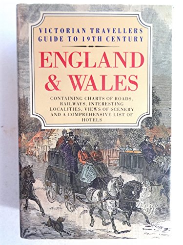
Victorian Travellers Guide to 19th Century England and Wales
Publicado por Bracken Books, 1985
ISBN 10: 0946495696ISBN 13: 9780946495696
Librería: ThriftBooks-Dallas, Dallas, TX, Estados Unidos de America
Valoración del vendedor:

Libro
Hardcover. Condición: As New. No Jacket. Pages are clean and are not marred by notes or folds of any kind. ~ ThriftBooks: Read More, Spend Less 2.1.
Más opciones de compra de otros vendedores en IberLibro
Nuevo desde EUR 89,44
Usado desde EUR 6,47
Encuentre también Tapa dura Original o primera edición
-
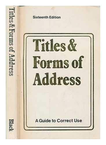
Titles and Forms of Address: A Guide to Their Correct Use
Publicado por A & C Black Publishers Ltd, 1978
ISBN 10: 0713619066ISBN 13: 9780713619065
Libro
paperback. Condición: Good. All orders are dispatched the following working day from our UK warehouse. Established in 2004, we have over 500,000 books in stock. No quibble refund if not completely satisfied.
Más opciones de compra de otros vendedores en IberLibro
Usado desde EUR 4,10
-

The Edinburgh Review of CRITICAL JOURNAL. No. 347.
Librería: Zellibooks. Zentrallager Delbrück, Delbrück, Alemania
Valoración del vendedor:

Libro
Longmans, Green, & CO., London, 3. Pp.,London 1889, 302 S. Sprache: Deutsch.
-

Who Was Who: 1897-1915 v. 1
Publicado por Adams & Charles Black, 1967
ISBN 10: 071360168XISBN 13: 9780713601688
Librería: Better World Books, Mishawaka, IN, Estados Unidos de America
Valoración del vendedor:
Libro
Condición: Good. Former library book; may include library markings. Used book that is in clean, average condition without any missing pages.
Más opciones de compra de otros vendedores en IberLibro
Usado desde EUR 13,24
-
Beautiful Britain : Winchester
Publicado por London, 1914
Librería: Novel Ideas Books & Gifts, Decatur, IL, Estados Unidos de America
Valoración del vendedor:
Hardcover. Condición: Good. Estado de la sobrecubierta: No Dust Jacket. Lower 1" of covers has been water damaged - it appears that to lower edge of a dust jacket absorbed water and stuck to the covers. When the jacket was removed a light residue of paper stuck to the covers and some of the blue dye in the cloth was removed. There is no rippling to the cloth - just cosmetic damage. Light wear to spine edges. ; Small 4to 9" - 11" tall; 63 pages.
-
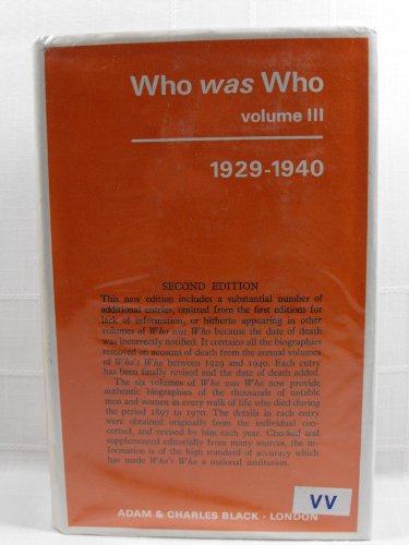
Who Was Who: Volume 3 - 1929-1940
Publicado por Adams & Charles Black, London, 1967
ISBN 10: 0713601701ISBN 13: 9780713601701
Librería: Bookmarc's, Houston, TX, Estados Unidos de America
Miembro de asociación: IOBA
Valoración del vendedor:
Libro
Hard Cover. Condición: Very Good. Estado de la sobrecubierta: Very Good. 2nd Edition. P6 - A 2nd edition ex-library hardcover book in very good condition in very good dust jacket that is mylar protected. Dust jacket has labels on the spine, wrinkling and chipping on some edges, light discoloration and shelf wear. Book has library markings (labels, stamping, cardholder, etc.), some bumped corners, tape stains on the cover and endpapers, light discoloration and shelf wear. Who Was Who: Volume 3 - 1929-1940. A companion to Who's Who containing the biographies of those who died during the period 1929-1940. 8.75"x6", unpaged. Satisfaction Guaranteed. Size: 8vo - over 7ľ" - 9ľ" tall. Ex-Library.
Más opciones de compra de otros vendedores en IberLibro
Nuevo desde EUR 85,38
Usado desde EUR 9,62
Encuentre también Tapa dura
-

Who Was Who: Volume 5 - 1951-1960
Publicado por Adams & Charles Black, London, 1967
ISBN 10: 0713601728ISBN 13: 9780713601725
Librería: Bookmarc's, Houston, TX, Estados Unidos de America
Miembro de asociación: IOBA
Valoración del vendedor:
Libro
Hard Cover. Condición: Very Good. Estado de la sobrecubierta: Very Good. 3rd Edition. P6 - A 3rd edition ex-library hardcover book in very good condition in very good dust jacket that is mylar protected. Dust jacket has labels on the spine, wrinkling and chipping on some edges, light discoloration and shelf wear. Book has library markings (labels, stamping, cardholder, etc.), some bumped corners, tape stains on the cover and endpapers, some stains, light discoloration and shelf wear. Who Was Who: Volume 5 - 1951-1960. A companion to Who's Who containing the biographies of those who died during the period 1951-1960. 8.75"x6", unpaged. Satisfaction Guaranteed. Size: 8vo - over 7ľ" - 9ľ" tall. Ex-Library.
Más opciones de compra de otros vendedores en IberLibro
Usado desde EUR 9,62
-
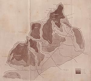
Condición: Good. COTSWOLDS. Sketch map of Central and Northern Cotswolds. By GF Nicholls 1908. Antique colour map; George Frank Nicholls (1908). 16.0 x 18.0cm, 6.25 x 7.25 inches; this is a folding map. Condition: Good. The image shown may have been taken from a different example of this map than that which is offered for sale. The map you will receive is in good condition but there may be minor variations in the condition from that shown in the image which may include some light spotting. There is nothing printed on the reverse side, which is plain.
-
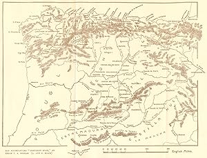
Condición: Good. SPAIN. Sketch map North 1906 old antique vintage plan chart. Antique sketch map; from a painting by SirEdgar Thomas AingerWigram (1906). 19.5 x 25.5cm, 7.5 x 10 inches. Condition: Good. There is nothing printed on the reverse side, which is plain.
-
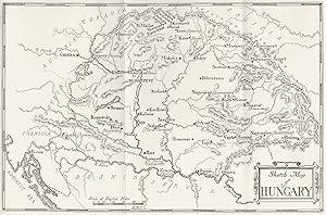
Condición: Good. HUNGARY. Sketch 1909 old antique vintage map plan chart. Antique sketch map; from a painting by Adrian & Marianne Stokes (1909). 19.0 x 29.0cm, 7.5 x 11.5 inches. Condition: Good. The image shown may have been taken from a different example of this map than that which is offered for sale. The map you will receive is in good condition but there may be minor variations in the condition from that shown in the image. There is nothing printed on the reverse side, which is plain.
-
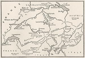
Condición: Good. SWITZERLAND. Sketch map of Switzerland 1917 old antique vintage plan chart. Vintage map; Black, Adam & Charles (1917). 10.5 x 15.5cm, 4 x 6 inches. Condition: Good. There are images and/or text printed on the reverse side of the picture. In some cases this may be visible on the picture itself or around the margin of the picture.
-
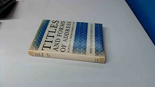
Titles and Forms of Address: A Guide to Their Correct Use
Publicado por A & C Black Publishers Ltd, 1971
ISBN 10: 0713612665ISBN 13: 9780713612660
Libro
hardcover. Condición: Good. Estado de la sobrecubierta: Good. 14Rev Ed.
-

Black's Picturesque Tourist And Road And Railway Guide Book Through England And Wales: With A General Traveling Map (Paperback or Softback)
Publicado por Legare Street Press 10/27/2022, 2022
ISBN 10: 1018188541ISBN 13: 9781018188546
Librería: BargainBookStores, Grand Rapids, MI, Estados Unidos de America
Valoración del vendedor:
Libro
Paperback or Softback. Condición: New. Black's Picturesque Tourist And Road And Railway Guide Book Through England And Wales: With A General Traveling Map 0.17. Book.
Más opciones de compra de otros vendedores en IberLibro
Nuevo desde EUR 16,10
-
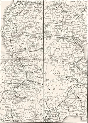
Great-Western Railway & South-Devon Railways-Bristol to Exeter and Plymouth
Ańo de publicación: 1874
Mapa
Condición: Good. DEVON. Great Western map. Bristol, Exeter, Plymouth 1874 old antique chart. Antique engraving; Black, Adam & Charles (1874). 20.0 x 14.5cm, 7.75 x 5.5 inches; this is a folding map. Condition: Good. The image shown may have been taken from a different example of this map than that which is offered for sale. The map you will receive is in good condition but there may be minor variations in the condition from that shown in the image. May have some light age-related spotting not shown on the image. If the print has been scanned in black and white, any foxing or spotting highlighted in this statement may appear brown on the actual print. There is nothing printed on the reverse side, which is plain.
-
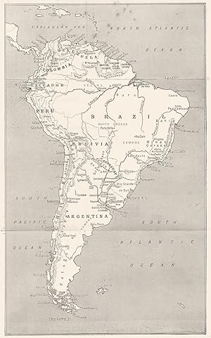
Condición: Fair. SOUTH AMERICA. Sketch map of South America 1908 old antique plan chart. Antique colour map; Archibald Stevenson Forrest (1908). 25.5 x 16.0cm, 10 x 6.25 inches; this is a folding map. Condition: Fair: Spotting. There is nothing printed on the reverse side, which is plain.
-
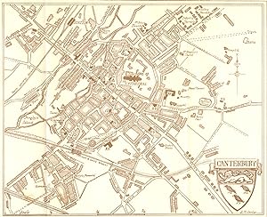
Condición: Good. KENT. Sketch plan of Canterbury 1907 old antique vintage map chart. Colour antique map; WilliamBiscombe Gardner (1907). 16.0 x 20.0cm, 6.25 x 7.75 inches. Condition: Good. Spot. There is nothing printed on the reverse side, which is plain.
-
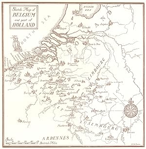
Condición: Good. BELGIUM. Sketch Map of Belgium and part of Holland 1908 old antique chart. Colour antique map; Amédée Forestier (1908). 19.0 x 19.0cm, 7.5 x 7.5 inches. Condition: Good. There is nothing printed on the reverse side, which is plain.
-
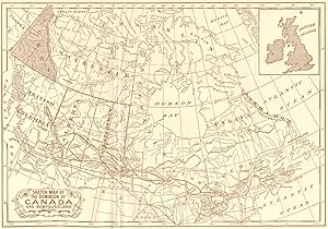
Condición: Fair. CANADA. Sketch map Dominion of & Newfoundland 1907 old antique plan chart. Colour antique map; Thomas Mower Martin (1907). 19.0 x 27.5cm, 7.5 x 10.75 inches. Condition: Fair: Creased. Spot. There is nothing printed on the reverse side, which is plain.
-
![Imagen de archivo de Literary Capital: A Washington Reader [Hardcover] Sten, Christopher; Adams, Abigail; Hines, Christian; Irving, Washington; Watterson, George; Smith, Margaret Bayard; Cooper, James Fenimore; Trollope, Frances; Tocqueville, Alexis de; Dickens, Charles; Melville, Herman; Hawk, Black; Whittier, John Greenleaf; Emerson, Ralph Waldo; Brown, William Wells; Northup, Solomon; Hawthorne, Nathaniel; Alcott, Louisa May; Whitman, Walt; Keckley, Elizabeth Hobbs; Sinclair, Upton; Twain, Mark; Warner, Charles Dudley; DeForest, John William; Harte, Bret; Douglass, Frederick; Adams, Henry; Burnett, Frances Hodgson; Atherton, Gertrude; Washington, Booker T.; James, Henry; Phillips, David Graham; Cooper, Anna; Dunbar, Paul Laurence; Hopkins, Pauline Elizabeth; Terrell, Mary Church; Du Bois, W. E. B.; Williams, Edward Christopher; Locke, Alain; Hughes, Langston; Ellison, Ralph; Bencastro, Mario; Lewis, Sinclair; Toomer, Jean; Cather, Willa; Adams, Samuel Hopkins; Passos, John Dos; Halle, Louis J.; Golden, a la venta por Particular Things](https://pictures.abebooks.com/isbn/9780820338361-es-300.jpg)
Literary Capital: A Washington Reader [Hardcover] Sten, Christopher; Adams, Abigail; Hines, Christian; Irving, Washington; Watterson, George; Smith, Margaret Bayard; Cooper, James Fenimore; Trollope, Frances; Tocqueville, Alexis de; Dickens, Charles; Melville, Herman; Hawk, Black; Whittier, John Greenleaf; Emerson, Ralph Waldo; Brown, William Wells; Northup, Solomon; Hawthorne, Nathaniel; Alcott, Louisa May; Whitman, Walt; Keckley, Elizabeth Hobbs; Sinclair, Upton; Twain, Mark; Warner, Charles Dudley; DeForest, John William; Harte, Bret; Douglass, Frederick; Adams, Henry; Burnett, Frances Hodgson; Atherton, Gertrude; Washington, Booker T.; James, Henry; Phillips, David Graham; Cooper, Anna; Dunbar, Paul Laurence; Hopkins, Pauline Elizabeth; Terrell, Mary Church; Du Bois, W. E. B.; Williams, Edward Christopher; Locke, Alain; Hughes, Langston; Ellison, Ralph; Bencastro, Mario; Lewis, Sinclair; Toomer, Jean; Cather, Willa; Adams, Samuel Hopkins; Passos, John Dos; Halle, Louis J.; Golden,
Publicado por University of Georgia Press, 2011
ISBN 10: 0820338362ISBN 13: 9780820338361
Librería: Particular Things, Frederick, MD, Estados Unidos de America
Valoración del vendedor:
Libro
Hardcover. Condición: Like New. signed by author with inscription, excellent condition, no writing or markings, book is crisp and clean. 100% satisfaction guarantee. Shipped with care in a bubble mailer. Feel free to inquire for photos or more details.
-
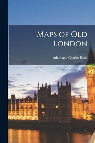
Maps of Old London (Paperback)
Publicado por Legare Street Press, 2022
ISBN 10: 1015943012ISBN 13: 9781015943018
Librería: Grand Eagle Retail, Wilmington, DE, Estados Unidos de America
Valoración del vendedor:
Libro
Paperback. Condición: new. Paperback. This work has been selected by scholars as being culturally important, and is part of the knowledge base of civilization as we know it.This work is in the "public domain in the United States of America, and possibly other nations. Within the United States, you may freely copy and distribute this work, as no entity (individual or corporate) has a copyright on the body of the work.Scholars believe, and we concur, that this work is important enough to be preserved, reproduced, and made generally available to the public. We appreciate your support of the preservation process, and thank you for being an important part of keeping this knowledge alive and relevant. Shipping may be from multiple locations in the US or from the UK, depending on stock availability.
Más opciones de compra de otros vendedores en IberLibro
Nuevo desde EUR 18,31
-
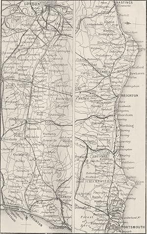
London and Brighton, and South-Coast Railways (London to Brighton, Portsmouth & Hastings)
Ańo de publicación: 1874
Mapa
Condición: Good. RAIL. London, Brighton, Portsmouth, Hastings 1874 old antique map plan chart. Antique engraving; Black, Adam & Charles (1874). 13.5 x 8.5cm, 5.25 x 3.25 inches. Condition: Good. The image shown may have been taken from a different example of this map than that which is offered for sale. The map you will receive is in good condition but there may be minor variations in the condition from that shown in the image. May have some light age-related spotting not shown on the image. If the print has been scanned in black and white, any foxing or spotting highlighted in this statement may appear brown on the actual print. There is nothing printed on the reverse side, which is plain.
-
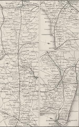
South Eastern Railway (Reigate to Dover, Canterbury, Deal, Ramsgate & Margate)
Ańo de publicación: 1874
Mapa
Condición: Good. KENT. Reigate, Dover, Canterbury, Ramsgate, Margate 1874 old antique map chart. Antique engraving; Black, Adam & Charles (1874). 14.0 x 8.5cm, 5.5 x 3.25 inches. Condition: Good. The image shown may have been taken from a different example of this map than that which is offered for sale. The map you will receive is in good condition but there may be minor variations in the condition from that shown in the image. May have some light age-related spotting not shown on the image. If the print has been scanned in black and white, any foxing or spotting highlighted in this statement may appear brown on the actual print. There is nothing printed on the reverse side, which is plain.
-
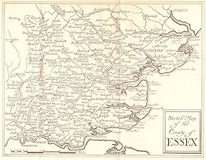
Condición: Good. ESSEX. Sketch 1909 old antique vintage map plan chart. Coloured antique map; from a painting by Louis Burleigh Bruhl (1909). 20.0 x 25.5cm, 7.75 x 10 inches; this is a folding map. Condition: Good. The image shown may have been taken from a different example of this map than that which is offered for sale. The map you will receive is in good condition but there may be minor variations in the condition from that shown in the image which may include some light spotting. There is nothing printed on the reverse side, which is plain.
-
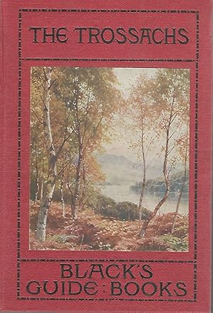
Black's Guide to The Trossachs, Loch Katrine, Loch Lomond, etc
Publicado por R.S. Shearer & Son Adam & Charles Black, London
Librería: Dorley House Books, Inc., Hagerstown, MD, Estados Unidos de America
Valoración del vendedor:
Arte / Grabado / Póster
Hardcover. Condición: Very Good. No Jacket. 12 Maps & Plans and 4 Colored Illustrations Ilustrador. 28th edition; red c w/pictorial inset on front; black titles; fold-out map as frontis Size: 12 vo.
-

Black's Picturesque Tourist of Scotland, Vol. 1 (Classic Reprint): Edinburgh, Roslin and Hawthornden, Hopetoun House, Dunfermline, Etc.; Melrose, . Norham, Berwick-On-Tweed (Classic Reprint)
Publicado por Forgotten Books, 2017
ISBN 10: 1333086075ISBN 13: 9781333086077
Libro
Condición: Good. Most items will be dispatched the same or the next working day.
Más opciones de compra de otros vendedores en IberLibro
Nuevo desde EUR 19,06
Usado desde EUR 9,60
Encuentre también Tapa blanda
-
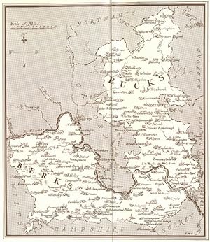
Condición: Good. Buckinghamshire and Berkshire county sketch map by Sutton palmer & Mitton 1920. Colour antique map; from a painting by Harold Sutton Palmer, R.I. (1920). 18.0 x 15.5cm, 7 x 6 inches; this is a folding map. Condition: Good. There is nothing printed on the reverse side, which is plain.
-
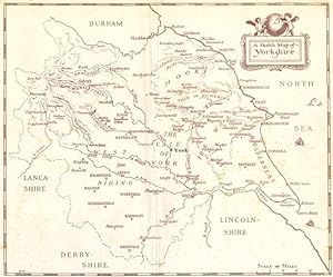
Condición: Good. YORKS. A sketch map of Yorkshire 1908 old antique vintage plan chart. Colour antique map; GordonCochraneHome (1908). 19.0 x 23.0cm, 7.5 x 9 inches. Condition: Good. However, please note: The image shown may have been taken from a different example of this map than that which is offered for sale. The map you will receive is in good condition but there may be minor variations in the condition from that shown in the image which may include some light spotting. There is nothing printed on the reverse side, which is plain.
-
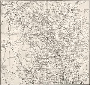
Condición: Good. DERBYS. Derbyshire 1874 old antique vintage map plan chart. Antique engraving; Black, Adam & Charles (1874). 16.5 x 17.5cm, 6.5 x 6.75 inches; this is a folding map. Condition: Good. The image shown may have been taken from a different example of this map than that which is offered for sale. The map you will receive is in good condition but there may be minor variations in the condition from that shown in the image. May have some light age-related spotting not shown on the image. If the print has been scanned in black and white, any foxing or spotting highlighted in this statement may appear brown on the actual print. There is nothing printed on the reverse side, which is plain.
-
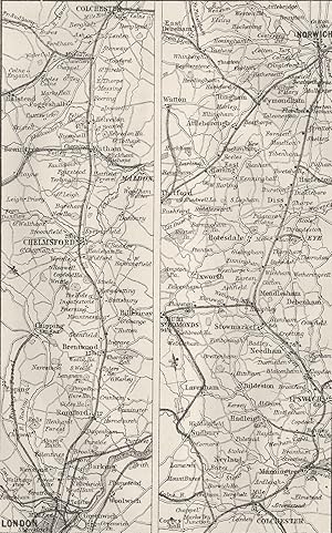
Condición: Good. GT EASTERN RAIL. London, Ipswich, Bury, Norwich 1874 old antique map chart. Antique engraving; Black, Adam & Charles (1874). 13.5 x 8.5cm, 5.25 x 3.25 inches. Condition: Good. The image shown may have been taken from a different example of this map than that which is offered for sale. The map you will receive is in good condition but there may be minor variations in the condition from that shown in the image. May have some light age-related spotting not shown on the image. If the print has been scanned in black and white, any foxing or spotting highlighted in this statement may appear brown on the actual print. There is nothing printed on the reverse side, which is plain.
-
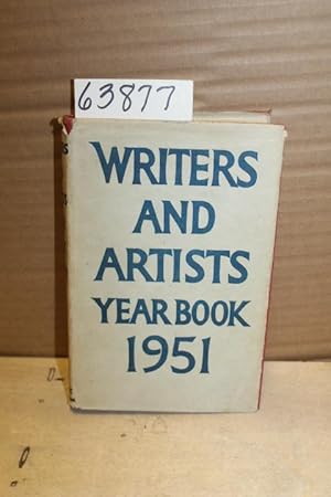
The writers? and artists? year book. 1951. A directory for writers, artists, playwrights, film writers, photographers and compos
Publicado por ADAM AND CHARLES BLACK, LONDON, 1951
Librería: Princeton Antiques Bookshop, Atlantic City, NJ, Estados Unidos de America
Valoración del vendedor:
HARD BACK RED. Condición: GOOD. JACKET: GOOD DJ. former owner bookplate on inside front cover, d.j. has some slight tearing along spine, pages yellowing A Directory for Writers Artists, Playwrights, Film Writers, Photographers and composers, Forty Fourth Year of New Issue DATE PUBLISHED: 1951 EDITION: 385.