Importe total (1 artículo artículos):
Destino del pedido:

ORDNANCE SURVEY OFFICE (72 resultados)
Ir a los resultados principales
Tipo de artículo
- Todo tipo de artículos
- Libros (41)
- Revistas y publicaciones
- Cómics
- Partituras
- Arte, grabados y pósters
- Fotografías
- Mapas (31)
-
Manuscritos y
coleccionismo de papel
Condición
- Todo
- Nuevos
- Antiguos o usados
Encuadernación
Más atributos
- Primera edición (8)
- Firmado
- Sobrecubierta (3)
- Con imágenes del vendedor (40)
- Sin impresión bajo demanda
Gastos de envío gratis
Ubicación del vendedor
Valoración de los vendedores
-

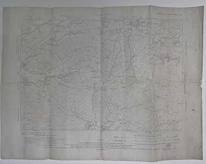
Ordnance Survey One-inch Map Bournemouth And Weymouth [ England And Wales 140]
Publicado por Ordnance Survey Office, Southampton, UK, 1937
Librería: Willis Monie-Books, ABAA, Cooperstown, NY, Estados Unidos de America
Miembro de asociación: ABAA ESA ILAB
Valoración del vendedor:

Softcover. Condición: Good. Estado de la sobrecubierta: No Dust Jacket. Fifth Edition. Folded map, mounted on cloth. When folded, there are stiff paper covers on the outside. Slight damp staining to the outside of the front cover, less so on the inside. Very slight wrinkling to the first panel of the map. A few small spots of staining to the rear cover. Covers have wear to the corners.
-
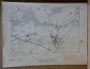
ORDNANCE SURVEY MAP of PRESTON and DISTRICT (Southport & Blackpool). Coloured Edition, Scale 1 Inch to 1 Mile- Sheet # 29
Publicado por Ordance Survey, Southampton, Southampton, UK, 1913
Librería: Liberty Book Shop, Avis, PA, Estados Unidos de America
Valoración del vendedor:

Condición: Good+. Folder is 3 3/4 X 7 in high and unfolds to 30 X 21 inches. Edge rubbing on folder, with map back with cloth. Creases are rubbed, but map is whole. ; 12mo 7" - 7˝" tall; [1] pages.
-
Ireland 4 South East [ Folded Map]
Publicado por Ordnance Survey Office, Dublin, 1979
Librería: Willis Monie-Books, ABAA, Cooperstown, NY, Estados Unidos de America
Miembro de asociación: ABAA ESA ILAB
Valoración del vendedor:
Softcover. Condición: Very Good-. Estado de la sobrecubierta: No Dust Jacket. Eighth Edition. Folded map in stiff paper covers. Some creasing. Covers have slight edge creasing.
-
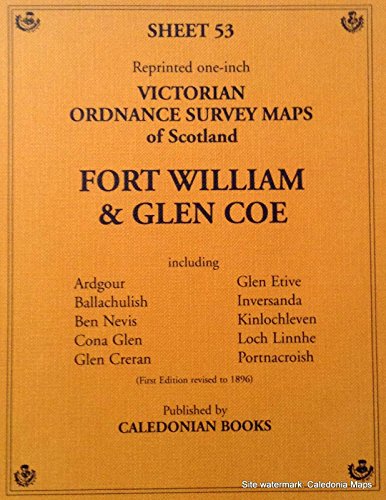
Victorian Ordnance Survey Maps Of Scotland Fort William & Glen Coe Sheet 53 Reprinted One-inch
Publicado por Caledonian Books, Aberdeenshire, Scotland, 1987
ISBN 10: 1853490539ISBN 13: 9781853490538
Librería: Willis Monie-Books, ABAA, Cooperstown, NY, Estados Unidos de America
Miembro de asociación: ABAA ESA ILAB
Valoración del vendedor:
Libro
Softcover. Condición: Very Good. Estado de la sobrecubierta: No Dust Jacket. Reprint. Folded map. Original was revised up to 1896.
-
![Imagen de archivo de Ordnance Survey Of Scotland Rannoch Sheet 54 Reprint Of The First Edition Of The One-inch [ Map] a la venta por Willis Monie-Books, ABAA](https://pictures.abebooks.com/isbn/9781853490545-es-300.jpg)
Ordnance Survey Of Scotland Rannoch Sheet 54 Reprint Of The First Edition Of The One-inch [ Map]
Publicado por Caledonian Books, Aberdeenshire, Scotland, 1987
ISBN 10: 1853490547ISBN 13: 9781853490545
Librería: Willis Monie-Books, ABAA, Cooperstown, NY, Estados Unidos de America
Miembro de asociación: ABAA ESA ILAB
Valoración del vendedor:
Libro
Softcover. Condición: Very Good. Estado de la sobrecubierta: No Dust Jacket. Reprint. Folded map. Original was revised up to 1896.
-
![Imagen de archivo de Ordnance Survey Of Scotland Corpach & Spean Bridge Sheet 62 Reprint Of The First Edition Of The One-inch [ Map] a la venta por Willis Monie-Books, ABAA](https://pictures.abebooks.com/isbn/9781853490620-es-300.jpg)
Ordnance Survey Of Scotland Corpach & Spean Bridge Sheet 62 Reprint Of The First Edition Of The One-inch [ Map]
Publicado por Caledonian Books, Aberdeenshire, Scotland, 1987
ISBN 10: 1853490628ISBN 13: 9781853490620
Librería: Willis Monie-Books, ABAA, Cooperstown, NY, Estados Unidos de America
Miembro de asociación: ABAA ESA ILAB
Valoración del vendedor:
Libro
Softcover. Condición: Very Good. Estado de la sobrecubierta: No Dust Jacket. Reprint. Folded map. Original was revised up to 1896.
-
![Imagen de archivo de Ordnance Survey Of Scotland Dalwhinnie & Glen Roy Sheet 63 Reprint Of The First Edition Of The One-inch [ Map] a la venta por Willis Monie-Books, ABAA](https://pictures.abebooks.com/isbn/9781853490637-es-300.jpg)
Ordnance Survey Of Scotland Dalwhinnie & Glen Roy Sheet 63 Reprint Of The First Edition Of The One-inch [ Map]
Publicado por Caledonian Books, Aberdeenshire, Scotland, 1987
ISBN 10: 1853490636ISBN 13: 9781853490637
Librería: Willis Monie-Books, ABAA, Cooperstown, NY, Estados Unidos de America
Miembro de asociación: ABAA ESA ILAB
Valoración del vendedor:
Libro
Softcover. Condición: Very Good. Estado de la sobrecubierta: No Dust Jacket. Reprint. Folded map. Original was revised up to 1896.
-

Ordnance Survey Maps Of Scotland Loch Lomond Sheet 38 Reprint Of The First Edition Of The One-inch
Publicado por Caledonian Books, Aberdeenshire, Scotland, 1987
ISBN 10: 1853490385ISBN 13: 9781853490385
Librería: Willis Monie-Books, ABAA, Cooperstown, NY, Estados Unidos de America
Miembro de asociación: ABAA ESA ILAB
Valoración del vendedor:
Libro
Softcover. Condición: Very Good. Estado de la sobrecubierta: No Dust Jacket. Reprint. Folded map.
-
Galway Offaly [ Map 15]
Publicado por Ordnance Survey Office, Government of Ireland, Dublin, 1978
Librería: Willis Monie-Books, ABAA, Cooperstown, NY, Estados Unidos de America
Miembro de asociación: ABAA ESA ILAB
Valoración del vendedor:
Softcover. Condición: Very Good. Estado de la sobrecubierta: No Dust Jacket. Covers have some very slight creasing. ; Large folded map attached to stiff paper covers.
-
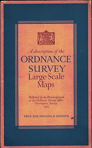
A Description of the Ordnance Survey Large Scale Plans.
Publicado por Chessington Surrey: Ordnance Survey Office 1947., 1947
Librería: Saintfield Antiques & Fine Books, Northern Ireland, Reino Unido
Valoración del vendedor:

v+23 pp. 9 plates, card covers, in very good condition.
-
ORDNANCE SURVEY ROAD MAP OF GREAT BRITAIN (SHEET 1) In Two Sheets; Showing Ministry of Transport Road Classification
Publicado por Great Britain Ministry of Transport, 1932
Librería: Rivers Edge Used Books, Clinton, CT, Estados Unidos de America
Valoración del vendedor:
Mapa
Map. Name penciled on front and rear covers. Light wear from age and; 8vo 8" - 9" tall Very Good use. Copyright of 1932. Ten miles to one inch. Mounted on Linen. 7.5" x 4.5" folded, card covers. Published by authority of the Ministry of Agriculture & Fisheries. (B340).
-
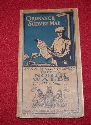
Ordnance Survey Quarter-Inch to 1 Mile Map Sheet 4 NORTH WALES
Publicado por Ordnance Survey Office, Southampton, 1920
Librería: Antiquarian Bookshop, Washington, DC, Estados Unidos de America
Valoración del vendedor:
Mapa
Map. Condición: Very Good. lovely map of North Wales mounted on cloth. Very Good condition, with one tiny worn spot at a corner fold.
-
Kidderminster Sheet 130 New Popular Edition One-Inch Maps of England & Wales
Publicado por Ordnance Survey, Chessington, UK, 1947
Libro
Folded Soft Cover - Paper Map. Condición: Fair. Revision Full 1915 with Corrections. Folded OS map - grimy beige background covers with red around the edges. Heavy wear to corners and edges. Clean colour map with some rubbing to folds. Working copy.
-
Taunton & Minehead S`heet 129 One-Inch Map
Publicado por Ordnance Survey, Chessington, UK, 1937
Libro
Folded Soft Cover - Paper Map. Condición: Fair. Fifth Edition. Folded OS map - grimy beige background covers with blue around the edges. Heavy wear to corners and edges. Clean colour map with some rubbing to folds. Working copy.
-
Condición: Very Good. Map: Ordnance Survey Office. Map in very good condition. Address of possibly the previous owner inscribed on the front cover. ALL ITEMS ARE DISPATCHED FROM THE UK WITHIN 48 HOURS ( BOOKS ORDERED OVER THE WEEKEND DISPATCHED ON MONDAY) ALL OVERSEAS ORDERS SENT BY TRACKABLE AIR MAIL. IF YOU ARE LOCATED OUTSIDE THE UK PLEASE ASK US FOR A POSTAGE QUOTE FOR MULTI VOLUME SETS BEFORE ORDERING.
-
District Map. Winchester.
Publicado por Southampton & London: Ordnance Survey, 1910
Librería: David Ford Books PBFA, Cley-next-the-Sea, Reino Unido
Miembro de asociación: PBFA
Valoración del vendedor:
Mapa
Condición: Very Good. 1910 printing of map, based on the 1901 revision; no survey date is given. No print code. Printed colour map on paper, backed with linen, folding into 24 sections, attached inside pictorial card wrappers (with nice coloured image to front of touring car in landscape). Scale One Mile to One Inch. Very Good condition. Map face is clean, with light wear to the folds and tiny holes where folds cross; wrapper has some rubbing with small abrasions and crease to front, and name in ink to top front. .Now in clear removable sleeve.
-
Contoured Road Map of Pontypridd and Barry. Popular Edition. Sheet 109.
Publicado por Southampton & London: Ordnance Survey, 1931
Librería: David Ford Books PBFA, Cley-next-the-Sea, Reino Unido
Miembro de asociación: PBFA
Valoración del vendedor:
Mapa
Condición: Very Good. 1931 reprinting of map, based on the 1881 survey originally published in 1887, and last revised in 1920, with railways added to 1926. Printers code 3500/31 Printed colour map on cloth , folding into 27 sections, attached inside pictorial card wrappers (red and black to front with image of seated man looking at a vista with map in hand). Scale One Mile to One Inch. Very Good condition. Wrappers clean with light wear to edges, and tear along edge where map attached. Map clean and bright, with a little wear to folds. Now in clear removable sleeve.
-
Tourist Map. New Forest.
Publicado por Southampton & London: Ordnance Survey, 1938
Librería: David Ford Books PBFA, Cley-next-the-Sea, Reino Unido
Miembro de asociación: PBFA
Valoración del vendedor:
Mapa
Condición: Good. 1938 printing of map; appears to be part of the 5th edition series; no survey date is given. print code 8038 Printed colour map on paper, backed with linen, folding into 24 sections, attached inside pictorial card wrappers (with Arthur Palmer coloured image to front from watercolour of the New Forest) . Scale One Mile to One Inch. Very Good condition. Map face is clean and bright, with light wear to folds; wrapper has light handling wear and marks, and name in ink to top front. .Now in clear removable sleeve.
-
Tourist Map of Chichester.
Publicado por Southampton & London: Ordnance Survey, 1934
Librería: David Ford Books PBFA, Cley-next-the-Sea, Reino Unido
Miembro de asociación: PBFA
Valoración del vendedor:
Mapa
Condición: Very Good. 1934 reprinting of map, with minor corrections to 1933, originally published in 1922, and with roads added to 1933. Print code 3200/34 Printed colour map on cloth , backed with linen, folding into 24 sections, attached inside pictorial card wrappers (with Arthur Palmer coloured image to front from watercolour of Chichester) . Scale One Mile to One Inch. This is a map of the area around Chichester, not a town map, with the coast shown from Portsmouth to Littlehampton, and the South Downs inland. Very Good condition. Generally clean and bright, with very light wear to map folds and wrapper edges; back wrapper has feint liquid stain. Now in clear removable sleeve. Nice Map.
-
OS Sheet 22. (Map of south Devonshire area)
Publicado por Southampton: OS Office, 1903
Librería: David Ford Books PBFA, Cley-next-the-Sea, Reino Unido
Miembro de asociación: PBFA
Valoración del vendedor:
Mapa
Condición: Very Good. HB. Engraved coloured map laid onto linen, folding into 21 sections, with red cloth covers when folded up, lettered in black. Scale 4 miles to one inch, reduced from the I inch map, revised in 1894-7, with railways inserted to Jan. 1904. Includes south Devon and a little bit of Cornwall, roughly centering on Dartmoor and Exeter. Opened out size: 48 x 62cm. Very Good condition. Generally clean map surface, with some browning to folds and some light foxing spots. Clean bright covers.
-
Helmsdale (Ordnance Survey of Scotland Popular edition sheet 17 War Revision 1940)
Publicado por War Office/Ordnance Survey, 1940
Librería: Simply Read Books, Boat Of Garten, Reino Unido
Valoración del vendedor:
Libro
Unbound. Condición: Good. No Jacket. 1940 War Office/Ordnance Survey folded coloured paper linen-backed map, Ordnance Survey of Scotland Popular edition sheet 17 Caithness and Sutherland War Revision 1940, unmounted sheet; ref W O 10,000/40 5,000/5/41; 56 centimetres h by 76 w; scale one inch to one statute mile; folds 1 x 5; stamped "may be used along with 1932 Popular edition No significant change"; good clean copy, listed as good because the edges have been cut so some of the legend has been lost, the map itself is complete and in very good condition; UK dealer, immediate dispatch.
-
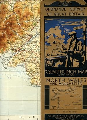
Ordnance Survey of Great Britain | Quarter-Inch Map | Fourth Edition | Sheet 4: North Wales and Manchester
Publicado por Published by Minister of Agriculture and Fisheries for Ordnance Survey Office, Southampton Fourth Edition . 1934., 1934
Librería: Little Stour Books PBFA Member, Canterbury, Reino Unido
Miembro de asociación: PBFA
Valoración del vendedor:
Publisher's original illustrated front cover brown and blue card covered single-sided map. 12'' x 5'' which folds out to measure 42" x 24". Scale of map is 4 miles to 1 inch, mounted in sections on linen, includes fold-out sheet of 17 town plans with with inset details of Mersey Tunnel Charges and Horse Power limitations. Small chip to the top front corner of the front cover and in Very Good clean and crisp condition. Member of the P.B.F.A. CARTOGRAPHY, MAPS, PLANS.
-
Cumberland OS Map 1926 Edition Sheet LXVIII.SW Six Inches to the Mile
Publicado por Ordnance Survey Office, Southampton, 1923
Mapa
Single sheet thick paper. Condición: Very Good. Estado de la sobrecubierta: No Dust Jacket. Revised Edition. Map has hard creases from being a book insert. Has scattered foxing mostly around the border of the map. Edges have some wear and a small part is missing from the right side but is only in the white margin area and does not effect the map image or surrounding text. Why on Amazon do most sellers not describe their actual book? Buy with confidence and support a genuine Independent Bricks & Mortar Real Bookshop. We are Maynard & Bradley CAMBO & PBFA(now lapsed) members here in Leicester City Centre. Size: 570 x 425 mm. Item Type: Map. Quantity Available: 1. Shipped Weight: Under 500 grams. Category: Geography & Maps; Britain/UK; 1920s; Pictures of this item not already displayed here available upon request. Inventory No: 04052.
-
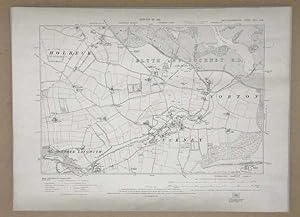
OS MAP Nottinghamshire, Edition of 1921 Ordnance Survey, Sheet XVIII. N.W.
Publicado por Director General at the Ordnance Survey Office, Southhampton, 1921
Original o primera edición
Softcover. Condición: Very Good. First Edition. Original print of an ordnance survey of the North West Nottinghamshire showing part of Holbeck, Nether Langwith, Cuckney, Norton, and Blyth and Cuckney R.D. Map is 425 x 580 mm, a bit grubby around the margins from age, edges a bit rough, some creases from storage, overall in great condition for its age. Why on Amazon do most sellers not describe their actual book? Buy with confidence and support a genuine Independent Bricks & Mortar Real Bookshop. We are Maynard & Bradley CAMBO & PBFA(now lapsed) members here in Leicester City Centre. Size: 425 x 580 mm. Item Type: Antique Print. Quantity Available: 1. Shipped Weight: Under 500 grams. Category: Geography & Maps; Map; Britain/UK; 1920s; Pictures of this item not already displayed here available upon request. Inventory No: 30013.
-
Original Printed Map, Provisional Edition Ordinance Survey, OS MAP of Nottinghamshire, Sheet XVIII. S.W.
Publicado por Director General at the Ordnance Survey Office, Southhampton, 1948
Original o primera edición
Softcover. Condición: Very Good. First Edition. Original print of an ordinance survey of the south west of Nottinghamshire showing part of Warsop. Map is 425 x 580 mm, a bit grubby around the margins from age, edges a bit rough, some creases from storage, heavy foxing on bottom half and bottom right corner, overall in great condition for its age. Why on Amazon do most sellers not describe their actual book? Buy with confidence and support a genuine Independent Bricks & Mortar Real Bookshop. We are Maynard & Bradley CAMBO & PBFA(now lapsed) members here in Leicester City Centre. Size: 425 x 580 mm. Item Type: Antique Print. Quantity Available: 1. Shipped Weight: Under 500 grams. Category: Geography & Maps; Map; Britain/UK; 1940s; Pictures of this item not already displayed here available upon request. Inventory No: 30014.
-
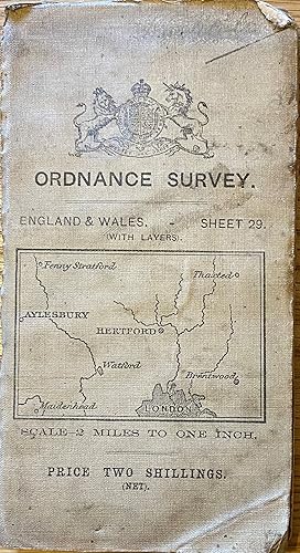
Ordnance Survey. England & Wales. Sheet 29 (with layers). St. Albans. Scale -2 Miles to One Inch.
Publicado por Southampton, 1911
Mapa
Soft cover. Condición: Near Fine. Map measuring approximately 71 x 61 cm. Reduced from the One Inch Map of 1902-03. Published by Colonel S.C.N Grant, Director General at the Ordnance Survey Office. #36461.
-
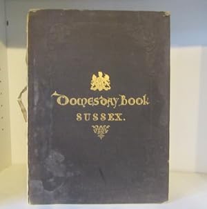
Domesday Book, or The Great Survey of England of William the Conqueror, A.D.1086. Facsimile of the Part Relating to Sussex. Photo-Zincographed by Her Majesty's Command at the Ordnance Survey Office, Southampton
Publicado por Ordnance Survey Office, Southampton, 1862, 1862
hardback, large folio, (vi)28pp, printed in red and black, edges browned and some light foxing, blindstamped black cloth gilt, soiled, corners bumped and scuffed, front board detached and lacks spine backstrip; Fair condition.
-
Victorian Ordnance Survey Maps of Scotland, Reprinted One-inch : KILMARNOCK & TROON Sheet 22
Publicado por Caledonian Books Collieston 1987, 1987
Librería: Andrew Barnes Books / Military Melbourne, Melbourne, VIC, Australia
Valoración del vendedor:
Original o primera edición
1st ed. thus map in plastic cover As New map folding map, First edition revised to 1896. Large folding map 70 x 56 cms.
-
Victorian Ordnance Survey Maps of Scotland, Reprinted One-inch : AYR Sheet 14
Publicado por Caledonian Books Collieston 1987, 1987
Librería: Andrew Barnes Books / Military Melbourne, Melbourne, VIC, Australia
Valoración del vendedor:
Original o primera edición
1st ed. thus map in plastic cover As New map folding map, First edition revised to 1896. Large folding map 70 x 56 cms.
-
Victorian Ordnance Survey Maps of Scotland, Reprinted One-inch : ISLAND OF ARRAN Sheet 13
Publicado por Caledonian Books Collieston 1987, 1987
Librería: Andrew Barnes Books / Military Melbourne, Melbourne, VIC, Australia
Valoración del vendedor:
Original o primera edición
1st ed. thus map in plastic cover As New map folding map, Revised to 1896. Large folding map 70 x 56 cms.