Importe total (1 artículo artículos):
Destino del pedido:

MERIAN, MATTHAEUS 1593 1650 AND MARTIN ZEILER 1589 1661 (14 resultados)
Ir a los resultados principales
Tipo de artículo
- Todo tipo de artículos
- Libros (14)
- Revistas y publicaciones
- Cómics
- Partituras
- Arte, grabados y pósters
- Fotografías
- Mapas
-
Manuscritos y
coleccionismo de papel
Condición
- Todo
- Nuevos
- Antiguos o usados
Encuadernación
- Todo
- Tapa dura (11)
- Tapa blanda
Más atributos
- Primera edición (3)
- Firmado (1)
- Sobrecubierta
- Con imágenes del vendedor (11)
- Sin impresión bajo demanda
Ubicación del vendedor
Valoración de los vendedores
-
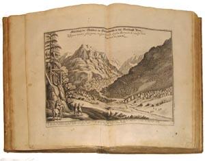
Topographiae Galliae,.[Parts V,VI,VII, and VIII].
Publicado por Frankfurt: Caspar Merians, 1657., 1657
Librería: Arader Galleries - AraderNYC, New York, NY, Estados Unidos de America
Valoración del vendedor:

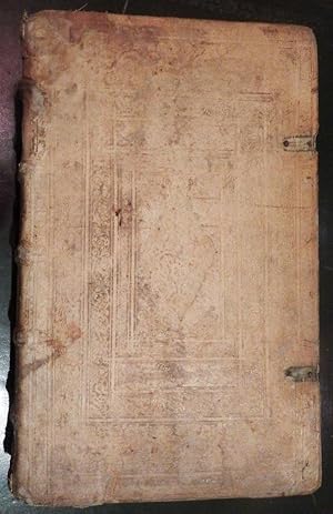
M. Z. Topographiae Galliae, oder Beschreib: und Contrafaitung deß Mächtigen Königreichs Franckreich: Die fürnehmste und bekantiste Stätte und Plätze in der Landern. Lyonnois. Forests. Beaviolois, und Bovrbonnais, Abhandelend. und fur gesteldt. Frankfurt: Caspar Merians, 1657. M. Z. Topographiae Galliae, oder Beschreib: und Contrafaitung deß Mächtigen Königreichs Franckreich Sechter Theil: Die fürnehmste und bekantiste Stätte und Plätze in den Landern. Berry, Avergne. und Limosin, Abhandlend und fur gesteldt. Frankfurt: Caspar Merians, 1657. M. Z. Topographiae Galliae, oder Beschreib: und Contrafaitung deß Mächtigen Königreichs Franckreich Siebender Theil: Die fürnehmste und bekantiste Stätte und Plätze in der Provinc Beavsse, Chartrain, l'Angov, le Maine, le Perche. Vandosme, le Blaisois. Dvnois. la Tovraine. l'Orleanois. Poictov. l'Avnis. und fur gestelde. Frankfurt: Caspar Merians, 1657. M. Z. Topographiae Galliae, oder Beschreib: und Contrafaitung deß Mächtigen Königreichs Franckreich Achter Theil: Die fürnehmste und bekantiste Stätte und Plätze in dem Hertzogthumb Normandie. Abhandlend und furgesteldt. Frankfurt: Caspar Merians, 1657. 4 parts in one volume. Folio (11 6/8 x 7 4/8 inches). 4 engraved title-pages (the first laid down), 6 double-page engraved maps of Lyonnois, Bitvricum, Auvergne, Berry, d'Orleans, and Normandie, 40 double-page and or folding engraved plates of views and plans, 7 full-page plates of views and plans. Modern vellum backed 16th-century red and black letterpress paper boards, vellum corners. Edition in German of parts V, VI, VII, and VIII, of and eventual 13. Published just as Louis XIV, the Sun King, began his rule and cultural revolution in France, this is the most comprehensive guide to France of the 17th-century. "Until 1661 the real master of France was Cardinal Mazarin, under whose government his country, victorious over Austria (1643-48) and Spain (1643-59), acquired by the Treaties of Westphalia (1648) and the Pyrennes (1659) Alsace, Artois, and Roussillon, which had already been occupied by French troops since the days of Richelieu. As a result of the marriage between Louis XIV and Maria Theresa of Austria, Louis XIV also acquired rights over the Low Countries. When Louis's personal government began (1661), France was the arbiter of Europe: she had re-established peace among the Powers of the North (Sweden, Brandenburg, Denmark, and Poland); she protected the League of the Rhine; and her authority in Germany was greater than the emperor's. At that period the power of France, established upon the firmest foundations, was perhaps less imposing, but was assuredly more solid, than it became during the most glorious days of Louis XIV's personal government' (Catholic Encyclopedia online). Matthaeus Merian was a notable Swiss engraver born in 1593 in Basel. He learned copperplate engraving in Zurich, though he studied later in Strasbourg, Nancy and Paris. He returned to Basel in 1615, moving to Frankfurt 1616. There he worked for Johann Theodor de Bry, the celebrated publisher whose daughter, Maria Magdelana he married in 1617. In 1620 he and his family moved back to Basel, though they returned to Frankfurt in 1623. After his death in 1650, Mathaeus' sons, Mathaeus and Caspar continued his monumental "Topographia" series of Europe. Shirley G-Meri 22a. Catalogued by Kate Hunter.
-
Theatri Europaei Vierdter Theil Das ist,.
Publicado por Frankfurt: Matthias Merian, 1643, 1643
Librería: Arader Galleries - AraderNYC, New York, NY, Estados Unidos de America
Valoración del vendedor:
MERIAN, Matthaeus (1593-1650) and Martin ZEILER (1589-1661). Theatri Europaei Vierdter Theil Das ist: Glaubwu rdige Beschreibung Denckwu rdiger Geschichten die sich in Europa auch zum theil in Ost- und West-Indien zuvorderist in Hispanien Italien Franckreich Groß-Britannien Schott- und Irrland: In Hungarn Polen Siebenbu rgen Wallachey: In der Tu rckey Persien Moscaw: In Dennemarck Schweden Hoch- und Nieder-Teutschland sonderlich aber im Kriegs-Wesen seydhero Anno 1638. biß Anno 1643. exclusive` begeben haben : Auß vertrewlich communicirten Schrifften/ und andern Documenten/ mit Fleiß zusammen getragen und beschrieben. Frankfurt: Matthias Merian, 1643. Folio (12 4/8 x 8 inches). Additional engraved title-page (early ink library stamp obscured), letterpress title-page with engraved vignette (lower right-hand corner renewed), double-page engraved map of Germany (lower edge repaired), 28 vignette portraits of Europe's Kings and military leaders, 2 folding panoramas, one double-page and folding map, 42 double-page maps, plans and views (of 43, the battle of Breitenfeld in facsimile, some washed or supplied), one full-page plate, 4 vignettes in the text (dampstained throughout, one or two repairs). Contemporary German paneled pigskin over beveled boards, remains of two pairs of clasps and catches (recased, endpapers renewed). Published just as Europe began to emerge from the Thirty Years War and in a brief hiatus between the first and second English Civil Wars. The Thirty Years War (1618 1648) was a series of wars whose destructive campaigns and battles occurred over most of Europe, which when it ended with the Treaty of Westphalia in 1648, had completely redrawn the map of Europe. Merian's extraordinary town books of Europe cover "cover events in Europe over a complete century between 1617 and 1718, comprising more than 20,000 pages of text, approximately 720 maps, plans, views and other prints and nearly 700 portraits. Many items reflect sieges and military actions during, first, the Thirty Years' War, then the several campaigns against the Turks in Hungary and eastern Europe and then the War of the Spanish Succession, as well as other European conflicts in the seventeenth and eighteenth century. Matthaus Merian the Elder. contributed many engravings until his death in 1650, some being repeated from his various national topographical works. He was followed by his son Matthaeus the Younger and another son, Caspar Merian. These two sons died in 1687 and 1686 respectively and subsequently the work was continued by their heirs." (Shirley page 1590-1591). Lipperheide Ci 20. Catalogued by Kate Hunter.
-
Theatri Europaei Sechster und letzter Theil Das ist.
Publicado por Frankfurt: Matthias Merian, 1652., 1652
Librería: Arader Galleries - AraderNYC, New York, NY, Estados Unidos de America
Valoración del vendedor:
MERIAN, Matthaeus (1593-1650) and Martin ZEILER (1589-1661). Theatri Europaei Sechster und letzter Theil Das ist Außführliche Beschreibung der Denckwürdigsten Geschichten so sich hin und wieder durch Europam, als in Hoch und NiederTeutschland Franckreich Hispanien Italien GroßBritannien Dennemärck Schweden Polen Moscau Schlesien Böhmen Ober und NiederOesterreich Hungarn Siebenbürgen Wallachey Moldau Türckey und Barbarien so wohl im Weltlichen Regiment als KriegsWesen; Bevorab bey denen zwischen mehrentheils kriegenden Partheyen nach Münster und Oßnabrück angesetzten . General FriedensTractaten vom Jahr Christi 1647. biß 1651. allerseits begeben und zugetragen. Frankfurt: Matthias Merian, 1652. Folio (13 x 8 inches). Additional engraved title-page (laid down), letterpress title-page with woodcut printer's device, engraved arms of King Charles X Gustav of Sweden, large folding map of Crete and 10 other folding maps, 27 double-page maps, 145 full-page and vignette portraits of kings, queens, and heads of state (text leaves browned, one or two short marginal tears and repairs). Contemporary German paneled pigskin over beveled boards, one of two pairs of clasps and catches remaining (scuffed and stained). Published in the aftermath of The Thirty Years War (1618 1648), which when it ended with the Treaty of Westphalia in 1648, had completely redrawn the map of Europe, seeing the rise of centralised nation states, the decline of Spanish power and the rise of French hegemony. Merian's extraordinary town books of Europe cover "cover events in Europe over a complete century between 1617 and 1718, comprising more than 20,000 pages of text, approximately 720 maps, plans, views and other prints and nearly 700 portraits. Many items reflect sieges and military actions during, first, the Thirty Years' War, then the several campaigns against the Turks in Hungary and eastern Europe and then the War of the Spanish Succession, as well as other European conflicts in the seventeenth and eighteenth century. Matthaus Merian the Elder. contributed many engravings until his death in 1650, some being repeated from his various national topographical works. He was followed by his son Matthaeus the Younger and another son, Caspar Merian. These two sons died in 1687 and 1686 respectively and subsequently the work was continued by their heirs." (Shirley page 1590-1591). Catalogued by Kate Hunter.
-
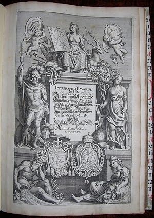
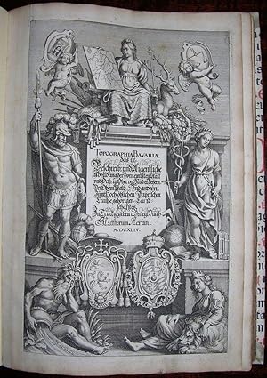
Topographia Bavariae.
Publicado por Frankfurt: Matthias Merian, 1644., 1644
Librería: Arader Galleries - AraderNYC, New York, NY, Estados Unidos de America
Valoración del vendedor:
Original o primera edición Ejemplar firmado
MERIAN, Matthaeus (1593-1650) and Martin ZEILER (1589-1661). Topographia Bavariae, das ist Beschreib. und Aigentliche Abildung der Vornembsten Stätt vnd Orth in Ober- und Nieder-Beyern, Der Obern Pfaltz, und Andern, zum Hochlöblichen Bayrischen Craiße gehörigen Landschafften. Frankfurt: Matthias Merian, 1644. ?Folio (12 x 8 4/8 inches). Engraved title-page, 2 double-page engraved maps of Bavaria and Bohemia, 31 double-page engraved plates of views and plans, 12 full-page plates of views and plans (apparently lacking 4 plates of views), one vignette, extra-illustrated with 4 plates of views in Salzburg. Modern vellum backed 16th-century red and black letterpress paper boards, vellum corners. First edition. A comprehensive and beautifully illustrated description of the Rhenish Palatinate from Merian and Zeiller's "Topographiae Germaniae" series (16 volumes 1641-1654). Published as the reign of Maximilian I (1573-1651), Duke of Bavaria, 1598-1622, Elector of Bavaria and Lord High Steward of the Holy Roman Empire, 1623-1651, was drawing to a close, a reign dominated by the Thirty Years' War during which Bavaria suffered terribly, and which broke out in 1619. No other "German prince of that time possessed an army so well organized and equipped. Its commander was the veteran soldier from the Netherlands Johann Tserclaes, Count of Tilly, who, austere himself, knew how to maintain discipline among his troops. The fortifications at Ingolstadt on the Danube were greatly strengthened, and Munich and other towns were surrounded by walls and moats. Well-filled arsenals were established in different places as preparation for time of need. The youthful Swedish king, Gustavus Adolphus, defeated Tilly, the veteran leader of the army of the League at Breitenfeld (1631), and in a battle with Gustavus Adolphus near the Lech, 16 April, 1632, Tilly was again vanquished, receiving a wound from which he died two weeks later at Ingolstadt. Although the siege of this city by the Swedes was unsuccessful, Gustavus plundered the Bavarian towns and villages, laid waste the country and pillaged Munich. After the death of Gustavus Adolphus at the battle of Lützen (1632) Bernhard of Weimar, unmolested by Wallenstein, ravaged Bavaria until he received a crushing defeat the battle of Nordlingen (6 Sept., 1634). Even in the last ten years of the war the country was not spared from hostile attacks. Consequently Maximilian sought by means of a truce with the enemy (1647) to gain for Bavaria an opportunity to recover. The desired result, however, not being attained, he united his forces to those of the imperial army, but the allied troops were not sufficient to overthrow the confederated French and Swedes, and once more suffered all the terrors of a pitiless invasion. The fighting ended with the capture of the Swedish generals, 6 Oct., 1648, and the Peace of Westphalia was signed at Munster, 24 Oct. of the same year. The material benefits derived by Maximilian from his attitude in politics were meagre: the Electoral dignity, the office of Lord High Steward, and the Upper Palatinate. The abstract gains, on the other hand, appear far greater. Not only since then has Bavaria had the second place among the Catholic principalities of Germany, ranking next to Austria, but for centuries a strong bulwark was opposed to the advance of Protestantism, and the latter was, at times, even driven back" (Catholic Encyclopedia). Born in Basel, Switzerland and a pupil of Jacob van der Heyden, Merian joined the Frankfurt publishing house of Johann Theodor de Bry in 1616 and, the following year, married de Bry's daughter Maria Magdalena. He became one of the most prominent members of the publishing family, known throughout Europe for his engravings of cityscapes and landscapes, his scientific books, and achieved his greatest acclaim as head of the family publishing house following the death of his father-in-law in 1623. He rapidly and almost single-handedly built up the house to.
-
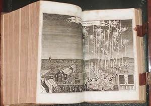
Topographiae Galliae,. [Parts II,III, and IV].
Publicado por Frankfurt: Caspar Merians, 1656., 1656
Librería: Arader Galleries - AraderNYC, New York, NY, Estados Unidos de America
Valoración del vendedor:
Topographiae Galliae oder Beschribung und Contrafaitung deß Mächtigen Königreichs Franckreich Zweyter Theil die ürnehmste und bekantiste Stätte und Plätze in der Provinc Picardiae. Frankfurt: Caspar Merians, 1656. Topographiae Galliae oder Beschribung und Contrafaitung deß Mächtigen Königreichs Franckreich Dritter Theil die ürnehmste und bekantiste Stätte und Plätze in der Provinc Champagne und Brie furstellendt. Frankfurt: Caspar Merians, 1656. Topographiae Galliae oder Beschribung und Contrafaitung deß Mächtigen Königreichs Franckreich VierderTheil die ürnehmste und bekantiste Stätte und Plätze von Burgund Bresse. Niver Nois und Dombes. furstellendt. Frankfurt: Caspar Merians, 1656. 3 parts in one volume. Folio (11 4/8 x 7 4/8 inches). 3 engraved title-pages (that for Picardy laid down). 3 fine folding engraved maps of Picardie, Champagne et Brie, Les Deux Bourgognes, 5 folding panoramas of Mouza and St. Merehould, Tonnere, Charite, Dijon, and Nevers, 86 double-page engraved plates of views and plans (2 loose), and 13 full-pages plates of views and plans (some waterstaining towards the middle of the book). Modern vellum backed 16th-century red and black letterpress paper boards, vellum corners. Edition in German of Parts II, III, and IV, of an eventual 13. Published just as Louis XIV, the Sun King, began his rule and cultural revolution in France, this is the most comprehensive guide to France of the 17th-century. "Until 1661 the real master of France was Cardinal Mazarin, under whose government his country, victorious over Austria (1643-48) and Spain (1643-59), acquired by the Treaties of Westphalia (1648) and the Pyrennes (1659) Alsace, Artois, and Roussillon, which had already been occupied by French troops since the days of Richelieu. As a result of the marriage between Louis XIV and Maria Theresa of Austria, Louis XIV also acquired rights over the Low Countries. When Louis's personal government began (1661), France was the arbiter of Europe: she had re-established peace among the Powers of the North (Sweden, Brandenburg, Denmark, and Poland); she protected the League of the Rhine; and her authority in Germany was greater than the emperor's. At that period the power of France, established upon the firmest foundations, was perhaps less imposing, but was assuredly more solid, than it became during the most glorious days of Louis XIV's personal government' (Catholic Encyclopedia online). Matthaeus Merian was a notable Swiss engraver born in 1593 in Basel. He learned copperplate engraving in Zurich, though he studied later in Strasbourg, Nancy and Paris. He returned to Basel in 1615, moving to Frankfurt 1616. There he worked for Johann Theodor de Bry, the celebrated publisher whose daughter, Maria Magdelana he married in 1617. In 1620 he and his family moved back to Basel, though they returned to Frankfurt in 1623. After his death in 1650, Mathaeus' sons, Mathaeus and Caspar continued his monumental "Topographia" series of Europe. Shirley G-Meri 22a. Catalogued by Kate Hunter.
-
Topographia Hassiae et Regionum Vicinarum
Publicado por Frankfurt: Matthias Merian, [1655], 1655
Librería: Arader Galleries - AraderNYC, New York, NY, Estados Unidos de America
Valoración del vendedor:
MERIAN, Matthaeus (1593-1650) and Martin ZEILER (1589-1661). Topographia Hassiae et regionum vicinarum, das ist, Beschreibung der vornembsten Sta tte und Pla tze in Hessen, und den benachbahrten Landtschaften, als Buchen, Nassau, Wetteraw, Westerwaldt, Wittgenstein, Lohngaw, und Andern. Frankfurt: Matthias Merian, [1655]. 2 parts in one volume. Folio (12 2/8 x 7 7/8 inches). Engraved title-page (laid down), sectional title-page. 3 fine engraved double-page maps of Hassia Superior, Hassia Landgraviatus, and Wetteravia, 22 fine double-page engraved plates of views and plans, extra-illustrated with a double-page view of Frauensee in Hessen. Modern vellum backed 16th-century red and black letterpress paper boards, vellum corners. Provenance: with the near contemporary engraved bookplate of a Marquis with the monogramme D.S.H. on the verso of the title-page. Third edition. On his death in 1567, Philip the Magnanimous divided Hesse between his four legitimate sons, but, as "two of these died without heirs in 1583 and 1604 respectively, his family was split into two chief lines that of Hesse-Darmstadt, represented by George I, and that of Hesse-Kassel, represented by William IV. From these two lines sprang in the course of time some collateral lines, but no member of the family at present occupies a throne. In contrast to his father, the first Landgrave of Hesse-Darmstadt, George I (1567-96) espoused the cause of the Hapsburgs. He increased his family possessions considerably, and in this his example was followed by his eldest son Louis V (1596-1626), who for his attachment to the emperor was called "the Faithful". He founded the University of Giessen in 1607. George II (1628-61) acquired a portion of Upper Hesse in 1648; his brother Frederick returned to the Catholic Faith, became Cardinal and Prince-Bishop of Breslau, and died in 1682. Although three sons of Louis VI (1661-78) also returned to Catholicism, there was no mitigation in the stern Lutheranism of the land. In Hesse-Kassel William IV (1567-92) was succeeded by Moritz "the Learned" (1592-1627), during whose reign the Thirty Years' War broke out. His son, William V (1627-37), allied himself with Gustavus Adolphus and was forced to retire into exile. Under William VI (1637-63) the foundation of Hersfeld and a portion of Upper Hesse were acquired by Hesse-Kassel" (Catholic Encyclopedia). During the American War of Independence Hessian soldiers were famously contracted for military service by the British government. Brunet 1529; Graesse VII 509; Wuthrich IV, 36. Catalogued by Kate Hunter.
-
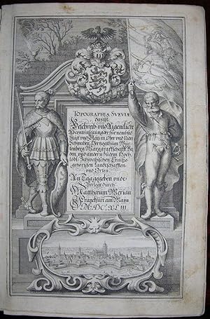
Topographia Sveviae das ist Beschreib,. Schwaben, Hertzogthum Wurtenberg, Marggraffschafft Baden vnd andern zu dem Hochlobl
Publicado por Frankfurt: Matthaeus Merian, 1643., 1643
Librería: Arader Galleries - AraderNYC, New York, NY, Estados Unidos de America
Valoración del vendedor:
Original o primera edición
Folio (12 x 8 inches). Engraved allegorical title-page, double-page engraved maps of "Svevia" (Bavaria) and Wirtenberg, 40 (of 41, without plate 31 of Leipheim) double-page engraved plates of birds-eye views, and 15 full-page plates of views (early leaves loose). Contemporary full vellum over paste-board, yapp fore-edges, the title in manuscript on the spine (upper joint split but holding, inner hinge broken, lacking ties). Provenance: near contemporary bookplate removed from the front paste-down; later engraved book label with the monogramme J.M.S. on the front paste-down. First edition. A comprehensive and beautifully illustrated description of Swabia (German Schwaben, Latin Suevia), from Merian and Zeiller's "Topographiae Germaniae" series (16 volumes 1641-1654). With its capital at Augsburg, Swebia was "a medieval duchy in the lands now forming southwestern Germany. Its territories covered the area now occupied by Baden-Württemberg (including the Black Forest) and parts of western Bavaria (to the Lech River) and northern Switzerland. It owes its importance to its strategic position between the upper reaches of two of Europe's most important rivers, the Danube and the Rhine.In 1376, 14 cities, for their own protection, organized themselves into the Swabian League of Cities. The League grew to eventually include over 32 cities from Basle in the west to Regensburg in the east, from Constance in the south to Nürnberg (Nuremberg) in the North. In 1488, a new grouping, now simply styled "Swabian League" was formed by these cities, the larger principalities and even individual knights, for the purpose of maintaining internal stability. When in the 16th century, the Holy Roman Empire began to organize around the Kreis, literally, "circle", these states called themselves the Swabian Kreis" (Harald Pleiner online). Nowadays Swabia is understood to be the area around Württemberg, south of the Danube, inclduing Lake Constance, or Bodensee, and the Rhine, called Oberschwaben, and the region between Iller and Lech, called Bavarian Swabia. Born in Basel, Switzerland and a pupil of Jacob van der Heyden, Merian joined the Frankfurt publishing house of Johann Theodor de Bry in 1616 and, the following year, married de Bry's daughter Maria Magdalena. He became one of the most prominent members of the publishing family, known throughout Europe for his engravings of cityscapes and landscapes, his scientific books, and achieved his greatest acclaim as head of the family publishing house following the death of his father-in-law in 1623. He rapidly and almost single-handedly built up the house to become one of the most important in Europe, etching most of the plates himself until about 1645, when he increasingly relied upon the help of a growing staff of assistants and pupils among them Wenceslaus Hollar, Rudolf and Conrad Meyer of Zurich, and his sons-in-law Christoph Le Blon and Melchior Kusel. After his death in 1650, Mathaeus' sons, Mathaeus and Caspar continued his monumental "Topographia" series of Europe. Catalogued by Kate Hunter.
-
Topographia Palatinatus Rheni et Vicinarum Regionum.
Publicado por Frankfurt: Matthias Merian, 1645 [but 1660]., 1660
Librería: Arader Galleries - AraderNYC, New York, NY, Estados Unidos de America
Valoración del vendedor:
MERIAN, Matthaeus (1593-1650) and Martin ZEILER (1589-1661). Topographia Palatinatus Rheni et vicinarum regionum : das ist Beschreibung und eigentliche Abbildung der vornemsten Sta tte und Pla tz der Untern Pfalz am Rhein. Frankfurt: Matthias Merian, 1645 [but 1660]. Folio (12 2/8 x 8 inches). Engraved title-page (laid down), sectional title-page. 3 double-page engraved maps of Palatinatus Rheni, Lothingaria, and Savoye, 37 fine double-page engraved plates of views and plans, 24 full-page plates of views and plans. Modern vellum backed 16th-century red and black letterpress paper boards, vellum corners. Second edition. A comprehensive and beautifully illustrated description of the Rhenish Palatinate from Merian and Zeiller's "Topographiae Germaniae" series (16 volumes 1641-1654). Frederick V (1610-23), the husband of the British Princess Elizabeth (daughter of James I), "was a man of boundless self- confidence and ambition, and when he took the crown of Bohemia, offered him by the unsurgents, the Thirty Years' War broke out. The battle at Weissen Berg, near Prague (1620), cost Frederick not only the "Winter Kingdom" but also his electoral Palatinate, which together with the electoral dignity and the Upper Palatinate was transferred in 1623 to Maximilian of Bavaria. The entire burden of the war rested for decades upon the Palatinate; the famous library of Heidelberg was presented to the pope by Tilly, who had captured the city in 1622. At the Peace of Westphalia Frederick's son, Charles Frederick (1648-80), received back the Rhenish Palatinate undiminished, but had to give up the Upper Palatinate and be content with a newly-created electoral vote. In spite of his diminished resources, he raised the country materially and intellectually to a highly-flourishing condition. In contrast with his predecessors he permitted the three great creeds of Germany to exist side by side, and received colonists from all lands without questioning them as to their religion. Church and schools found in him a zealous patron: the University of Heidelberg, deserted since 1630, was again opened by him in 1652, and renowned scholars such as Pufendorf were appointed to the professorships. In the wars between Germany and France he remained loyal to the emperor; as a consequence his lands suffered severely from the devastation of the French soldiers in the Wars for Reunion. With his incompetent son, Charles Louis (1680-88), the Palatinate-Simmern line became extinct" (Catholic Encyclopedia online). Born in Basel, Switzerland and a pupil of Jacob van der Heyden, Merian joined the Frankfurt publishing house of Johann Theodor de Bry in 1616 and, the following year, married de Bry's daughter Maria Magdalena. He became one of the most prominent members of the publishing family, known throughout Europe for his engravings of cityscapes and landscapes, his scientific books, and achieved his greatest acclaim as head of the family publishing house following the death of his father-in-law in 1623. He rapidly and almost single-handedly built up the house to become one of the most important in Europe, etching most of the plates himself until about 1645, when he increasingly relied upon the help of a growing staff of assistants and pupils among them Wenceslaus Hollar, Rudolf and Conrad Meyer of Zurich, and his sons-in-law Christoph Le Blon and Melchior Kusel. After his death in 1650, Mathaeus' sons, Mathaeus and Caspar continued his monumental "Topographia" series of Europe. Brunet 1529; Graesse VII 509; Wüthrich IV, 26. Catalogued by Kate Hunter.
-
Topographia Archiepiscopatuvm Moguntinensis, Treuirensis, et Coloniensis
Publicado por [Frankfurt], M. Merian 1646., 1646
Librería: Arader Galleries - AraderNYC, New York, NY, Estados Unidos de America
Valoración del vendedor:
Topographia Archiepiscopatuvm Moguntinensis, Treuirensis, et Coloniensis Das ist Beschreibung der Vornembsten Statt vnd Platz in denen Ertzbistumen Mayntz, Trier, vnd Coln. [Frankfurt], Matth. Merian 1646. Folio (12 x 7 6/8 inches). Engraved title-page. 4 fine double-page engraved maps of Eichsfeld now part of Thuringia, Hassia Superior, Trier, and Cologne, one fine folding engraved panorama of Mainz, 19 double-page engraved plates of views and plans, and 20 full-page plates of views and plans. Modern vellum backed 16th-century red and black letterpress paper boards, vellum corners. Mogontiacum, the precursor to modern Mainz, was founded by the Roman general Drusus perhaps as early as 13/12 BC. s the capital of the state of Rhineland-Palatinate in Germany. It was the capital of the Electorate of Mainz at the time of the Holy Roman Empire, and as this book was being published the reign of Anselm Casimir Wambold von Umstadt, archbishop of Mainz from 1629 to 1647, was coming to an end, and Mainz itself was occupied by the French. Anselm Casimir was the highest-ranking of the prince-electors and Imperial chancellor for most of the Thirty Years War, "he played a distinct role in a key series of political and military events within the Holy Roman Empire, directed a large part of the Imperial constitutional and legal machinery, [and] was a key figure in coordinating Catholic policy in the Empire, enjoyed a high degree of influence with the emperor. The new archbishop was elected in the midst of the debate over the forcible re-catholicization of all ecclesiastical territory that had been acquired by Protestant princes since the 1555 Peace of Augsburg. The Swedish invasion of North Germany radically transformed the situation. Following the victory at Breitenfeld in September 1631, the troops of Gustavus Adolphus spilled out into the Rhineland; Mainz was occupied and became the center of Swedish military operations for the next four years. While his territory was garrisoned and subjected to massive war taxes, the archbishop was driven into exile. From Cologne, Anselm Casimir conducted extended but fruitless negotiations with France in the hope that diplomatic pressure might persuade the Swedes to accept the French "protection" of his bishopric. Following this failure, the archbishop made a final and definitive shift of alliance over to the emperor, bringing both his territorial resources and his constitutional standing with the other Catholic states directly into the emperor s service. This overt alliance with the Habsburgs weakened his influence as Imperial chancellor in the negotiations for a peace settlement in the Empire at Pirna, then at Prague. The Swedish pulled out of Mainz in 1635, but when France declared war on the Habsburgs, Mainz was again threatened. It was not until January 1636 that Anselm Casimir finally re-entered his episcopal city. The new phase of the war opened by French intervention and the resurgence of Swedish military pressure ensured that the Imperial chancellor remained at the center of political maneuvers within the Empire, but as a virtual client of the emperor. Although once the Westphalia negotiations opened, he again demonstrated tenacity in arguing against Catholic intransigence and for compromise with both German Protestants and external powers. This did not prevent Mainz being occupied again by the French in 1645, leading to the second exile of the archbishop, who died in Frankfurt in October 1647". (David Parrott. "Der Erzkanzler im Religionskrieg: Kurfürst Anselm Casimir von Mainz, die geistlichen Fürsten und das Reich, 1629 bis 1647 by Franz Brendle (review)." The Catholic Historical Review 100.2 (2014). Catalogued by Kate Hunter.
-

Topographia Italiae, das ist warhaffte und curiose Beschreibung von gantz Italien.
Publicado por Frankfurt: Matthaeus Merian's heirs, 1688 (but c.1700)., 1700
Librería: Arader Galleries - AraderNYC, New York, NY, Estados Unidos de America
Valoración del vendedor:
2 parts in one volume. 4to., (13 2/8 x 8 2/8 inches). Additional engraved title-page (lower margin cropped not affecting the image), 52 fine double-page engraved views, maps and plans of Italy all mounted on guards (panoramas of Rome and Venice each bound as two separate plates); and three double-page maps and views of Koenigreich Morea. Contemporary sheep, the spine in seven compartments with six raised bands, citron morocco lettering-piece in one, the others decorated with fine gilt tools. The second edition thus. A detailed account of Italy, depicting it as it was towards the end of nearly two hundred years of Spanish domination. By about 1550 almost all of Italy had been subjugated by the Habsburg ruler Charles V, who was both the Holy Roman emperor and king of Spain. When Charles abdicated in 1555-56, dividing the Habsburg territories between his brother Emperor Ferdinand I and his son Philip II of Spain, Italy was part of the latter's inheritance. Spain remained the dominant power in Italy until Austria replaced it after the War of the Spanish Succession (1701-14). In the 18th century some areas of Italy achieved independence. Savoy (the Kingdom of Sardinia after 1720) annexed Sardinia and portions of Lombardy. In 1735 the Kingdom of the Two Sicilies became an independent monarchy under the junior branch of the Spanish Bourbon dynasty. Italy itself, however, no longer played a central role in European politics. Burckhardt, Jakob, The Civilization of the Renaissance in Italy (1860; repr. 1990); Brunet 1529; Graesse VII 509; Wuthrich IV, 83-4. C. Schuchhard, Die Zeiller-Merianischen Topographien bibliographisch beschreiben, 100. Catalogued by Kate Hunter.
-
Topografia Helvetiae Rhaetiae et Valesiae
Publicado por Frankfurt: Matthaeus Merian, 1654., 1654
Librería: Arader Galleries - AraderNYC, New York, NY, Estados Unidos de America
Valoración del vendedor:
Folio (12 x 8 inches). Letterpress title-page with woodcut printer's device. Additional engraved title-page dated 1642, 2 double-page engraved maps of Germany and Switzerland, and 78 fine engraved plates, including 64 double-page and or folding (numerous marginal tears, some with early repairs crossing the image, a few pale stains, some minor worming to the last few gatherings affecting the images and text). Contemporary limp vellum (soiled, stained and joints split at the head and foot of the spine). Provenance: obscured ownership inscription dated 1665 on the title-page; inscribed by Gabriel le Clerc on the front paste-down and the title-page and dated 1685; lengthy inscription dated 1814 on the verso of the third blank. Third edition in German, first published in 1642, and then reissued many times and added to by Merian's son Caspar in 1653. The "Topographia Helvetiae" formed the first part of an extensive general topography of Germany. The author Matthaus Merian was a notable Swiss engraver born 1593 in Basel. He learned copperplate engraving in Zurich, though he studied later in such cities as Strasbourg, Nancy and Paris. He returned to Basel in 1615, moving to Frankfurt 1616. There he worked for Johann Theodor de Bry, the celebrated publisher whose daughter, Maria Magdelana he married in 1617. In 1620 he and his family moved back to Basel, though they returned to Frankfurt in 1623. Maria took over her father's publishing house upon his death. Brunet 1529; Graesse VII 509; Wuthrich IV, 6.
-
Topographia Galliae.
Publicado por Frankfurt: Caspar Merian, 1660-1663, 1663
Librería: Arader Galleries - AraderNYC, New York, NY, Estados Unidos de America
Valoración del vendedor:
Original o primera edición
Full Vellum. Condición: Very Good. First Edition Thus. 13 parts in 4 volumes (12 4/8 x 8 inches): 4 additional engraved title-pages, folding double-page maps of Gaul (France), 2 of Paris, Isle de France, Lyonnois, Orleans, Rouen, The English Channel, Gascony, Provence, 2 folding panoramas of Paris, and others of Rouen, Dijon, and Nevers, double-page folding plans of Paris and 9 others, 251 double-page and 48 full-page plates of regional maps, town plans and views, churches, chateaux and other important buildings (some browning to text, particularly at the end of the last volume). Contemporary Dutch blind panelled vellum (a bit worn and soiled, lacking ties). PROVENANCE: From the collection of Prince and Princess Henry de la Tour D'Auvergne Lauraguais, their sale, Sotheby's, 3rd May 2012, lot 418. EDITION IN DUTCH, ALSO PUBLISHED IN GERMAN AND LATIN. Published just as Louis XIV, the Sun King, began his rule and cultural revolution in France, this is the most comprehensive guide to France of the 17th-century. "Until 1661 the real master of France was Cardinal Mazarin, under whose government his country, victorious over Austria (1643-48) and Spain (1643-59), acquired by the Treaties of Westphalia (1648) and the Pyrennes (1659) Alsace, Artois, and Roussillon, which had already been occupied by French troops since the days of Richelieu. As a result of the marriage between Louis XIV and Maria Theresa of Austria, Louis XIV also acquired rights over the Low Countries. When Louis's personal government began (1661), France was the arbiter of Europe: she had re-established peace among the Powers of the North (Sweden, Brandenburg, Denmark, and Poland); she protected the League of the Rhine; and her authority in Germany was greater than the emperor's. At that period the power of France, established upon the firmest foundations, was perhaps less imposing, but was assuredly more solid, than it became during the most glorious days of Louis XIV's personal government' (Catholic Encyclopedia online). Matthaeus Merian was a notable Swiss engraver born in 1593 in Basel. He learned copperplate engraving in Zurich, though he studied later in Strasbourg, Nancy and Paris. He returned to Basel in 1615, moving to Frankfurt 1616. There he worked for Johann Theodor de Bry, the celebrated publisher whose daughter, Maria Magdelana he married in 1617. In 1620 he and his family moved back to Basel, though they returned to Frankfurt in 1623. After his death in 1650, Mathaeus' sons, Mathaeus and Caspar continued his monumental "Topographia" series of Europe. Catalogued by Kate Hunter. Book.
-
Topographia Italiae.Beschreibung derer im Koenigreich Morea.
Publicado por Frankfurt: Matthaeus Merian's heirs, 1688 (but c.1700)., 1700
Librería: Arader Galleries - AraderNYC, New York, NY, Estados Unidos de America
Valoración del vendedor:
2 parts in one volume. 4to., (13 2/8 x 8 4/8 inches). Additional engraved title-page, 50 EXCEPTIONALLY FINE engraved views, amps and plans of Italy, including two magnificent folding panoramas of Rome and Venice, 41 of which are double page and or folding and mounted on guards; and three double-page maps and views of Koenigreich Morea (one or two leaves with light scattered spotting, a few pale marginal stains). Contemporary sheep, the spine in seven compartments with six raised bands, brown morocco lettering-piece in one, the others decorated in gilt (one or two minor surface tears). Provenance: with the near contemporary ownership inscription of Julius Hoerle, "Pharmacoleac" on both title-pages. The second edition thus. An unusually clean and bright copy of this detailed account of Italy, depicting it as it was towards the end of nearly two hundred years of Spanish domination. By about 1550 almost all of Italy had been subjugated by the Habsburg ruler Charles V, who was both the Holy Roman emperor and king of Spain. When Charles abdicated in 1555-56, dividing the Habsburg territories between his brother Emperor Ferdinand I and his son Philip II of Spain, Italy was part of the latter's inheritance. Spain remained the dominant power in Italy until Austria replaced it after the War of the Spanish Succession (1701-14). In the 18th century some areas of Italy achieved independence. Savoy (the Kingdom of Sardinia after 1720) annexed Sardinia and portions of Lombardy. In 1735 the Kingdom of the Two Sicilies became an independent monarchy under the junior branch of the Spanish Bourbon dynasty. Italy itself, however, no longer played a central role in European politics. Burckhardt, Jakob, The Civilization of the Renaissance in Italy (1860; repr. 1990); Brunet 1529; Graesse VII 509; Wuthrich IV, 83-4. Catalogued by Kate Hunter.
-
Topographia Helvetiae, Rhaetiae et Valesiae / Een Historische Beschrijvinge Van Switser-landt
Publicado por Cornelius Dankers, Amsterdam, 1644
Librería: Arader Galleries - AraderNYC, New York, NY, Estados Unidos de America
Valoración del vendedor:
2 works in one. Folio (12 1/8 x 7 2/3 inches). Engraved title-page to the first work, vignette title-page to the second, and 39 (of 74) double-page engraved plates to the first work, engraved vignette head-pieces, woodcut initials (apparently bound without the 36 additional plates). Contemporary vellum over paste-board (lightly soiled). Second edition, first published in 1642, and then reissued many times and added to by Merian's son Caspar in 1653. The "Topographia Helvetiae" formed the first part of an extensive general topography of Germany. L64F8F.
![Imagen del vendedor de Topographiae Galliae,.[Parts V,VI,VII, and VIII]. a la venta por Arader Galleries - AraderNYC](https://pictures.abebooks.com/inventory/md/md13942281417.jpg)
![Imagen del vendedor de Topographiae Galliae,. [Parts II,III, and IV]. a la venta por Arader Galleries - AraderNYC](https://pictures.abebooks.com/inventory/md/md13942281420.jpg)