Importe total (1 artículo artículos):
Destino del pedido:

J G BARTHOLOMEW (736 resultados)
Ir a los resultados principales
Tipo de artículo
- Todo tipo de artículos
- Libros (547)
- Revistas y publicaciones (1)
- Cómics
- Partituras
- Arte, grabados y pósters
- Fotografías
- Mapas (188)
-
Manuscritos y
coleccionismo de papel
Condición
Encuadernación
Más atributos
- Primera edición (117)
- Firmado (2)
- Sobrecubierta (13)
- Con imágenes del vendedor (442)
- Sin impresión bajo demanda (642)
Gastos de envío gratis
Ubicación del vendedor
Valoración de los vendedores
-

Manpower and Management Science
Publicado por Lexington Books/Fortress Academic, 1972
ISBN 10: 0669829331ISBN 13: 9780669829334
Librería: Better World Books, Mishawaka, IN, Estados Unidos de America
Valoración del vendedor:

Libro Original o primera edición
Condición: Good. 1st. Former library book; may include library markings. Used book that is in clean, average condition without any missing pages.
-
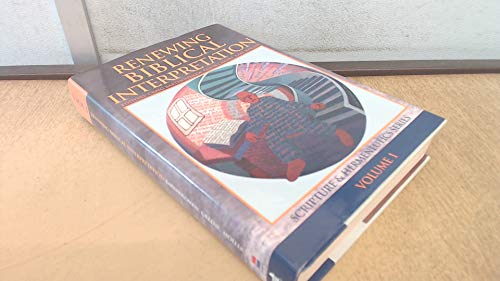
Renewing Biblical Interpretation
Publicado por Zondervan, 2001
ISBN 10: 0853640343ISBN 13: 9780853640349
Librería: Better World Books, Mishawaka, IN, Estados Unidos de America
Valoración del vendedor:
Libro
Condición: Very Good. Former library book; may include library markings. Used book that is in excellent condition. May show signs of wear or have minor defects.
Más opciones de compra de otros vendedores en IberLibro
Usado desde EUR 6,06
-
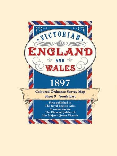
Victorian Maps England and Wales, 1897 (9): No. 9 (Victorian Maps, England and Wales 1897 S.)
Publicado por Old House Books
ISBN 10: 1873590490ISBN 13: 9781873590492
Librería: WorldofBooks, Goring-By-Sea, WS, Reino Unido
Valoración del vendedor:
Libro
Paperback. Condición: Very Good. The book has been read, but is in excellent condition. Pages are intact and not marred by notes or highlighting. The spine remains undamaged.
-

Victorian Maps England and Wales, 1897 : Sheet 7 , South West.
Publicado por Old House, 2005
ISBN 10: 1873590474ISBN 13: 9781873590478
Librería: Lewes Book Centre, LEWES East Sussex, ES, Reino Unido
Valoración del vendedor:
Mapa
No Binding. Condición: Fine. Fine fold-out-map,in decorative sleeve,a facsimile edition of the 1897,copy*MAP NEW AMD UN-FOLDED*COLOURED ORDNANCE SURVEY MAP SHEET 7. SOUTH WEST.
-

London's Railways Map 1897: A Coloured Map of the Railway Network That Helped to Make London the Greatest City in the World
Publicado por Old House Books, 2007
ISBN 10: 1873590652ISBN 13: 9781873590652
Librería: WorldofBooks, Goring-By-Sea, WS, Reino Unido
Valoración del vendedor:
Libro
Paperback. Condición: Very Good. The book has been read, but is in excellent condition. Pages are intact and not marred by notes or highlighting. The spine remains undamaged.
Más opciones de compra de otros vendedores en IberLibro
Usado desde EUR 4,44
-
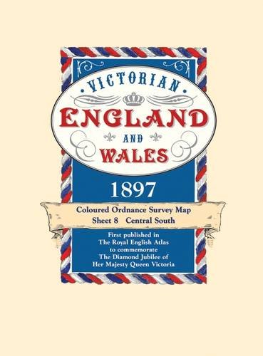
Victorian Maps England and Wales, 1897 : No. 8 (Victorian Maps, England and Wales 1897 S.)
Publicado por Old House, 2005
ISBN 10: 1873590482ISBN 13: 9781873590485
Librería: Lewes Book Centre, LEWES East Sussex, ES, Reino Unido
Valoración del vendedor:
Mapa
No Binding. Condición: Very Good. v/g sleeve ,with as new FOLD-OUT-map,1897,facsimle copy.
-

Victorian Maps England and Wales, 1897 (5): No. 5 (Victorian Maps, England and Wales 1897 S.)
Publicado por Old House Books
ISBN 10: 1873590458ISBN 13: 9781873590454
Librería: WorldofBooks, Goring-By-Sea, WS, Reino Unido
Valoración del vendedor:
Libro
Paperback. Condición: Very Good. The book has been read, but is in excellent condition. Pages are intact and not marred by notes or highlighting. The spine remains undamaged.
-
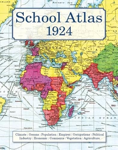
School Atlas 1924
Publicado por Old House Books, 2008
ISBN 10: 1873590725ISBN 13: 9781873590720
Librería: WorldofBooks, Goring-By-Sea, WS, Reino Unido
Valoración del vendedor:
Libro
Hardback. Condición: Very Good. The book has been read, but is in excellent condition. Pages are intact and not marred by notes or highlighting. The spine remains undamaged.
-

Victorian Maps England and Wales, 1897 (9): No. 9 (Victorian Maps, England and Wales 1897 S.)
Publicado por Old House
Condición: VeryGood. Most items will be dispatched the same or the next working day.
-

Deserting the King : The Book of Judges
Publicado por Lexham Press, 2017
ISBN 10: 157799776XISBN 13: 9781577997764
Librería: GreatBookPrices, Columbia, MD, Estados Unidos de America
Valoración del vendedor:
Libro
Condición: As New. Unread book in perfect condition.
Más opciones de compra de otros vendedores en IberLibro
Nuevo desde EUR 16,38
Usado desde EUR 9,51
Encuentre también Tapa blanda
-

A Literary & Historical Atlas of Europe
Publicado por J. M. Dent & Sons Limited, 1111
Librería: World of Rare Books, Goring-by-Sea, SXW, Reino Unido
Valoración del vendedor:
Condición: Good. 253 pages. No dust jacket. Purple cloth with gilt lettering. Pages are clean and bright with a firm binding. Endpapers and page edges are lightly tanned and foxed. Boards are a little rub worn with slight shelf wear to corners, spine and edges. Corners are a little bumped and spine ends are a mildly crushed. Book has a forward lean. Boards are bowed. Tanning to spine and edges.
-

Victorian Maps England and Wales, 1897 (5): No. 5 (Victorian Maps, England and Wales 1897 S.)
Publicado por Old House
Condición: VeryGood. Most items will be dispatched the same or the next working day.
-
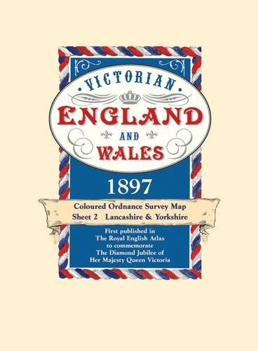
Victorian Maps England and Wales, 1897 (2): No. 2 (Victorian Maps, England and Wales 1897 S.)
Publicado por Bloomsbury Publishing PLC, United Kingdom, London, 2005
ISBN 10: 1873590423ISBN 13: 9781873590423
Librería: WorldofBooks, Goring-By-Sea, WS, Reino Unido
Valoración del vendedor:
Libro
Paperback. Condición: Very Good. 1897, the year in which these maps first appeared in The Royal English Atlas, was one of great celebration for it marked the Diamond Jubilee of Britain's longest reigning monarch Queen Victoria. But there was much more to celebrate than her continuing occupancy of the throne as the previous sixty years had seen the greatest ever period of industrial development. The rapidly expanding industrial towns and cities were now the homes of workers who once laboured on the land but were now in the factories and mines creating and processing the needs of the mother country and the Empire. To record these changes the Victorians had become great map makers and the Ordnance Survey had already been publishing maps for a century. This series, created from Ordnance Survey maps, were coloured and published in book form. They are now available in sheets for the first time. The construction of the railway network, commenced a mere 72 years before, was now virtually complete with over 20,000 miles in use. They are all marked, as are their 'predecessors' the canals. But, despite all the changes brought about by the Industrial Revolution, the great conurbations we know today were still surprisingly small in 1897. The countryside had changed little for centuries. There were still scores of aristocratic homes surrounded by park land where now the urban sprawl, new towns and industrial estates may be found. Just as interesting is what is not shown. Notice how small the towns and scattered villages are, indeed there is a village just to the west of London on sheet 9 which shows the three or four houses that made up the village of Heathrow. There are no by-passes and all the major trunk roads pass along the high streets of country towns. Motorways had, of course, not even been dreamt about but interestingly the route of a proposed channel tunnel is marked. These maps provide a fascinating insight into the past and will be a delight for local historians, walkers, genealogists and indeed anyone curious to see how their area used to be. Each map has a booklet describing England and Wales in 1897. The book has been read, but is in excellent condition. Pages are intact and not marred by notes or highlighting. The spine remains undamaged.
Más opciones de compra de otros vendedores en IberLibro
Usado desde EUR 9,61
-

Invited to Know God : The Book of Deuteronomy
Publicado por Lexham Press, 2019
ISBN 10: 1683593502ISBN 13: 9781683593508
Librería: GreatBookPrices, Columbia, MD, Estados Unidos de America
Valoración del vendedor:
Libro
Condición: As New. Unread book in perfect condition.
Más opciones de compra de otros vendedores en IberLibro
Nuevo desde EUR 12,25
Usado desde EUR 12,89
Encuentre también Tapa blanda
-
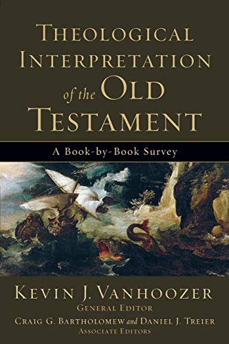
Theological Interpretation of the Old Testament: A Book-by-Book Survey
Publicado por Baker Academic, Grand Rapids, MI, 2008
ISBN 10: 0801036240ISBN 13: 9780801036248
Librería: Abacus Bookshop, Pittsford, NY, Estados Unidos de America
Valoración del vendedor:
Libro Original o primera edición
softcover. Condición: Fine copy. 1st edition. 8vo, 336 pp.
-
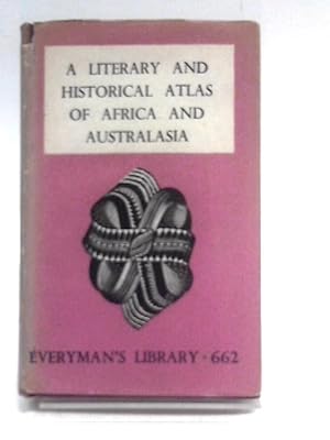
A Literary & Historical Atlas Of Africa And Australasia.
Publicado por J.M.Dent, 1913
Librería: World of Rare Books, Goring-by-Sea, SXW, Reino Unido
Valoración del vendedor:
Original o primera edición
Condición: Good. 1913. First Edition Thus. 218 pages. Illustrated dust jacket over purple cloth covered boards with gilt. Pages have mild tanning and foxing throughout, moderate at end-papers, paste-downs and text-block edges. Binding remains firm. Boards have moderate edge-wear with bumping to corners and rubbing to surfaces. Mild crushing to spine ends. Book has a slight forward lean. Sunning to spine. Gilt lettering is bright and clear. Unclipped jacket has light edge-wear with tears and creasing. Moderate tanning to spine.
-
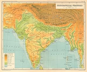
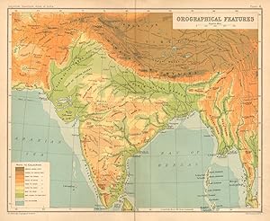
Condición: Good. SOUTH ASIA RELIEF. India Burma Pakistan Orographical Features 1931 old map. Vintage colour gazetteer map; J. G. Bartholomew (1931). 20.5 x 25.0cm, 8 x 9.75 inches; this is a folding map. Condition: Good. There is nothing printed on the reverse side, which is plain.
-
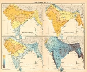
Condición: Good. SOUTH ASIA. British India & Burma. Seasonal Rainfall 1931 old vintage map. Vintage colour gazetteer map; J. G. Bartholomew (1931). 21.0 x 25.0cm, 8.25 x 10 inches; this is a folding map. Condition: Good. There is nothing printed on the reverse side, which is plain.
-
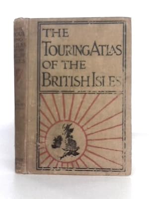
The Handy Touring Atlas of the British Isles, Specially Prepared for Cyclists, Motorists & Travellers
Publicado por George Newnes Ltd., 1111
Librería: World of Rare Books, Goring-by-Sea, SXW, Reino Unido
Valoración del vendedor:
Condición: Fair. Second Edition. 120 pages. No dust jacket. Decorated brown cloth. Contains colour illustrated plates. Pages and plates are lightly tanned and foxed throughout, heavier to endpapers and pastedowns.Slight cracking to gutters of a few pages. Minor pencil inscription to front pastedown, with scuffed inscription to front free endpaper. Binding is slightly shaky. Boards have moderate edge wear with bumping to corners and rubbing to surfaces. Crushing to spine ends with small splits and fraying to cloth. Moderate tanning to spine and edges. Some dark rubbing overall. Moderate splits to joints.
-

Victorian England and Wales 1897 Coloured Ordnance Survey Map Sheet 4: East Wales & West Midlands (Victorian England & Wales 1897)
Publicado por Old House, 2006
ISBN 10: 187359044XISBN 13: 9781873590447
Librería: Kennys Bookstore, Olney, MD, Estados Unidos de America
Valoración del vendedor:

Libro
Condición: New. 2005. Folded. Map. New. . . . . Books ship from the US and Ireland.
-
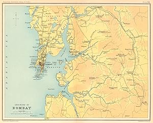
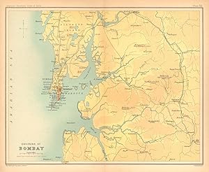
Condición: Good. Bombay / Mumbai city & environs. Maharashtra. Salsette. British India 1931 map. Vintage colour gazetteer map; J. G. Bartholomew (1931). 20.0 x 24.5cm, 7.75 x 9.75 inches; this is a folding map. Condition: Good. There is nothing printed on the reverse side, which is plain.
-
Condición: Good. Bombay/Mumbai city & environs. Maharashtra. Salsette. British India 1909 map. Antique colour gazetteer map; J. G. Bartholomew (1909). 20.5 x 25.0cm, 8 x 9.75 inches; this is a folding map. Condition: Good. The image shown may have been taken from a different example of this map than that which is offered for sale. The map you will receive is in good condition but there may be minor variations in the condition from that shown in the image. There is nothing printed on the reverse side, which is plain.
-
A literary & historical atlas of Asia
Publicado por Alpha Edition, 2019
ISBN 10: 9353604508ISBN 13: 9789353604509
Librería: Lucky's Textbooks, Dallas, TX, Estados Unidos de America
Valoración del vendedor:
Libro
Condición: New.
Más opciones de compra de otros vendedores en IberLibro
Nuevo desde EUR 13,55
-

The comparative atlas [physical and political] (Professor Meiklejohn's comparative geographical series)
Publicado por Meiklejohn and Son
Librería: Wonder Book, Frederick, MD, Estados Unidos de America
Miembro de asociación: ABAA ILAB
Valoración del vendedor:
Condición: Fair. Acceptable condition. 20th edition, revised and improved (1926). Spine ends frayed, front joint torn. Boards sunned. Corners bumped. Front hinge cracked; first signature detached. Pencil comment at bottom of series ads ("you are nuts"). (atlases, physical geography).
-
A Literary and Historical Atlas of Europe
Librería: Elvis Shakespeare Ltd, Edinburgh, Reino Unido
Valoración del vendedor:
Condición: Fair/Fair. Dent/Everyman h/b edition. No jacket. Undated, possible 1st edition. Pages loose at spine.
-
A Literary and Historical Atlas of Europe (Everyman's library No. 496)
Publicado por Dent, 1941
Librería: Regent College Bookstore, Vancouver, BC, Canada
Valoración del vendedor:
Libro
Hardcover. Condición: Fair. No Jacket. Cover creases and wear, browning of paper but text block clear and binding good.
-

A Literary & Historical Atlas of Asia
Publicado por J.M. Dent & Sons, 1111
Librería: World of Rare Books, Goring-by-Sea, SXW, Reino Unido
Valoración del vendedor:
Condición: Good. No Edition Remarks. 226 pages. No dust jacket. Brown cloth. Contains black and white illustrations. Well bound and clean pages, with heavy tanning to text block edges. Some rub-marking and tanning to pastedowns and endpapers. Boards have mild shelf wear with light rubbing and corner bumping. Some light marking and sunning. Binding remains firm. Boards are slightly bowed.
-
A Literary and Historical Atlas of Europe
Publicado por J.M. Dent & Sons Ltd., 1905
Librería: E. Manning Books, Robertsdale, AL, Estados Unidos de America
Valoración del vendedor:
Libro
Hardcover. Condición: Fair. No Jacket. J.M. Dent & Sons Ltd., Everyman's Library, London, circa early-1900s. Hardcover (approx 4.5 x 7 inches (12 x 18 cm)), 253 pages. Book is in Fair condition. Red boards w/gold lettering along spine. Soiled and rubbed. Tearing along spine hinges (nearly detached). The textblock, along the hinge of the front board/pastedown is cracked (shaken).
-
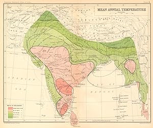
Condición: Good. SOUTH ASIA. British India & Burma. Mean Annual Temperature 1931 old map. Vintage colour gazetteer map; J. G. Bartholomew (1931). 20.5 x 24.5cm, 8 x 9.75 inches; this is a folding map. Condition: Good. There is nothing printed on the reverse side, which is plain.
-
Condición: Good. SOUTH ASIA RELIEF. India Burma Pakistan Orographical Features 1909 old map. Antique colour gazetteer map; J. G. Bartholomew (1909). 20.5 x 25.0cm, 8 x 10 inches; this is a folding map. Condition: Good. The image shown may have been taken from a different example of this map than that which is offered for sale. The map you will receive is in good condition but there may be minor variations in the condition from that shown in the image. There is nothing printed on the reverse side, which is plain.