
Importe total (1 artículo artículos):
Destino del pedido:

AFRICA MAP (71 resultados)
Ir a los resultados principales
Tipo de artículo
- Todo tipo de artículos
- Libros (66)
- Revistas y publicaciones
- Cómics
- Partituras
- Arte, grabados y pósters (2)
- Fotografías
- Mapas (3)
-
Manuscritos y
coleccionismo de papel
Condición
- Todo
- Nuevos
- Antiguos o usados
Encuadernación
Más atributos
- Primera edición (11)
- Firmado
- Sobrecubierta (2)
- Con imágenes del vendedor (25)
- Sin impresión bajo demanda
Ubicación del vendedor
Valoración de los vendedores
-

CHILDREN ARE DIAMONDS, AN AFRICAN APOCALYSE, A NOVEL
Publicado por Arcade, NY, 2013
ISBN 10: 161145834XISBN 13: 9781611458343
Librería: WONDERFUL BOOKS BY MAIL, Durham-CA, CA, Estados Unidos de America
Valoración del vendedor:

Libro
Hardcover. Condición: Good. Estado de la sobrecubierta: Good. Illustrated by Full Page Map africa frontis Ilustrador. GOOD CONDITION IN GOOD UNCLIPT(S23.95) DUST JACKET GOOD Condition , SOLID, BRIGHT. HAS STICKERS ON DJ & BOOK .DJ PASTED TO INNER COVERS.BUT ALSO INSIDE NICE VINYL PROTECTOR. ; WHITE spine & cover titles on MOSTLY BLACK DUST JACKET.1x1" Author photo dj flap.white endpapers.; 232pg pages Ex LIBRARY HARDCOVER; 10987654321pt line.
-

A Voyager Out: the life of Mary Kingsley
Publicado por Houghton Mifflin (1986), Boston, 1986
Librería: Crabtree's Collection Old Books, Sebago, ME, Estados Unidos de America
Valoración del vendedor:

Condición: VG lg sz PB. Photos, Africa map frontis Ilustrador. Most engaging, unselfconscious heroine of surprise of the late Victorian world. She saved herself and her sanity, a model too complex and original for us to follow yet too vital and important to be forgotten.
-
Trader Horn being the life and works of Alfred Aloysius Horn: the works written by himself at the age of seventy-three and the life, with such of his philosophy as is the gift of age & experience
Publicado por Simon and Schuster., New York, 1927
Librería: Hedgehog's Whimsey BOOKS etc., Newport, NH, Estados Unidos de America
Valoración del vendedor:

Hard cover. Wallace, Noel (Frontispiece from a drawing by), and Illian (? ) (End paper Africa maps, after Horn's memory, by). Ilustrador. Green cloth over boards, orange cover design lines, small orange giraffes and elephant heads. Easy reading print size. viii, [1], 302 p., 24 cm. Maps, Portraits, Plates, Music. Memoir of "the boy pioneer of West Africa, " as Mrs. Ethelreda Lewis describes him. His story begins in the "Earlies" of the late 19th century, and he told it to his editor over 6 months of weekly visits to her porch, the first being introductory when he came as a peddlar of kitchen ware, and tales emerged over tea. He spoke of cannibals, French colonialists, "the swish of elephants in the grass", and more, written by himserlf, with supplementary conversations noted by Lewis. John Galsworthy's Foreword describes Lewis as a South African novelist who discovered "this gold mine" being Trader Horn, and her skill in displaying " this 'Old Visiter's' personality, philosophy, and prejudices". French phrasing occasionally embellishes the narrative. Good. No dust jacket. Spine is darkened; edge and corner wear moderate. Interior clean. Tissue protects frontispiece portrait. Reprint. 10th short run printing June-Oct: 3500-25000 ea. 1 0.0.
-

Bartholomew's Map of South Africa and Madagascar
Publicado por Bartholomews, United Kingdom, 1951
Librería: Winghale Books, South Kelsey, LINCS, Reino Unido
Valoración del vendedor:
Libro
Soft cover. Condición: Good. Linen backed. No date but there is a previous owners stamp on the front cover showing February 1951. 100 cm x 76 cm. A few pin holes around the edges. (Bartholomew's Map of South Africa and Madagascar in layer colouring with roads and other features scale 1: 4,000,000).
-
Africa
Publicado por J. Martin Miller, Chicago, 1899
Librería: Thomas J. Joyce And Company, Chicago, IL, Estados Unidos de America
Valoración del vendedor:
Original o primera edición
Condición: Fine. First edition. Measures 17 x 22 inches, two folds A map of the continent of Africa, with inset maps of South Africa ( the Transvaal ), Cairo, and the Suez Canal and Lower Egypt. With The Congo , and Cameroon spelled with Ks. Very timely for the Boer War then in the Transvaal. This was likely prepared for Miller's The Twentieth century atlas of the commercial, geographical and historical world.
-
Africa - an Antique Map
Publicado por London, 1890
Librería: K Books Ltd ABA ILAB, York, YORKS, Reino Unido
Miembro de asociación: ABA ILAB PBFA
Valoración del vendedor:
Libro
No Binding. Condición: Very Good. An attractive coloured map - excellent condition . mounted - matted - and ready to frame. Mount size approx 9 x 7 inches , 27 x 21 cms. Circa 1890 , An excellent map of .Africa.
-
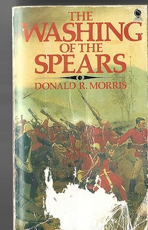
The Washing of the Spears
Publicado por Sampson Low Marston and Company, London, 1976
Librería: Matilda Mary's Books, PORTISHEAD Somerset, Reino Unido
Valoración del vendedor:
Pictorial Card Covers. Condición: Good. 2 Maps, South Africa Before 1879, Zululand and Tip of Afica Giving Zululand Location Ilustrador. 1976. 670pp including 18 pp. of Zulu Orthography (fascinating discussion of pronuciation and of the Zulu language), Sources, Bibliography and Index at rear of text.Covers lightly worn, pages light age tanning, and faint rippling of pages at lower edges of book, Still a tight, clean copy, no inscriptions, Size: 12mo - over 6ľ" - 7ľ" tall. Paperback.
-
AFRICA, AN ANTIQUE MAP - an Original Antique MAP
Ańo de publicación: 1866
Librería: K Books Ltd ABA ILAB, York, YORKS, Reino Unido
Miembro de asociación: ABA ILAB PBFA
Valoración del vendedor:
Libro
No Binding. Condición: Very Good. An original antique coloured map printed in 1866. Mounted (matted) and ready to frame. Very good condition. AN EARLY MAP , IN GOOD CONDITION, MOUNT SIZE 12 X 14 INCHES, 34 X 38 CMS THE MAP SHOWS AFRICA IN 1866.
-
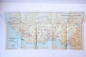
Cartography/Map: Übersichtkarte von West-Afrika. 1:8000000. 1 pp. In the left corner Kapverdische Inseln.
Librería: Antiquariaat Arine van der Steur / ILAB, Den Haag, Holanda
Miembro de asociación: ILAB NVVA
Valoración del vendedor:
250 x 480 mm, in good condition, with folds. Lithography by Dietrich Reimer (Andrews & Steiner) Berlin. Plate from: Martens, O. / O. Karstedt, Afrika. Ein handbuch fur wirtschaft und Reise, II band: Reise, 3e auflage, Berlin 1936.
-
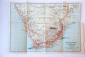
Cartography/Map: Übersichtkarte von SüdAfrika. 1:8000000. 1 pp.
Librería: Antiquariaat Arine van der Steur / ILAB, Den Haag, Holanda
Miembro de asociación: ILAB NVVA
Valoración del vendedor:
280 x 380 mm, in good condition, with folds. Lithography by Dietrich Reimer Berlin. Plate from: Martens, O. / O. Karstedt, Afrika. Ein handbuch fur wirtschaft und Reise, II band: Reise, 3e auflage, Berlin 1936.
-

Cartography/Map: Übersichtkarte von Afrika. 1:35000000. 1 pp.
Librería: Antiquariaat Arine van der Steur / ILAB, Den Haag, Holanda
Miembro de asociación: ILAB NVVA
Valoración del vendedor:
370 x 260 mm, in good condition, with folds. Lithography. Plate from: Martens, O. / O. Karstedt, Afrika. Ein handbuch fur wirtschaft und Reise, II band: Reise, 3e auflage, Berlin 1936.
-
COLOURED MAP OF SOUTH AFRICA, 1865
Publicado por EDWARD STANFORD, London, 1865
Librería: K Books Ltd ABA ILAB, York, YORKS, Reino Unido
Miembro de asociación: ABA ILAB PBFA
Valoración del vendedor:
Libro
No Binding. Condición: Very Good. Engraved By J & C WALKER Ilustrador. Shows the German Military Posts and Villages situated along along the roads on either side of the Buffalo River in British Kaffraria, the railways etc. 4 insets of the Cape, the District of George, the Environs of Graham Town and Cape Town. The map has a central fold, with a short tear in the margin which has been neatly mended.
-
West Africa - Antique Map - Hand Coloured.
Ańo de publicación: 1845
Librería: K Books Ltd ABA ILAB, York, YORKS, Reino Unido
Miembro de asociación: ABA ILAB PBFA
Valoración del vendedor:
Libro
No Binding. Condición: Very Good. A splendid antique hand coloured map of West Africa - showing the River Kongo or Zayre and the countries of Congo etc . Mounted and ready to frame. Hand coloured - colouring not contemporary but delicately and expertly executed. Detailed with much information - very attractive.
-
AFRICA: GENERAL MAP - an Original Coloured Map, Printed C1908
Publicado por George Philip & Son/The London Geographical Institute, London, 1908
Librería: K Books Ltd ABA ILAB, York, YORKS, Reino Unido
Miembro de asociación: ABA ILAB PBFA
Valoración del vendedor:
Libro
No Binding. Condición: Very Good. An original map, printed in full colour, central fold. A map of Africa showing the principal railways, the larger towns, with a population map inset.
-
AFRICA: INDUSTRIES & COMMUNICATIONS - an Original Coloured Map, Printed C1908
Publicado por George Philip & Son/The London Geographical Institute, London, 1908
Librería: K Books Ltd ABA ILAB, York, YORKS, Reino Unido
Miembro de asociación: ABA ILAB PBFA
Valoración del vendedor:
Libro
No Binding. Condición: Very Good. An original map, printed in full colour, central fold. A map of Africa, showing railways, canals, caravan routes, steamship routes, cables, British and American Consuls, docks, coaling stations, and the main products of all the areas including gold, diamonds, ostriches, rubber, ivory, copper, horses, salt, gum, coffee, bananas, sugar etc.
-
EUROPEAN POSSESSIONS IN WEST AFRICA - an Original Coloured Map, Printed C1908
Publicado por George Philip & Son/The London Geographical Institute, London, 1908
Librería: K Books Ltd ABA ILAB, York, YORKS, Reino Unido
Miembro de asociación: ABA ILAB PBFA
Valoración del vendedor:
Libro
No Binding. Condición: Very Good. An original map, printed in full colour, central fold. A map of West Africa showing the railways, steamer routes, submarine cables, tribal areas etc, with inset maps of Mauritius, Ascension and St Helena.
-
MAP OF AFRICA - an Original Antique Map, Printed Circa 1830
Publicado por London, 1830
Librería: K Books Ltd ABA ILAB, York, YORKS, Reino Unido
Miembro de asociación: ABA ILAB PBFA
Valoración del vendedor:
Libro
No Binding. Condición: Good. SIDNEY HALL Ilustrador. An original antique map of Africa "including the latest discoveries" drawn and engraved by Sidney Hall, Bury Street, Bloomsbury. It is uncoloured. The fold creases are fairly strong, with some damage at the edges.
-
Morocco. North Africa. Libya- an Antique Hand Coloured Map .
Ańo de publicación: 1798
Librería: K Books Ltd ABA ILAB, York, YORKS, Reino Unido
Miembro de asociación: ABA ILAB PBFA
Valoración del vendedor:
Libro
No Binding. Condición: Very Good. A splendid original antique hand coloured map . . Very good condition .Coloured . . mounted - (matted) . Colouring is not contemporary - but delicately and expertly executed . very detailed - a good acceptable copy - scarce . Shows North Africa , Libya and Morocco etc - with Latin names etc .
-
Angola - Antique Map - Hand Coloured.
Ańo de publicación: 1845
Librería: K Books Ltd ABA ILAB, York, YORKS, Reino Unido
Miembro de asociación: ABA ILAB PBFA
Valoración del vendedor:
Libro
No Binding. Condición: Very Good. A splendid antique hand coloured map of the coast of Angola, detailed . Mounted and ready to frame. Hand coloured - colouring not contemporary but delicately and expertly executed. Detailed with much information - very attractive -.
-
Africa - an Antique Map
Librería: K Books Ltd ABA ILAB, York, YORKS, Reino Unido
Miembro de asociación: ABA ILAB PBFA
Valoración del vendedor:
Libro
No Binding. Condición: Very Good. Engraved By Walker Ilustrador. A fine antique map - printed in 1844. Mounted (matted) and ready to frame. Engraved Size 12 x 10 Ins, 30 x 26 Cms. Mounted size approx 15 x 13 ins, 38 x 33cms. Coloured in outline, hand colouring contemporary. A fine opportunity to purchase an attractive and decorative engraved antique map of Africa.
-
North Africa or Barbary - and Marocco - an Antique Map
Librería: K Books Ltd ABA ILAB, York, YORKS, Reino Unido
Miembro de asociación: ABA ILAB PBFA
Valoración del vendedor:
Libro
No Binding. Condición: Very Good. Engraved By Walker Ilustrador. A fine antique map in very good condition - printed in circa 1844. Mounted (matted) and ready to frame. Engraved size approx 16 x 13 Ins, 41 x 33 Cms. Mounted size approx 19 x 16 in, 49 x 41cm. Coloured in outline, hand colouring contemporary. A fine engraved map of North Africa or Barbary - and Marocco.
-
Tunis and Tripoli - north Africa or Barbary - an Antique Map
Librería: K Books Ltd ABA ILAB, York, YORKS, Reino Unido
Miembro de asociación: ABA ILAB PBFA
Valoración del vendedor:
Libro
No Binding. Condición: Very Good. Engraved By Walker Ilustrador. A fine antique map in very good condition - printed in circa 1844. Mounted (matted) and ready to frame. Engraved size approx 16 x 13 Ins, 41 x 33 Cms. Mounted size approx 19 x 16 in, 49 x 41cm. Coloured in outline, hand colouring contemporary. A fine engraved map of Tunis and Tripoli - north Africa or Barbary.
-
Tunis and Tripoli - north Africa or Barbary - an Antique Map
Librería: K Books Ltd ABA ILAB, York, YORKS, Reino Unido
Miembro de asociación: ABA ILAB PBFA
Valoración del vendedor:
Libro
No Binding. Condición: Very Good. Engraved By Walker Ilustrador. A fine antique map in very good condition - printed in circa 1844. Mounted (matted) and ready to frame. Engraved size approx 16 x 13 Ins, 41 x 33 Cms. Mounted size approx 19 x 16 in, 49 x 41cm. Coloured in outline, hand colouring contemporary. A fine engraved map of Tripoli - North Africa or Barbary.
-
Ancient Africa or Libya - an Antique Map
Librería: K Books Ltd ABA ILAB, York, YORKS, Reino Unido
Miembro de asociación: ABA ILAB PBFA
Valoración del vendedor:
Libro
No Binding. Condición: Very Good. Engraved By Walker Ilustrador. A fine antique map in very good condition - printed in circa 1844. Mounted (matted) and ready to frame. Engraved size approx 16 x 13 Ins, 41 x 33 Cms. Mounted size approx 19 x 16 in, 49 x 41cm. Coloured in outline, hand colouring contemporary. A fine engraved map of Ancient Africa or Libya.
-
Greece, Asia & Northern Africa - Antique Map, Contemporary Colouring 1798
Publicado por R Wilkinson, London, 1800
Librería: K Books Ltd ABA ILAB, York, YORKS, Reino Unido
Miembro de asociación: ABA ILAB PBFA
Valoración del vendedor:
Libro
No Binding. Condición: Very Good. E Bourne Ilustrador. A splendid original antique map. Contemporary colouring and in excellent condition. Mounted and ready to frame. Extremely decorative and printed in 1800. Detailed and attractive map - "Patriarchati Oreintales", centred on the Mediterranean.
-
Eastern Africa & Asia "The Dominion of Solomon and His Allies" - Antique Map, Contemporary Colouring 1798
Publicado por R Wilkinson, London, 1798
Librería: K Books Ltd ABA ILAB, York, YORKS, Reino Unido
Miembro de asociación: ABA ILAB PBFA
Valoración del vendedor:
Libro
No Binding. Condición: Very Good. A splendid original antique map of Sicily. Contemporary coloring and in excellent condition. Mounted and ready to frame. Extremely decorative and printed in 1798. Detailed and attractive map. Subtilted " The Dominion of Solomon and his Allies" with attractive inset "Sheba with the Voyage to Tarshish and Ophir".
-
Asia, Northern Africa & Europe in Classical Times - Antique Map, Contemporary Colouring 1798
Publicado por R Wilkinson, London, 1798
Librería: K Books Ltd ABA ILAB, York, YORKS, Reino Unido
Miembro de asociación: ABA ILAB PBFA
Valoración del vendedor:
Libro
No Binding. Condición: Very Good. A splendid original antique map of Europe Norhthern Africa and Asia. Contemporary coloring and in excellent condition. Mounted and ready to frame. Extremely decorative and printed in 1798. Detailed and attractive map. Entitled " Imperiorum Antiquorum" with table inset "Tabula Regnorum Chronologica".
-
Africa.
Publicado por The London Printing and Publishing Company. [Circa1880s]., London., 1880
Librería: Asia Bookroom ANZAAB/ILAB, Canberra, ACT, Australia
Miembro de asociación: ANZAAB ILAB
Valoración del vendedor:
Printed map, 24 x 32.1 cm, decorative border, two original vertical folds, paper toned, mainly at the edges, inner margin of the sheet ragged, but in good order. A late edition of the map used for the well-known Tallis map, this without the characteristic vignettes and on thinner paper.
-
Africa.
Publicado por Rand, McNally & Co., [New York]., 1899
Librería: Asia Bookroom ANZAAB/ILAB, Canberra, ACT, Australia
Miembro de asociación: ANZAAB ILAB
Valoración del vendedor:
Printed colour map, 36.3 x 24.3 cm, inset map of the Suez Canal and two smaller insets of the Cardagos Crayos Islands, Mascarene Islands and Cape Verde Islands, central fold, and on the verso a printed panel listing the countries in Africa with their territorial governance, area and population, lower corner creased at the outer margin, but in very good condition. An interesting late nineteenth-century map noting colonial governance.
-
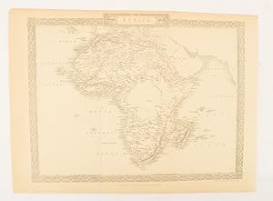
Africa [and] N. W. Africa, Morocco, Algeria & Tunis.
Publicado por Geo. F. Cram. (1894)., Chicago., 1894
Librería: Asia Bookroom ANZAAB/ILAB, Canberra, ACT, Australia
Miembro de asociación: ANZAAB ILAB
Valoración del vendedor:
Chromolithographed maps, 54.3 x 34.1 cm (sheet), central fold, a few small edge tears and marginal age toning, but in very good condition. Detailed maps prepared for George F. Cram's 1894 "Standard American Atlas": one of the first American firms to publish a world atlas. Maps of Oceania and South Africa printed on the verso.

![Imagen del vendedor de Africa [and] N. W. Africa, Morocco, Algeria & Tunis. a la venta por Asia Bookroom ANZAAB/ILAB](https://pictures.abebooks.com/inventory/md/md31208508236.jpg)