Descripción
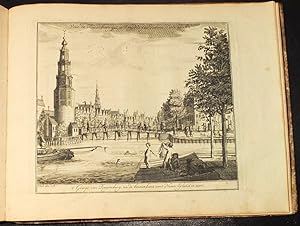
STOOPENDAEL, Hermanus, and others. Views of Amsterdam. ?Amsterdam: Hendrik de Leth, 1725. Oblong 4to., (8 1/8 x 10 4/8 inches). One engraved city plan and 46 exceptionally fine engraved views of Amsterdam by Daniel and Herman Stoopendael (11), Jan Smit (12), P. van Buysen (1), and others. Contemporary vinegar marbled paper boards (minor repairs to the extremities). Provenance: with a contemporary large engraved publisher's device on the front paste-down: "Labore et Perseverantia"; 20th-century ink stamp in Russian on the front free endpaper. A fine and very early collection of engraved views of Amsterdam. The superb city plan of Amsterdam is in the earliest state by D'Ailly, see 268 in his Plattengronden, and is recorded as being issued, as here, in an untitled suite of plates, published by de Leth in 1725. A subsequent issue was published in 1772 as "Le Guide d'Amsterdam", but included only 21 of the plates in this collection. The views are of the ports of Haarlem, Leyden, Utrecht, Weseyer, Muiderpoort, the sluice gates in the Amstel, the Amstel frozen over in winter, and many other scenes along the Amstel, a wintry scene in Utrecht, comprehensive views of the Stadthuys, the Stock Exchange, the churches and synagogues and other major landmark buildings in and around Amsterdam. The artists of the views include: Daniel (1672-1726) and his brother Hermanus Stoopendael, sons of Bastiaen Stoopendael (1637-1726) who worked on the famous Dutch Keur bible from 1702, and were associated with the Visscher publishing house; Jan Smith (probably the elder, ca 1663/64 - 1726) and Pieter van Buysen (active 1710-1713). Hendrick de Leth, the supposed publisher of this album, also began his cartographic career working for the foremost family printing company in 17th and 18th-century Amsterdam, the Visscher firm. The family of Visscher was one of the most distinguished of all 17th-century cartographic firms, and a major player in the era now considered the golden age of Dutch mapmaking. In the late 1600's, a period of great geographical discovery, Amsterdam became an international center of the arts and of cartography, with engravers and printers produced magnificent maps and charts of every kind. The fields of artistic production and map-making were arguably more seamlessly united during this era than any period before or since, as the strong competition among publishers meant that maps not only had to be scrupulously accurate, but also visually appealing. In this milieu, a number of venerable firms, including those established by Blaeu, Jansson, Hondius, as well as Visscher, competed for the ever-expanding market for maps and atlases. The firm founded by Nicholas Visscher set standards for exceptional quality that few others were able to equal, and Hendrick de Leth, who eventually rose to assume control of the Visscher publishing house in the 18th century, maintained the company's standards for excellence during a period when Amsterdam's cartographic preeminence was just beginning to be challenged by the French school of scientific cartography. Not in Nijhoff & Van Hattum (cf 121, Le Guide d'Amsterdam, 1722, with 22 plates) or elsewhere; cf. Hollstein XXVIII, Daniel Stoopendael 8,10,12-13 (recording the earlier states of 4 of the plates). N° de ref. del artículo 72lib1431
Contactar al vendedor
Denunciar este artículo
![]()


