Descripción
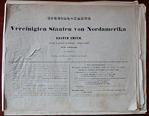
SMITH, J. Calvin. Special-Karte der Vereinigten Staaten von Nord-America. Cassel: Theodor Fischer, 1851 Portfolio (17 4/8 x 22 4/8 inches). 2-page publisher's advertisement, bound after the front wrapper. Lithographed general map of North America and 15 regional mapsheets which combine to make a large wall-map of the eastern portion of the United States, with title and inset of the territories bordering the Arctic Circle (some edges frayed), all with original hand-colour and loosely sewn into 5 fascicles with small leaf of explanatory text, including a key map, and bound into lithographed self-wrappers with title-page on the front cover (which is a bit spotted and torn with minor loss), as issued. Preserved in a modern brown cloth portfolio and slipcase. RARE GERMAN EDITION OF J. CALVIN SMITH'S MAP OF THE UNITED STATES, in its original published state, first published in New York in 1843, published to encourage emigration to North America. The regional maps extend as far northeast as Nova Scotia, as far northwest as the Indian territories west of Louisiana, Arkansas, Missouri and Iowa, as far north as the Great Lakes and the border with Canada, as far southeast as Florida, as far southwest as Texas. Cf. Rumsey 3471. Catalogued by Kate Hunter. N° de ref. del artículo 72map365
Contactar al vendedor
Denunciar este artículo
![]()


