Descripción
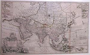
"2 sheets joined, matted and framed (23 x 38 inches to the neat line; framed size: 34 x 50 inches). A MAGNIFICENT MAP OF ASIA, from Turkey and the Arabian peninsula east to Japan and New Guinea, showing Persia, Tartary, India and China, the Sea of Corea and Land of Iesso, and the Company's Land, with original hand-colour in outline, the dedication within an elaborate historiated cartouche surmounted by the arms of the dedicatee, William, the first Earl Cowper, showing the wealth of Asia, lower left, 7 vignette maps of the Hellespont, the Gulf of Smirna, Bombay and Sallset Islands, Hugly River, an area north of the Arctic Circle including Nova Zembla, and two maps of small parts of the Chinese coast including Chusan Island and Amoy Island, upper right and left. From Moll's "Catalogue of a New and Compleat Set of Twenty-Five Two-Sheet Maps" first published in 1710-1715 and then reissued circa 1730 with 30 maps. An attractive and comprehensive map of Asia, with legends in the Sea of Corea stating that Pearl Fishing happens in all the rivers along the coast, and that it is not known in the Land of Iesso is joined to the Continent or not. To the lower right is another legend: "The Jesuits Paul Clain and le Gibien, give an Account. of a new discovery of 87 Islands, called by them ye New Philippines, and place them between the Moluccas, Philippina, and Ladrone Islands, according to ye Report of Some Indians". Moll emigrated to London from Germany in about 1675. By 1678 he is recorded as working for the map-maker Moses Pitt as an engraver and frequenting famous Jonathan's Coffee House, where he mingled with the likes of Daniel Defoe, Jonathan Swift, the buccaneers William Dampier and Woodes Rogers, John Oldmixon, Thomas Salmon, Samuel Simpson, and for all of whom he made maps to accompany their works. "Moll first gained notice in London in the late 1670s as a fine engraver working for map publishers such as Moses Pitt, Sir Jonas Moore, the royal hydrographer Greenville Collins, John Adair, [Jeremiah] Seller and [Charles] Price, and others. What can be identified as his two earliest maps-'America' and 'Europe' respectively-and bearing the imprint 'H. Mol schulp.' appeared in Moore's 'A New Systeme of the Mathematicks Containing … a New Geography' in 1681… Moll worked increasingly independently. He published his first solo volume, the now rare 'Atlas Thesaurus' in 1695, and in 1701, by which time he worked completely on his own, he published his first major work, 'A System of Geography', an informative global geography with a full complement of crisp, straightforward maps that sold initially for 18s. a copy. Although relatively traditional and derivative, it helped to establish him as an independent geographer-cartographer. "Moll's reputation rests upon a long and extremely fertile career of almost sixty years that yielded a diverse offering of over two dozen geographies, atlases, and histories and a myriad of individual maps, charts, and globes, spanning the known earth. Through his many works, he had also had an impact beyond geography and cartography on his adopted country and its future by graphically staunchly advocating early British expansion and empire" (Dennis Reinhartz for DNB).". N° de ref. del artículo 72map287
Contactar al vendedor
Denunciar este artículo
![]()
