Descripción
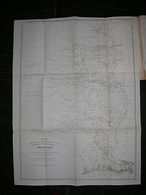
8vo., (8 7/8 x 6 inches). 2 fine large folding lithographed maps: ".Illustrating the plan of the defences of the Western & North-Western Frontier." proposed by Poinsett and Gratiet (short tear near mount of the second map). Later brown patterned paper wrapper. Senate issue. At the height of the second Seminole War (1835-1842) against the Indians in Florida, these maps illustrate Secretary of War Poinsett and Chief Engineer Charles Gratiet's opinions as how to best protect the Western and Northwestern Frontier. Poinsett favours military posts: "to be established and kept up within the Indian Territory, in such positions as to maintain peace among the Indians, and protect the emigrant and feebler tribes against the stronger and more warlike nations that surround them; which the United States are bound to do by treaty stipulations". Gratiet proposes a road with ordinary posts along it, and spells out exactly where the Western Frontier lies: "Beginning at the mouth of the Sabine River, on the Gulf of Mexico, and running up the said river to its intersection with the meridianal Territorial line; thence along this line by Texas, to its junction with the Red river; thence along the western boundary of Arkansas and Missouri, the the mouth of the Kansas; thence up the Missouri river, to its union with the north boundary of the state of Missouri; and thence following the external line of the territory over which the Indian title has been extinguished, to Lake Superior, by the country to which the tribes east of the Mississippi have been removed, and which is in part still occupied by aborigines" (page 4). Poinsett, a career diplomat and statesman, lived abroad for many years in Europe and South America. In 1821 he undertook "a secret assignment for President Monroe. This involved further travel throughout South America to survey revolutionary conditions, particularly in Mexico and Cuba. Out of that experience came his only book, published for public consumption in diary format, 'Notes on Mexico . . . Accompanied by an Historical Sketch of the Revolution' (1824). In 1825 President Monroe appointed Poinsett as the first American minister to Mexico. He stayed on there until the first part of 1830, although he was not popular among all Mexicans.Trying unsuccessfully to acquire part of Texas for the United States [for $1,000,000], he requested his own recall after Mexico asked him to leave. "A new president, Martin Van Buren, succeeded in recalling Poinsett to the nation's capital in 1837 as secretary of war, a position for which Poinsett was admirably fitted. At age fifty-eight, in addition to reorganizing and equipping both the army and state militias, he also oversaw the nation's exploratory expeditions as well as American Indian affairs. The Seminole War occurred during Secretary Poinsett's period in office. "After the war Poinsett was in a position to encourage a group of young and devoted admirers in the opening up of the American West. Among them was John Charles Frémont, a fellow Charlestonian and a member of the new Corps of Topographical Engineers, whom Poinsett chose to accompany the skilled government explorer and cartographer Joseph Nicollet. Frémont and Nicollet were ordered to give special attention to the most remote portions of the region between the Missouri and Mississippi rivers. Poinsett also authorized the expedition of Captain Charles Wilkes to the South Seas and North Pacific coast. Scientific specimens gathered on the voyage are housed in the Smithsonian Institution, of which Poinsett was a founder. He also spearheaded the establishment of a National Institute for the Promotion of Science." (Andrew Rolle for ANB). Wagner-Camp 72a. N° de ref. del artículo 72map276
Contactar al vendedor
Denunciar este artículo
![]()
