Descripción
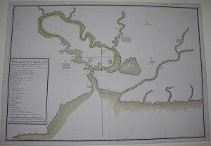
Single sheet (15 x 21 4/8 inches; 14 x 20 4/8 inches to the neatline). A FINE MANUSCRIPT MAP OF FERNANDINA DE JAGUA, NOW KNOWN AS CIENFUEGOS, ON THE SOUTHERN COAST OF CUBA, the title, key and scale within a frame lower left, in pen and black and red ink with colour wash, showing the Cienfuegos Bay region, including the coastline, coastal features, soundings, navigational hazards, an anchorage, roads, salt flats, and pictorial representation of buildings and settlements. An early map of the southern port of Cienfuegos in Cuba, although originally settled by the Spanish the port was settled by the French in the early 19th-century, and became a trading place for sugar cane, tobacco and coffee. In 1507, Spain's King Ferdinand, for whom Cienguegos Bay was originally named, established the office of the Piloto Mayor in the Casa de Contratación in Seville to collect and compile the latest geographical and cartographical information from all voyages of discovery since Columbus' 1492 voyage to America. At the time Spain was at the forefront of accumulating knowledge of the emerging world, and "no evidence of this careful description of portions of the world is more compelling than that of .the extensive mapping of Spanish areas of influence by the Real Escuela de Navegación in the eighteenth century. The maps produced under the auspices of the Real Escuela de Navegación, Cadiz, Spain were intended to provide Spanish pilots and navigators with the latest information available about navigational hazards, characteristics of the water bottom, and distinguishing features of coastal sites and relief. As such, these maps had to be as accurate as possible.it is probable that the Real Escuela de Navegación was established in the mid-eighteenth century to ensure the accuracy and consistency of maps produced for naval and commercial shipping and to house the growing record of maps and charts related to Spain's vast empire. "By and large, these maps reflect hydrographic and navigational concerns as they depict coastlines, coastal features, soundings, navigational hazards such as shoals and sandbanks, and the characteristics of the water bottom. Maps of this group were intended to help mariners and explorers to identify harbors, headlands, coastlines, and particular navigational hazards associated with those places. Although coastal towns, settlements, and relief are usually depicted, this group of maps tends to include little or no information about other interior features, such as Native American nations and settlements or the origins of interior streams. It is evident that the maps were intended, as were the portolan charts that preceded them, to provide navigational information in order to assist military and commercial shipping to reach safely intended destinations. With some exceptions, most of these maps are clear and crisp and have a spareness that lends an abstract quality to them. Some also have elaborate cartouches and wind roses that add to their elegance. Among the reasons for expanded Spanish mapping in the eighteenth century were perceived military threats, increased marine trade and commerce, scientific expeditions, and the expansion in the number of ports in Spain and in its empire that was open exclusively to Spanish trade. Previous to the mid-eighteenth century, all shipping to and from Spain was controlled as a matter of state policy. Ships were allowed to sail from only a handful of designated Iberian ports, specifically, Cadiz, Seville, and La Coruña, and were permitted to enter an equally limited number of ports in the Americas and in Asia, specifically, Havana, Vera Cruz, Cartagena, Portobelo, Acapulco, and Manila" (John R. Hébert & Anthony P. Mullan for the Library of Congress online). N° de ref. del artículo 72map267
Contactar al vendedor
Denunciar este artículo
![]()
