Descripción
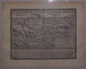
Single sheet, float-mounted and framed (sheet size: 14 4/8 x 11 4/8 inches; 9 x 11 4/8 inches to the neat line; framed size: 21 x 23 inches). A fine engraved map of North America by Johannes Bussemacher, the title and note within a frame beneath the map. A MAP OF NORTH AMERICA FROM THE FIRST ATLAS PUBLISHED IN GERMAN First edition, from Matthias Quad's general atlas of the world, "Geographisch Handtbuch", 1600. The atlas was largely an expansion of his earlier 'Europae totius orbis terrarum' of 1592. It was a landmark moment in publishing, the work being the first atlas to be composed in German. Johannes Bussemacher was employed by Quad to engrave the map of North America which is a reduced version of Cornelis de Jode's 'Americae pars borealis'. It is one of the earliest maps to concentrate on North America alone. De Jode condensed information for the map, which excludes the extreme northwest, from current wall maps and he was the first to make use of both John White and Jacques le Moyne's east coast cartography, although he inaccurately placed it. Quad here continues the mistake of placing the nomenclature of Virginia too far north. A long narrow waterway to the north represents the North West Passage; Lago de Conibas is also indicated. Some names have been surprisingly left out, notably Bermuda, St. Augustine, Roanoke and Chesapeake. A curious 'second' peninsula is shown to the west of Florida which could be an early depiction of the Mississippi delta. Below the map is a panel with descriptive text. Quad included this map in a second edition of the atlas called Fasciculus Geographicus and published in 1608. It was also included in the German edition of Botero entitled Allgemeine Weltbeschreibung published in Munich, 1611, and again the following year. There is only one know state of this map (Burden). A prolific member of the "Cologne School of Cartography," Matthias Quad completed his training in Holland before arriving in Germany in 1587. Beginning in 1570, Cologne became a haven for Dutch cartographers eager to seek refuge from religious and political persecution at home. The migration continued for more than forty years resulting in a renaissance of Dutch mapmaking headed by Matthias Quad and Frans Hogenberg. Meurer states, "Quad's work is probably more extensive than is generally recognized." He is known to have published under a number of pseudonyms, including Cyprian Eichovius and Konrad Loew, in order to avoid difficulties resulting from his Reformed faith.W. Bonacher, Introduction, in the facsimile of Quad's Geographisch Handtbuch of 1600 (Amsterdam, 1969); P.D. Burden, The Mapping of North America (Rickmansworth, 1996) no. 133; W. Cumming, The Southeast in Early Maps (Chapel Hill, 1998) no. 24; P.H. Meurer, Atlantes Colonienses. (Bad Neustadt, 1988) p.197 QUA 6 & 7; The A.E. Nordenskiold Collection (Helsinki, 1979) no. 239. N° de ref. del artículo 000981
Contactar al vendedor
Denunciar este artículo
![]()
