Descripción
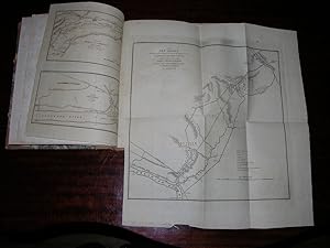
4 volumes: 3 text volumes. 8vo., (8 4/8 x 5 2/8 inches). 3 folding facsimiles, 9 folding letterpress tables. 19th-century half black morocco, gilt (extremities a bit scuffed). Atlas: folio (11 2/8 x 9 inches). 19 fine engraved maps and plans of varying sizes. Late 19th-century half tan calf, marbled paper boards, gilt (extremities worn with minor loss). First edition of the atlas and text volumes. General Wilkinson was "a general who never won a battle or lost a court-martial" (Leckie). He participated in many famous military encounters from 1775 - 1815, but was dogged by scandal and controversy. The maps are the "Rivers St. Lawrence and Soriel", "Trenton", "Part of New Jersey, embracing Trenton & Princeton to exhibit the operations of the American & British Armies, Jan 1st, 2nd, & 3rd 1777 with Gen: Washington's previous movements, against the Hessians, under Col. Rahl., at Trenton." (folding), "Affair of Princeton January 3rd 1777", "Part of the River St. Lawrence" (2 maps), "Disposition of the American Troops on the 30th march 1814, before La Cole Mill.", Sackets Harbour, Niagara River, "Battle of Bridgewater" (4) with original hand-colour in outline, "Map of the Straights of Niagara" folding, "Map of Maj: Gen: Ross's route.", "The Affair of Bladensburg", area north of Philadelphia, "Plan of Rouses Point", "Part of Vermont". Sabin 104029. Catalogued by Kate Hunter. N° de ref. del artículo 72lib535
Contactar al vendedor
Denunciar este artículo
![]()
