Descripción
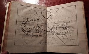
Description Geographique des Debouquements qui sont au Nord de L'Isle de Saint Domingue avec des Cartes et des Plans des Isles qui forment ces Passages, et des Dangers qui s'y trouvent. Pour le service des Vaisseaux du Roy, par Ordre de M. Le duc de Praslin Ministre et Secretaire d'Etat, ayant le Departement de la Marine. Par N. Bellin Ingenieur de la Marine et du Depost des Plans, Censeur Royal, de l'Academie de Marine, et de la Societe Royal de Londres. 4to.(10 x 8 in.; 25.4 x 20.3 cm.). Additional engraved title-page, 15 double-page maps, including one folding, 19 full-page maps, including one folding, one vignette head-piece; some marginal staining towards the end. BINDING: Modern vellum over paste-board. PROVENANCE: with the near contemporary ownership inscription of Dugay, at the foot of the title-page, and ink library stamp centre left, annotations dated 1776 on the map of "De Kroo-Ked-Island", and detailed instructions about how to enter the Port du Cap on the Island of Saint Domingue on the verso of that map; with the early ownership inscription of Thomas Blanchard of Yarmouth on the verso of the letterpress title-page; with the small engraved library label of Thomas Dixon of Littleton on the front paste-down. THE ESSENTIAL GUIDE FOR NAVIGATORS WISHING TO DEPART SAINT-DOMINGUE FOR EUROPE An attractive and surprisingly comprehensive little atlas showing the island of Haiti, and the mostly smaller islands of the Caribbean to the north that vessels of the French Navy must negotiate to return to Europe, and including a description of the Bahama Channel and the peninsula of Florida and the Bermuda Islands. In September of 1697 the Treaty of Ryswick was signed, and Spain was forced to recognize France s control of Tortuga and their presence on Hispaniola. Spain ceded the western third of the island. The French call their new territory Saint-Domingue and the Spanish call their territory Santo Domingo. Saint-Domingue, known as the "Pearl of the Antilles," became France s most lucrative colony, holding world production records for sugar and coffee by the end of the 18th century, supplied by an ever increasing number of slaves. In 1791, the slaves and some free people of color of Saint-Domingue began waging a rebellion against French authority. The rebels became reconciled to French rule following the abolition of slavery in the colony in 1793, although this alienated the island's dominant slave-holding class. France controlled the entirety of Hispaniola from 1795 to 1802, when a renewed rebellion began. The last French troops withdrew from the western portion of the island in late 1803, and in 1804 this territory declared its independence as the Republic of Haiti. Bellin was born in Paris in 1703 and was appointed chief cartographer and hydrographer to the French Navy in 1721. He was appointed "ingénier hydrographe" to the French navy's Dépôt des cartes et plans de la Marine in August 1741. Bellin was also a member of the Académie de Marine and of the Royal Society of London. During his 50-year career, Bellin published a number of important atlases, including "Hydrographie française" (1753), "Carte de l'Amerique septentrionale" (1755), "Petit Atlas Maritime" (1764), and "Nouvelle méthode pour apprendre la géographie" (1769). REFERENCES: Sabin, 4552. N° de ref. del artículo 72lib1376
Contactar al vendedor
Denunciar este artículo
![]()


