Descripción
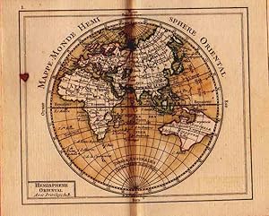
16mo., (4 6/8 x 3 inches). 7-page publisher's advertisement at end. "Idee de la Sphere, ou Principes sur la Geographique", by M. Bonne, 1723. Fine engraved hand-coloured title-page. 29 double-page engraved hand-coloured maps (without the frontispiece of the armillory sphere and the two unnumbered maps sometimes found with this edition). Fine contemporary cherry red morocco, each cover finely decorated with a border of triple gilt filets, with a fine gilt lily tool at each inner corner, the smooth spine ruled in six compartment, the second with a black morocco lettering-piece, the others decorated with fine gilt lily tools, all edges gilt. A FINE AND ATTRACTIVE COPY of this beautiful pocket atlas including double-page maps of both hemispheres; maps of the continents, including one each of North and South America; and several detailed maps of east and west Europe, including a six-sheet map of the German Empire. Essentially depicting Europe towards the end of the Seven Years War (1756-1763). With its origins in the French-Indian wars in North America two years earlier, the conflict began in Europe with the French siege of British Minorca and Prussia's invasion of Saxony, and ended with the Treaty of Paris in 1763. However the effect of the war was global: it ended France's position as the major colonial power in America, and consequently strengthened Britain's power there and in India. Rizzi-Zannoni was born 1736 in Naples and was renowned from an early age as one of the finest cartographers in Europe. In addition to cartography he worked as an astronomer, surveyor and mathematician. He was the first cartographer to triangulate Poland and helped also in the French and English border survey of America in 1757. While in the service of the Prussian's he was captured by the French at the Battle of Rosbach in early December 1757 and sent to France, where he lived for the next twenty years. In 1781 the Bourbon rulers of Naples made him director of the Topographical Office, one of the first governmental cartographic offices in Europe, where he oversaw the creation of the celebrated and monumental "Geographic Atlas of the Kingdom of Naples", published shortly before his death in 1812. Philipps 633, listing probably by error only 22 maps. N° de ref. del artículo 001479
Contactar al vendedor
Denunciar este artículo
![]()
